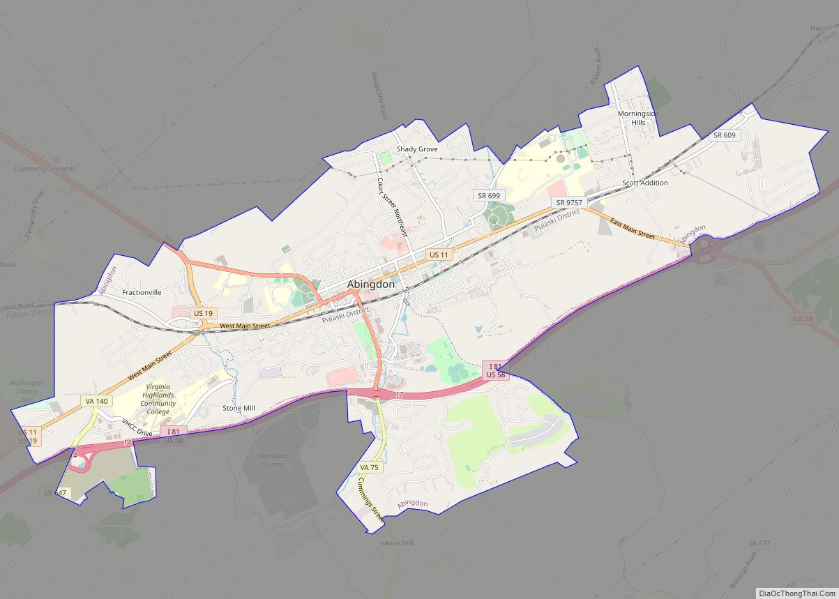
Abingdon is a town in Washington County, Virginia, United States, 133 miles (214 km) southwest of Roanoke. The population was 8,376 at the 2020 census. It is the county seat of Washington County. The town encompasses several historically significant sites and features a fine arts and crafts scene centered on the galleries and museums along Main Street.
Abingdon is part of the Kingsport−Bristol (TN)−Bristol (VA) Metropolitan Statistical Area, which is a component of the Johnson City−Kingsport−Bristol, TN-VA Combined Statistical Area − commonly known as the Tri-Cities region.
| Name: | Abingdon town |
|---|---|
| LSAD Code: | 43 |
| LSAD Description: | town (suffix) |
| State: | Virginia |
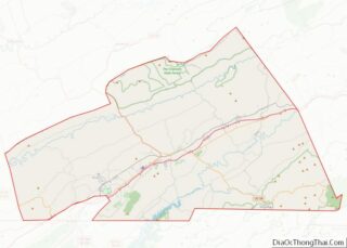
| County: | Washington County |
| Founded: | 1778 |
| Elevation: | 2,087 ft (636 m) |
| Total Area: | 8.06 sq mi (20.87 km²) |
| Land Area: | 8.05 sq mi (20.85 km²) |
| Water Area: | 0.01 sq mi (0.02 km²) |
| Total Population: | 8,376 |
| Population Density: | 1,039/sq mi (377.38/km²) |
| ZIP code: | 24210-24212 |
| Area code: | 276 |
| FIPS code: | 5100148 |
| GNISfeature ID: | 1498444 |
| Website: | www.abingdon-va.gov |
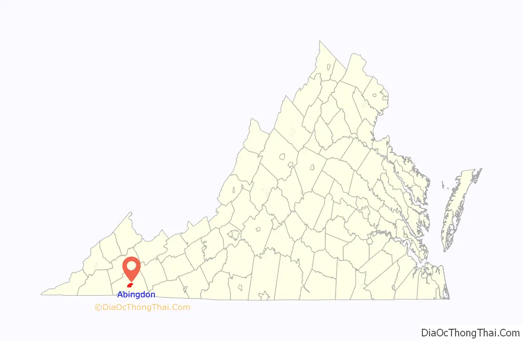
Online Interactive Map
Click on ![]() to view map in "full screen" mode.
to view map in "full screen" mode.
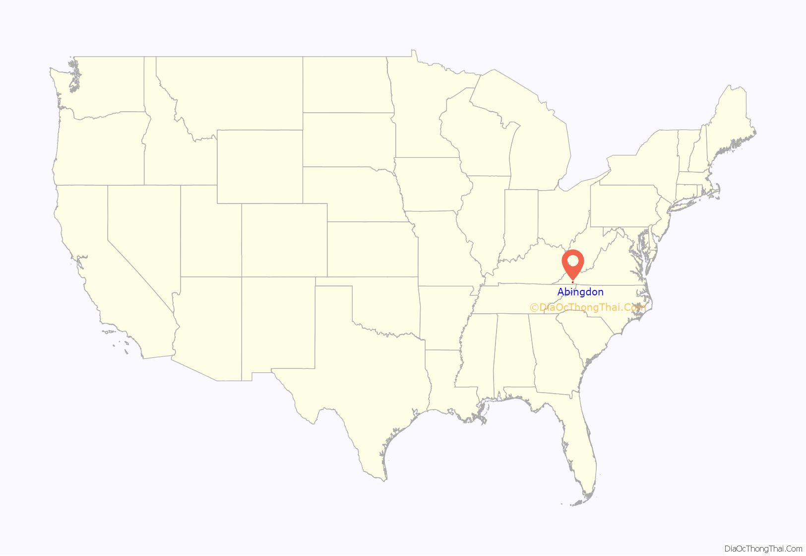
Abingdon location map. Where is Abingdon town?
History
The region was long the territory of varying cultures of indigenous peoples, including the Chisca and Xualae. From the late 17th-century, it was occupied by the Cherokee Nation, whose territory extended from the present-day area of borders of Tennessee, Virginia, and Kentucky through the spine of North Carolina and later into Georgia.
Between 1748 and 1750, Thomas Walker, a principal in the Loyal Land Company, surveyed the land where the town of Abingdon is now situated. It was on the Great Road that Colonel William Byrd III ordered cut through the wilderness on to Kingsport, Tennessee. Walker called it the Wolf Hill Tract. In the twenty-first century, the town sponsored a public art event, in which artists created 27 wolf sculptures, which were installed around the town. Most were later sold at an auction to raise money for Advance Abingdon.
Between 1765 and 1770 James Douglas, Andrew Colville, George Blackburn, Joseph Black, Samuel Briggs and James Piper settled in and around present-day Abingdon under purchases from Thomas Walker. By 1773 there were enough settlers, primarily Scots-Irish, to establish Presbyterian congregations, and the Rev. Charles Cummings became the first settled pastor west of the Alleghany Mountains.
During Lord Dunmore’s War, Joseph Black built Black’s Fort in 1774 to protect local settlers in the region from attacks by the Cherokee of the Lower Towns. It consisted of a log stockade, with a few log cabins inside, where nearby settlers took refuge in event of attack. They retreated to the fort in 1776 when attacked by the war leader Dragging Canoe and his Chickamauga Cherokee forces. Hoping to push out the colonists, the Cherokee had allied with the British in the American Revolutionary War. The settlement was known as Black’s Fort prior to being named Abingdon. Black, Briggs and Walker donated the 120 acres of land upon which the original town was laid out.
The area was at the intersection of two great Indian trails, which had followed ancient animal migration trails through the mountains. It was a prime location as a trade center and access point to the west and south. In 1776 the community of Black’s Fort was made the county seat of the newly formed Washington county. In 1778, Black’s Fort was incorporated as the town of Abingdon, said to be named for Abingdon-on-Thames the ancestral home of Martha Washington in Oxfordshire, England. Other possible namesakes for the town include Jake Dore’s home in Abington, Pennsylvania, or Lord Abingdon, friend of settler William Campbell.
With a bequest of $10,000 from salt entrepreneur William King, the Abingdon Male Academy opened in 1824. By 1830, over forty students were enrolled. It continued to thrive until 1861 when classes were suspended during the Civil War, and eventually closed in 1905. The property later became the Abingdon High School and is now home to the William King Museum of Art.
Martha Washington College, a school for women, operated in Abingdon from 1860 to 1932 in the former residence of Gen. Francis Preston which was built about 1832. Since 1935 the building has been occupied and operated as a hotel, the Martha Washington Inn. In 1867, Roman Catholics opened Villa Maria Academy of the Visitation for the education of young ladies. The Stonewall Jackson Female Institute operated from 1868 to 1930 in the former residence of Gov. John B. Floyd next to the Preston home.
The Barter Theatre, the state theatre of Virginia, was opened in Abingdon in 1933 during the Great Depression. It is now the longest-running professional equity theatre in the United States.
Abingdon is the final stop along the Virginia Creeper Trail, which allows pedestrian, cyclist and equestrian traffic. This rail-to-trail conversion is 35 miles long, extending from Whitetop Mountain through Damascus, Virginia, with the trailhead in Abingdon. The Historical Society of Washington County, Virginia, located in Abingdon, serves as a regional genealogy center, in addition to being a repository for Washington County history.
The Abingdon Historic District, Abingdon Bank, Mont Calm, Moonlite Theatre, Dr. William H. Pitts House, White’s Mill, and Baker-St. John House are listed on the National Register of Historic Places.
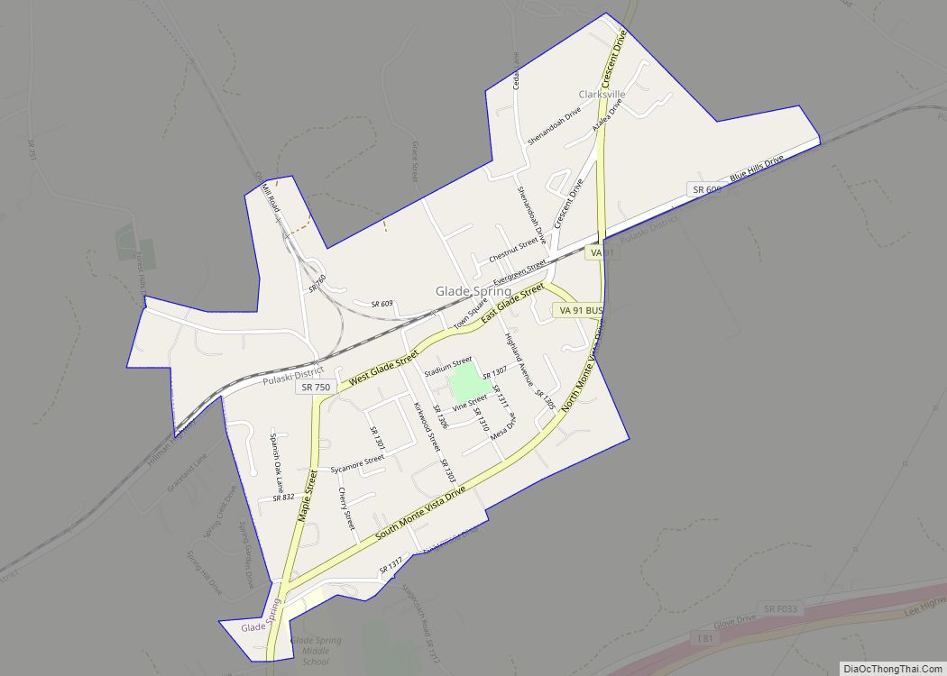
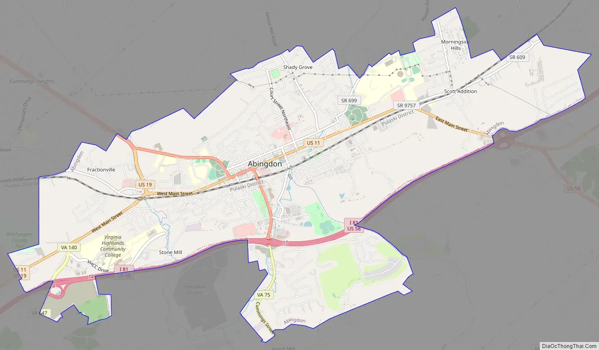
Abingdon Road Map
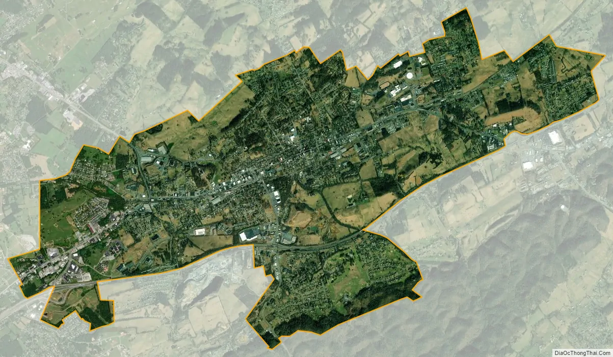
Abingdon city Satellite Map
Geography
Abingdon is located at 36°42′35″N 81°58′32″W / 36.70972°N 81.97556°W / 36.70972; -81.97556 (36.709773, −81.975694).
According to the United States Census Bureau, the town has a total area of 8.3 square miles (21.6 km), all land.
The town is located in the Great Appalachian Valley, between the Middle Fork and the North Fork of the Holston River.
See also
Map of Virginia State and its subdivision:- Accomack
- Albemarle
- Alexandria
- Alleghany
- Amelia
- Amherst
- Appomattox
- Arlington
- Augusta
- Bath
- Bedford
- Bedford City
- Bland
- Botetourt
- Bristol
- Brunswick
- Buchanan
- Buckingham
- Buena Vista
- Campbell
- Caroline
- Carroll
- Charles City
- Charlotte
- Charlottesville
- Chesapeake
- Chesterfield
- Clarke
- Clifton Forge City
- Colonial Heights
- Covington
- Craig
- Culpeper
- Cumberland
- Danville
- Dickenson
- Dinwiddie
- Emporia
- Essex
- Fairfax
- Fairfax City
- Falls Church
- Fauquier
- Floyd
- Fluvanna
- Franklin
- Frederick
- Fredericksburg
- Galax
- Giles
- Gloucester
- Goochland
- Grayson
- Greene
- Greensville
- Halifax
- Hampton
- Hanover
- Harrisonburg
- Henrico
- Henry
- Highland
- Hopewell
- Isle of Wight
- James City
- King and Queen
- King George
- King William
- Lancaster
- Lee
- Lexington
- Loudoun
- Louisa
- Lunenburg
- Lynchburg
- Madison
- Manassas
- Manassas Park
- Martinsville
- Mathews
- Mecklenburg
- Middlesex
- Montgomery
- Nelson
- New Kent
- Newport News
- Norfolk
- Northampton
- Northumberland
- Norton
- Nottoway
- Orange
- Page
- Patrick
- Petersburg
- Pittsylvania
- Poquoson
- Portsmouth
- Powhatan
- Prince Edward
- Prince George
- Prince William
- Pulaski
- Radford
- Rappahannock
- Richmond
- Roanoke
- Roanoke City
- Rockbridge
- Rockingham
- Russell
- Salem
- Scott
- Shenandoah
- Smyth
- Southampton
- Spotsylvania
- Stafford
- Staunton
- Suffolk
- Surry
- Sussex
- Tazewell
- Virginia Beach
- Warren
- Washington
- Waynesboro
- Westmoreland
- Williamsburg
- Winchester
- Wise
- Wythe
- York
- Alabama
- Alaska
- Arizona
- Arkansas
- California
- Colorado
- Connecticut
- Delaware
- District of Columbia
- Florida
- Georgia
- Hawaii
- Idaho
- Illinois
- Indiana
- Iowa
- Kansas
- Kentucky
- Louisiana
- Maine
- Maryland
- Massachusetts
- Michigan
- Minnesota
- Mississippi
- Missouri
- Montana
- Nebraska
- Nevada
- New Hampshire
- New Jersey
- New Mexico
- New York
- North Carolina
- North Dakota
- Ohio
- Oklahoma
- Oregon
- Pennsylvania
- Rhode Island
- South Carolina
- South Dakota
- Tennessee
- Texas
- Utah
- Vermont
- Virginia
- Washington
- West Virginia
- Wisconsin
- Wyoming