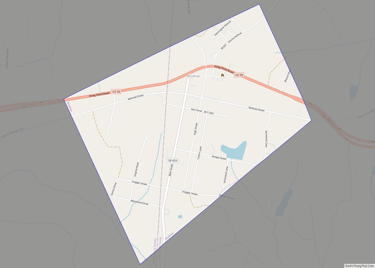
Brodnax is a town in Brunswick and Mecklenburg counties in the U.S. state of Virginia. The population was 298 at the 2010 census.
| Name: | Brodnax town |
|---|---|
| LSAD Code: | 43 |
| LSAD Description: | town (suffix) |
| State: | Virginia |
| County: | Brunswick County, Mecklenburg County |
| Elevation: | 410 ft (125 m) |
| Total Area: | 0.71 sq mi (1.84 km²) |
| Land Area: | 0.70 sq mi (1.83 km²) |
| Water Area: | 0.01 sq mi (0.02 km²) |
| Total Population: | 298 |
| Population Density: | 380.14/sq mi (146.84/km²) |
| ZIP code: | 23920 |
| Area code: | 434 |
| FIPS code: | 5110072 |
| GNISfeature ID: | 1463870 |
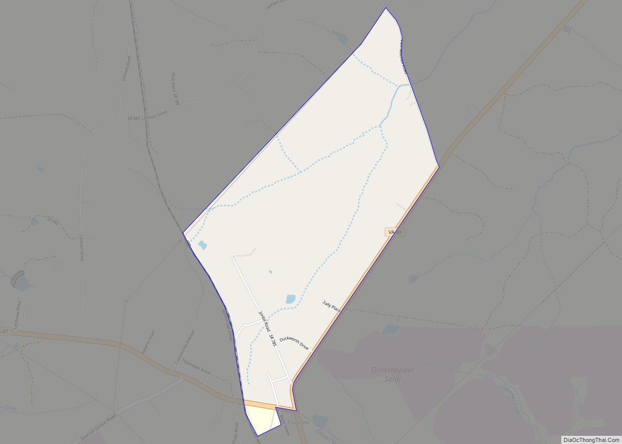
Online Interactive Map
Click on ![]() to view map in "full screen" mode.
to view map in "full screen" mode.
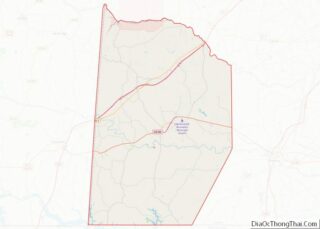
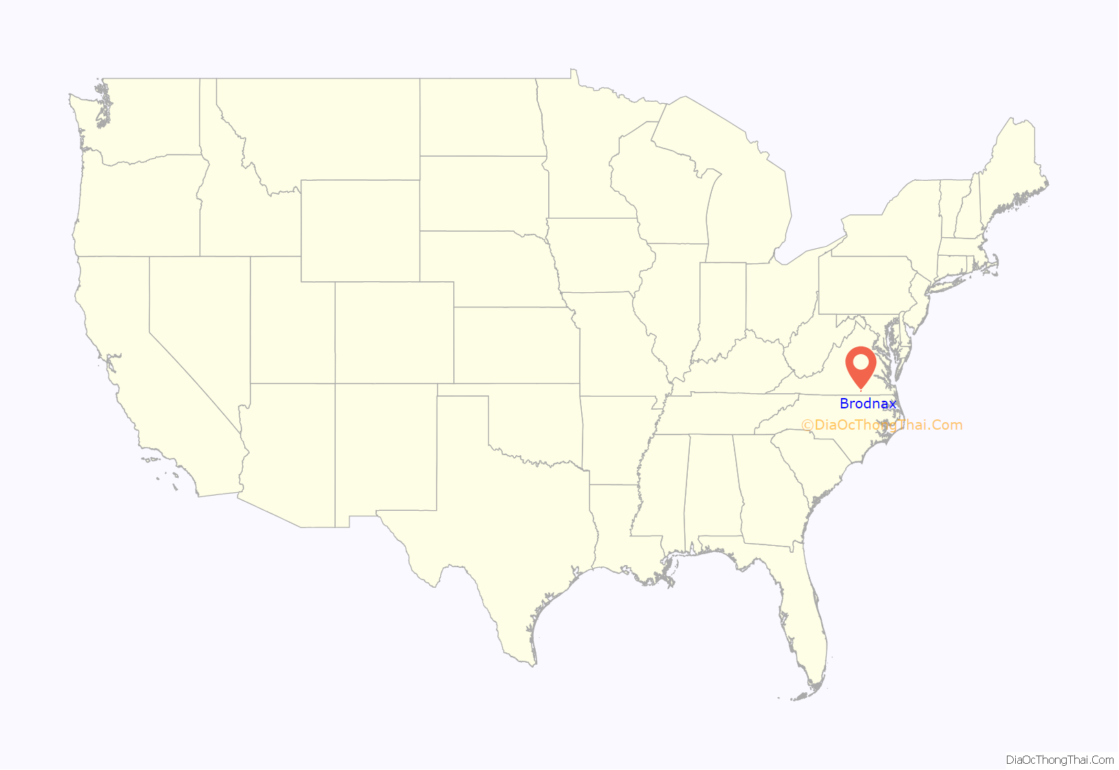
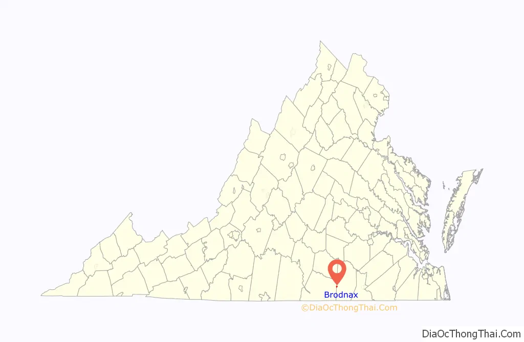
Brodnax location map. Where is Brodnax town?
History
Brodnax, Virginia was a stop on the Atlantic and Danville Railway. Due to Virginia Law, alcoholic spirits could not be sold on the Atlantic and Danville Railway train within 2 miles of Brodnax in 1896. The Southern Railway Company, which leased the A&D starting in 1899, made significant improvements to the passenger depot in Brodnax in 1904. Today, the Tobacco Heritage Trail runs through the town on the old Atlantic and Danville Railway.
The Church Home for Aged, Infirm and Disabled Colored People was listed on the National Register of Historic Places in 2004.
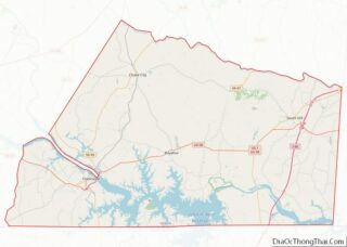
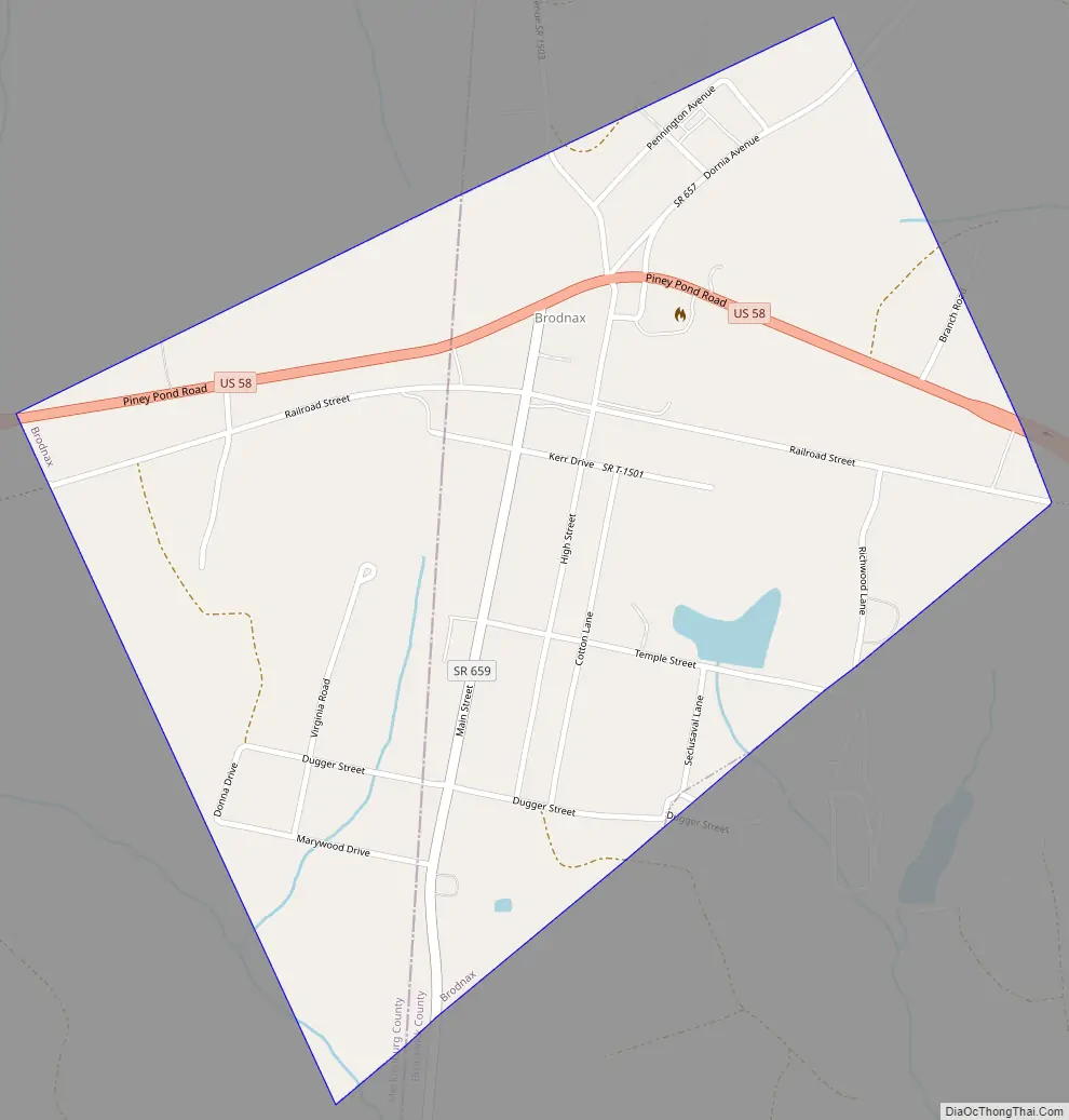
Brodnax Road Map
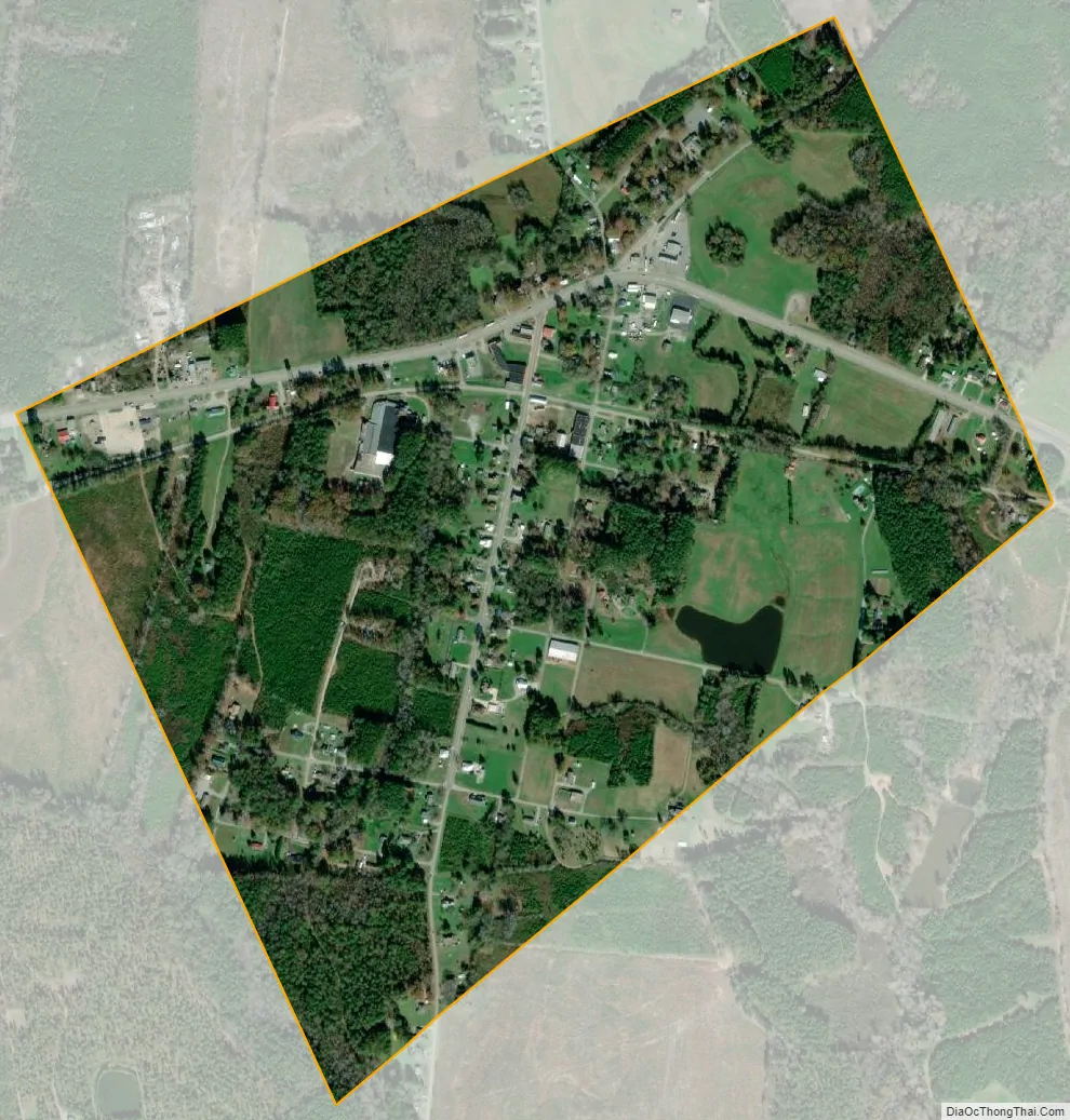
Brodnax city Satellite Map
Geography
Brodnax is located on the border of Brunswick and Mecklenburg counties at 36°42′12″N 78°1′54″W / 36.70333°N 78.03167°W / 36.70333; -78.03167 (36.703422, −78.031570). U.S. Route 58 passes through the town, leading west 6 miles (10 km) to South Hill and Interstate 85 and east 30 miles (48 km) to Emporia and Interstate 95.
According to the United States Census Bureau, the town has a total area of 0.71 square miles (1.84 km), of which 0.71 square miles (1.83 km) is land and 0.008 square miles (0.02 km), or 0.94%, is water.
See also
Map of Virginia State and its subdivision:- Accomack
- Albemarle
- Alexandria
- Alleghany
- Amelia
- Amherst
- Appomattox
- Arlington
- Augusta
- Bath
- Bedford
- Bedford City
- Bland
- Botetourt
- Bristol
- Brunswick
- Buchanan
- Buckingham
- Buena Vista
- Campbell
- Caroline
- Carroll
- Charles City
- Charlotte
- Charlottesville
- Chesapeake
- Chesterfield
- Clarke
- Clifton Forge City
- Colonial Heights
- Covington
- Craig
- Culpeper
- Cumberland
- Danville
- Dickenson
- Dinwiddie
- Emporia
- Essex
- Fairfax
- Fairfax City
- Falls Church
- Fauquier
- Floyd
- Fluvanna
- Franklin
- Frederick
- Fredericksburg
- Galax
- Giles
- Gloucester
- Goochland
- Grayson
- Greene
- Greensville
- Halifax
- Hampton
- Hanover
- Harrisonburg
- Henrico
- Henry
- Highland
- Hopewell
- Isle of Wight
- James City
- King and Queen
- King George
- King William
- Lancaster
- Lee
- Lexington
- Loudoun
- Louisa
- Lunenburg
- Lynchburg
- Madison
- Manassas
- Manassas Park
- Martinsville
- Mathews
- Mecklenburg
- Middlesex
- Montgomery
- Nelson
- New Kent
- Newport News
- Norfolk
- Northampton
- Northumberland
- Norton
- Nottoway
- Orange
- Page
- Patrick
- Petersburg
- Pittsylvania
- Poquoson
- Portsmouth
- Powhatan
- Prince Edward
- Prince George
- Prince William
- Pulaski
- Radford
- Rappahannock
- Richmond
- Roanoke
- Roanoke City
- Rockbridge
- Rockingham
- Russell
- Salem
- Scott
- Shenandoah
- Smyth
- Southampton
- Spotsylvania
- Stafford
- Staunton
- Suffolk
- Surry
- Sussex
- Tazewell
- Virginia Beach
- Warren
- Washington
- Waynesboro
- Westmoreland
- Williamsburg
- Winchester
- Wise
- Wythe
- York
- Alabama
- Alaska
- Arizona
- Arkansas
- California
- Colorado
- Connecticut
- Delaware
- District of Columbia
- Florida
- Georgia
- Hawaii
- Idaho
- Illinois
- Indiana
- Iowa
- Kansas
- Kentucky
- Louisiana
- Maine
- Maryland
- Massachusetts
- Michigan
- Minnesota
- Mississippi
- Missouri
- Montana
- Nebraska
- Nevada
- New Hampshire
- New Jersey
- New Mexico
- New York
- North Carolina
- North Dakota
- Ohio
- Oklahoma
- Oregon
- Pennsylvania
- Rhode Island
- South Carolina
- South Dakota
- Tennessee
- Texas
- Utah
- Vermont
- Virginia
- Washington
- West Virginia
- Wisconsin
- Wyoming