Fort Hunt is a census-designated place (CDP) in Fairfax County, Virginia, United States. The area is named after Fort Hunt, which was built on the bank of the Potomac River in 1897 to defend Washington, D.C. from naval attack and is now a public park. The area is also notable for its high population of senior citizens and for being one of the first suburbs in wealthy Fairfax County. The population was 16,045 at the 2010 census.
Fort Hunt encompasses the 22308 ZIP code of Alexandria, composed of much of the most affluent section of southeast Fairfax County, close to the George Washington Memorial Parkway and Potomac River, including the neighborhoods of Riverside Gardens, Tauxemont, Herbert Springs, Waynewood, Plymouth Haven, Potomac Valley – River Bend, Collingwood, Stratford Landing, Stratford on the Potomac, Hollin Hall, Wellington, Arcturus and (in ZIP code 22307) Villamay and Marlan Forest. As of the 2010 census, Fort Hunt also includes the neighborhood of Hollindale in ZIP code 22306 and much of Hollin Hills in 22307. Prominent Fort Hunt residents include U.S. Senator Tim Johnson and former House Speaker Bob Livingston.
| Name: | Fort Hunt CDP |
|---|---|
| LSAD Code: | 57 |
| LSAD Description: | CDP (suffix) |
| State: | Virginia |
| County: | Fairfax County |
| Elevation: | 33 ft (10 m) |
| Total Area: | 6.27 sq mi (16.23 km²) |
| Land Area: | 5.85 sq mi (15.16 km²) |
| Water Area: | 0.41 sq mi (1.07 km²) |
| Total Population: | 16,045 |
| Population Density: | 2,742/sq mi (1,058.7/km²) |
| ZIP code: | 22308 |
| FIPS code: | 5129136 |
| GNISfeature ID: | 1867588 |
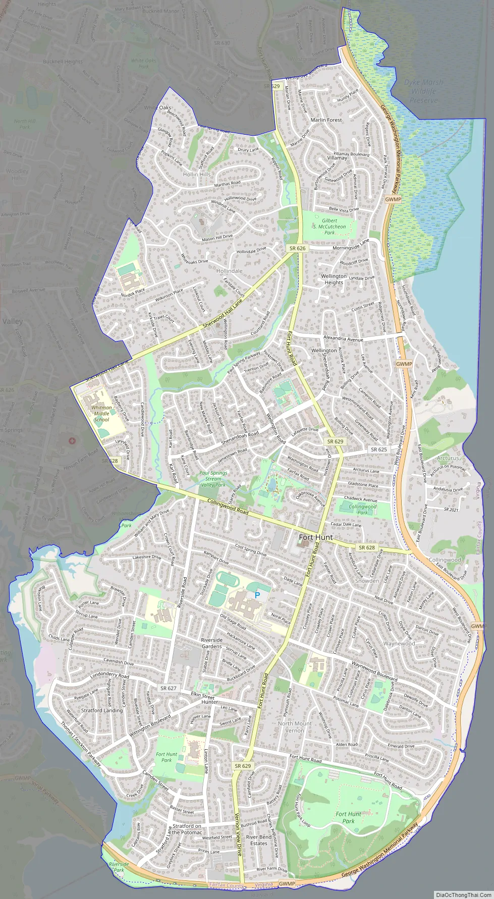
Online Interactive Map
Click on ![]() to view map in "full screen" mode.
to view map in "full screen" mode.
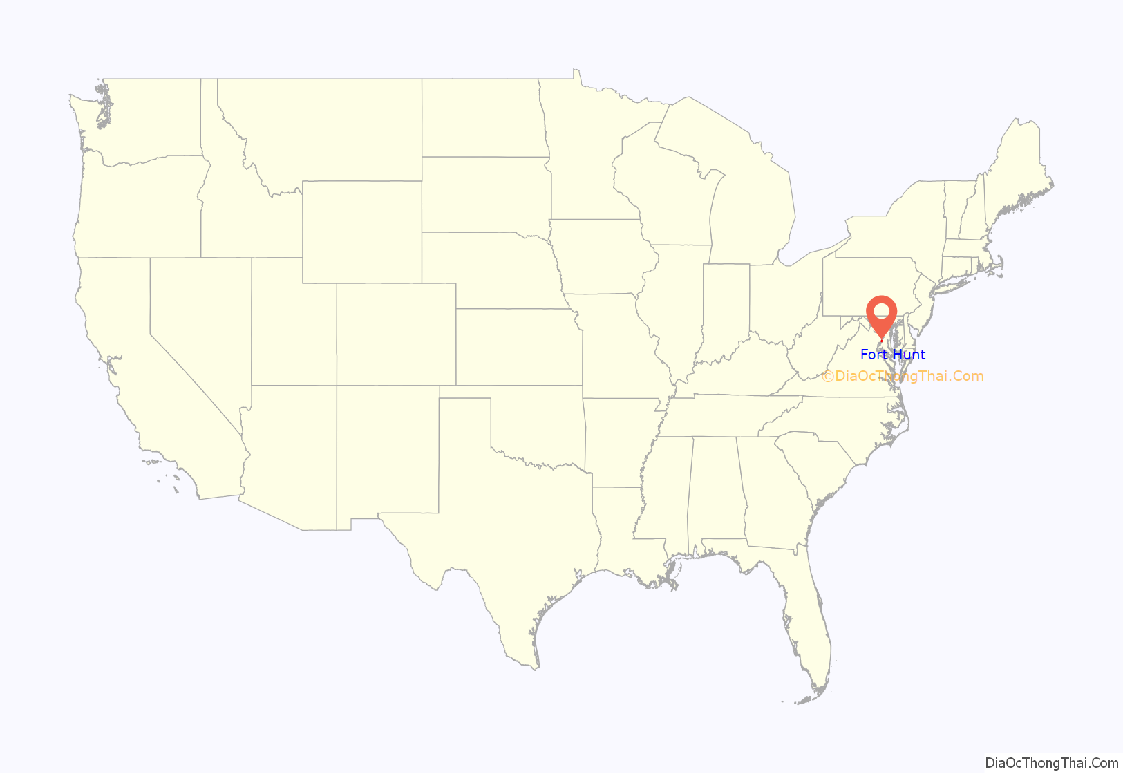
Fort Hunt location map. Where is Fort Hunt CDP?

History
The site of present-day Fort Hunt Park was used as an asset for the United States military beginning in the Spanish–American War. The fort had been completed on land that used to belong to the River Farm plantation of George Washington. The fort was used to complement Fort Washington across the river in Maryland, but it was not involved in an actual battle during the Spanish–American War.
During World War II, the fort was used as an interrogation center called P. O. Box 1142 where captive German officers were kept and questioned. Fort Hunt is the site of the death of Lieutenant Commander Werner Henke, the highest-ranking German officer to be shot while in American captivity during World War II.
During the war and after, neighborhoods such as Waynewood and Snowden began arising in the area around the fort, and the commercial center for the community, Hollin Hall shopping center, was constructed on Fort Hunt Road.
Fort Hunt Road Map
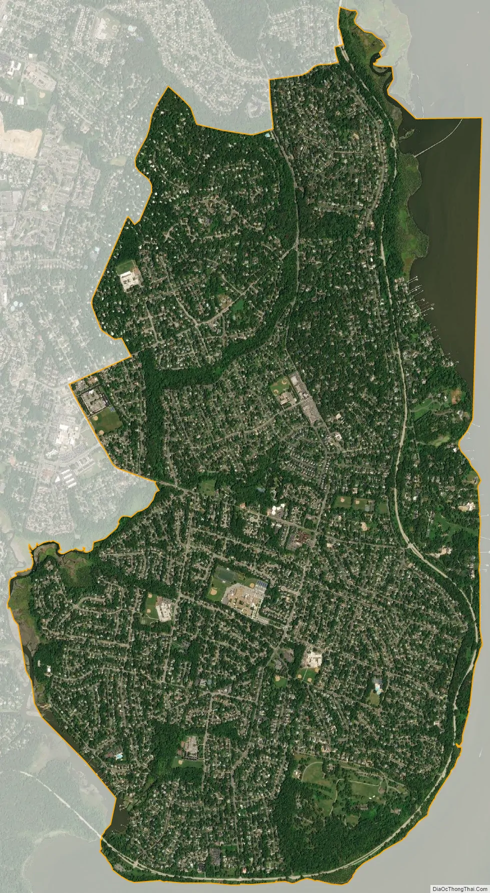
Fort Hunt city Satellite Map
Geography
Fort Hunt is located in southeastern Fairfax County at 38°43′58″N 77°3′29″W / 38.73278°N 77.05806°W / 38.73278; -77.05806 (38.732814, −77.058066). It is bordered to the south and east by the Potomac River, which forms the Maryland state line. Neighboring Virginia CDPs are Belle Haven to the north, Groveton to the northwest, Hybla Valley to the west, and Mount Vernon to the southwest across Little Hunting Creek. According to the United States Census Bureau, the Fort Hunt CDP has a total area of 6.3 square miles (16.2 km), of which 5.9 square miles (15.2 km) is land and 0.42 square miles (1.1 km), or 6.59%, is water.
Located within Fort Hunt is Fort Hunt Park, currently operated by the National Park Service, with a history of military activity dating from 1676.
See also
Map of Virginia State and its subdivision:- Accomack
- Albemarle
- Alexandria
- Alleghany
- Amelia
- Amherst
- Appomattox
- Arlington
- Augusta
- Bath
- Bedford
- Bedford City
- Bland
- Botetourt
- Bristol
- Brunswick
- Buchanan
- Buckingham
- Buena Vista
- Campbell
- Caroline
- Carroll
- Charles City
- Charlotte
- Charlottesville
- Chesapeake
- Chesterfield
- Clarke
- Clifton Forge City
- Colonial Heights
- Covington
- Craig
- Culpeper
- Cumberland
- Danville
- Dickenson
- Dinwiddie
- Emporia
- Essex
- Fairfax
- Fairfax City
- Falls Church
- Fauquier
- Floyd
- Fluvanna
- Franklin
- Frederick
- Fredericksburg
- Galax
- Giles
- Gloucester
- Goochland
- Grayson
- Greene
- Greensville
- Halifax
- Hampton
- Hanover
- Harrisonburg
- Henrico
- Henry
- Highland
- Hopewell
- Isle of Wight
- James City
- King and Queen
- King George
- King William
- Lancaster
- Lee
- Lexington
- Loudoun
- Louisa
- Lunenburg
- Lynchburg
- Madison
- Manassas
- Manassas Park
- Martinsville
- Mathews
- Mecklenburg
- Middlesex
- Montgomery
- Nelson
- New Kent
- Newport News
- Norfolk
- Northampton
- Northumberland
- Norton
- Nottoway
- Orange
- Page
- Patrick
- Petersburg
- Pittsylvania
- Poquoson
- Portsmouth
- Powhatan
- Prince Edward
- Prince George
- Prince William
- Pulaski
- Radford
- Rappahannock
- Richmond
- Roanoke
- Roanoke City
- Rockbridge
- Rockingham
- Russell
- Salem
- Scott
- Shenandoah
- Smyth
- Southampton
- Spotsylvania
- Stafford
- Staunton
- Suffolk
- Surry
- Sussex
- Tazewell
- Virginia Beach
- Warren
- Washington
- Waynesboro
- Westmoreland
- Williamsburg
- Winchester
- Wise
- Wythe
- York
- Alabama
- Alaska
- Arizona
- Arkansas
- California
- Colorado
- Connecticut
- Delaware
- District of Columbia
- Florida
- Georgia
- Hawaii
- Idaho
- Illinois
- Indiana
- Iowa
- Kansas
- Kentucky
- Louisiana
- Maine
- Maryland
- Massachusetts
- Michigan
- Minnesota
- Mississippi
- Missouri
- Montana
- Nebraska
- Nevada
- New Hampshire
- New Jersey
- New Mexico
- New York
- North Carolina
- North Dakota
- Ohio
- Oklahoma
- Oregon
- Pennsylvania
- Rhode Island
- South Carolina
- South Dakota
- Tennessee
- Texas
- Utah
- Vermont
- Virginia
- Washington
- West Virginia
- Wisconsin
- Wyoming


