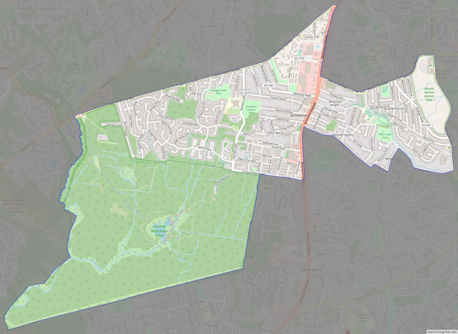
Groveton is a census-designated place (CDP) in Fairfax County, Virginia, United States. The population was 14,598 at the 2010 census, down from 21,296 in 2000 due to a reduction in area. Located south of the city of Alexandria, it encompasses numerous neighborhoods including Groveton, Bucknell Manor, Stoneybrooke, and portions of Hollin Hills. Huntley Meadows Park, Fairfax County’s largest park, is located in the southwest part of the CDP.
| Name: | Groveton CDP |
|---|---|
| LSAD Code: | 57 |
| LSAD Description: | CDP (suffix) |
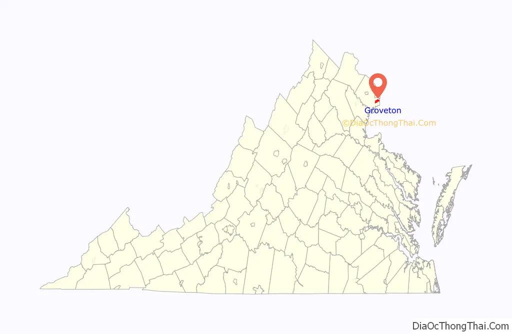
| State: | Virginia |
| County: | Fairfax County |
| Elevation: | 197 ft (60 m) |
| Total Area: | 4.4 sq mi (11.4 km²) |
| Land Area: | 4.3 sq mi (11.2 km²) |
| Water Area: | 0.08 sq mi (0.2 km²) |
| Total Population: | 14,598 |
| Population Density: | 3,363/sq mi (1,298.4/km²) |
| FIPS code: | 5133584 |
| GNISfeature ID: | 1493043 |
Online Interactive Map
Click on ![]() to view map in "full screen" mode.
to view map in "full screen" mode.
Groveton location map. Where is Groveton CDP?

Groveton Road Map
Groveton city Satellite Map

Geography
Groveton is in southeastern Fairfax County, bordered to the north by Rose Hill, to the northeast by Belle Haven, to the southeast by Fort Hunt and Hybla Valley, to the south by Woodlawn, to the southwest by Fort Belvoir, and to the west by Hayfield. U.S. Route 1 (Richmond Highway) passes through the developed center of Groveton in the eastern part of the CDP, leading northeast 3 miles (5 km) into Old Town Alexandria and 10 miles (16 km) into Washington, D.C., as well as southwest 13 miles (21 km) to Woodbridge. The Route 1 commercial area includes the Beacon Hill Shopping Center and surrounding retail stores, all of which run north towards Huntington.
According to the United States Census Bureau, the Groveton CDP has a total area of 4.4 square miles (11.4 km), of which 4.3 square miles (11.2 km) is land and 0.08 square miles (0.2 km), or 1.46%, is water.
See also
Map of Virginia State and its subdivision:- Accomack
- Albemarle
- Alexandria
- Alleghany
- Amelia
- Amherst
- Appomattox
- Arlington
- Augusta
- Bath
- Bedford
- Bedford City
- Bland
- Botetourt
- Bristol
- Brunswick
- Buchanan
- Buckingham
- Buena Vista
- Campbell
- Caroline
- Carroll
- Charles City
- Charlotte
- Charlottesville
- Chesapeake
- Chesterfield
- Clarke
- Clifton Forge City
- Colonial Heights
- Covington
- Craig
- Culpeper
- Cumberland
- Danville
- Dickenson
- Dinwiddie
- Emporia
- Essex
- Fairfax
- Fairfax City
- Falls Church
- Fauquier
- Floyd
- Fluvanna
- Franklin
- Frederick
- Fredericksburg
- Galax
- Giles
- Gloucester
- Goochland
- Grayson
- Greene
- Greensville
- Halifax
- Hampton
- Hanover
- Harrisonburg
- Henrico
- Henry
- Highland
- Hopewell
- Isle of Wight
- James City
- King and Queen
- King George
- King William
- Lancaster
- Lee
- Lexington
- Loudoun
- Louisa
- Lunenburg
- Lynchburg
- Madison
- Manassas
- Manassas Park
- Martinsville
- Mathews
- Mecklenburg
- Middlesex
- Montgomery
- Nelson
- New Kent
- Newport News
- Norfolk
- Northampton
- Northumberland
- Norton
- Nottoway
- Orange
- Page
- Patrick
- Petersburg
- Pittsylvania
- Poquoson
- Portsmouth
- Powhatan
- Prince Edward
- Prince George
- Prince William
- Pulaski
- Radford
- Rappahannock
- Richmond
- Roanoke
- Roanoke City
- Rockbridge
- Rockingham
- Russell
- Salem
- Scott
- Shenandoah
- Smyth
- Southampton
- Spotsylvania
- Stafford
- Staunton
- Suffolk
- Surry
- Sussex
- Tazewell
- Virginia Beach
- Warren
- Washington
- Waynesboro
- Westmoreland
- Williamsburg
- Winchester
- Wise
- Wythe
- York
- Alabama
- Alaska
- Arizona
- Arkansas
- California
- Colorado
- Connecticut
- Delaware
- District of Columbia
- Florida
- Georgia
- Hawaii
- Idaho
- Illinois
- Indiana
- Iowa
- Kansas
- Kentucky
- Louisiana
- Maine
- Maryland
- Massachusetts
- Michigan
- Minnesota
- Mississippi
- Missouri
- Montana
- Nebraska
- Nevada
- New Hampshire
- New Jersey
- New Mexico
- New York
- North Carolina
- North Dakota
- Ohio
- Oklahoma
- Oregon
- Pennsylvania
- Rhode Island
- South Carolina
- South Dakota
- Tennessee
- Texas
- Utah
- Vermont
- Virginia
- Washington
- West Virginia
- Wisconsin
- Wyoming


