Franconia is a census-designated place (CDP) in Fairfax County, Virginia, United States. The population was 18,245 at the 2010 census, down from 31,907 in 2000 due to the splitting off of part of it to form the Kingstowne CDP.
Located just southwest of Alexandria, Franconia has existed as a community since the 1870s, when a station by that name opened on the RF&P Railroad; however, like most of the surrounding area, it only began to develop into its present, suburban form in the 1950s. The CDP extends south to just north of the border of Fort Belvoir, encompassing neighborhoods such as Manchester Lakes and Windsor Estates. Street addresses have Alexandria ZIP Codes 22310 and 22315. It is near the Springfield Mall shopping area and the Franconia–Springfield Washington Metro station.
| Name: | Franconia CDP |
|---|---|
| LSAD Code: | 57 |
| LSAD Description: | CDP (suffix) |
| State: | Virginia |
| County: | Fairfax County |
| Elevation: | 249 ft (76 m) |
| Total Area: | 3.48 sq mi (9.01 km²) |
| Land Area: | 3.47 sq mi (8.99 km²) |
| Water Area: | 0.008 sq mi (0.02 km²) |
| Total Population: | 18,245 |
| Population Density: | 5,254/sq mi (2,028.5/km²) |
| Area code: | 703, 571 |
| FIPS code: | 5129552 |
| GNISfeature ID: | 1492975 |
Online Interactive Map
Click on ![]() to view map in "full screen" mode.
to view map in "full screen" mode.
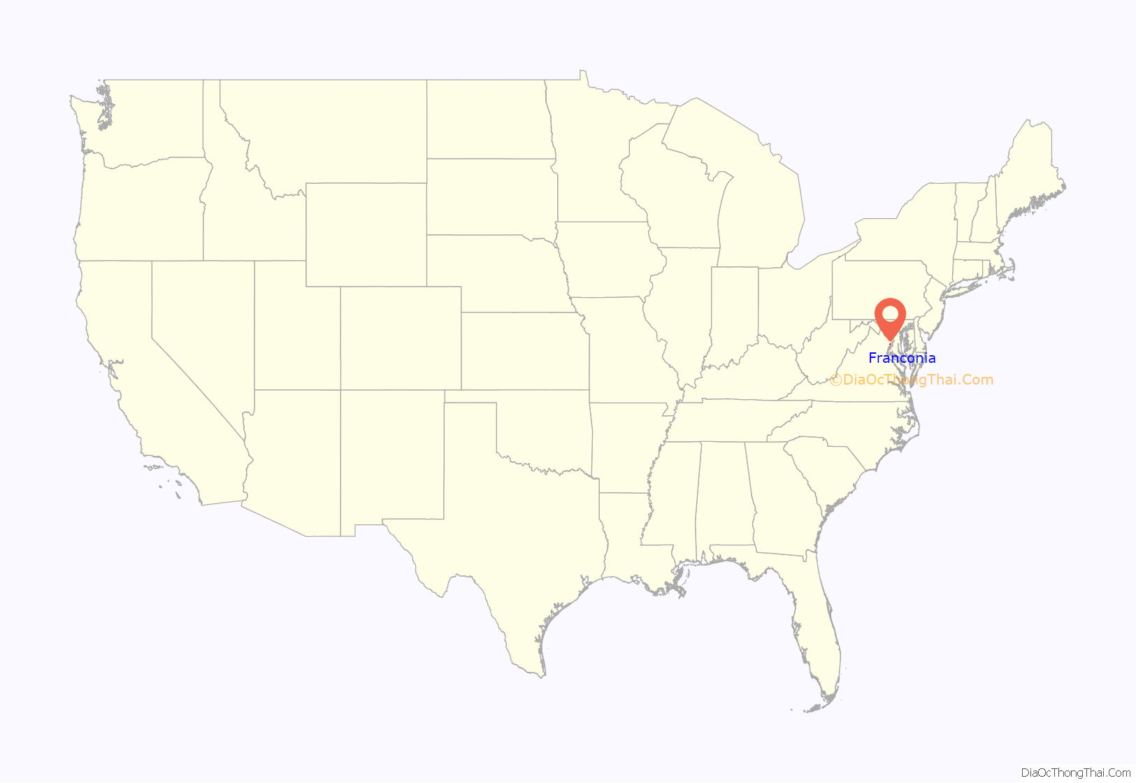
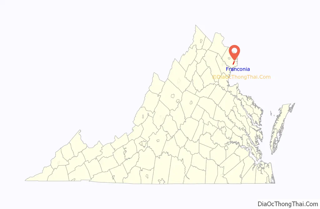
Franconia location map. Where is Franconia CDP?
History
Franconia Road once served as a rolling road to bring tobacco hogsheads to the port at Alexandria. The surrounding community derives its name from the “Frankhonia Farm”, which sat on a portion of a tract of 191 acres purchased from Joseph Broders of Oak Grove Farm in 1859 by William Fowle, a merchant from Alexandria. Fowle’s son, Robert Rollins Fowle, sold 18 acres of the property to the Alexandria & Fredericksburg Railway Company in 1871 for the erection of a railway station, which took its name of the farm. The station was the site of the Garfield Post Office from 1881 until 1890, and again from 1898 until 1907. In 1903 it was relocated after a fire from its original site, near Fleet Drive, to the north side of Franconia Road. The railway station remained in regular service until around 1953. Today it is memorialized with a historic marker erected by the Fairfax County History Commission in 2000, located in front of the Franconia Governmental Center. For many years the center of the community was Wards Corner, at the intersection of Franconia Road and Old Rolling Road. Over twenty-five years the complex grew to include a gas station, grocery store, bar, movie theater, and dance hall; a 1959 fire destroyed everything at the site.
The Franconia area was the site of a skirmish in January 1862, during the American Civil War. Colonel Wade Hampton III, having led a group of cavalrymen across the Occoquan River past Pohick Church, encountered a group of Union cavalry in the area and gave chase. Being warned by a Texas scout that he was soon to enter an ambush, Hampton stopped short and formed a squadron on top of Potter’s Hill. The trap having failed, both sides began firing at each other; several soldiers were wounded, including one of Hampton’s men who was shot in the face. The Confederates then retreated across the Occoquan. In later years Potter’s Hill was the site of three schoolhouses, the last of them burning in 1932; more recently it was the site of a chicken farm and, later, a gravel quarry which provided material for the construction of the first Woodrow Wilson Bridge. Today the location is the site of the Hilltop Village Center. Members of the Potter family are buried at the Millan family cemetery, located nearby on the former grounds of the Millan family home, Dairy Lodge.
The Franconia Volunteer Fire Department was organized in 1934; its first firehouse, completed in 1937, stood where the government center is located today. Today the department continues to serve the community from two locations in the vicinity.
Franconia is also the site of the Laurel Grove Colored School and Church, organized as a congregation of former slaves in the 1880s. The school site was deeded to the Virginia School System in 1881 by Georgianna and William Jasper for $10; the school served the community until 1932. In 1884 the couple provided another half-acre for a church to be built next to the school. Laurel Grove Baptist Church stood until being destroyed by an electrical fire in December 2004. The church cemetery still exists, as does the school building, which was honored in 2008 with the erection of a historical marker by the Fairfax County History Commission. A number of other churches have existed in the neighborhood over the years, including Sharon Chapel, founded in 1848 and counting Phillips Brooks among its early seminarians, and Olivet Episcopal Church. Adjacent to Sharon Chapel is a cemetery, one of several in the area; another marks the former site of Oak Grove plantation, which was demolished in 1996 to make way for an assisted living facility. Other cemeteries can be found along Beulah Street.
The Franconia area is represented in the Virginia House of Delegates by Democrat Mark D. Sickles. Other residents have included former South Carolina Congressman William Waters Boyce, who purchased the house Ashland and 195 acres of farmland after the Civil War.
The history of the Franconia community and the surrounding area is preserved and interpreted by the Franconia Museum, located in the Franconia Governmental Center.
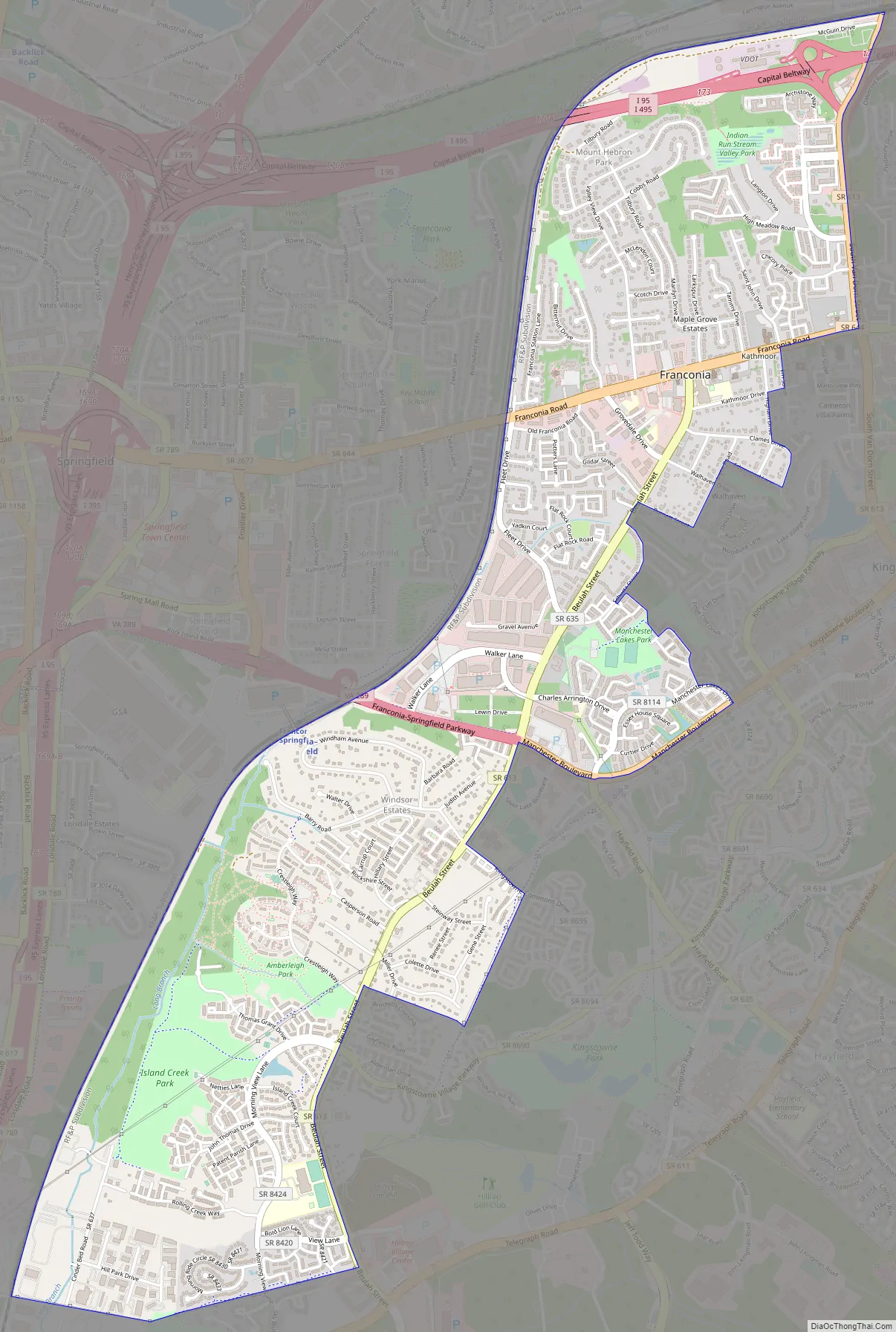
Franconia Road Map
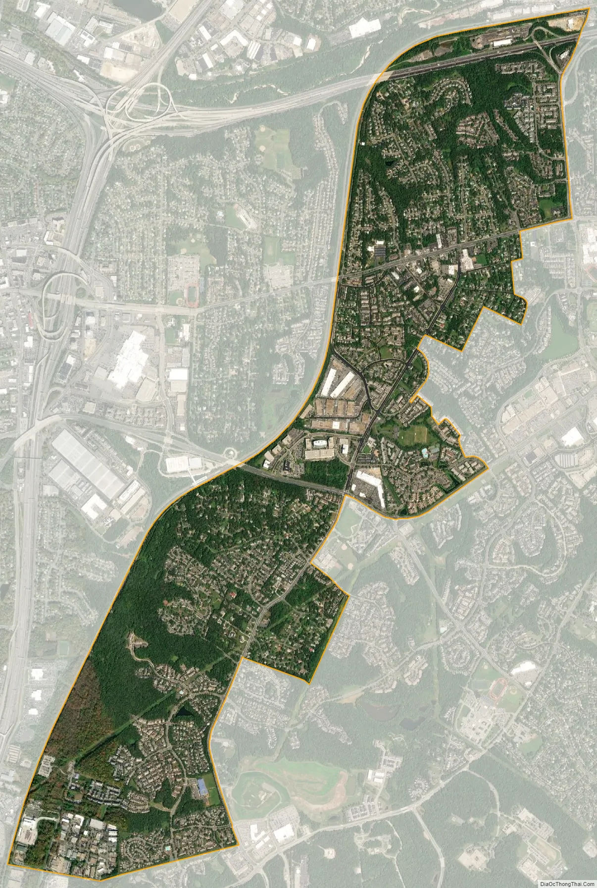
Franconia city Satellite Map
Geography
Franconia is located in southeastern Fairfax County at 38°45′48″N 77°09′01″W / 38.763351°N 77.150328°W / 38.763351; -77.150328 (38.763351, −77.150328). It is bordered to the west by Springfield, to the north by Lincolnia, to the northeast by Rose Hill, to the east by Kingstowne, and to the south by Newington. It is 13 miles (21 km) southwest of Washington, D.C.
According to the United States Census Bureau, the Franconia CDP has a total area of 3.5 square miles (9.0 km), of which 0.01 square miles (0.02 km), or 0.18%, is water.
See also
Map of Virginia State and its subdivision:- Accomack
- Albemarle
- Alexandria
- Alleghany
- Amelia
- Amherst
- Appomattox
- Arlington
- Augusta
- Bath
- Bedford
- Bedford City
- Bland
- Botetourt
- Bristol
- Brunswick
- Buchanan
- Buckingham
- Buena Vista
- Campbell
- Caroline
- Carroll
- Charles City
- Charlotte
- Charlottesville
- Chesapeake
- Chesterfield
- Clarke
- Clifton Forge City
- Colonial Heights
- Covington
- Craig
- Culpeper
- Cumberland
- Danville
- Dickenson
- Dinwiddie
- Emporia
- Essex
- Fairfax
- Fairfax City
- Falls Church
- Fauquier
- Floyd
- Fluvanna
- Franklin
- Frederick
- Fredericksburg
- Galax
- Giles
- Gloucester
- Goochland
- Grayson
- Greene
- Greensville
- Halifax
- Hampton
- Hanover
- Harrisonburg
- Henrico
- Henry
- Highland
- Hopewell
- Isle of Wight
- James City
- King and Queen
- King George
- King William
- Lancaster
- Lee
- Lexington
- Loudoun
- Louisa
- Lunenburg
- Lynchburg
- Madison
- Manassas
- Manassas Park
- Martinsville
- Mathews
- Mecklenburg
- Middlesex
- Montgomery
- Nelson
- New Kent
- Newport News
- Norfolk
- Northampton
- Northumberland
- Norton
- Nottoway
- Orange
- Page
- Patrick
- Petersburg
- Pittsylvania
- Poquoson
- Portsmouth
- Powhatan
- Prince Edward
- Prince George
- Prince William
- Pulaski
- Radford
- Rappahannock
- Richmond
- Roanoke
- Roanoke City
- Rockbridge
- Rockingham
- Russell
- Salem
- Scott
- Shenandoah
- Smyth
- Southampton
- Spotsylvania
- Stafford
- Staunton
- Suffolk
- Surry
- Sussex
- Tazewell
- Virginia Beach
- Warren
- Washington
- Waynesboro
- Westmoreland
- Williamsburg
- Winchester
- Wise
- Wythe
- York
- Alabama
- Alaska
- Arizona
- Arkansas
- California
- Colorado
- Connecticut
- Delaware
- District of Columbia
- Florida
- Georgia
- Hawaii
- Idaho
- Illinois
- Indiana
- Iowa
- Kansas
- Kentucky
- Louisiana
- Maine
- Maryland
- Massachusetts
- Michigan
- Minnesota
- Mississippi
- Missouri
- Montana
- Nebraska
- Nevada
- New Hampshire
- New Jersey
- New Mexico
- New York
- North Carolina
- North Dakota
- Ohio
- Oklahoma
- Oregon
- Pennsylvania
- Rhode Island
- South Carolina
- South Dakota
- Tennessee
- Texas
- Utah
- Vermont
- Virginia
- Washington
- West Virginia
- Wisconsin
- Wyoming


