Gate City is a town in Scott County, Virginia, United States. The population was 2,034 at the 2010 census. It is the seat of Scott County.
Gate City is part of the Kingsport–Bristol (TN)–Bristol (VA) Metropolitan Statistical Area, which is a component of the Johnson City–Kingsport–Bristol, TN-VA Combined Statistical Area – commonly known as the “Tri-Cities” region.
Some scenes from The River were shot here.
| Name: | Gate City town |
|---|---|
| LSAD Code: | 43 |
| LSAD Description: | town (suffix) |
| State: | Virginia |
| County: | Scott County |
| Elevation: | 1,339 ft (408 m) |
| Total Area: | 4.02 sq mi (10.41 km²) |
| Land Area: | 3.98 sq mi (10.31 km²) |
| Water Area: | 0.04 sq mi (0.10 km²) |
| Total Population: | 2,034 |
| Population Density: | 469.48/sq mi (181.28/km²) |
| ZIP code: | 24251 |
| Area code: | 276 |
| FIPS code: | 5130496 |
| GNISfeature ID: | 1498481 |
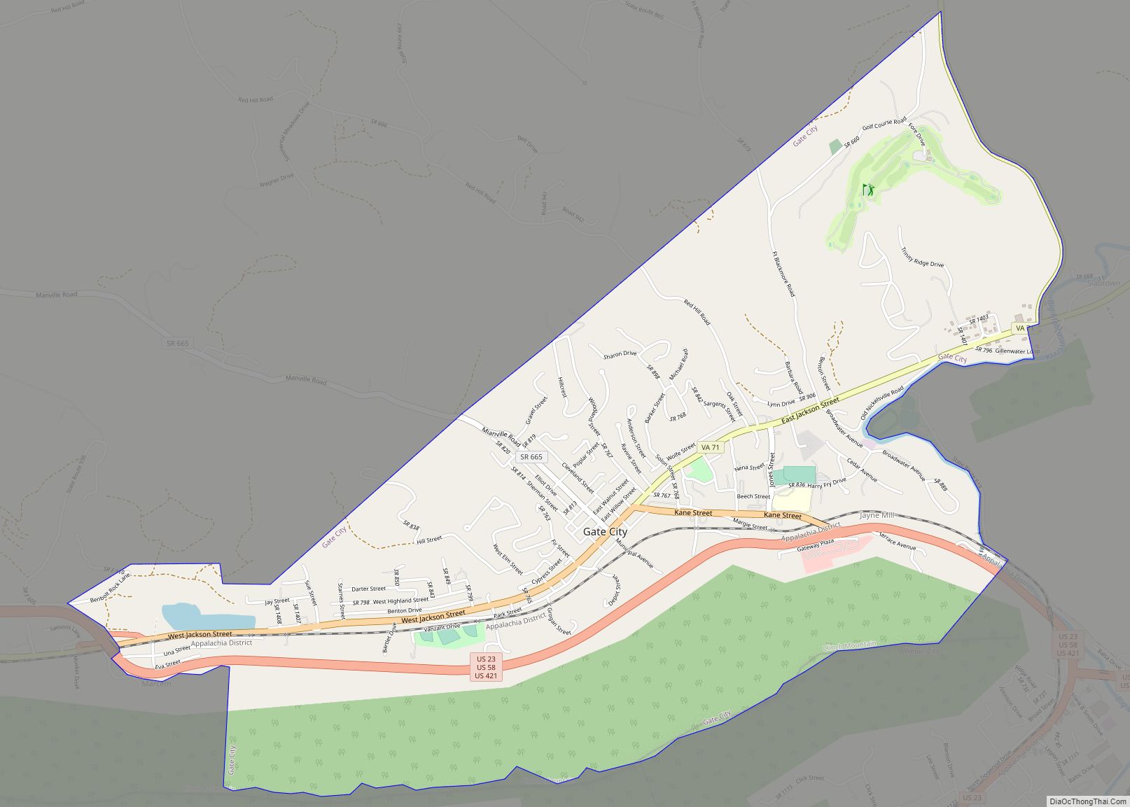
Online Interactive Map
Click on ![]() to view map in "full screen" mode.
to view map in "full screen" mode.
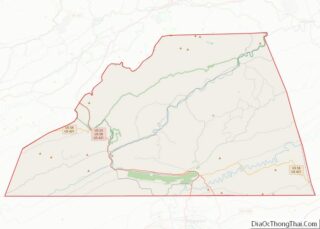
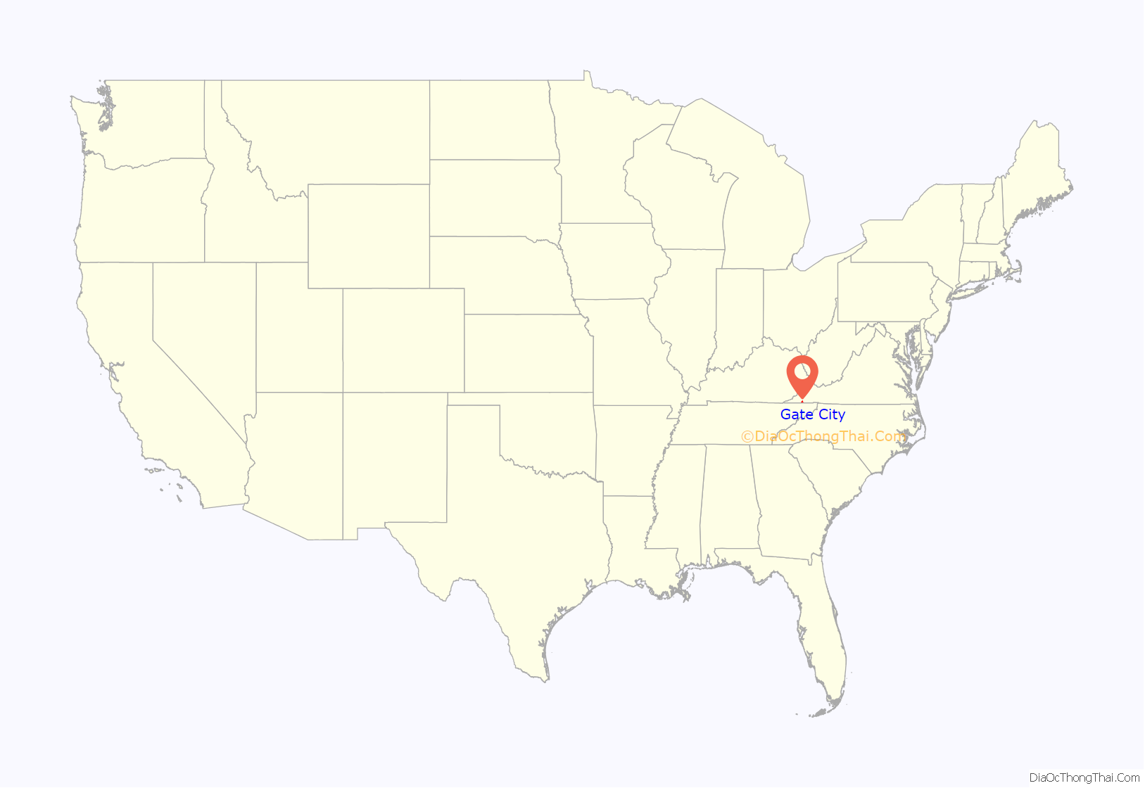
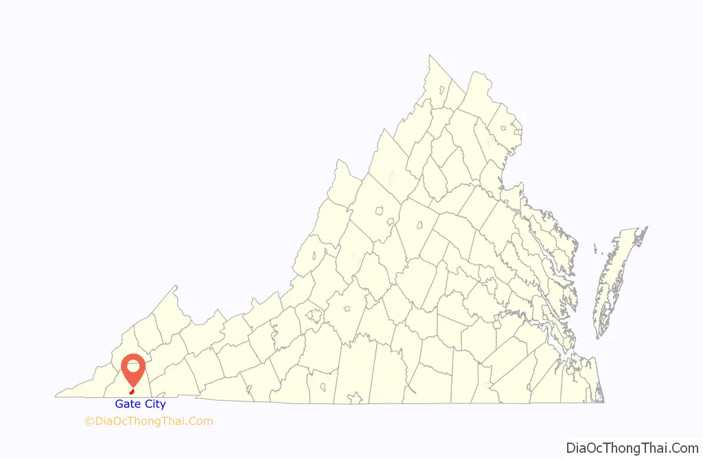
Gate City location map. Where is Gate City town?
History
In 1771, Silas Engart received a land grant of 200 acres that included the location of the future town. By the time of Scott County’s formation in 1815, landowner James Davidson, Sr. donated approximately 13 acres of his plantation for establishing the county seat. The location of the town was such that it would emerge as an important commercial center for people and goods traveling through Big Moccasin Gap and the North Fork of the Holston River.
When the county seat was established in 1815, it was named Winfield in honor of War of 1812 hero Gen. Winfield Scott. The main street of the new town honored war hero and future president Andrew Jackson.
In 1817, the town was renamed Estillville in honor of Benjamin Estill, a local judge instrumental in the formation of the new county. As a result of the county seat’s location near Big Moccasin Gap and the North Fork of the Holston River, the town grew into a commercial center for people passing through on their way westward, for farmers hoping to sell goods, and businessmen in town for legal affairs. A regular wagon train and coach line service conveying people, mail, and commercial goods between Bedford and Estilville.
Gate City received its present name in 1886, when Attorney General Rufus A. Ayers pointed out that proximity to Big Moccasin Gap marked the town as the “Gate Way to the West.” The town was incorporated in 1892.
By the beginning of the twentieth-century, Gate City was one of several “boom towns” located in southwestern Virginia. Although the streets were little more than dirt byways in the town, the area was a vibrant commercial and transportation center. Up to six daily passenger trains passed through Gate City. The town also had a railroad log yard where logs from all over the county were stored and then loaded to be later transported by train. Iron ore from the Snowflake and Nickelsville areas as well as glass sand from the south of Clinch Mountain were manufactured and shipped from Gate City. In addition, the town had a thriving manufacturing center in the area of Water Street where wood pumps, staves, sleds, and harnesses were built. By 1915, the town supported two livery stables on Willow Street and a blacksmith shop on Jackson Street, as well as a dentist’s office, an ice plant, a casket shop, and a furniture manufacturing business. By the 1930s, Gate City had three movie theaters, banks, and a hotel. The town also had two businesses that dealt with auto sales and repairs.
By the 1950s and 1960s, the town’s momentum was slowing. As industry in Kingsport, Tennessee (6 miles to the south) attracted Gate City residents, several local businesses and small manufacturing companies shut down. By 2010, many former commercial buildings stood vacant, but the Gate City Historic District was newly listed on the National Register of Historic Places.
Pilot Flying J, the largest network of service station/travel centers in North America operating in 44 states and 6 Canadian provinces, and headquartered in Knoxville, TN, was started in Gate City in 1958.
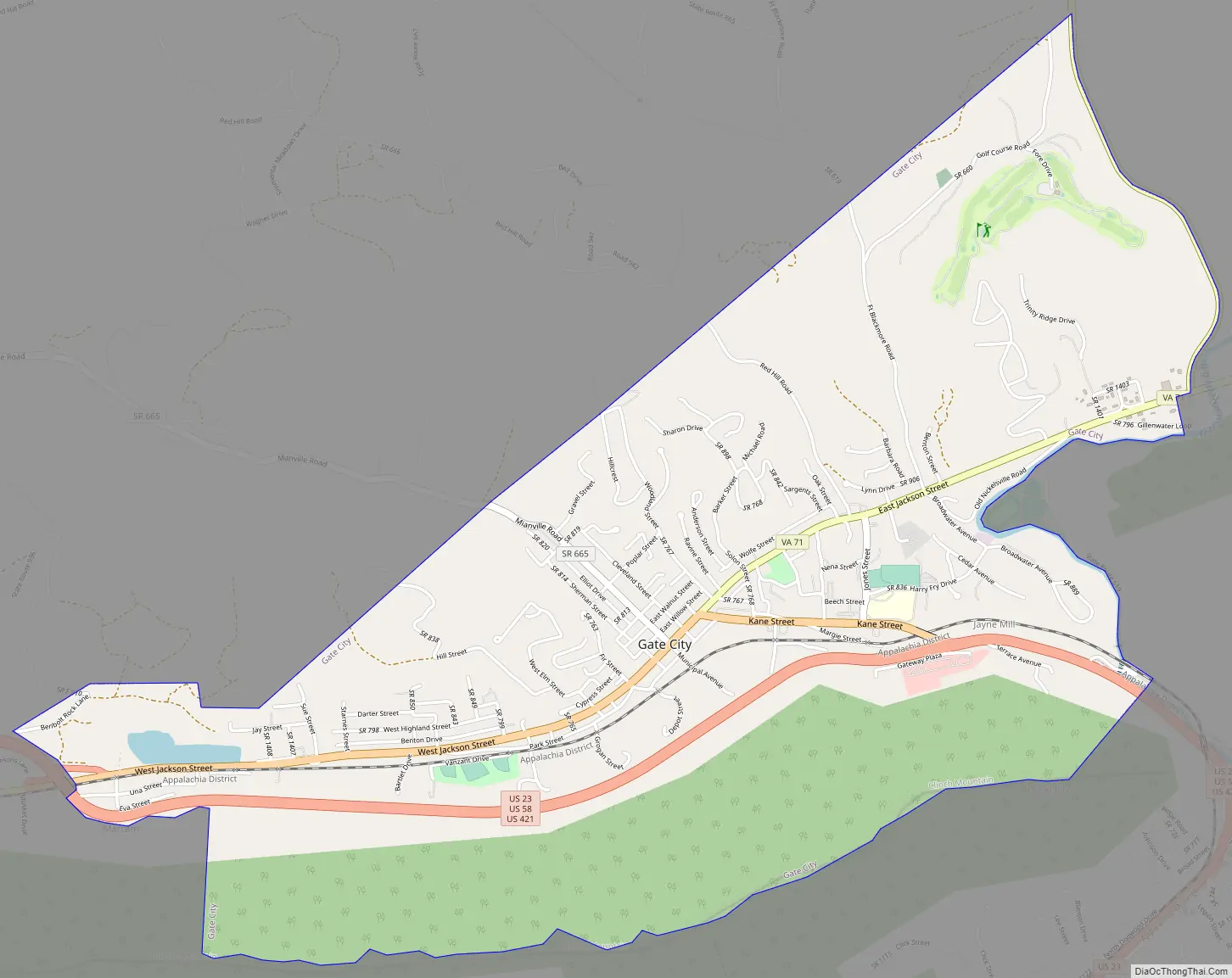
Gate City Road Map
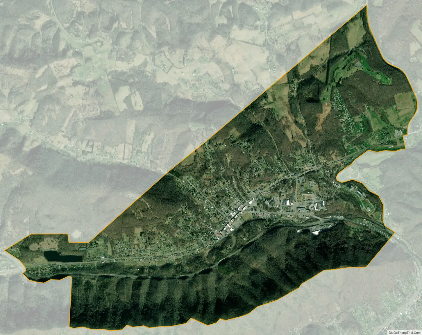
Gate City city Satellite Map
Geography
Gate City is located at 36°38′18″N 82°34′50″W / 36.63833°N 82.58056°W / 36.63833; -82.58056 (36.638325, −82.580659).
According to the United States Census Bureau, the town has a total area of 2.1 square miles (5.4 km), of which 2.0 square miles (5.2 km) is land and 0.04 square miles (0.10 km), or 0.97%, is water. The town has expanded its boundaries since the 2000 census via a boundary adjustment agreement with the county.
Bordered by a mountain, Gate City is a small city relative to its neighbors and located on U.S. Routes 23 and 421 near the Tennessee state line. The Virginia Department of Transportation (VDOT) plans for a large portion of the mountain at Moccasin Gap to be shorn away.
See also
Map of Virginia State and its subdivision:- Accomack
- Albemarle
- Alexandria
- Alleghany
- Amelia
- Amherst
- Appomattox
- Arlington
- Augusta
- Bath
- Bedford
- Bedford City
- Bland
- Botetourt
- Bristol
- Brunswick
- Buchanan
- Buckingham
- Buena Vista
- Campbell
- Caroline
- Carroll
- Charles City
- Charlotte
- Charlottesville
- Chesapeake
- Chesterfield
- Clarke
- Clifton Forge City
- Colonial Heights
- Covington
- Craig
- Culpeper
- Cumberland
- Danville
- Dickenson
- Dinwiddie
- Emporia
- Essex
- Fairfax
- Fairfax City
- Falls Church
- Fauquier
- Floyd
- Fluvanna
- Franklin
- Frederick
- Fredericksburg
- Galax
- Giles
- Gloucester
- Goochland
- Grayson
- Greene
- Greensville
- Halifax
- Hampton
- Hanover
- Harrisonburg
- Henrico
- Henry
- Highland
- Hopewell
- Isle of Wight
- James City
- King and Queen
- King George
- King William
- Lancaster
- Lee
- Lexington
- Loudoun
- Louisa
- Lunenburg
- Lynchburg
- Madison
- Manassas
- Manassas Park
- Martinsville
- Mathews
- Mecklenburg
- Middlesex
- Montgomery
- Nelson
- New Kent
- Newport News
- Norfolk
- Northampton
- Northumberland
- Norton
- Nottoway
- Orange
- Page
- Patrick
- Petersburg
- Pittsylvania
- Poquoson
- Portsmouth
- Powhatan
- Prince Edward
- Prince George
- Prince William
- Pulaski
- Radford
- Rappahannock
- Richmond
- Roanoke
- Roanoke City
- Rockbridge
- Rockingham
- Russell
- Salem
- Scott
- Shenandoah
- Smyth
- Southampton
- Spotsylvania
- Stafford
- Staunton
- Suffolk
- Surry
- Sussex
- Tazewell
- Virginia Beach
- Warren
- Washington
- Waynesboro
- Westmoreland
- Williamsburg
- Winchester
- Wise
- Wythe
- York
- Alabama
- Alaska
- Arizona
- Arkansas
- California
- Colorado
- Connecticut
- Delaware
- District of Columbia
- Florida
- Georgia
- Hawaii
- Idaho
- Illinois
- Indiana
- Iowa
- Kansas
- Kentucky
- Louisiana
- Maine
- Maryland
- Massachusetts
- Michigan
- Minnesota
- Mississippi
- Missouri
- Montana
- Nebraska
- Nevada
- New Hampshire
- New Jersey
- New Mexico
- New York
- North Carolina
- North Dakota
- Ohio
- Oklahoma
- Oregon
- Pennsylvania
- Rhode Island
- South Carolina
- South Dakota
- Tennessee
- Texas
- Utah
- Vermont
- Virginia
- Washington
- West Virginia
- Wisconsin
- Wyoming