Great Falls is a census-designated place (CDP) in Fairfax County, Virginia, United States. The population as of the 2010 census was 15,427, an increase of 80.5% from the 2000 census.
| Name: | Great Falls CDP |
|---|---|
| LSAD Code: | 57 |
| LSAD Description: | CDP (suffix) |
| State: | Virginia |
| County: | Fairfax County |
| Elevation: | 344 ft (105 m) |
| Total Area: | 25.66 sq mi (66.5 km²) |
| Land Area: | 25.42 sq mi (65.8 km²) |
| Water Area: | 0.24 sq mi (0.6 km²) |
| Total Population: | 15,427 |
| Population Density: | 606.9/sq mi (234.3/km²) |
| ZIP code: | 22066 |
| Area code: | 703, 571 |
| FIPS code: | 5132496 |
| GNISfeature ID: | 1467429 |
Online Interactive Map
Click on ![]() to view map in "full screen" mode.
to view map in "full screen" mode.
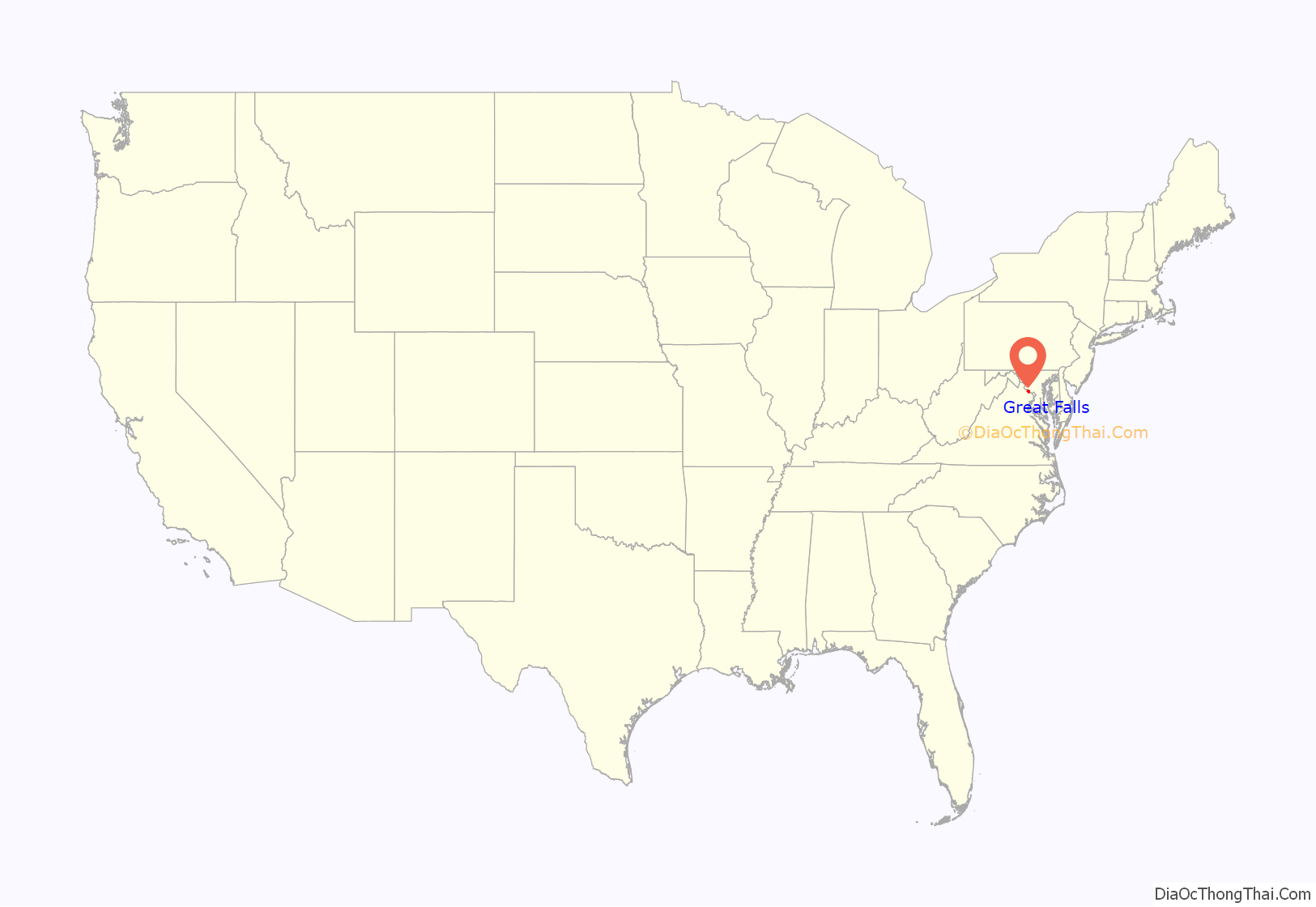
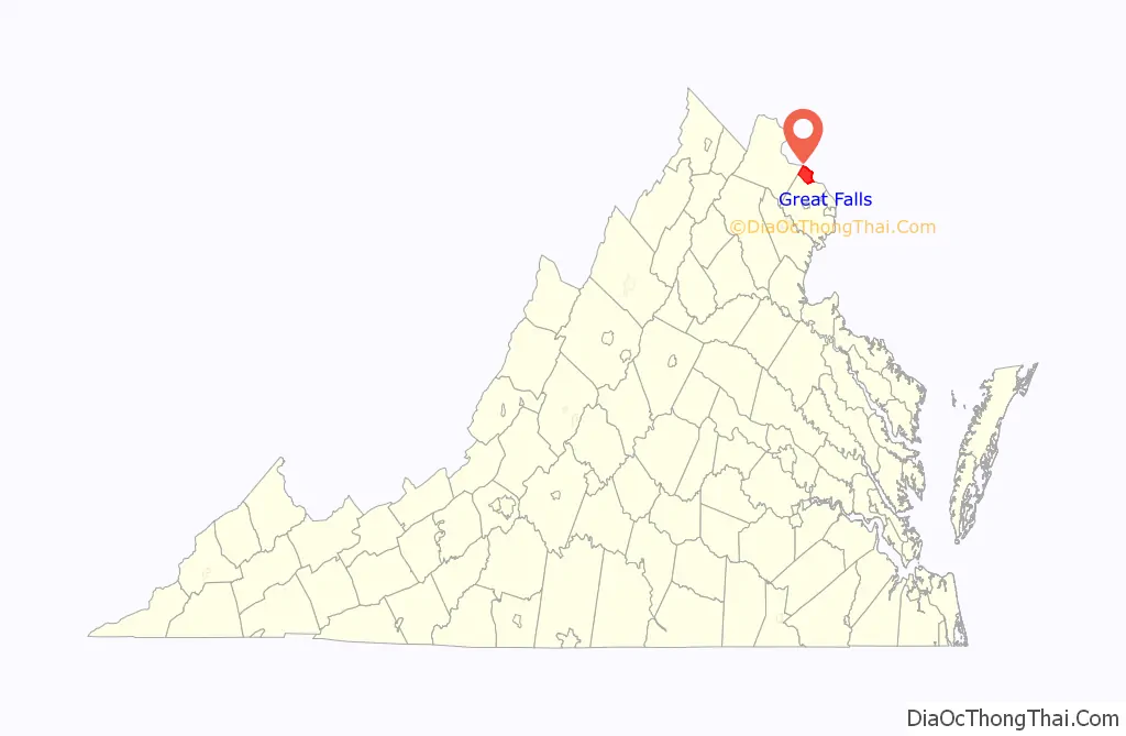
Great Falls location map. Where is Great Falls CDP?
History
Colonial farm settlements began to form in the area as early as the late 1700s.
Early on, the village was known as Forestville (unofficially, since there was already a Forestville with a Post Office), but was renamed Great Falls in 1955.
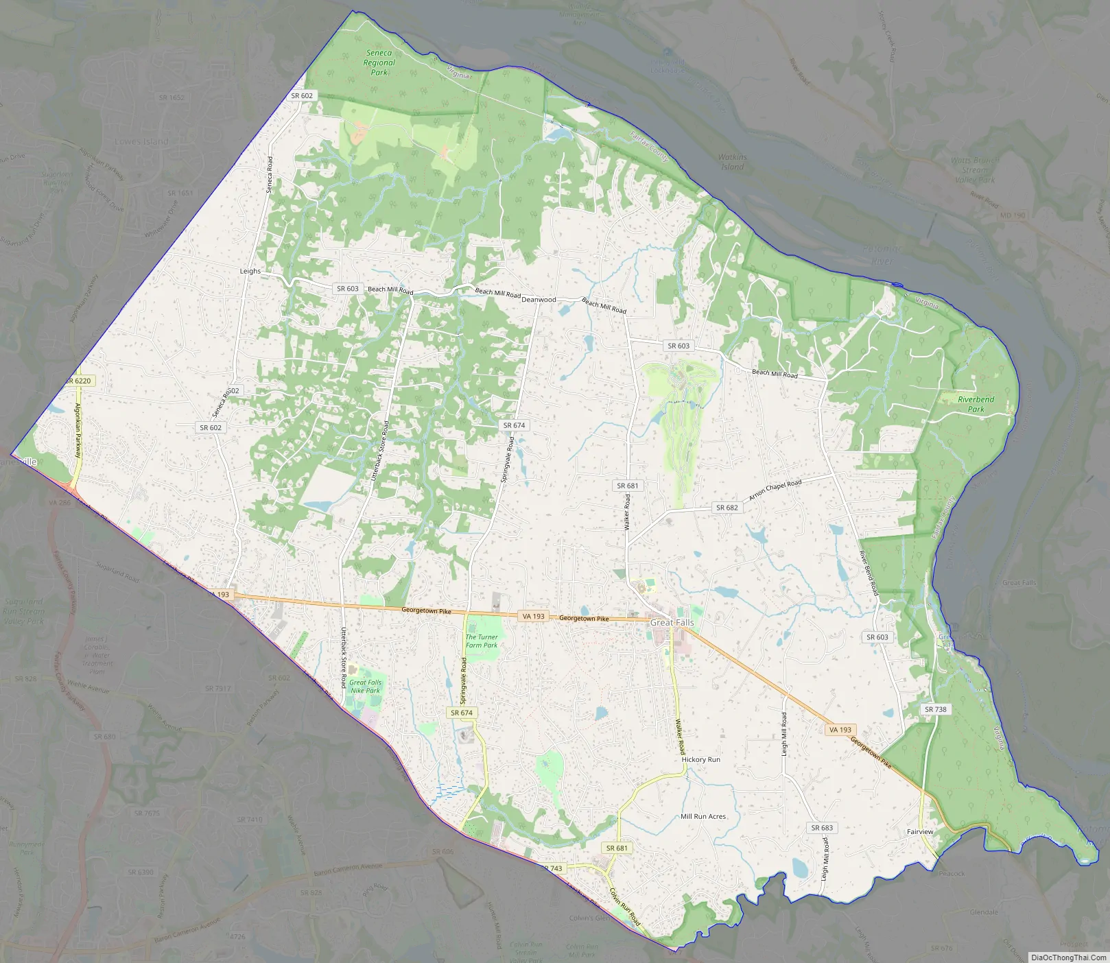
Great Falls Road Map
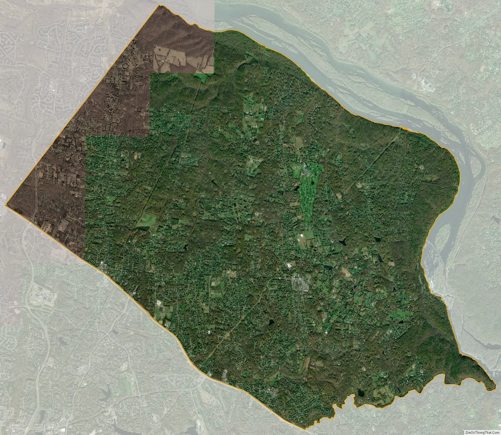
Great Falls city Satellite Map
Geography
Great Falls is located at 38°59′53″N 077°17′18″W / 38.99806°N 77.28833°W / 38.99806; -77.28833 (38.9981653, −77.2883157) at an elevation of 344 feet (105 m). Located on Virginia State Route 7 in Northern Virginia, Great Falls is 15 miles (24 km) west-northwest of downtown Washington, D.C. and 10.5 miles (16.9 km) north of Fairfax, the county seat.
Great Falls lies in the Piedmont upland on the right bank of the Potomac River. The Potomac River forms the northern and eastern borders of the CDP, and several of its tributaries flow north and east through the CDP. From north to south, these include Nichols Run, Clarks Branch, and Difficult Run. Difficult Run (along with Leesburg Pike) forms the southern border of the CDP. Two of its tributaries, Captain Hickory Run and Piney Run, flow southeast through the southern part of the CDP. The Great Falls of the Potomac River, the community’s namesake, are on the east side of the CDP.
According to the United States Census Bureau, the CDP has a total area of 25.66 square miles (66.5 km) of which 25.42 square miles (65.8 km) is land and 0.24 square miles (0.62 km) is water.
As a suburb of Washington, D.C., Great Falls is a part of both the Washington Metropolitan Area and the larger Baltimore-Washington Metropolitan Area. It is bordered on all sides by other Washington suburbs, including: Darnestown and Travilah, Maryland to the north, Potomac, Maryland to the east, McLean to the southeast, Wolf Trap to the south, Reston and Dranesville to the southwest, Sterling to the west, and Lowes Island to the northwest.
See also
Map of Virginia State and its subdivision:- Accomack
- Albemarle
- Alexandria
- Alleghany
- Amelia
- Amherst
- Appomattox
- Arlington
- Augusta
- Bath
- Bedford
- Bedford City
- Bland
- Botetourt
- Bristol
- Brunswick
- Buchanan
- Buckingham
- Buena Vista
- Campbell
- Caroline
- Carroll
- Charles City
- Charlotte
- Charlottesville
- Chesapeake
- Chesterfield
- Clarke
- Clifton Forge City
- Colonial Heights
- Covington
- Craig
- Culpeper
- Cumberland
- Danville
- Dickenson
- Dinwiddie
- Emporia
- Essex
- Fairfax
- Fairfax City
- Falls Church
- Fauquier
- Floyd
- Fluvanna
- Franklin
- Frederick
- Fredericksburg
- Galax
- Giles
- Gloucester
- Goochland
- Grayson
- Greene
- Greensville
- Halifax
- Hampton
- Hanover
- Harrisonburg
- Henrico
- Henry
- Highland
- Hopewell
- Isle of Wight
- James City
- King and Queen
- King George
- King William
- Lancaster
- Lee
- Lexington
- Loudoun
- Louisa
- Lunenburg
- Lynchburg
- Madison
- Manassas
- Manassas Park
- Martinsville
- Mathews
- Mecklenburg
- Middlesex
- Montgomery
- Nelson
- New Kent
- Newport News
- Norfolk
- Northampton
- Northumberland
- Norton
- Nottoway
- Orange
- Page
- Patrick
- Petersburg
- Pittsylvania
- Poquoson
- Portsmouth
- Powhatan
- Prince Edward
- Prince George
- Prince William
- Pulaski
- Radford
- Rappahannock
- Richmond
- Roanoke
- Roanoke City
- Rockbridge
- Rockingham
- Russell
- Salem
- Scott
- Shenandoah
- Smyth
- Southampton
- Spotsylvania
- Stafford
- Staunton
- Suffolk
- Surry
- Sussex
- Tazewell
- Virginia Beach
- Warren
- Washington
- Waynesboro
- Westmoreland
- Williamsburg
- Winchester
- Wise
- Wythe
- York
- Alabama
- Alaska
- Arizona
- Arkansas
- California
- Colorado
- Connecticut
- Delaware
- District of Columbia
- Florida
- Georgia
- Hawaii
- Idaho
- Illinois
- Indiana
- Iowa
- Kansas
- Kentucky
- Louisiana
- Maine
- Maryland
- Massachusetts
- Michigan
- Minnesota
- Mississippi
- Missouri
- Montana
- Nebraska
- Nevada
- New Hampshire
- New Jersey
- New Mexico
- New York
- North Carolina
- North Dakota
- Ohio
- Oklahoma
- Oregon
- Pennsylvania
- Rhode Island
- South Carolina
- South Dakota
- Tennessee
- Texas
- Utah
- Vermont
- Virginia
- Washington
- West Virginia
- Wisconsin
- Wyoming


