Newington is a census-designated place (CDP) in Fairfax County, Virginia, United States. The population was 12,943 at the 2010 census. The 2010 census showed a significant decrease after half the population was split off to the newly created Newington Forest CDP.
While the ZIP code for Newington is 22122, this is only for delivery points within the post office itself. Homes and businesses in the CDP have Springfield or Lorton street addresses.
| Name: | Newington CDP |
|---|---|
| LSAD Code: | 57 |
| LSAD Description: | CDP (suffix) |
| State: | Virginia |
| County: | Fairfax County |
| Elevation: | 108 ft (33 m) |
| Total Area: | 4.6 sq mi (11.9 km²) |
| Land Area: | 4.6 sq mi (11.8 km²) |
| Water Area: | 0.04 sq mi (0.1 km²) |
| Total Population: | 12,943 |
| Population Density: | 2,844/sq mi (1,098.1/km²) |
| ZIP code: | 22153 |
| Area code: | 703 |
| FIPS code: | 5155752 |
| GNISfeature ID: | 1495074 |
Online Interactive Map
Click on ![]() to view map in "full screen" mode.
to view map in "full screen" mode.
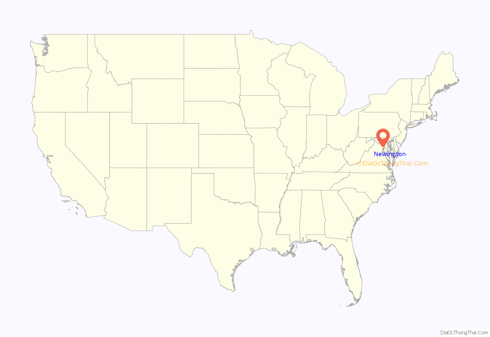
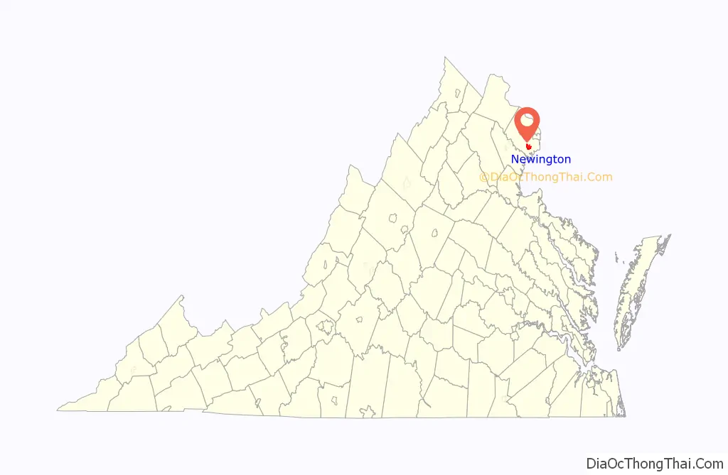
Newington location map. Where is Newington CDP?
History
The community of Newington derives its name from the second glebe house of Truro Parish, completed in 1760 and so named after becoming the private residence of Richard and Sarah McCarty Chichester sometime after 1767. The house itself was purchased by the family of William Nevitt, in 1828, along with 1000 acres of land; they occupied the building until it burned in 1875. The Alexandria and Fredericksburg Railway opened a railway station on the property in April 1872. Originally known as the Long Branch Station and later renamed Accotink and then Newington, it was closed in 1971; it is remembered by a historic marker erected by the Fairfax County History Commission in 2005. Also in the Newington area are the remains of the Mount Air plantation, originally granted to Dennis McCarty in 1727. The house was destroyed by fire in 1992, but ruins remain; they, too, are denoted by a historic marker, erected in 2006, and are owned by the Fairfax County Park Authority, which interprets the site.
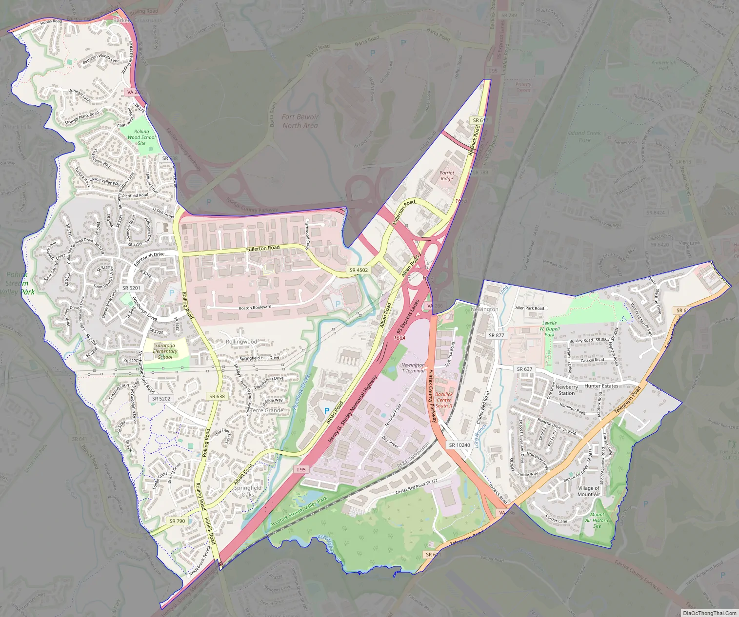
Newington Road Map
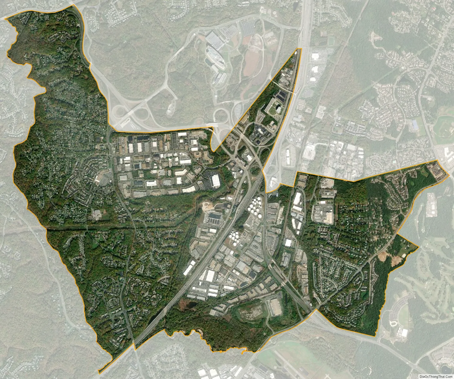
Newington city Satellite Map
Geography
Newington is located in southern Fairfax County at 38°44′7″N 77°12′13″W / 38.73528°N 77.20361°W / 38.73528; -77.20361 (38.735414, −77.203558). It is bordered to the north by Springfield, to the northeast by Franconia and Kingstowne, to the east and southeast by Fort Belvoir, to the southwest by Lorton, to the west by Newington Forest, and to the northwest by West Springfield. Interstate 95 passes through the middle of the CDP, with access from Exit 166 (Virginia Route 286, the Fairfax County Parkway). Washington, D.C. is 16 miles (26 km) to the northeast via I-95 and I-395, and Fredericksburg is 37 miles (60 km) to the southwest. The Fairfax County Parkway leads northwest 16 miles (26 km) to Interstate 66 between Fairfax and Centreville.
According to the United States Census Bureau, the Newington CDP has a total area of 4.6 square miles (11.9 km), of which 4.6 square miles (11.8 km) is land and 0.04 square miles (0.1 km), or 0.97%, is water.
See also
Map of Virginia State and its subdivision:- Accomack
- Albemarle
- Alexandria
- Alleghany
- Amelia
- Amherst
- Appomattox
- Arlington
- Augusta
- Bath
- Bedford
- Bedford City
- Bland
- Botetourt
- Bristol
- Brunswick
- Buchanan
- Buckingham
- Buena Vista
- Campbell
- Caroline
- Carroll
- Charles City
- Charlotte
- Charlottesville
- Chesapeake
- Chesterfield
- Clarke
- Clifton Forge City
- Colonial Heights
- Covington
- Craig
- Culpeper
- Cumberland
- Danville
- Dickenson
- Dinwiddie
- Emporia
- Essex
- Fairfax
- Fairfax City
- Falls Church
- Fauquier
- Floyd
- Fluvanna
- Franklin
- Frederick
- Fredericksburg
- Galax
- Giles
- Gloucester
- Goochland
- Grayson
- Greene
- Greensville
- Halifax
- Hampton
- Hanover
- Harrisonburg
- Henrico
- Henry
- Highland
- Hopewell
- Isle of Wight
- James City
- King and Queen
- King George
- King William
- Lancaster
- Lee
- Lexington
- Loudoun
- Louisa
- Lunenburg
- Lynchburg
- Madison
- Manassas
- Manassas Park
- Martinsville
- Mathews
- Mecklenburg
- Middlesex
- Montgomery
- Nelson
- New Kent
- Newport News
- Norfolk
- Northampton
- Northumberland
- Norton
- Nottoway
- Orange
- Page
- Patrick
- Petersburg
- Pittsylvania
- Poquoson
- Portsmouth
- Powhatan
- Prince Edward
- Prince George
- Prince William
- Pulaski
- Radford
- Rappahannock
- Richmond
- Roanoke
- Roanoke City
- Rockbridge
- Rockingham
- Russell
- Salem
- Scott
- Shenandoah
- Smyth
- Southampton
- Spotsylvania
- Stafford
- Staunton
- Suffolk
- Surry
- Sussex
- Tazewell
- Virginia Beach
- Warren
- Washington
- Waynesboro
- Westmoreland
- Williamsburg
- Winchester
- Wise
- Wythe
- York
- Alabama
- Alaska
- Arizona
- Arkansas
- California
- Colorado
- Connecticut
- Delaware
- District of Columbia
- Florida
- Georgia
- Hawaii
- Idaho
- Illinois
- Indiana
- Iowa
- Kansas
- Kentucky
- Louisiana
- Maine
- Maryland
- Massachusetts
- Michigan
- Minnesota
- Mississippi
- Missouri
- Montana
- Nebraska
- Nevada
- New Hampshire
- New Jersey
- New Mexico
- New York
- North Carolina
- North Dakota
- Ohio
- Oklahoma
- Oregon
- Pennsylvania
- Rhode Island
- South Carolina
- South Dakota
- Tennessee
- Texas
- Utah
- Vermont
- Virginia
- Washington
- West Virginia
- Wisconsin
- Wyoming


