Tangier is a town in Accomack County, Virginia, United States, on Tangier Island in Chesapeake Bay. The population was 727 at the 2010 census. Since 1850, the island’s landmass has been reduced by 67%. Under the mid-range sea level rise scenario, much of the remaining landmass is expected to be lost in the next 50 years and the town will likely need to be abandoned.
The people who came to permanently settle the island arrived in the 1770s, and were farmers. In the late 19th century, the islanders began to become more dependent on harvesting crabs and oysters from the Chesapeake Bay. As the waterman livelihood became more important and more lucrative, there were often conflicts among the oyster dredgers and oyster tongers in the bay, and between those living in Maryland and those living in Virginia.
Many people who live on Tangier speak a distinctive dialect of Southern American English. Scholars have disputed how much of the dialect is derived from British English lexicon and phonetics, particularly from Cornish. Linguist David Shores has argued that, while it may sound like a British variety of English, the dialect is a distinct creation of its own time and place off the eastern shore of Virginia. The persistence of this dialectal variety is often attributed to the geographic isolation of the population from the mainland. Tangier Island is listed on the National Register of Historic Places.
| Name: | Tangier town |
|---|---|
| LSAD Code: | 43 |
| LSAD Description: | town (suffix) |
| State: | Virginia |
| County: | Accomack County |
| Elevation: | 3 ft (0.9 m) |
| Total Area: | 0.54 sq mi (1.40 km²) |
| Land Area: | 0.54 sq mi (1.40 km²) |
| Water Area: | 0.00 sq mi (0.00 km²) |
| Total Population: | 727 |
| Population Density: | 1,295.75/sq mi (499.87/km²) |
| ZIP code: | 23440 |
| Area code: | 757, 948 (planned) |
| FIPS code: | 5177520 |
| GNISfeature ID: | 1500206 |
| Website: | www.tangierisland-va.com |
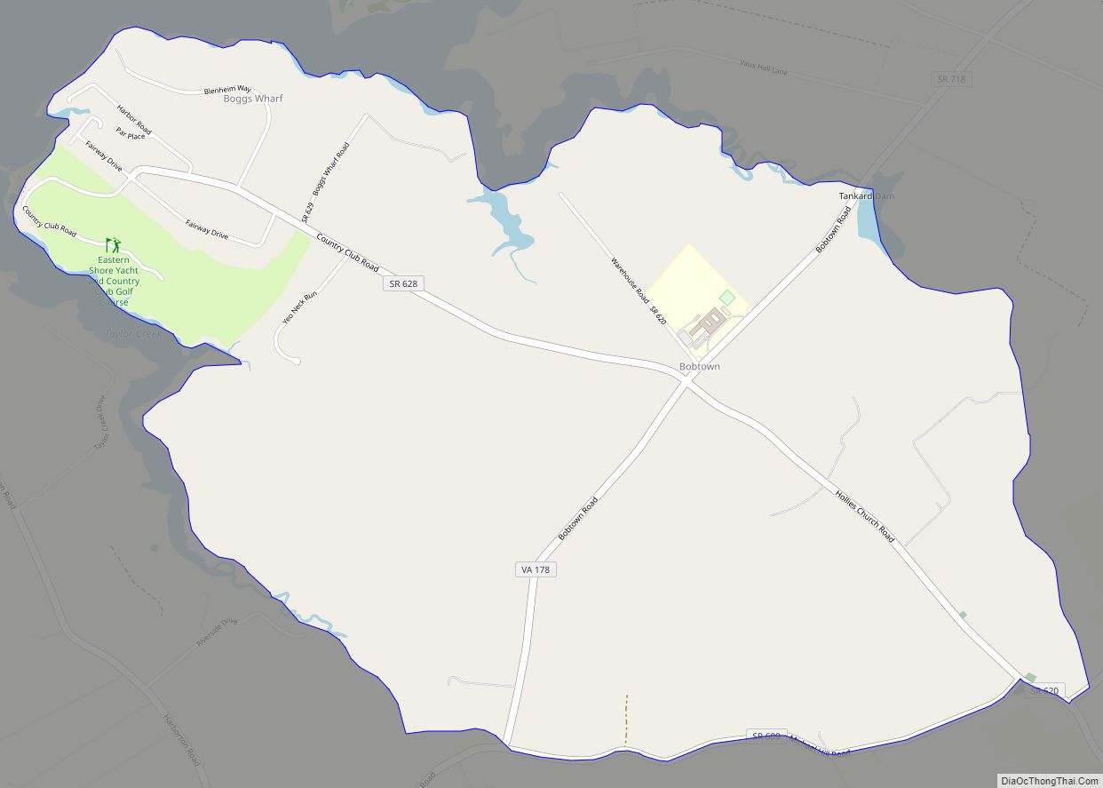
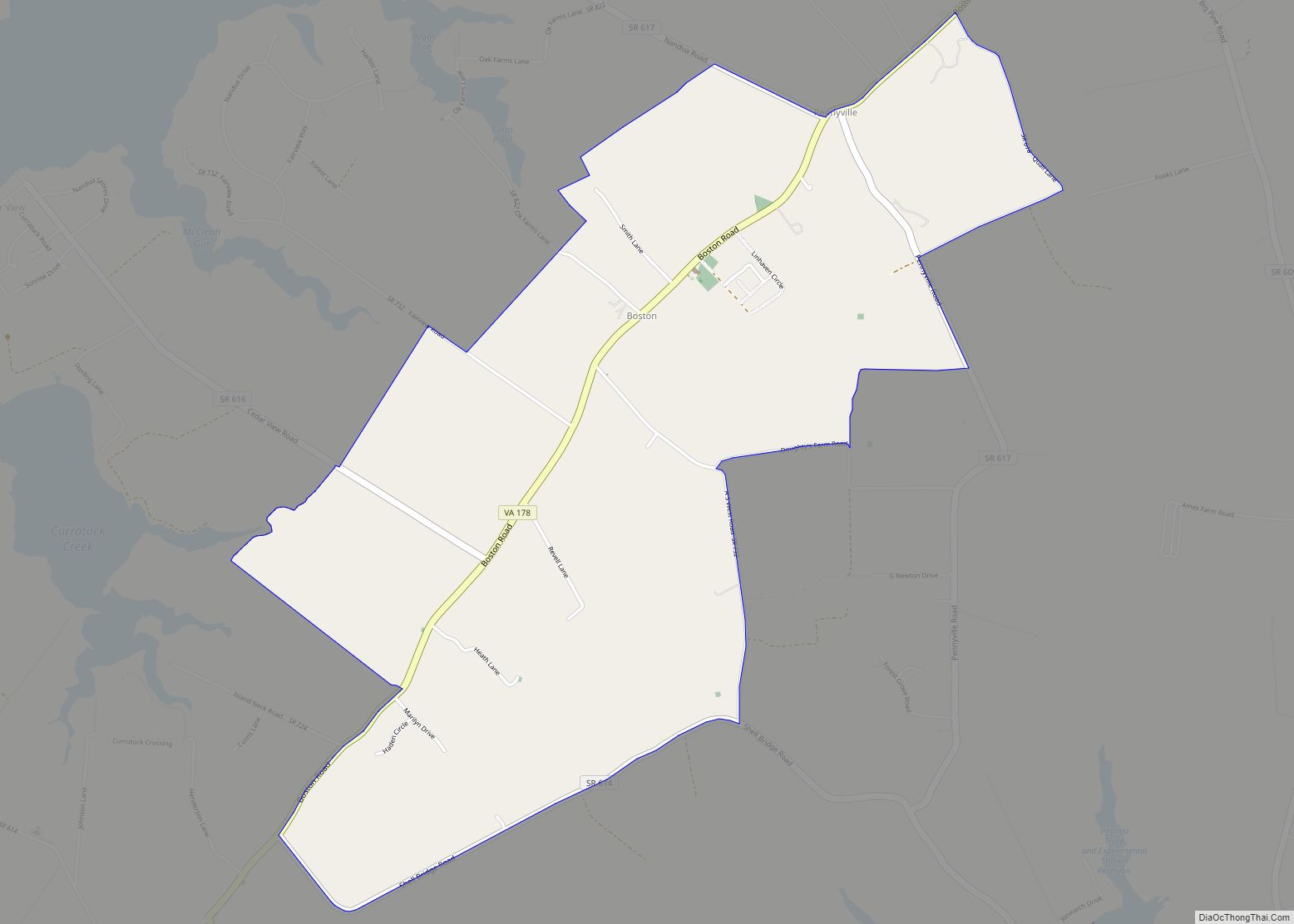
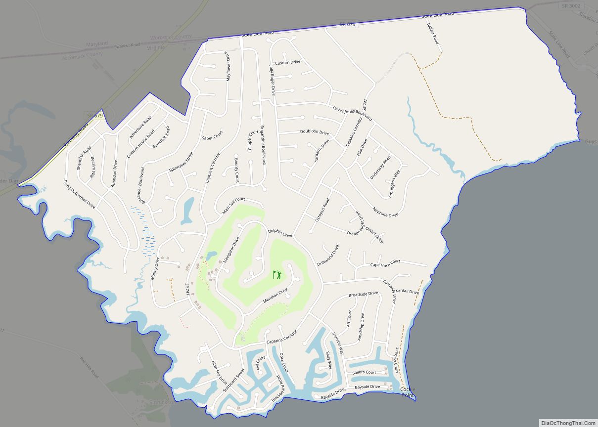
Online Interactive Map
Click on ![]() to view map in "full screen" mode.
to view map in "full screen" mode.
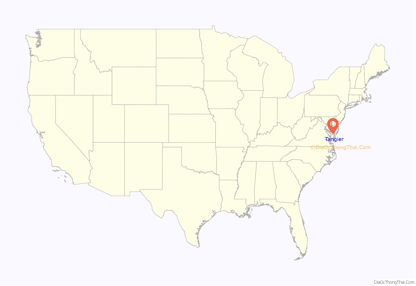
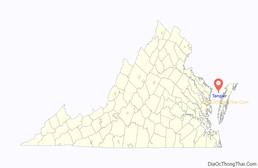
Tangier location map. Where is Tangier town?
History
Prior to the arrival of colonists on Tangier Island, it was a retreat for the Pocomoke Indians for centuries. Although not much is known about these people, their existence is evidenced by the thousands of stone arrowheads that have been found all over the island. Almost any morning after gale-force winds have been blowing all night, new arrowheads can be found on the beach. The discovery of an ancient offshore oyster midden, thousands of years old and containing a huge pile of shells which could only have been deposited by humans, is further evidence that there was a regular population on Tangier, at least in the warm part of the year, long before it had an English name. The enormous numbers of arrowheads and spear points found here suggest the island was probably much larger than recorded history can verify and was home to many animal species.
The first known European explorer of the island was John Smith in 1608. He named Tangier and the surrounding islands the “Russel Isles” after the doctor onboard his ship.
In 1670, Ambrose White received a patent for 400 acres (160 hectares) called “an Island in the Chesapeake Bay”. The next year, White assigned his patent to Charles and John West. In 1673, William Walton was granted 400 acres (160 ha) on the western island which was formerly patented by White. There is a similar entry in the patent book three years later, but Charles Scarburgh and West were the recipients instead of Walton, and in 1678, a formal patent was issued to both of them. Scarburgh (often now spelled Scarborough) left his interest to his wife Elizabeth in 1702, and John West’s interest went to his eldest son a year later. In 1713, two patents were granted to Elizabeth Scarburgh and Anthony West for Tangier Islands. One was for 900 acres (360 ha), which included the original 400 acres (160 ha) plus 500 acres (200 ha) more found within its bounds. The other grant was for 170 acres (69 ha) of new land south of Tangier called “Sandy Beach Island” which was probably the hook-shaped part that is now attached to the main part of the island. This was the first time Tangier Islands was named in the records. Although Elizabeth Scarburgh left her interest to her daughters, the title went to her oldest son, Bennett. It then passed to Henry Scarburgh and then to a Charles Scarburgh. In 1762, Charles Scarburgh confirmed an undeeded sale of his half to Colonel Thomas Hall. The next year Hall sold this to William Andrews as 475 acres (192 ha).
Today many of the inhabitants have the surname Crockett, which was the name of the first permanent Anglo-American settler in the late 18th century, John Crockett. Other common surnames on the island include Pruitt, Thomas, Marshall, Charnock, Dise, Shores, and Parks. By 1900 there were 1,064 inhabitants.
The British used the island as a staging area in 1813 and 1814 under Rear Admiral George Cockburn during the War of 1812, constructing Fort Albion when there were as many as 1,200 British troops recorded as being present on the island at one time. Many black slaves escaped to the British on Tangier and were given their freedom. Some joined the Corps of Colonial Marines. When a dozen British sailors were captured, their account of hardships encountered with shortages of food and water on the island, and the construction of Fort Albion, were reported in a local newspaper.
Tangier was used as the base for the attack on the American capital in the decisive British victory at Bladensburg and the subsequent Burning of Washington in August 1814. This was followed by the Battle of Baltimore, when a failed British naval bombardment and barge assault on Fort McHenry in Baltimore harbor and the simultaneous Battle of North Point southeast of the city on September 12-14, 1814, influenced Francis Scott Key’s writing of the poem that became “The Star-Spangled Banner”, named the American national anthem in 1931.
The original church on the island was called Lee’s Bethel and burned down in the 19th century. A bench marking its location is in the graveyard in Canton. The present-day church on the island, Swain Memorial Methodist Church, was established in 1835. The other church is called the New Testament Congregation, established in 1946, a non-denominational Christian place of worship. For various reasons, both historical and practical, burials are sometimes located in the yards of houses. There are also churchyard cemeteries at each of the island’s churches.
Three 21st-century hurricanes, Isabel in 2003, Ernesto in 2006, and Sandy in 2012, caused much of the island to flood. A few houses were abandoned or torn down due to storm damage, while others have been elevated on new foundations. New buildings continue to be built on the island.
In the 1960s, the United States Army took over portions of Tangier Island via eminent domain, forcing some residents including Walter Crockett and Maggie Eskridge Crockett to move to Exmore on mainland Virginia, so the military could conduct missile testing.
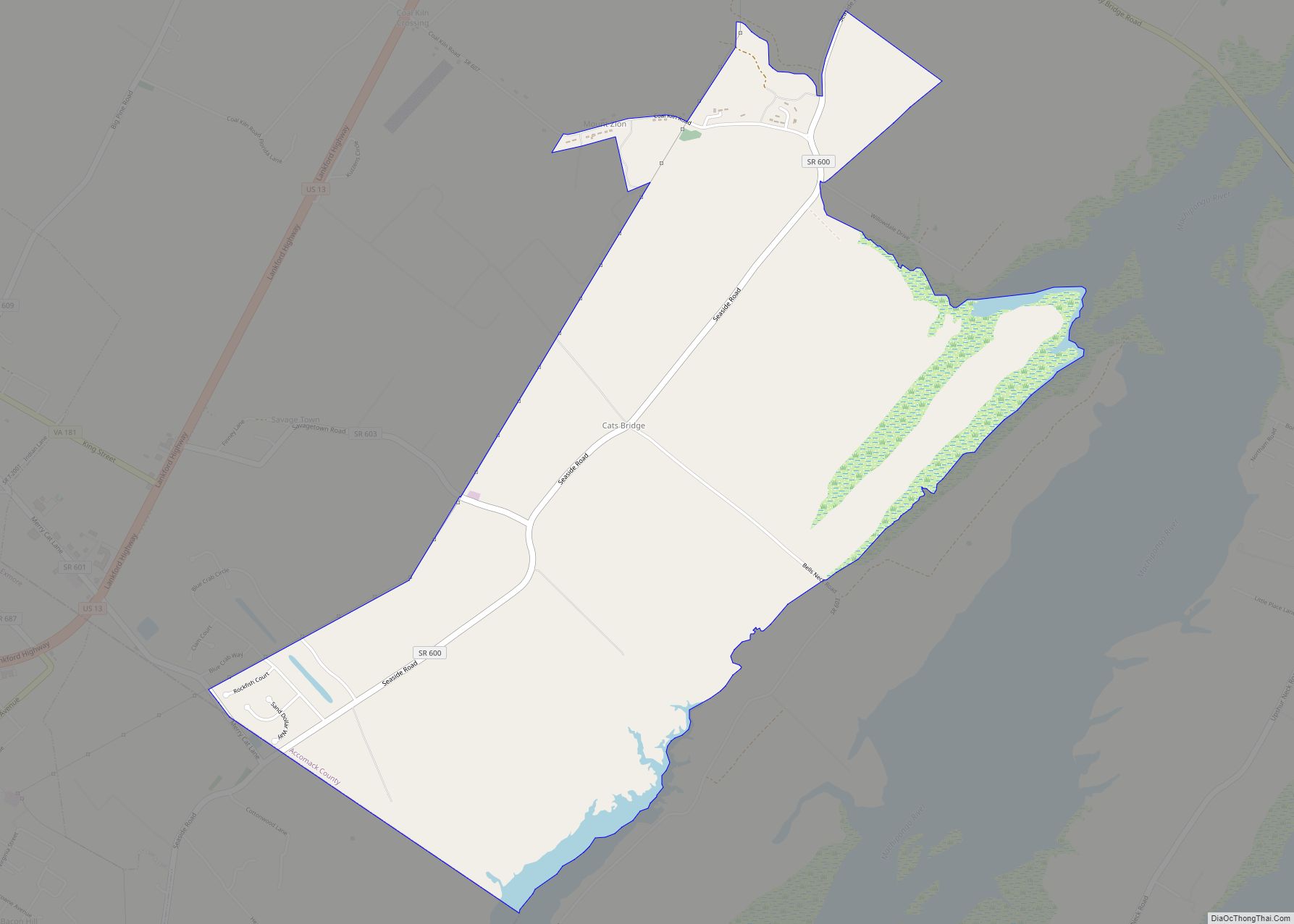
Tangier Road Map
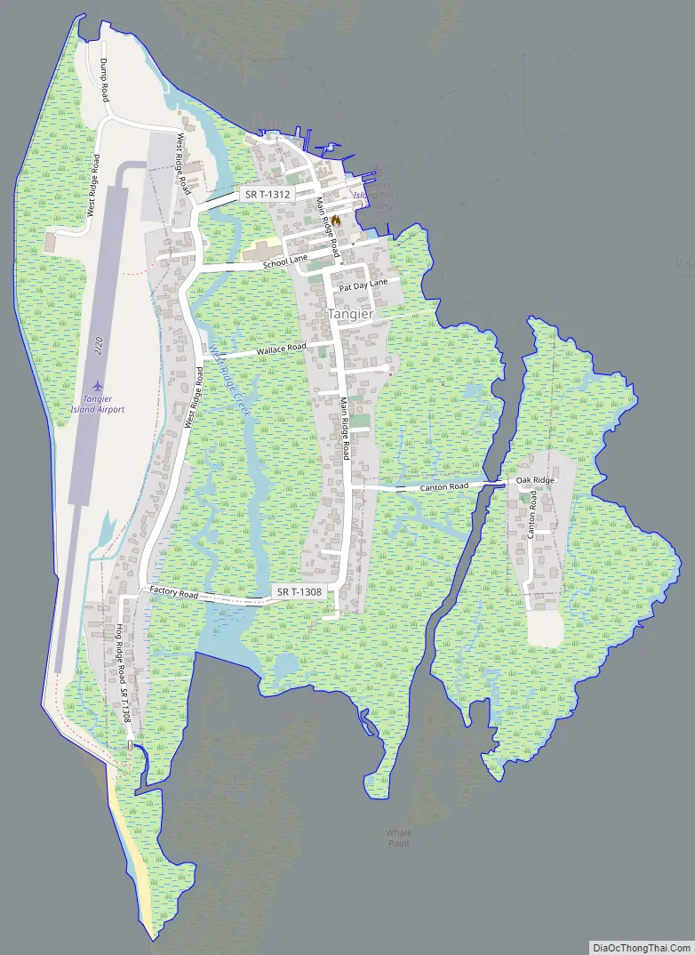
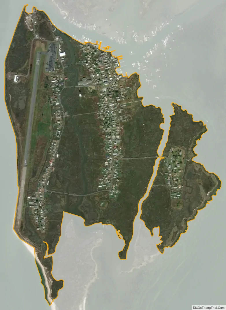
Tangier city Satellite Map
Geography
Tangier Island is located in Chesapeake Bay. The island features sandy ridges divided by marshes and tidal streams. The island has three ridges, called Main Ridge, Canton, and West Ridge. North of Tangier is an island that was abandoned after the stream between it and Tangier Island (Oyster Creek) became too wide to build a bridge over. This northernmost area is called Uppards, and originally had a neighborhood called Canaan. The only structures left on Uppards are duck hunting lodges from 1928. A few of the homes on Main Ridge were moved from Uppards before flooding became a major problem. Each of the ridges has neighborhoods. On the northern part of Main Ridge, the neighborhood is called Meat Soup. On the northern part of West Ridge is one called Sheep’s Hill. The southern part of Main Ridge has a ridge called Black Dye, and the one on the southern part of West Ridge is called Hog Ridge. Canton is in the most southeastern area of the island and is reached via a bridge. The bridges over the largest channel, called the Big Gut, are, to the north, Long Bridge, School Bridge, Wallace Bridge; and the farthest south is Heisten Bridge.
Because of its distance from the mainland, Tangier is sometimes considered isolated. The closest inhabited areas, and those most frequently traveled to and from, are Crisfield, Maryland; Onancock, Virginia; Reedville, Virginia; and other islands such as Smith Island, Maryland. Tangier is located at 37°49′33″N 75°59′32″W / 37.82583°N 75.99222°W / 37.82583; -75.99222. According to the United States Census Bureau, the town has a total area of 1.2 square miles (3.2 km), all of it land.
Reduction in land mass
The island is at risk of disappearing due to upland to wetland conversion and rising sea levels caused by climate change; since 1850, the island’s landmass has been reduced by 67%. Under a mid-range sea level rise scenario, two of the islands’ three ridges are expected to become wetland in the 2030s, with the third expected to succumb by 2051.
Many residents believe that erosion is the cause of the increasing incidence and severity of flooding. A 2015 study by Davide M. Schulte, Karin M. Dridge and Mark H. Hudgins, all members of the Army Corps of Engineers, concluded that Tangier has 25–50 years of habitability remaining and that the subsidence of the ridges is ongoing since at least the mid-19th century. The authors also conclude that the primary causes of the subsidence in the southern Chesapeake Bay region are sea-level rise due to the melting of the Laurentide ice sheet, groundwater extraction on mainland Virginia, and the remaining effects of the Chesapeake Bay impact crater near Cape Charles, Virginia, 35.5 million years ago.
The town has been talking with political representatives for decades to get protection for the island in the form of jetties or sea walls. The Town, the History Museum, and townspeople continue to raise money for their sea wall fund. In 2017, CNN aired a story about Tangier that featured the town’s mayor, James W. Eskridge. President Donald Trump called the mayor personally to assure him that the town would survive but offered no concrete form of relief or financial aid.
Marshes and waterfowl
Tangier and nearby islands are valuable tidal salt marsh habitat for waterfowl, especially as there is a general absence of predators for ground-nesting birds and birds in general. Tangier marshes are home to many birds, including pelicans, blue herons, rails, egrets, several varieties of ducks and geese, and osprey. The group of islands is one of the “few remaining population strongholds for American Black Ducks in Virginia.”
Including the surrounding marshes, Tangier Island totals less than 740 acres (300 hectares), but only 83 acres (34 hectares) are high enough for habitation. The highest point of land is barely 4 feet (1.2 m) above sea level, and about 9 acres (3.6 hectares) of Tangier shoreline are estimated to erode into the Chesapeake each year. Local residents see their existence threatened from falling catches, state regulation of the waterman livelihood on the Bay, constant erosion, and increasingly frequent flooding.
See also
Map of Virginia State and its subdivision:- Accomack
- Albemarle
- Alexandria
- Alleghany
- Amelia
- Amherst
- Appomattox
- Arlington
- Augusta
- Bath
- Bedford
- Bedford City
- Bland
- Botetourt
- Bristol
- Brunswick
- Buchanan
- Buckingham
- Buena Vista
- Campbell
- Caroline
- Carroll
- Charles City
- Charlotte
- Charlottesville
- Chesapeake
- Chesterfield
- Clarke
- Clifton Forge City
- Colonial Heights
- Covington
- Craig
- Culpeper
- Cumberland
- Danville
- Dickenson
- Dinwiddie
- Emporia
- Essex
- Fairfax
- Fairfax City
- Falls Church
- Fauquier
- Floyd
- Fluvanna
- Franklin
- Frederick
- Fredericksburg
- Galax
- Giles
- Gloucester
- Goochland
- Grayson
- Greene
- Greensville
- Halifax
- Hampton
- Hanover
- Harrisonburg
- Henrico
- Henry
- Highland
- Hopewell
- Isle of Wight
- James City
- King and Queen
- King George
- King William
- Lancaster
- Lee
- Lexington
- Loudoun
- Louisa
- Lunenburg
- Lynchburg
- Madison
- Manassas
- Manassas Park
- Martinsville
- Mathews
- Mecklenburg
- Middlesex
- Montgomery
- Nelson
- New Kent
- Newport News
- Norfolk
- Northampton
- Northumberland
- Norton
- Nottoway
- Orange
- Page
- Patrick
- Petersburg
- Pittsylvania
- Poquoson
- Portsmouth
- Powhatan
- Prince Edward
- Prince George
- Prince William
- Pulaski
- Radford
- Rappahannock
- Richmond
- Roanoke
- Roanoke City
- Rockbridge
- Rockingham
- Russell
- Salem
- Scott
- Shenandoah
- Smyth
- Southampton
- Spotsylvania
- Stafford
- Staunton
- Suffolk
- Surry
- Sussex
- Tazewell
- Virginia Beach
- Warren
- Washington
- Waynesboro
- Westmoreland
- Williamsburg
- Winchester
- Wise
- Wythe
- York
- Alabama
- Alaska
- Arizona
- Arkansas
- California
- Colorado
- Connecticut
- Delaware
- District of Columbia
- Florida
- Georgia
- Hawaii
- Idaho
- Illinois
- Indiana
- Iowa
- Kansas
- Kentucky
- Louisiana
- Maine
- Maryland
- Massachusetts
- Michigan
- Minnesota
- Mississippi
- Missouri
- Montana
- Nebraska
- Nevada
- New Hampshire
- New Jersey
- New Mexico
- New York
- North Carolina
- North Dakota
- Ohio
- Oklahoma
- Oregon
- Pennsylvania
- Rhode Island
- South Carolina
- South Dakota
- Tennessee
- Texas
- Utah
- Vermont
- Virginia
- Washington
- West Virginia
- Wisconsin
- Wyoming