Virgilina is a town in Halifax County, Virginia, United States. The population was 154 at the 2010 census. Virgilina was once a copper mining town. It was a stop on the Atlantic and Danville Railway as recently as the 1950s. It is named “Virgilina” because it is located on the Virginia and North Carolina border.
| Name: | Virgilina town |
|---|---|
| LSAD Code: | 43 |
| LSAD Description: | town (suffix) |
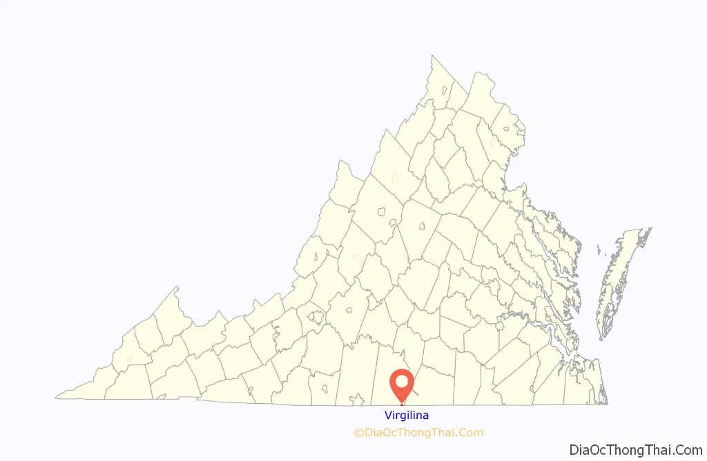
| State: | Virginia |
| County: | Halifax County |
| Elevation: | 551 ft (168 m) |
| Total Area: | 0.62 sq mi (1.60 km²) |
| Land Area: | 0.61 sq mi (1.59 km²) |
| Water Area: | 0.00 sq mi (0.01 km²) |
| Total Population: | 154 |
| Population Density: | 223.13/sq mi (86.15/km²) |
| ZIP code: | 24598 |
| Area code: | 434 |
| FIPS code: | 5181312 |
| GNISfeature ID: | 1493858 |
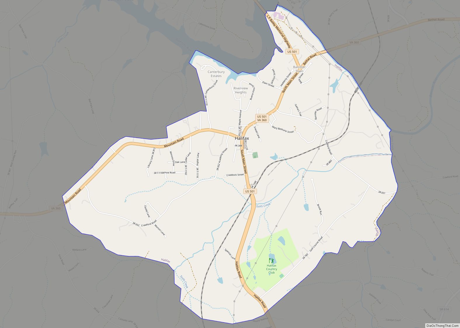
Online Interactive Map
Click on ![]() to view map in "full screen" mode.
to view map in "full screen" mode.
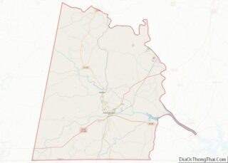
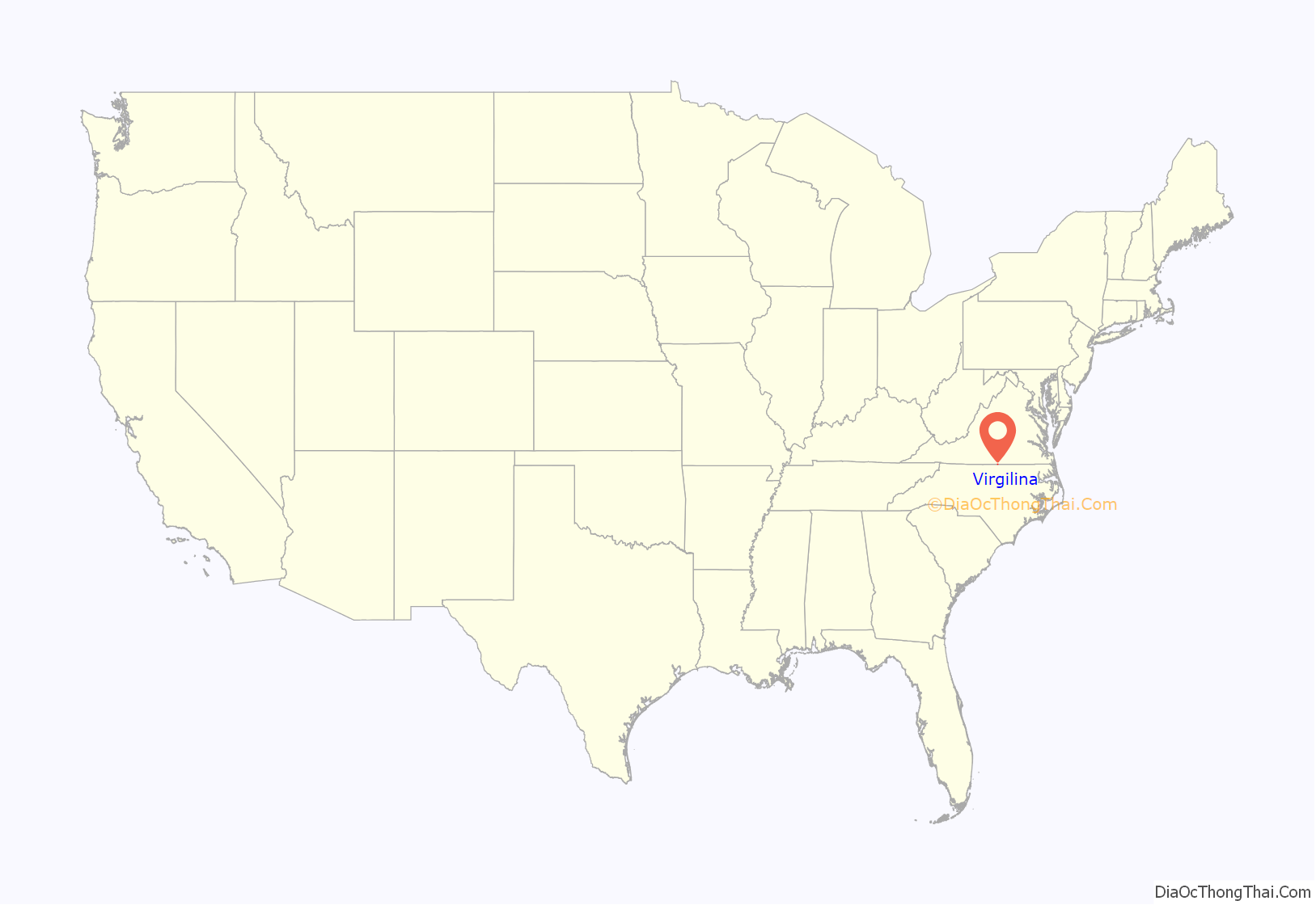
Virgilina location map. Where is Virgilina town?
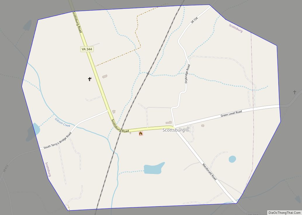
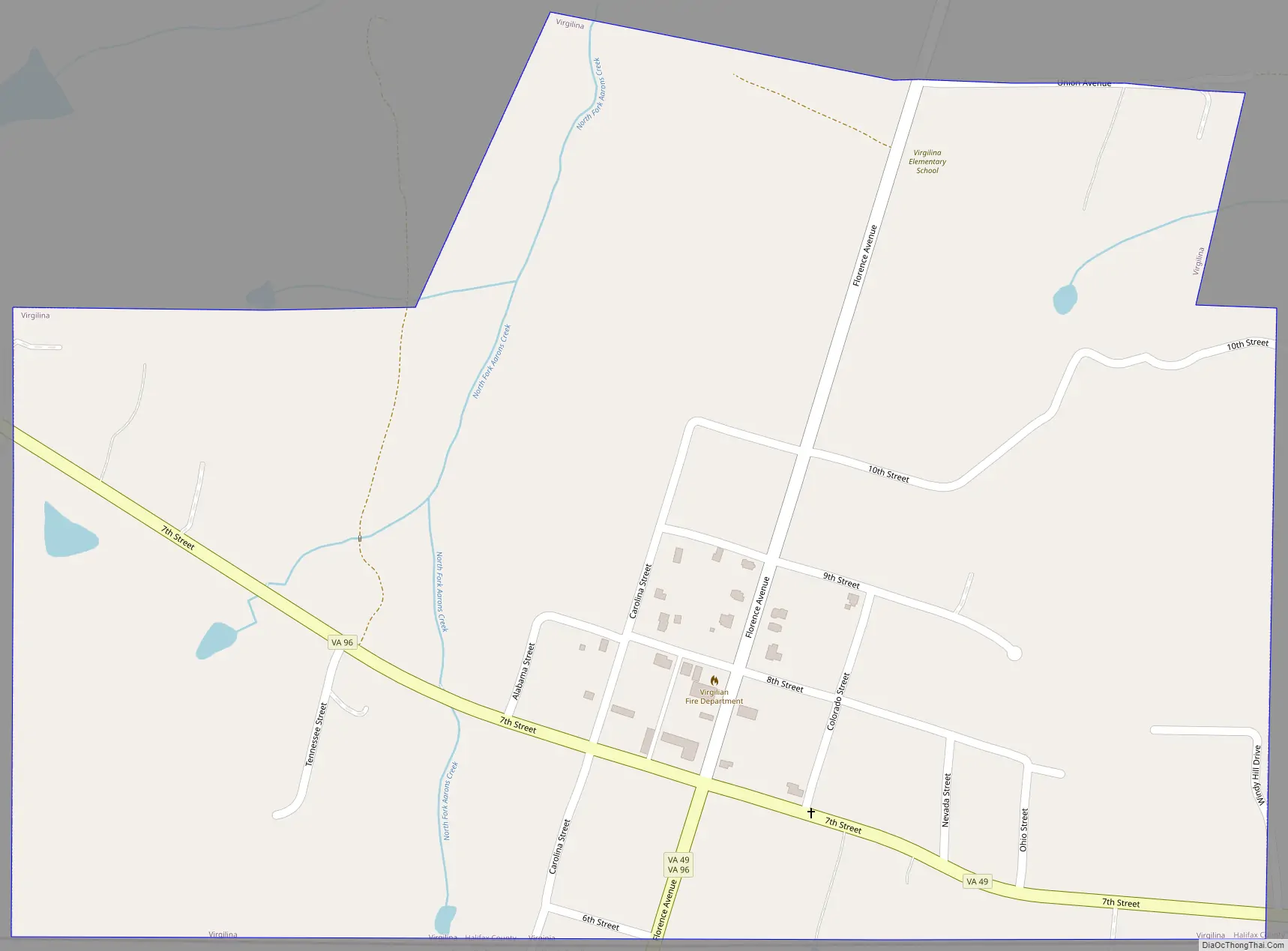
Virgilina Road Map
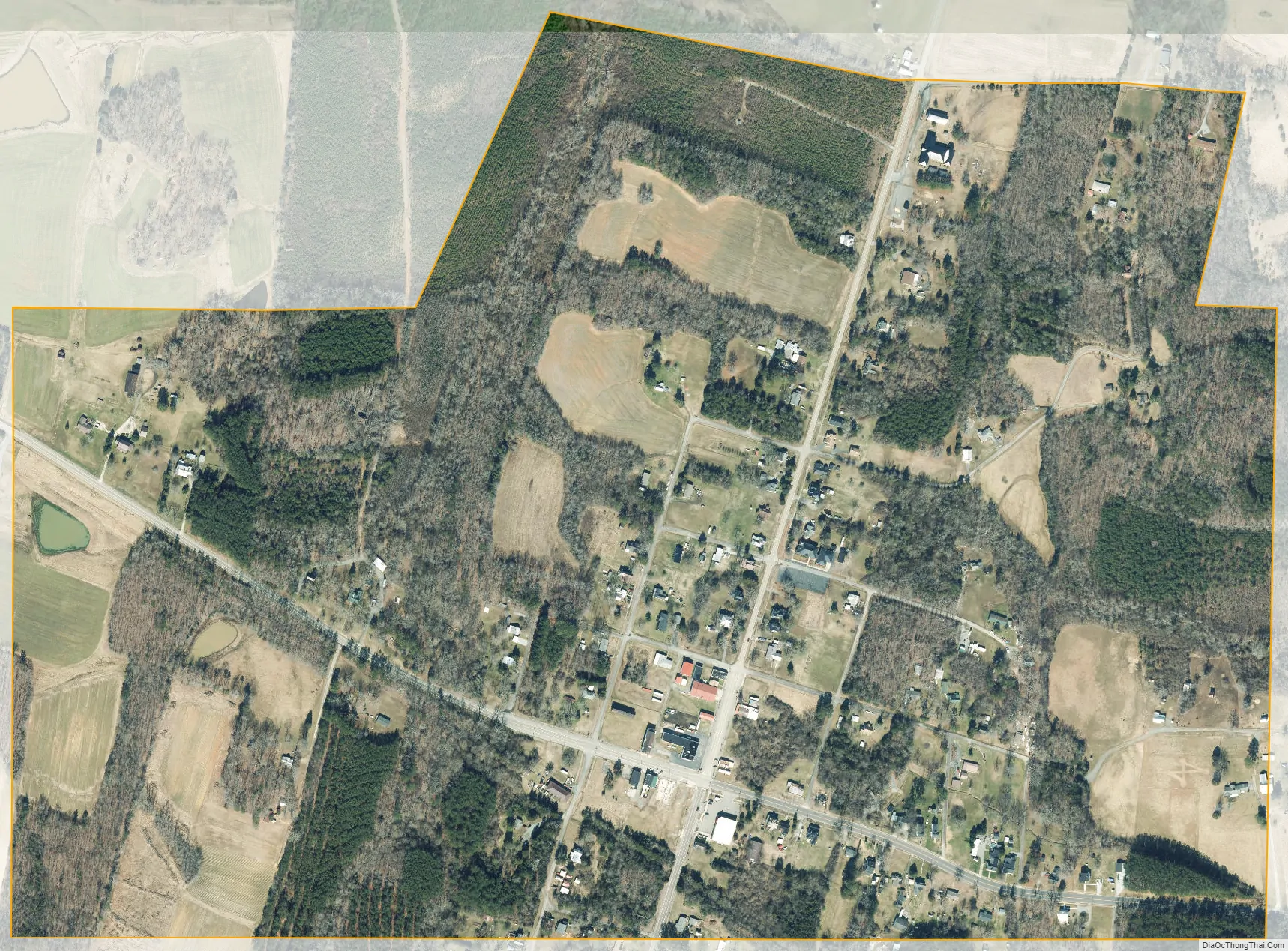
Virgilina city Satellite Map
Geography
Virgilina is located in the southeast corner of Halifax County at 36°32′43″N 78°46′25″W / 36.54528°N 78.77361°W / 36.54528; -78.77361 (36.545244, −78.773720). The town’s southern border is the Virginia–North Carolina line. Virginia State Routes 96 and 49 intersect at the center of town. VA-96 leads west 7 miles (11 km) to U.S. Route 501 south of Cluster Springs, while VA-49 leads northeast 14 miles (23 km) to Clarksville. Both highway numbers continue into North Carolina: NC 96 leads southeast 20 miles (32 km) to Oxford, North Carolina, while NC 49 runs southwest 17 miles (27 km) to Roxboro, North Carolina.
According to the United States Census Bureau, Virgilina has a total area of 0.62 square miles (1.6 km), all of it land. The town center sits on a small ridge, with both sides draining to tributaries of Aarons Creek, which flows north to the Dan River, part of the Roanoke River watershed.
See also
Map of Virginia State and its subdivision:- Accomack
- Albemarle
- Alexandria
- Alleghany
- Amelia
- Amherst
- Appomattox
- Arlington
- Augusta
- Bath
- Bedford
- Bedford City
- Bland
- Botetourt
- Bristol
- Brunswick
- Buchanan
- Buckingham
- Buena Vista
- Campbell
- Caroline
- Carroll
- Charles City
- Charlotte
- Charlottesville
- Chesapeake
- Chesterfield
- Clarke
- Clifton Forge City
- Colonial Heights
- Covington
- Craig
- Culpeper
- Cumberland
- Danville
- Dickenson
- Dinwiddie
- Emporia
- Essex
- Fairfax
- Fairfax City
- Falls Church
- Fauquier
- Floyd
- Fluvanna
- Franklin
- Frederick
- Fredericksburg
- Galax
- Giles
- Gloucester
- Goochland
- Grayson
- Greene
- Greensville
- Halifax
- Hampton
- Hanover
- Harrisonburg
- Henrico
- Henry
- Highland
- Hopewell
- Isle of Wight
- James City
- King and Queen
- King George
- King William
- Lancaster
- Lee
- Lexington
- Loudoun
- Louisa
- Lunenburg
- Lynchburg
- Madison
- Manassas
- Manassas Park
- Martinsville
- Mathews
- Mecklenburg
- Middlesex
- Montgomery
- Nelson
- New Kent
- Newport News
- Norfolk
- Northampton
- Northumberland
- Norton
- Nottoway
- Orange
- Page
- Patrick
- Petersburg
- Pittsylvania
- Poquoson
- Portsmouth
- Powhatan
- Prince Edward
- Prince George
- Prince William
- Pulaski
- Radford
- Rappahannock
- Richmond
- Roanoke
- Roanoke City
- Rockbridge
- Rockingham
- Russell
- Salem
- Scott
- Shenandoah
- Smyth
- Southampton
- Spotsylvania
- Stafford
- Staunton
- Suffolk
- Surry
- Sussex
- Tazewell
- Virginia Beach
- Warren
- Washington
- Waynesboro
- Westmoreland
- Williamsburg
- Winchester
- Wise
- Wythe
- York
- Alabama
- Alaska
- Arizona
- Arkansas
- California
- Colorado
- Connecticut
- Delaware
- District of Columbia
- Florida
- Georgia
- Hawaii
- Idaho
- Illinois
- Indiana
- Iowa
- Kansas
- Kentucky
- Louisiana
- Maine
- Maryland
- Massachusetts
- Michigan
- Minnesota
- Mississippi
- Missouri
- Montana
- Nebraska
- Nevada
- New Hampshire
- New Jersey
- New Mexico
- New York
- North Carolina
- North Dakota
- Ohio
- Oklahoma
- Oregon
- Pennsylvania
- Rhode Island
- South Carolina
- South Dakota
- Tennessee
- Texas
- Utah
- Vermont
- Virginia
- Washington
- West Virginia
- Wisconsin
- Wyoming