Glade Spring is a town in Washington County, Virginia, United States. The population was 1,456 at the 2010 census. It is part of the Kingsport–Bristol (TN)–Bristol (VA) Metropolitan Statistical Area, which is a component of the Johnson City–Kingsport–Bristol, TN-VA Combined Statistical Area – commonly known as the “Tri-Cities” region.
| Name: | Glade Spring town |
|---|---|
| LSAD Code: | 43 |
| LSAD Description: | town (suffix) |
| State: | Virginia |
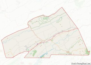
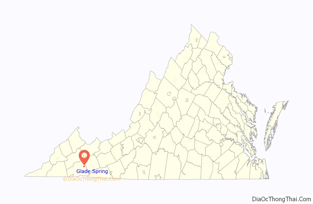
| County: | Washington County |
| Incorporated: | 1875 |
| Elevation: | 2,087 ft (636 m) |
| Total Area: | 1.22 sq mi (3.15 km²) |
| Land Area: | 1.22 sq mi (3.15 km²) |
| Water Area: | 0.00 sq mi (0.00 km²) |
| Total Population: | 1,456 |
| Population Density: | 1,156.25/sq mi (446.57/km²) |
| ZIP code: | 24340 |
| Area code: | 276 |
| FIPS code: | 5131056 |
| GNISfeature ID: | 1483656 |
| Website: | gladespringva.org |
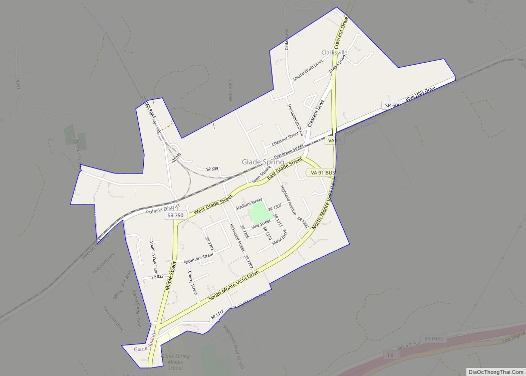
Online Interactive Map
Click on ![]() to view map in "full screen" mode.
to view map in "full screen" mode.
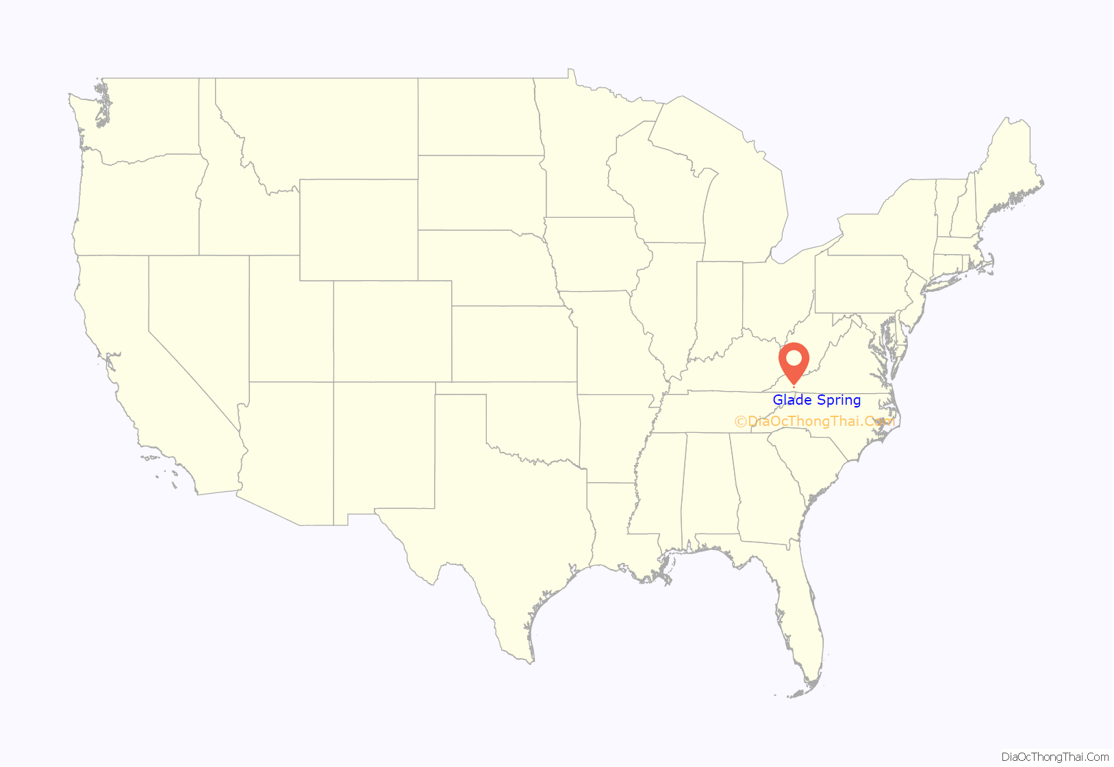
Glade Spring location map. Where is Glade Spring town?
History
The original name of Glade Spring derives from the Indian word Passawatami which means “this is the place”. According to early records, near the town is a field where Native American tribes held a type of Olympics in the fall, with athletic competitions, dancing and socializing. The Porterfield family, who arrived about 1760, were some of the earliest permanent settlers.
During its first years, the town was called Glade Spring Depot to differentiate it from the community centered on Glade Spring Presbyterian Church, two miles to the southwest on the old stage road, now U.S. Route 11. The post office was moved from Old Glade to Glade Spring Depot in 1856 due to the arrival of the railroad.
The Civil War slowed its growth, and local men made up a military unit called The Glade Spring Rifles. Federal and Confederate troops passed through the town several times, and cannon emplacements can still be seen just outside Glade Spring on the road to Saltville. Although a few new buildings were constructed before the Civil War, most of the town’s growth occurred rapidly in the decade after the war.
With the railroad access, Glade Spring turned into a prime shipping yard for produce, livestock and other local goods. An Abingdon newspaper first took note of the “stirring, thriving, wide-awake community” in 1870. By the time Glade Spring was incorporated in 1875, there were 31 houses (three were brick), six stores, two hotels, and a Masonic Hall. Virginia Intermont College was located in Glade from 1884 to 1892, before it moved to its location until its closure in Bristol.
After the passenger train service discontinued, the town’s growth slowed, although it still receives freight service from Norfolk Southern railway. The train tracks of the 8.91 “Saltville Branch”, which connected to Saltville via a junction from the main line at Glade Spring, have been removed and replaced with a hiking and biking trail called the “Salt Trail”.
In the early morning hours of April 28, 2011, an EF-3 tornado hit parts of the Glade Spring area, killing three people and injuring 50 others. Another person died in a traffic accident during the storm. The system that hit Glade Spring was part of the 2011 Super Outbreak that caused hundreds of deaths and widespread damage all across the South.
Brook Hall and the Glade Spring Commercial Historic District are listed on the National Register of Historic Places.
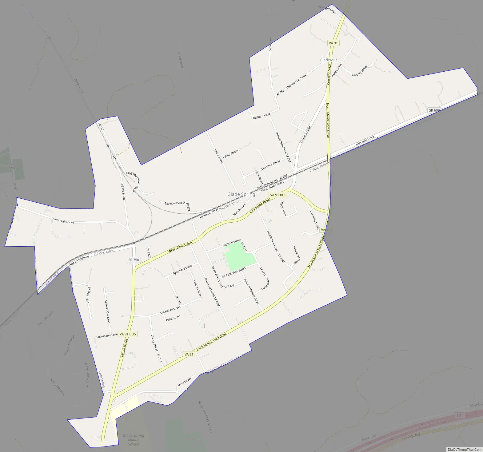
Glade Spring Road Map
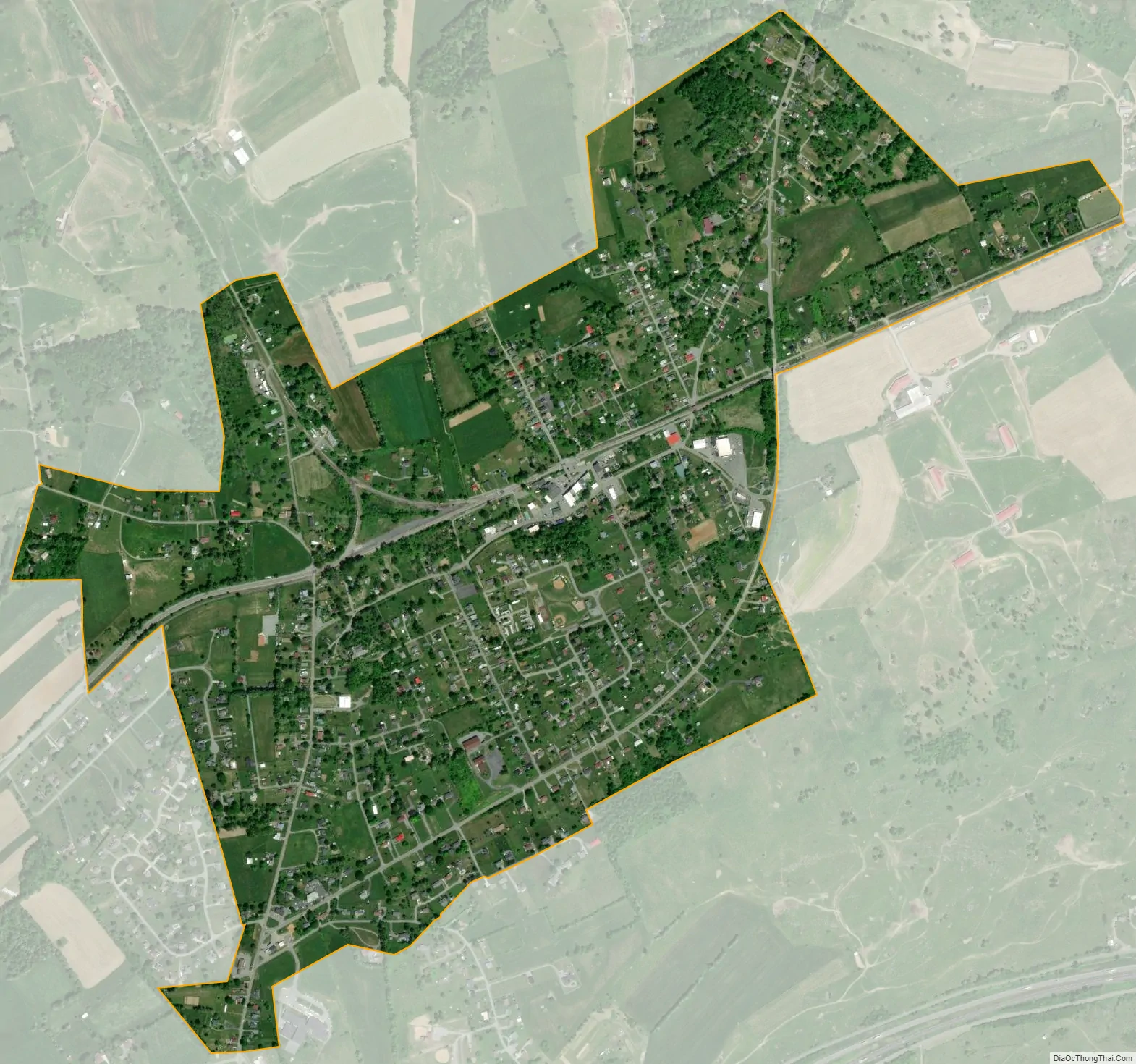
Glade Spring city Satellite Map
Geography
Glade Spring is located at 36°47′25″N 81°46′24″W / 36.79028°N 81.77333°W / 36.79028; -81.77333 (36.790338, -81.773220).
According to the United States Census Bureau, the town has a total area of 1.3 square miles (3.3 km), all of it land.
The elevation is 2,087 ft above sea level.
See also
Map of Virginia State and its subdivision:- Accomack
- Albemarle
- Alexandria
- Alleghany
- Amelia
- Amherst
- Appomattox
- Arlington
- Augusta
- Bath
- Bedford
- Bedford City
- Bland
- Botetourt
- Bristol
- Brunswick
- Buchanan
- Buckingham
- Buena Vista
- Campbell
- Caroline
- Carroll
- Charles City
- Charlotte
- Charlottesville
- Chesapeake
- Chesterfield
- Clarke
- Clifton Forge City
- Colonial Heights
- Covington
- Craig
- Culpeper
- Cumberland
- Danville
- Dickenson
- Dinwiddie
- Emporia
- Essex
- Fairfax
- Fairfax City
- Falls Church
- Fauquier
- Floyd
- Fluvanna
- Franklin
- Frederick
- Fredericksburg
- Galax
- Giles
- Gloucester
- Goochland
- Grayson
- Greene
- Greensville
- Halifax
- Hampton
- Hanover
- Harrisonburg
- Henrico
- Henry
- Highland
- Hopewell
- Isle of Wight
- James City
- King and Queen
- King George
- King William
- Lancaster
- Lee
- Lexington
- Loudoun
- Louisa
- Lunenburg
- Lynchburg
- Madison
- Manassas
- Manassas Park
- Martinsville
- Mathews
- Mecklenburg
- Middlesex
- Montgomery
- Nelson
- New Kent
- Newport News
- Norfolk
- Northampton
- Northumberland
- Norton
- Nottoway
- Orange
- Page
- Patrick
- Petersburg
- Pittsylvania
- Poquoson
- Portsmouth
- Powhatan
- Prince Edward
- Prince George
- Prince William
- Pulaski
- Radford
- Rappahannock
- Richmond
- Roanoke
- Roanoke City
- Rockbridge
- Rockingham
- Russell
- Salem
- Scott
- Shenandoah
- Smyth
- Southampton
- Spotsylvania
- Stafford
- Staunton
- Suffolk
- Surry
- Sussex
- Tazewell
- Virginia Beach
- Warren
- Washington
- Waynesboro
- Westmoreland
- Williamsburg
- Winchester
- Wise
- Wythe
- York
- Alabama
- Alaska
- Arizona
- Arkansas
- California
- Colorado
- Connecticut
- Delaware
- District of Columbia
- Florida
- Georgia
- Hawaii
- Idaho
- Illinois
- Indiana
- Iowa
- Kansas
- Kentucky
- Louisiana
- Maine
- Maryland
- Massachusetts
- Michigan
- Minnesota
- Mississippi
- Missouri
- Montana
- Nebraska
- Nevada
- New Hampshire
- New Jersey
- New Mexico
- New York
- North Carolina
- North Dakota
- Ohio
- Oklahoma
- Oregon
- Pennsylvania
- Rhode Island
- South Carolina
- South Dakota
- Tennessee
- Texas
- Utah
- Vermont
- Virginia
- Washington
- West Virginia
- Wisconsin
- Wyoming