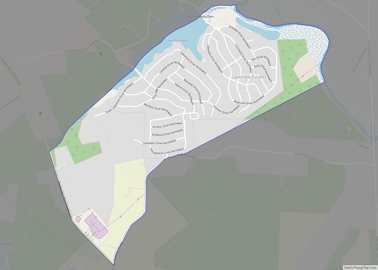
Lakeview Estates, also known as Sunrise Lakes by local residents, is a census-designated place (CDP) in Rockdale County, Georgia, United States. The population was 2,637 at the 2000 census.
Lakeview Estates was developed as a family community in the 1970s consisting of modular homes wrapping around the hills above Lake Sunrise and Lake Rockaway. A community club house, water processing plant, community store, and church were built in addition to the community. It is not a trailer park, as much of the land is privately owned, or owned by multiple landlords, and all of the roads are owned and maintained by the county. The original idea for the community was not a success. The affordable real estate was bought out by families and by landlords. In addition, the water processing plant was privately owned. In the early 1980s, the community felt a decline, as crime rose and the income level of the average family decreased. In addition, one landlord, Martha Ann Bailey, purchased the water processing facility and gouged prices.
In the 1980s and 1990s the Community Action Committee, headed by Ed Conway, a longtime resident of Lakeview, began a revitalization of the community. Invoking the help of the community, the two local churches, and the surrounding Rockdale County residents, the Community Action Committee held protests and brought Bailey to court to try to have the water facilities removed from her, due to the price of water, which was the highest in the country. Since the residents of Lakeview Estates could only get water from Ms. Bailey’s facilities, the State ruled her business to be a monopoly. By the end of the 1990s, it had been brought under the jurisdiction of Rockdale County.
The Community Action Committee continued its plan of revitalization and helped establish Lakeview’s own free health clinic (though as of fall 2006, the clinic is in dire need of funds, staff, and supplies), and brought a police precinct with bicycle mounted policemen to help lower the crime. Saint Pius X Catholic Church, a local church in Rockdale, ministered to the growing Mexican-American population in the community. Although the crime continues to decrease, Lakeview Estates still holds a stigma in Rockdale County for its poverty stricken residents and supposed high crime.
| Name: | Lakeview Estates CDP |
|---|---|
| LSAD Code: | 57 |
| LSAD Description: | CDP (suffix) |
| State: | Georgia |
| County: | Rockdale County |
| Elevation: | 787 ft (240 m) |
| Total Area: | 0.54 sq mi (1.40 km²) |
| Land Area: | 0.51 sq mi (1.32 km²) |
| Water Area: | 0.03 sq mi (0.08 km²) |
| Total Population: | 2,660 |
| Population Density: | 5,236.22/sq mi (2,020.27/km²) |
| ZIP code: | 30012 |
| FIPS code: | 1344956 |
| GNISfeature ID: | 0332172 |
Online Interactive Map
Click on ![]() to view map in "full screen" mode.
to view map in "full screen" mode.
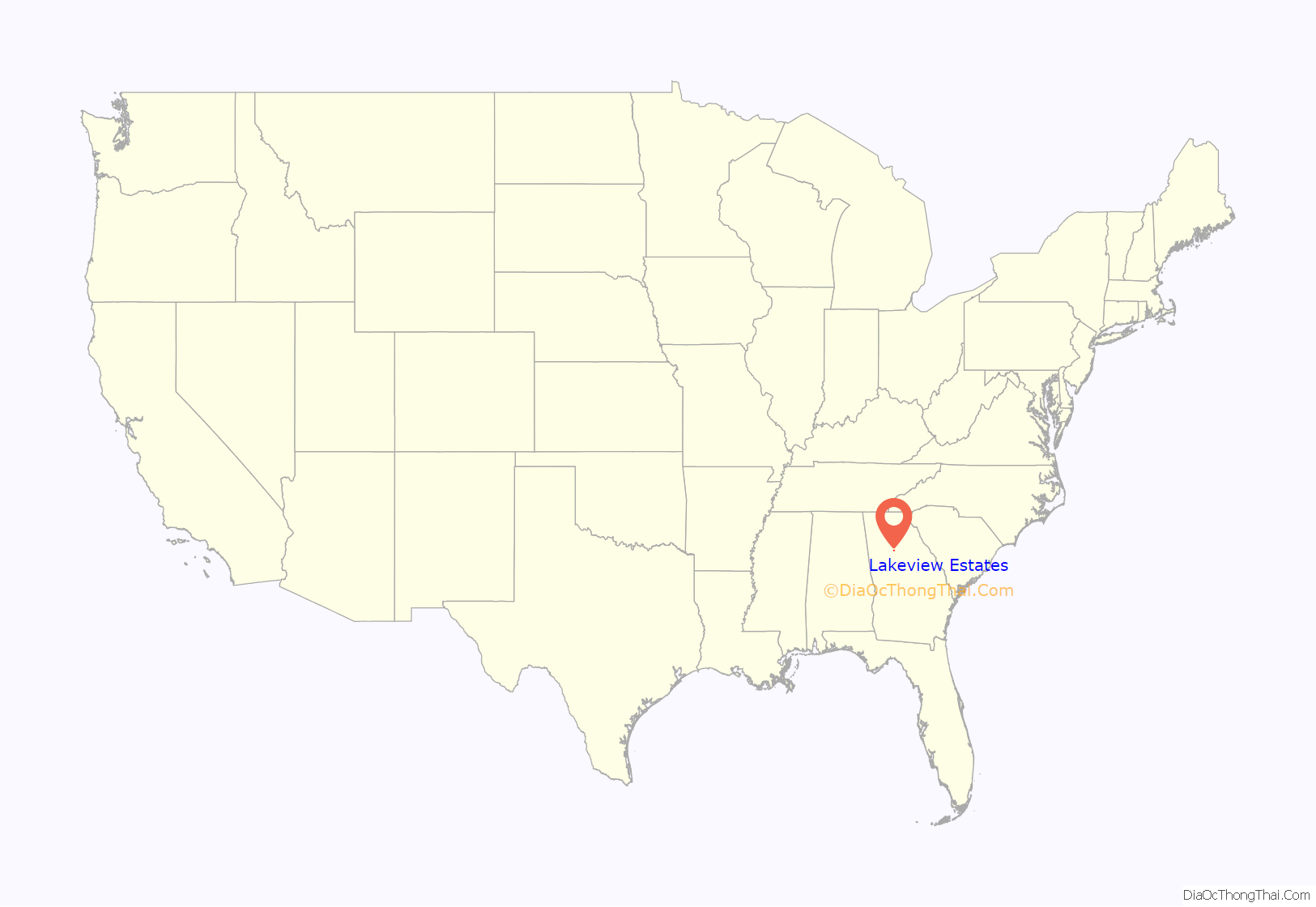
Lakeview Estates location map. Where is Lakeview Estates CDP?
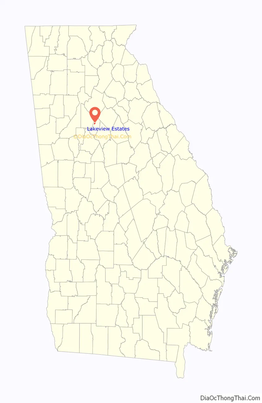
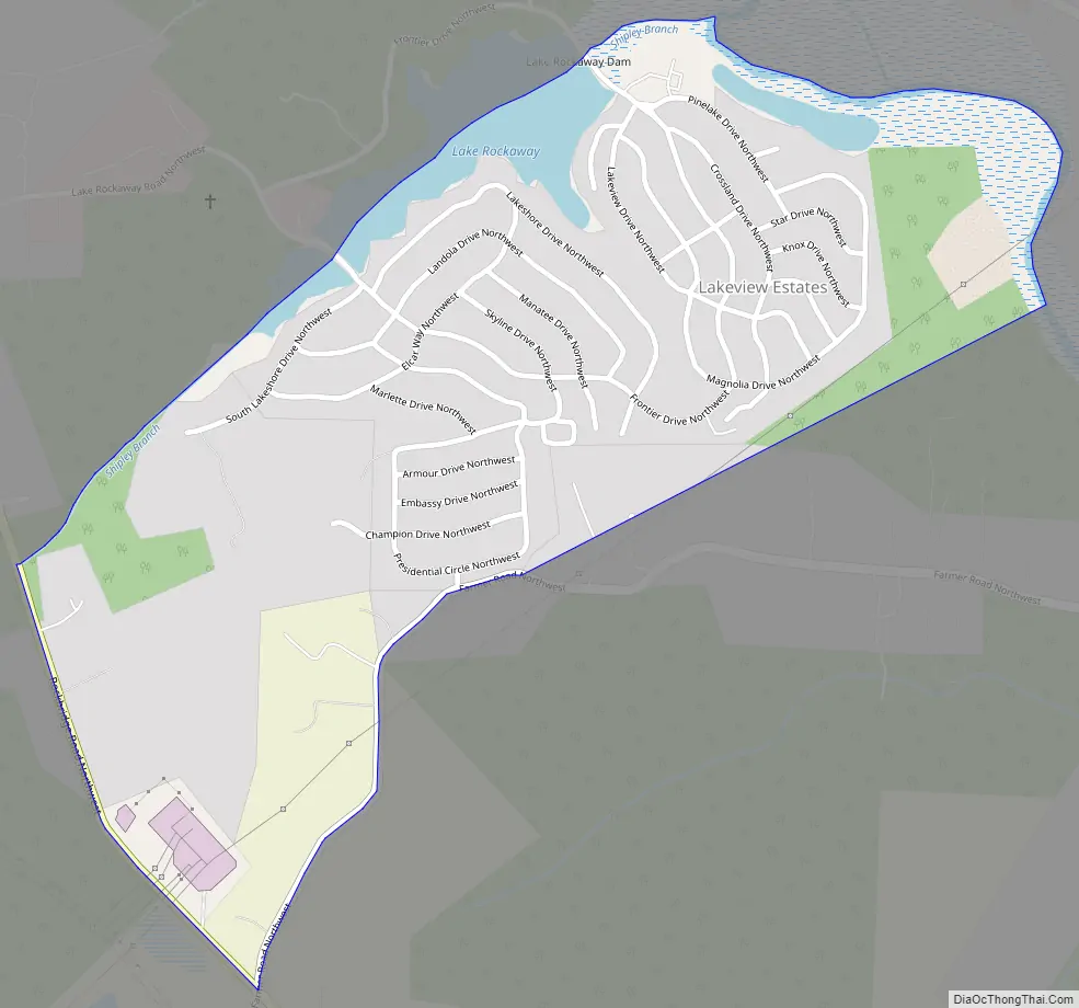
Lakeview Estates Road Map
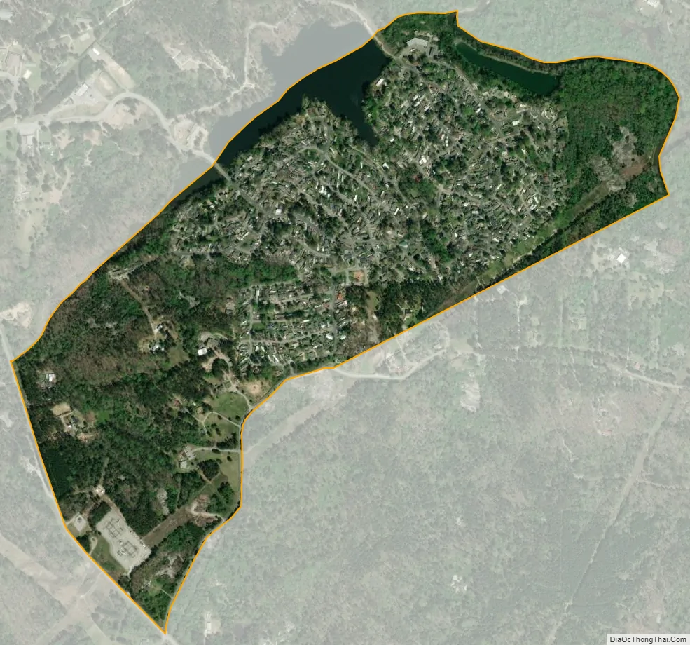
Lakeview Estates city Satellite Map
Geography
Lakeview Estates is located at 33°42′24″N 84°02′10″W / 33.706559°N 84.036005°W / 33.706559; -84.036005.
According to the United States Census Bureau, the CDP has a total area of 0.6 square miles (1.6 km), of which 0.5 square miles (1.3 km) is land and 0.04 square miles (0.10 km) (7.02%) is water.
See also
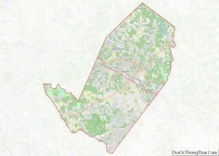
Map of Georgia State and its subdivision:- Appling
- Atkinson
- Bacon
- Baker
- Baldwin
- Banks
- Barrow
- Bartow
- Ben Hill
- Berrien
- Bibb
- Bleckley
- Brantley
- Brooks
- Bryan
- Bulloch
- Burke
- Butts
- Calhoun
- Camden
- Candler
- Carroll
- Catoosa
- Charlton
- Chatham
- Chattahoochee
- Chattooga
- Cherokee
- Clarke
- Clay
- Clayton
- Clinch
- Cobb
- Coffee
- Colquitt
- Columbia
- Cook
- Coweta
- Crawford
- Crisp
- Dade
- Dawson
- Decatur
- DeKalb
- Dodge
- Dooly
- Dougherty
- Douglas
- Early
- Echols
- Effingham
- Elbert
- Emanuel
- Evans
- Fannin
- Fayette
- Floyd
- Forsyth
- Franklin
- Fulton
- Gilmer
- Glascock
- Glynn
- Gordon
- Grady
- Greene
- Gwinnett
- Habersham
- Hall
- Hancock
- Haralson
- Harris
- Hart
- Heard
- Henry
- Houston
- Irwin
- Jackson
- Jasper
- Jeff Davis
- Jefferson
- Jenkins
- Johnson
- Jones
- Lamar
- Lanier
- Laurens
- Lee
- Liberty
- Lincoln
- Long
- Lowndes
- Lumpkin
- Macon
- Madison
- Marion
- McDuffie
- McIntosh
- Meriwether
- Miller
- Mitchell
- Monroe
- Montgomery
- Morgan
- Murray
- Muscogee
- Newton
- Oconee
- Oglethorpe
- Paulding
- Peach
- Pickens
- Pierce
- Pike
- Polk
- Pulaski
- Putnam
- Quitman
- Rabun
- Randolph
- Richmond
- Rockdale
- Schley
- Screven
- Seminole
- Spalding
- Stephens
- Stewart
- Sumter
- Talbot
- Taliaferro
- Tattnall
- Taylor
- Telfair
- Terrell
- Thomas
- Tift
- Toombs
- Towns
- Treutlen
- Troup
- Turner
- Twiggs
- Union
- Upson
- Walker
- Walton
- Ware
- Warren
- Washington
- Wayne
- Webster
- Wheeler
- White
- Whitfield
- Wilcox
- Wilkes
- Wilkinson
- Worth
- Alabama
- Alaska
- Arizona
- Arkansas
- California
- Colorado
- Connecticut
- Delaware
- District of Columbia
- Florida
- Georgia
- Hawaii
- Idaho
- Illinois
- Indiana
- Iowa
- Kansas
- Kentucky
- Louisiana
- Maine
- Maryland
- Massachusetts
- Michigan
- Minnesota
- Mississippi
- Missouri
- Montana
- Nebraska
- Nevada
- New Hampshire
- New Jersey
- New Mexico
- New York
- North Carolina
- North Dakota
- Ohio
- Oklahoma
- Oregon
- Pennsylvania
- Rhode Island
- South Carolina
- South Dakota
- Tennessee
- Texas
- Utah
- Vermont
- Virginia
- Washington
- West Virginia
- Wisconsin
- Wyoming