The city of Ashburn is the county seat of Turner County, Georgia, United States. As of 2010, the city had a population of 4,152. Ashburn’s government is classified as a council/manager form of municipal government.
Ashburn is noted for its peanuts and a fire ant festival.
| Name: | Ashburn city |
|---|---|
| LSAD Code: | 25 |
| LSAD Description: | city (suffix) |
| State: | Georgia |
| County: | Turner County |
| Elevation: | 427 ft (130 m) |
| Total Area: | 4.80 sq mi (12.43 km²) |
| Land Area: | 4.75 sq mi (12.29 km²) |
| Water Area: | 0.05 sq mi (0.14 km²) |
| Total Population: | 4,291 |
| Population Density: | 904.13/sq mi (349.12/km²) |
| ZIP code: | 31714 |
| Area code: | 229 |
| FIPS code: | 1303236 |
| GNISfeature ID: | 0354404 |
| Website: | https://www.cityofashburn.net |
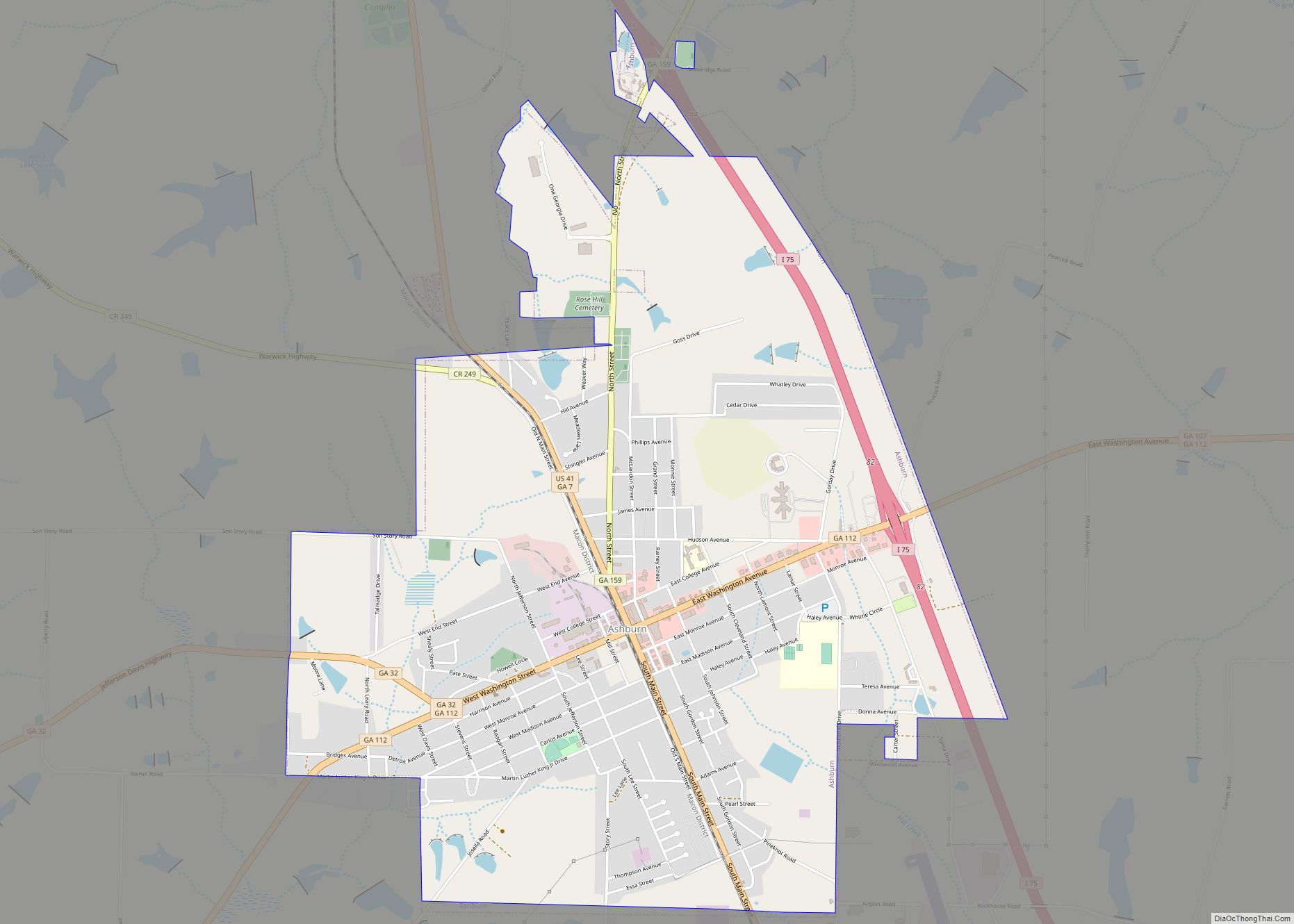
Online Interactive Map
Click on ![]() to view map in "full screen" mode.
to view map in "full screen" mode.
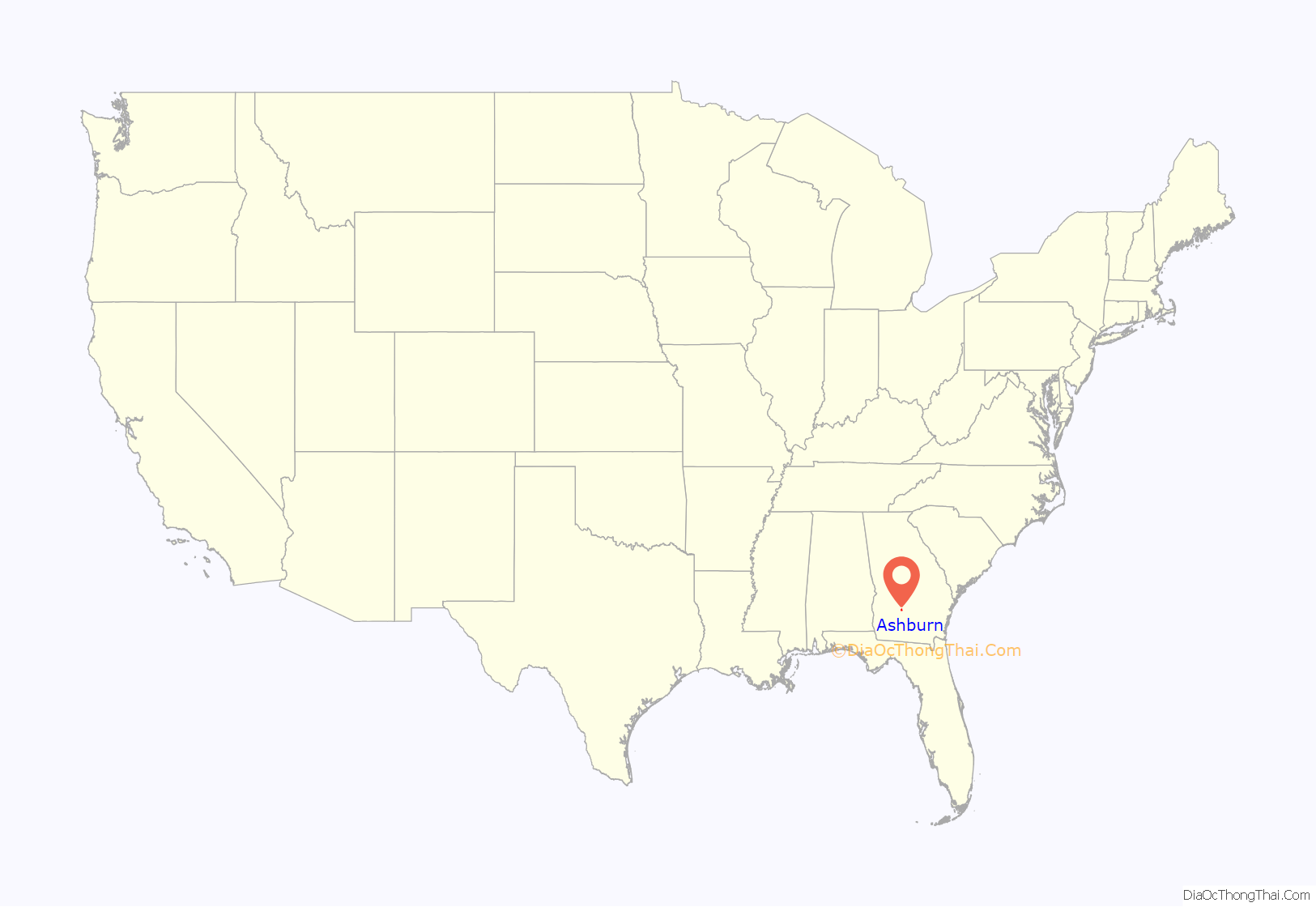
Ashburn location map. Where is Ashburn city?

History
The town of Marion was founded in 1888, and changed its name to Ashburn when it was incorporated in 1890. Ashburn was designated seat of Turner County when it was established in 1905. The community was named after W. W. Ashburn, a pioneer citizen.
Legal Publications for the City of Ashburn is The Wiregrass Farmer.
Ashburn Road Map

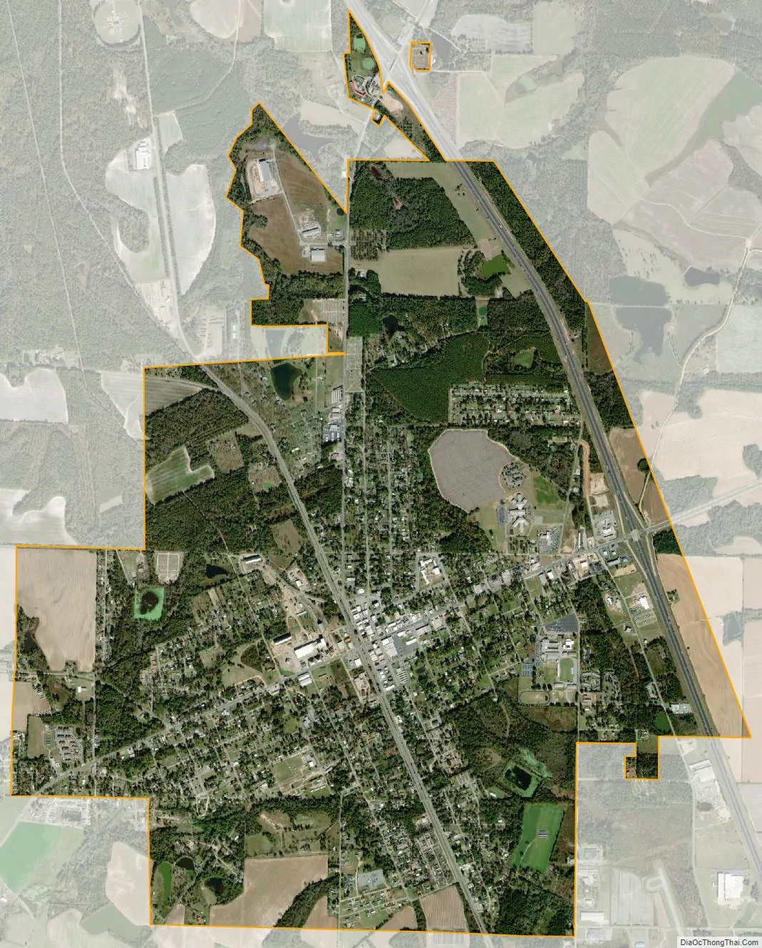
Ashburn city Satellite Map
Geography
Ashburn is located at 31°42′16″N 83°39′14″W / 31.70444°N 83.65389°W / 31.70444; -83.65389 (31.704378, -83.653786).
According to the United States Census Bureau, the city has a total area of 4.6 square miles (12 km), of which 4.5 square miles (12 km) is land and 0.04 square miles (0.10 km) (0.66%) is water.
See also
Map of Georgia State and its subdivision:- Appling
- Atkinson
- Bacon
- Baker
- Baldwin
- Banks
- Barrow
- Bartow
- Ben Hill
- Berrien
- Bibb
- Bleckley
- Brantley
- Brooks
- Bryan
- Bulloch
- Burke
- Butts
- Calhoun
- Camden
- Candler
- Carroll
- Catoosa
- Charlton
- Chatham
- Chattahoochee
- Chattooga
- Cherokee
- Clarke
- Clay
- Clayton
- Clinch
- Cobb
- Coffee
- Colquitt
- Columbia
- Cook
- Coweta
- Crawford
- Crisp
- Dade
- Dawson
- Decatur
- DeKalb
- Dodge
- Dooly
- Dougherty
- Douglas
- Early
- Echols
- Effingham
- Elbert
- Emanuel
- Evans
- Fannin
- Fayette
- Floyd
- Forsyth
- Franklin
- Fulton
- Gilmer
- Glascock
- Glynn
- Gordon
- Grady
- Greene
- Gwinnett
- Habersham
- Hall
- Hancock
- Haralson
- Harris
- Hart
- Heard
- Henry
- Houston
- Irwin
- Jackson
- Jasper
- Jeff Davis
- Jefferson
- Jenkins
- Johnson
- Jones
- Lamar
- Lanier
- Laurens
- Lee
- Liberty
- Lincoln
- Long
- Lowndes
- Lumpkin
- Macon
- Madison
- Marion
- McDuffie
- McIntosh
- Meriwether
- Miller
- Mitchell
- Monroe
- Montgomery
- Morgan
- Murray
- Muscogee
- Newton
- Oconee
- Oglethorpe
- Paulding
- Peach
- Pickens
- Pierce
- Pike
- Polk
- Pulaski
- Putnam
- Quitman
- Rabun
- Randolph
- Richmond
- Rockdale
- Schley
- Screven
- Seminole
- Spalding
- Stephens
- Stewart
- Sumter
- Talbot
- Taliaferro
- Tattnall
- Taylor
- Telfair
- Terrell
- Thomas
- Tift
- Toombs
- Towns
- Treutlen
- Troup
- Turner
- Twiggs
- Union
- Upson
- Walker
- Walton
- Ware
- Warren
- Washington
- Wayne
- Webster
- Wheeler
- White
- Whitfield
- Wilcox
- Wilkes
- Wilkinson
- Worth
- Alabama
- Alaska
- Arizona
- Arkansas
- California
- Colorado
- Connecticut
- Delaware
- District of Columbia
- Florida
- Georgia
- Hawaii
- Idaho
- Illinois
- Indiana
- Iowa
- Kansas
- Kentucky
- Louisiana
- Maine
- Maryland
- Massachusetts
- Michigan
- Minnesota
- Mississippi
- Missouri
- Montana
- Nebraska
- Nevada
- New Hampshire
- New Jersey
- New Mexico
- New York
- North Carolina
- North Dakota
- Ohio
- Oklahoma
- Oregon
- Pennsylvania
- Rhode Island
- South Carolina
- South Dakota
- Tennessee
- Texas
- Utah
- Vermont
- Virginia
- Washington
- West Virginia
- Wisconsin
- Wyoming