Bethlehem is a town in Barrow County in the U.S. state of Georgia. As of the 2020 census, it had a population of 715. The major employer in town is Harrison Poultry, which is the largest non-government employer in Barrow County.
The town was named after a local church, Bethlehem Methodist Church, and has a strong Christmas theme, with many of the street names being references to the nativity of Jesus, such as Mary, Joseph, and Manger. After the introduction of a 1967 stamp in Bethlehem, the town became known as a popular location for sending mail from during the holidays, as the post office sends letters marked “from Bethlehem.”
| Name: | Bethlehem town |
|---|---|
| LSAD Code: | 43 |
| LSAD Description: | town (suffix) |
| State: | Georgia |
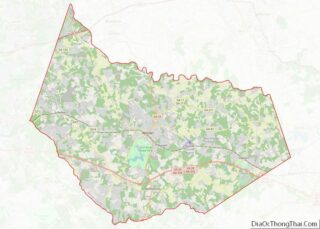
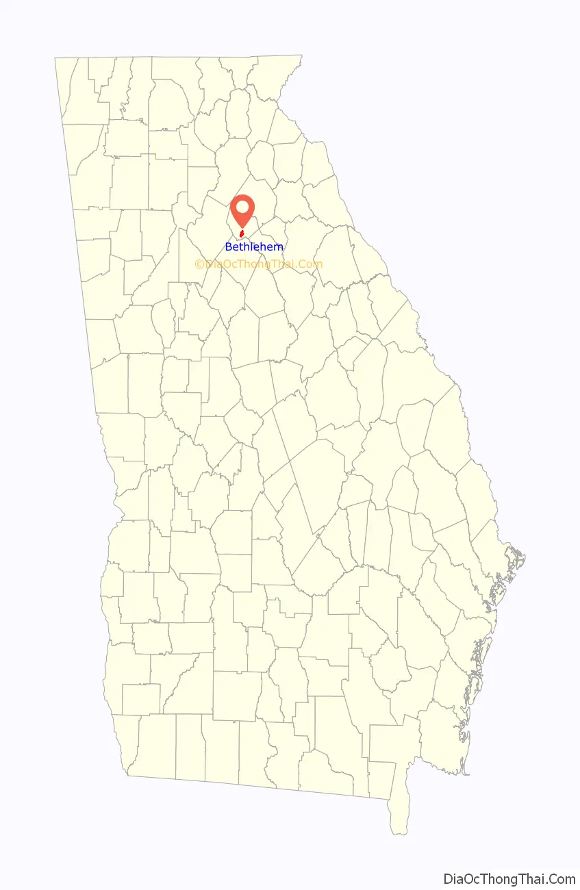
| County: | Barrow County |
| Elevation: | 860 ft (262 m) |
| Total Area: | 2.302 sq mi (6.0052 km²) |
| Land Area: | 2.3 sq mi (6.00 km²) |
| Water Area: | 0.002 sq mi (0.0052 km²) |
| Total Population: | 715 |
| Population Density: | 310.9/sq mi (119.2/km²) |
| ZIP code: | 30620 |
| FIPS code: | 1307612 |
| GNISfeature ID: | 0331150 |
| Website: | www.bethlehemga.org |
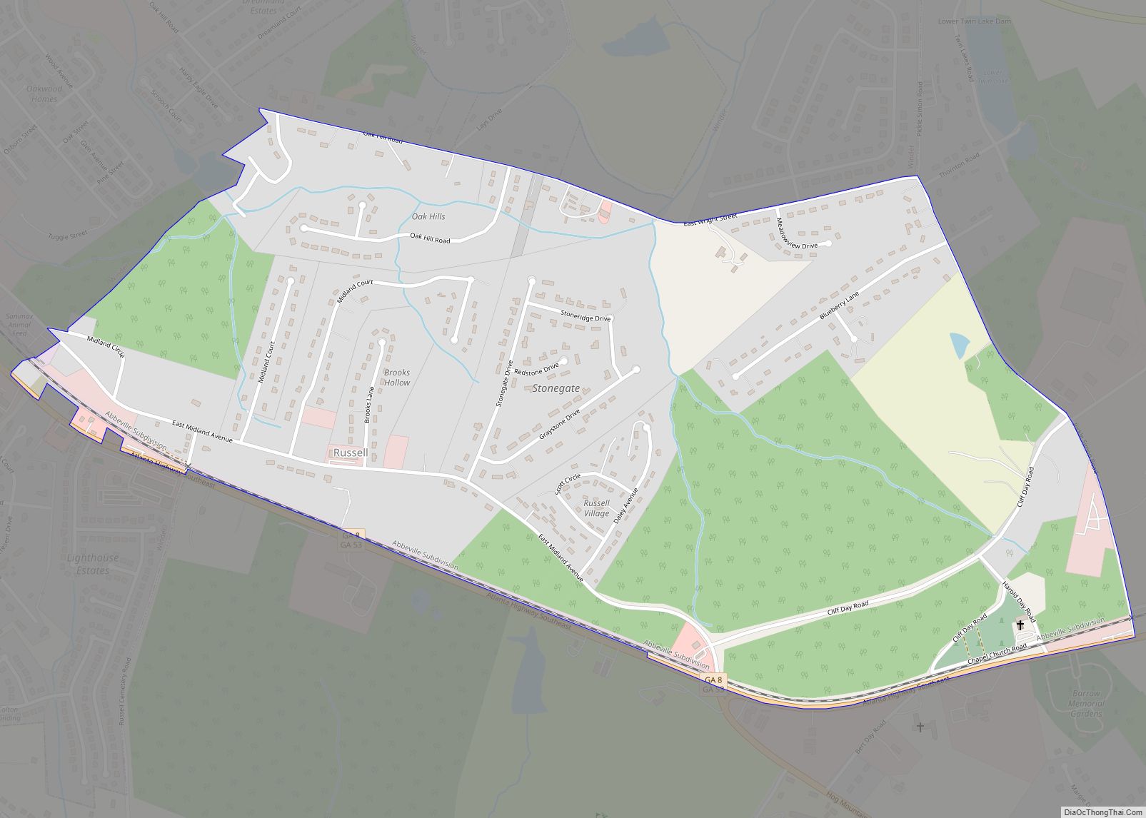
Online Interactive Map
Click on ![]() to view map in "full screen" mode.
to view map in "full screen" mode.
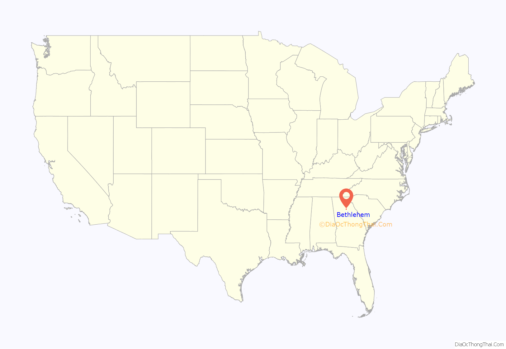
Bethlehem location map. Where is Bethlehem town?
History
The land that Bethlehem and the surrounding Barrow County occupies was originally occupied by Cherokee and Creek tribes. European settlers first arrived in the area in 1786. The Bethlehem Methodist Church was established in 1796 in what would later become Bethlehem. The church opened an adjacent camp ground that was used between 1851 and 1894 which was used as a troop mobilization center during the American Civil War. The Confederate States Army’s 16th Georgia Regiment was formed at the camp ground, and the grounds were used as a refugee camp during the war. During the Reconstruction era onwards the camp ground was used for various religious services. A Christian revival meeting was taking place on August 31, 1886, when shockwaves from the 1886 Charleston earthquake were felt at an estimated MMI intensity of 6. The camp ground is now the current location of the Bethlehem Methodist Church, which was built in 1949.
The area was informally established as the community of Bethlehem in December 1883 as a stop along the Belmont – Monroe line of the Gainesville, Jefferson and Southern Railroad. The stop was named after the local Bethlehem Methodist Church. The church itself was named after the ancient town of Bethlehem, identified in the Gospels of Matthew and Luke as the birthplace of Jesus. The railway line was removed in 1946. Bethlehem was incorporated as a town in 1902 by an act of the Georgia General Assembly “under the name and style of the town of Bethlehem”. At the time of its incorporation it was part of Walton County, but later became part of the newly formed Barrow County in 1914, which was created using land previously belonging to the nearby Gwinnett, Jackson, and Walton counties.
In 1986 a 13-year-old Bethlehem Elementary School student made national headlines when he stabbed his principal Murray Kennedy to death with a nail file. Because the white principal was killed by a black student, the incident stoked fears of racial conflict in the community, which were addressed by local black and white leaders in the community. The case drew the attention of the Southern Christian Leadership Conference who helped contribute to the student’s defense fund. It also drew the attention of the Ku Klux Klan; 65 members of the Ku Klux Klan held a rally in front of the Winder, Georgia courthouse in protest of the murder. Despite the involvement of the KKK, fears of racial tension in the community itself quickly died out. After being charged as an adult, the student was sentenced to 15 years after pleading guilty to voluntary manslaughter.
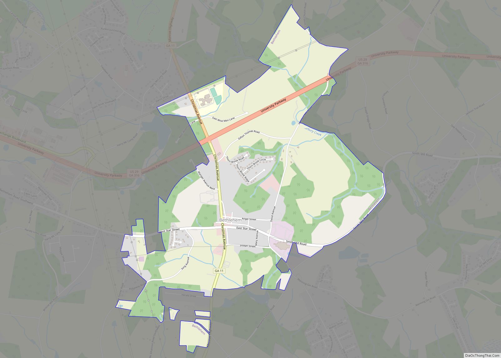
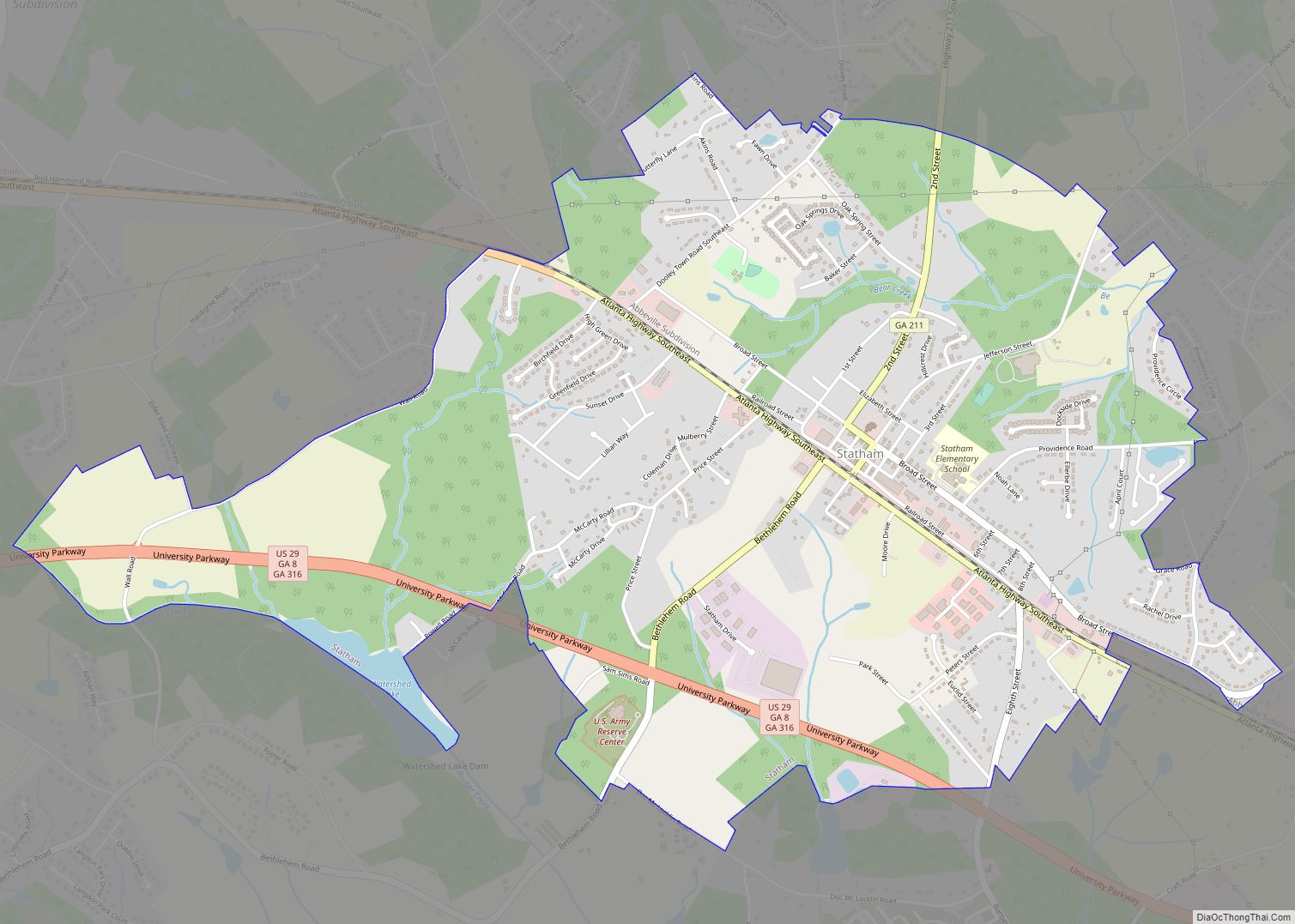
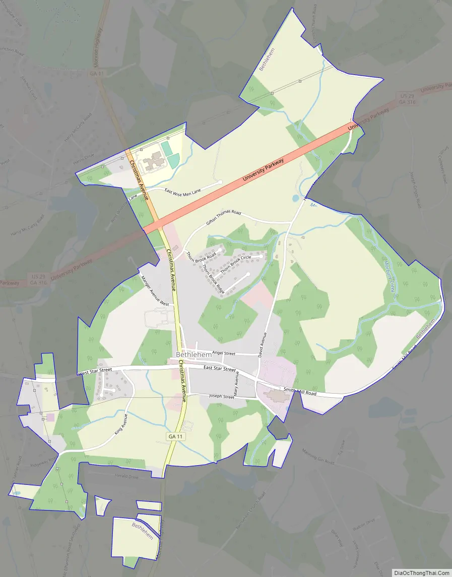
Bethlehem Road Map
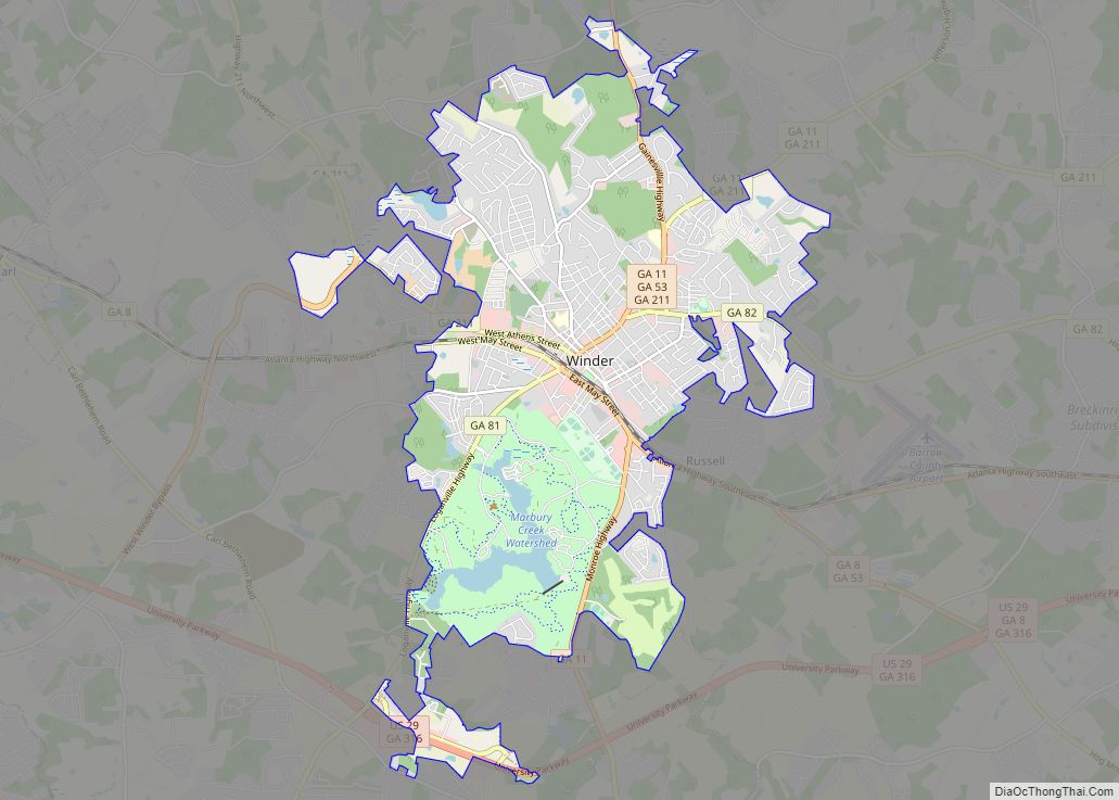
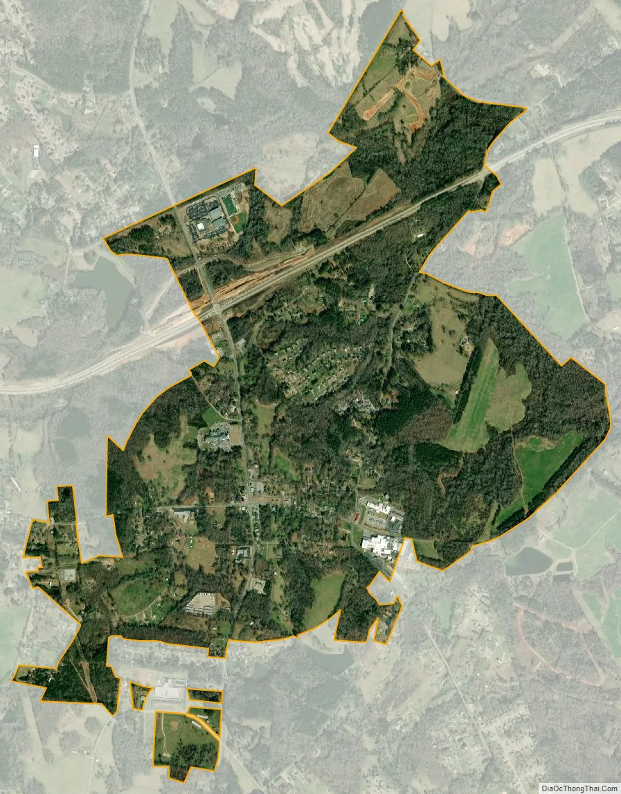
Bethlehem city Satellite Map
Geography
Bethlehem is located in southern Barrow County, 4 miles (6.4 km) south of Winder, the county seat. The town is 24.1 miles (38.8 km) west of Athens, Georgia, and 49.1 miles (79.0 km) east of Atlanta. According to the United States Census Bureau, the town has a total area of 2.3 square miles (6.0 km), with approximately 0.002 square miles (0.0052 km) of water. The land in and around Bethlehem forms a watershed that flows into the Apalachee River and Marburg Creek, which itself flows into the Apalachee River. Around 76.4% of the land in Bethlehem is used for agriculture or forestry, followed by 14.8% for residential use.
Climate
The climate of Bethlehem, as with most of the southeastern United States, is humid subtropical (Cfa) according to the Köppen classification, with four seasons including hot, humid summers and cool winters. July is generally the warmest month of the year with an average high of around 90 °F (32 °C). The coldest month is January which has an average high of around 53 °F (12 °C).
Bethlehem receives rainfall distributed evenly throughout the year as typical of southeastern U.S. cities, with March on average having the highest average precipitation at 5.12 inches (130 mm), and May typically being the driest month with 3.17 inches (81 mm).
See also
Map of Georgia State and its subdivision:- Appling
- Atkinson
- Bacon
- Baker
- Baldwin
- Banks
- Barrow
- Bartow
- Ben Hill
- Berrien
- Bibb
- Bleckley
- Brantley
- Brooks
- Bryan
- Bulloch
- Burke
- Butts
- Calhoun
- Camden
- Candler
- Carroll
- Catoosa
- Charlton
- Chatham
- Chattahoochee
- Chattooga
- Cherokee
- Clarke
- Clay
- Clayton
- Clinch
- Cobb
- Coffee
- Colquitt
- Columbia
- Cook
- Coweta
- Crawford
- Crisp
- Dade
- Dawson
- Decatur
- DeKalb
- Dodge
- Dooly
- Dougherty
- Douglas
- Early
- Echols
- Effingham
- Elbert
- Emanuel
- Evans
- Fannin
- Fayette
- Floyd
- Forsyth
- Franklin
- Fulton
- Gilmer
- Glascock
- Glynn
- Gordon
- Grady
- Greene
- Gwinnett
- Habersham
- Hall
- Hancock
- Haralson
- Harris
- Hart
- Heard
- Henry
- Houston
- Irwin
- Jackson
- Jasper
- Jeff Davis
- Jefferson
- Jenkins
- Johnson
- Jones
- Lamar
- Lanier
- Laurens
- Lee
- Liberty
- Lincoln
- Long
- Lowndes
- Lumpkin
- Macon
- Madison
- Marion
- McDuffie
- McIntosh
- Meriwether
- Miller
- Mitchell
- Monroe
- Montgomery
- Morgan
- Murray
- Muscogee
- Newton
- Oconee
- Oglethorpe
- Paulding
- Peach
- Pickens
- Pierce
- Pike
- Polk
- Pulaski
- Putnam
- Quitman
- Rabun
- Randolph
- Richmond
- Rockdale
- Schley
- Screven
- Seminole
- Spalding
- Stephens
- Stewart
- Sumter
- Talbot
- Taliaferro
- Tattnall
- Taylor
- Telfair
- Terrell
- Thomas
- Tift
- Toombs
- Towns
- Treutlen
- Troup
- Turner
- Twiggs
- Union
- Upson
- Walker
- Walton
- Ware
- Warren
- Washington
- Wayne
- Webster
- Wheeler
- White
- Whitfield
- Wilcox
- Wilkes
- Wilkinson
- Worth
- Alabama
- Alaska
- Arizona
- Arkansas
- California
- Colorado
- Connecticut
- Delaware
- District of Columbia
- Florida
- Georgia
- Hawaii
- Idaho
- Illinois
- Indiana
- Iowa
- Kansas
- Kentucky
- Louisiana
- Maine
- Maryland
- Massachusetts
- Michigan
- Minnesota
- Mississippi
- Missouri
- Montana
- Nebraska
- Nevada
- New Hampshire
- New Jersey
- New Mexico
- New York
- North Carolina
- North Dakota
- Ohio
- Oklahoma
- Oregon
- Pennsylvania
- Rhode Island
- South Carolina
- South Dakota
- Tennessee
- Texas
- Utah
- Vermont
- Virginia
- Washington
- West Virginia
- Wisconsin
- Wyoming