Buckhead is a town in Morgan County, Georgia, United States. As of the 2020 census, the town had a population of 194.
| Name: | Buckhead town |
|---|---|
| LSAD Code: | 43 |
| LSAD Description: | town (suffix) |
| State: | Georgia |
| County: | Morgan County |
| Elevation: | 626 ft (190 m) |
| Total Area: | 0.81 sq mi (2.11 km²) |
| Land Area: | 0.81 sq mi (2.09 km²) |
| Water Area: | 0.01 sq mi (0.02 km²) |
| Total Population: | 194 |
| Population Density: | 242.20/sq mi (93.51/km²) |
| ZIP code: | 30625 |
| Area code: | 706 |
| FIPS code: | 1311672 |
| GNISfeature ID: | 0354900 |
Online Interactive Map
Click on ![]() to view map in "full screen" mode.
to view map in "full screen" mode.
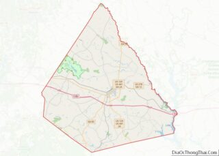
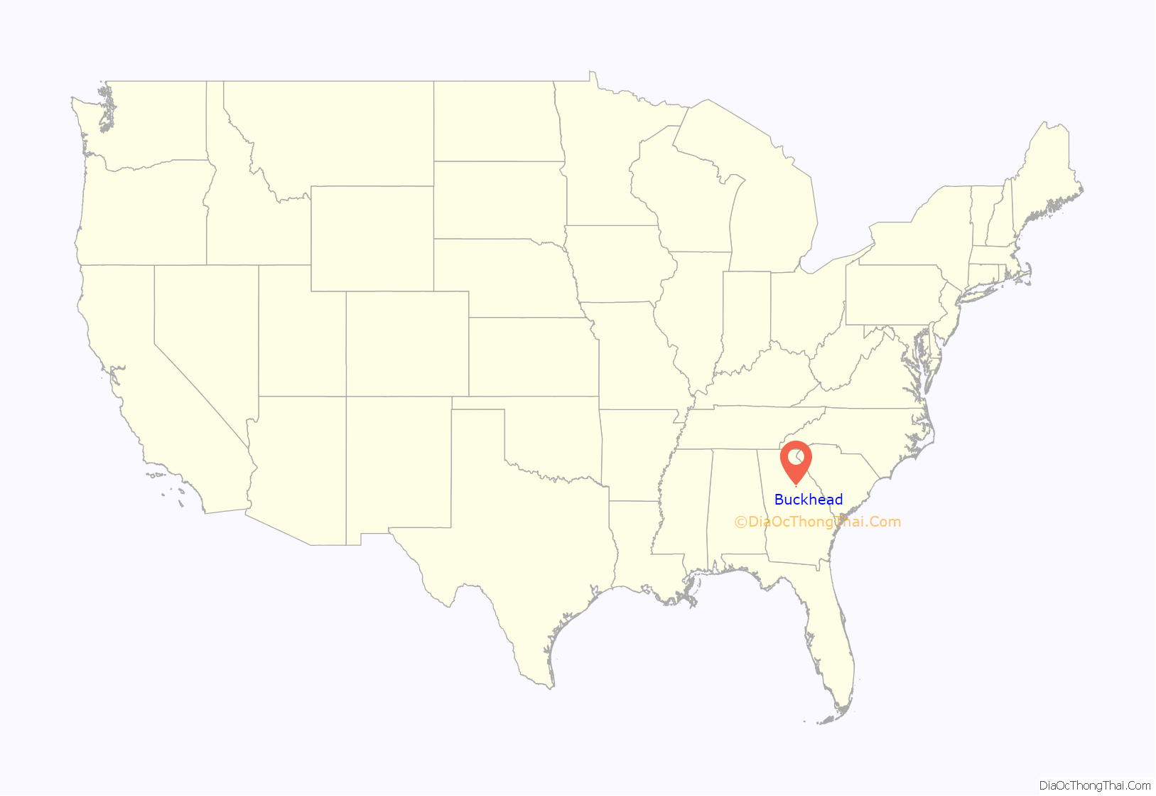
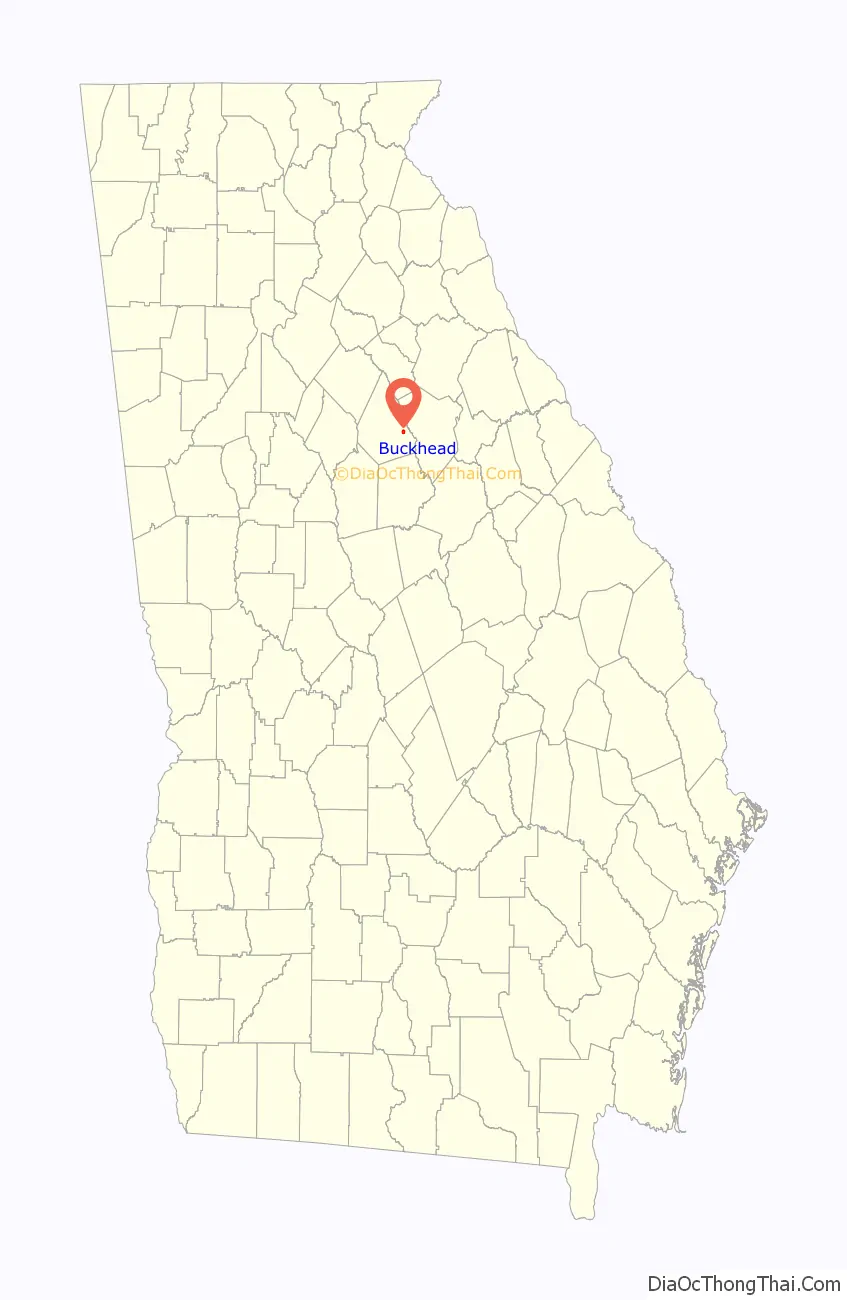
Buckhead location map. Where is Buckhead town?
History
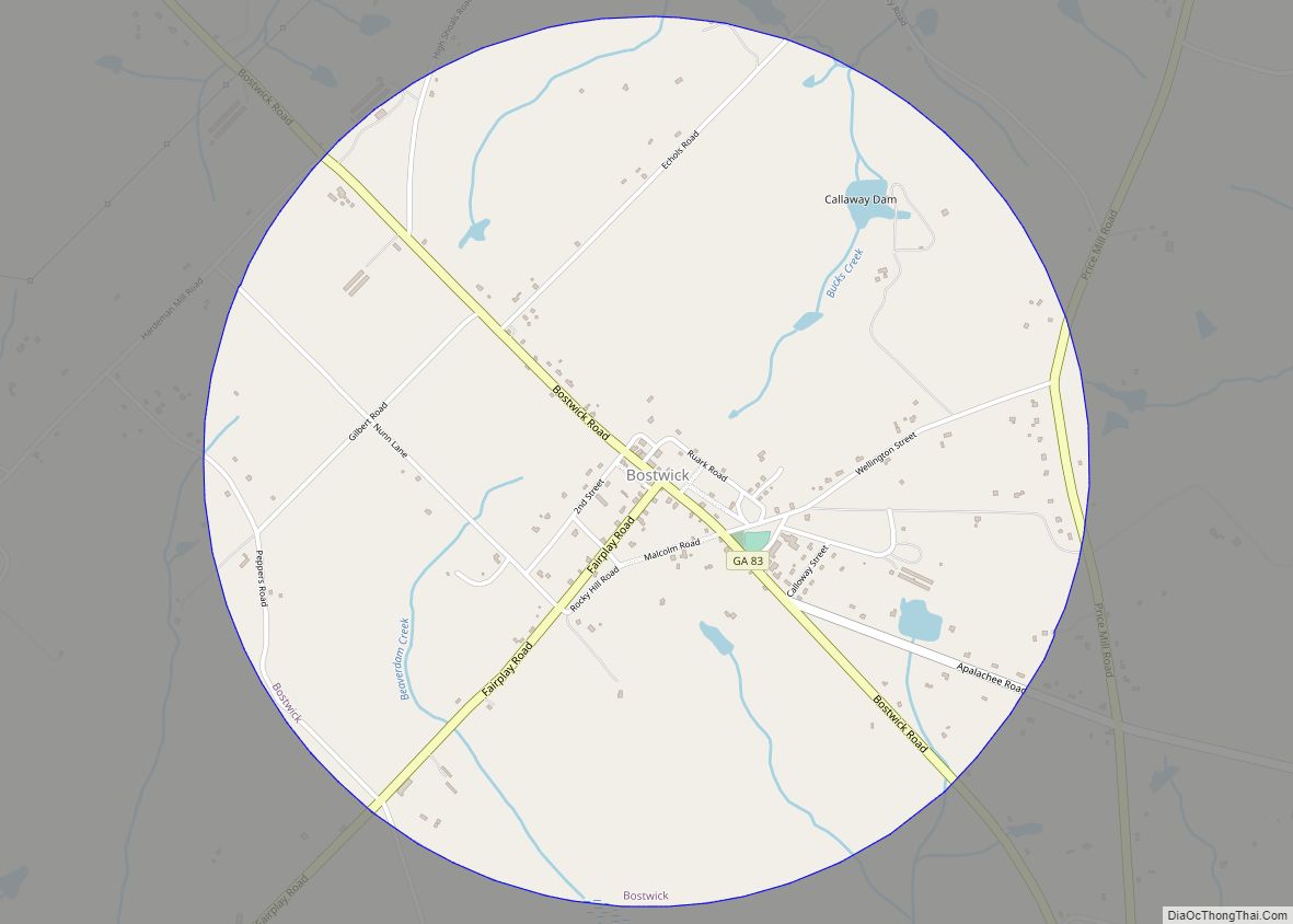
The Georgia General Assembly incorporated Buckhead as a town in 1908. According to tradition, Buckhead was named from a pioneer incident when hunters shot a deer and publicly mounted the buck’s head onto a tree.
Buckhead Road Map
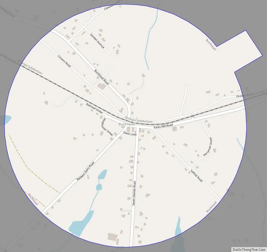
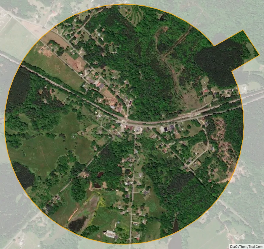
Buckhead city Satellite Map
Geography
Buckhead is located in southeastern Morgan County at 33°34′5″N 83°21′45″W / 33.56806°N 83.36250°W / 33.56806; -83.36250 (33.568012, -83.362443). It is 7 miles (11 km) east-southeast of Madison, the county seat. Interstate 20 passes 1 mile (1.6 km) south of the town, with access from Exit 121 (Seven Islands Road). Via I-20, Buckhead is 65 miles (105 km) east of Atlanta and 85 miles (137 km) west of Augusta.
According to the United States Census Bureau, Buckhead has a total area of 0.8 square miles (2.1 km), of which 0.008 square miles (0.02 km), or 0.99%, are water. The town is drained to the north by tributaries of the Apalachee River and to the south by tributaries of Sugar Creek, both of which flow southeast to the Oconee River.
See also
Map of Georgia State and its subdivision:- Appling
- Atkinson
- Bacon
- Baker
- Baldwin
- Banks
- Barrow
- Bartow
- Ben Hill
- Berrien
- Bibb
- Bleckley
- Brantley
- Brooks
- Bryan
- Bulloch
- Burke
- Butts
- Calhoun
- Camden
- Candler
- Carroll
- Catoosa
- Charlton
- Chatham
- Chattahoochee
- Chattooga
- Cherokee
- Clarke
- Clay
- Clayton
- Clinch
- Cobb
- Coffee
- Colquitt
- Columbia
- Cook
- Coweta
- Crawford
- Crisp
- Dade
- Dawson
- Decatur
- DeKalb
- Dodge
- Dooly
- Dougherty
- Douglas
- Early
- Echols
- Effingham
- Elbert
- Emanuel
- Evans
- Fannin
- Fayette
- Floyd
- Forsyth
- Franklin
- Fulton
- Gilmer
- Glascock
- Glynn
- Gordon
- Grady
- Greene
- Gwinnett
- Habersham
- Hall
- Hancock
- Haralson
- Harris
- Hart
- Heard
- Henry
- Houston
- Irwin
- Jackson
- Jasper
- Jeff Davis
- Jefferson
- Jenkins
- Johnson
- Jones
- Lamar
- Lanier
- Laurens
- Lee
- Liberty
- Lincoln
- Long
- Lowndes
- Lumpkin
- Macon
- Madison
- Marion
- McDuffie
- McIntosh
- Meriwether
- Miller
- Mitchell
- Monroe
- Montgomery
- Morgan
- Murray
- Muscogee
- Newton
- Oconee
- Oglethorpe
- Paulding
- Peach
- Pickens
- Pierce
- Pike
- Polk
- Pulaski
- Putnam
- Quitman
- Rabun
- Randolph
- Richmond
- Rockdale
- Schley
- Screven
- Seminole
- Spalding
- Stephens
- Stewart
- Sumter
- Talbot
- Taliaferro
- Tattnall
- Taylor
- Telfair
- Terrell
- Thomas
- Tift
- Toombs
- Towns
- Treutlen
- Troup
- Turner
- Twiggs
- Union
- Upson
- Walker
- Walton
- Ware
- Warren
- Washington
- Wayne
- Webster
- Wheeler
- White
- Whitfield
- Wilcox
- Wilkes
- Wilkinson
- Worth
- Alabama
- Alaska
- Arizona
- Arkansas
- California
- Colorado
- Connecticut
- Delaware
- District of Columbia
- Florida
- Georgia
- Hawaii
- Idaho
- Illinois
- Indiana
- Iowa
- Kansas
- Kentucky
- Louisiana
- Maine
- Maryland
- Massachusetts
- Michigan
- Minnesota
- Mississippi
- Missouri
- Montana
- Nebraska
- Nevada
- New Hampshire
- New Jersey
- New Mexico
- New York
- North Carolina
- North Dakota
- Ohio
- Oklahoma
- Oregon
- Pennsylvania
- Rhode Island
- South Carolina
- South Dakota
- Tennessee
- Texas
- Utah
- Vermont
- Virginia
- Washington
- West Virginia
- Wisconsin
- Wyoming