Cumming is a city in Forsyth County, Georgia, United States, and the sole incorporated area in the county. It is a suburban city, and part of the Atlanta metropolitan area. In the 2020 census, the population is 7,318, up from 5,430 in 2010. Surrounding unincorporated areas with a Cumming mailing address have a population of approximately 100,000. Cumming is the county seat of Forsyth County.
| Name: | Cumming city |
|---|---|
| LSAD Code: | 25 |
| LSAD Description: | city (suffix) |
| State: | Georgia |
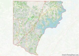
| County: | Forsyth County |
| Incorporated: | 1834 |
| Elevation: | 1,217 ft (371 m) |
| Total Area: | 7.23 sq mi (18.73 km²) |
| Land Area: | 7.19 sq mi (18.62 km²) |
| Water Area: | 0.04 sq mi (0.10 km²) |
| Total Population: | 7,318 |
| Population Density: | 1,017.80/sq mi (393.00/km²) |
| ZIP code: | 30028, 30040, 30041 |
| Area code: | 770 |
| FIPS code: | 1320932 |
| GNISfeature ID: | 0331494 |
| Website: | www.cityofcumming.net |
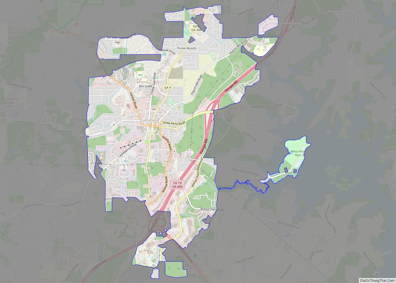
Online Interactive Map
Click on ![]() to view map in "full screen" mode.
to view map in "full screen" mode.
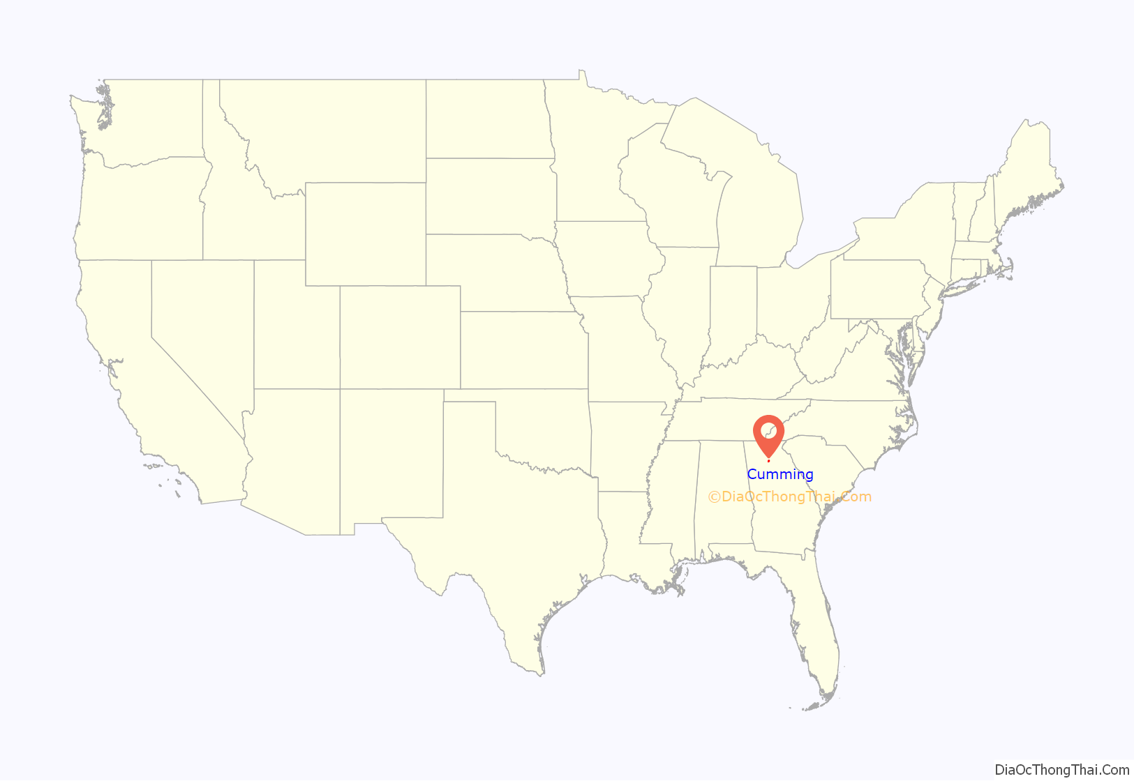
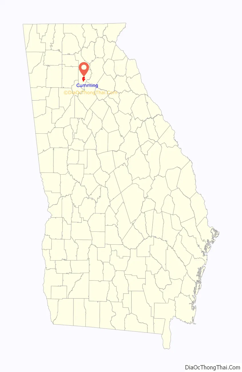
Cumming location map. Where is Cumming city?
History
The area now called Cumming is located west of the historic location of Vann’s Ferry between Forsyth County and Hall County.
Early history
The area, now called Cumming, was inhabited earlier by Cherokee tribes, who are thought to have arrived in the mid-18th century. The Cherokee and Creek people developed disputes over hunting land. After two years of fighting, the Cherokee won the land in the Battle of Taliwa. The Creek people were forced to move south of the Chattahoochee River.
The Cherokee coexisted with white settlers until the discovery of gold in Georgia in 1828. Settlers that moved to the area to mine for gold pushed for the removal of the Cherokee. In 1835, the Treaty of New Echota was signed. The treaty stated that the Cherokee Nation must move to the Indian Territory, west of the Mississippi River. This resulted in the Trail of Tears. The Cherokee territory was then formed into Cherokee County in 1831. In 1832, the county had been split into several counties including Forsyth County.
In 1833, the town of Cumming was formed from two 40-acre (16 ha) land lots that had been issued as part of a Georgia State Land Lottery in 1832. The two lots designated as Land Lot 1269 and Land Lot 1270 were purchased by a couple of Forsyth County Inferior Court justices who realized that it was necessary to have a seat of government to conduct county business. The boundaries of the two lots ended at what is now Tolbert Street on the west side, Eastern Circle on the east side, Resthaven Street on the south side, and School Street on the north side. In 1834 the post office was established and began delivering mail. The justices of the Inferior Court divided the town land into smaller lots and began selling them to people over the next several years, reserving one lot for the county courthouse. During that same year, the Georgia State Legislature incorporated the town of Cumming into the City of Cumming and made it the official government seat of Forsyth County.
A second charter was issued in 1845, decreeing that Cumming’s government would follow the mayor–council model of government.
The community is commonly thought to be named after Colonel William Cumming. An alternate theory proposed by a local historian posits the name honors Rev. Frederick Cumming, a professor of Jacob Scudder, a resident of the area since 1815 who owned land in present-day downtown. Yet another theory is that the town is named after Alexander Cuming, the son of a Scottish baronet.
Modern history
During the 1830s and 1840s, Cumming benefited from the gold mining industry as many businesses were created to meet the needs of the miners. However, the California Gold Rush in 1849 put the city into an economic depression. Newly built railroads bypassed the city and took traffic from the Federal Road that ran near Cumming. The city was spared during the Civil War because William T. Sherman did not pass through the city during his March to the Sea. In 1900, the county courthouse was destroyed in a fire after being struck by lightning; it was rebuilt in 1905.
In 1912, Governor Joseph M. Brown sent four companies of state militia to Cumming to prevent riots after two reported attacks of young white women, allegedly by black men. A suspect in the second assault, in which the victim was also raped and later died, was dragged from the Cumming county jail and lynched. The governor then declared martial law, but the effort did little to stop a month-long barrage of attacks by night riders on the black citizens. This led to the banishment of blacks, and the city had virtually no black population.
Racial tensions were strained again in 1987 when a group of black people were assaulted while camping at a park on Lake Lanier. This was widely reported by local newspapers and in Atlanta. As a result of this a local businessman decided to hold a “Peace March” the following week. Civil rights leader Reverend Hosea Williams joined the local businessman in a march along Bethelview and Castleberry Road in south Forsyth County into the City of Cumming where they were assaulted by whites. The marchers retreated and vowed to return. During the following “Brotherhood March” on January 24, 1987, another racially mixed group returned to Forsyth County to complete the march the previous group had been unable to finish. March organizers estimated the number at 20,000, while police estimates ran from 12,000 to 14,000. Hosea Williams and former senator Gary Hart were in the demonstration. A group of the National Guard kept the opposition of about 1,000 in check. Oprah Winfrey featured Cumming and Forsyth County on her The Oprah Winfrey Show. She formed a town hall meeting where one audience member said:
However, most of the audience members agreed that Forsyth County should integrate. Rev. Hosea Williams was excluded from Oprah’s show and arrested for trespassing.
Today, the city is experiencing new growth and bears little resemblance to the small rural town it was mere decades ago. The completion of Georgia 400 has helped turn Cumming into a commuter town for metropolitan Atlanta. The city holds the Cumming Country Fair & Festival every October. The Sawnee Mountain Preserve provides views of the city from the top of Sawnee Mountain. In 1956, Buford Dam, along the Chattahoochee River, started operating. The reservoir that it created is called Lake Lanier. The lake, a popular spot for boaters, has generated income from tourists for Cumming as well as provides a source of drinking water. However, because of rapid growth of the Atlanta area, drought, and mishandling of a stream gauge, Lake Lanier has seen record-low water levels. Moreover, the lake is involved in a longstanding lawsuit between Georgia, Alabama, and Florida. Because of a recent ruling, the city of Cumming may not be able to draw water from the lake. However, the city is looking into different sources of water such as wells and various creeks.
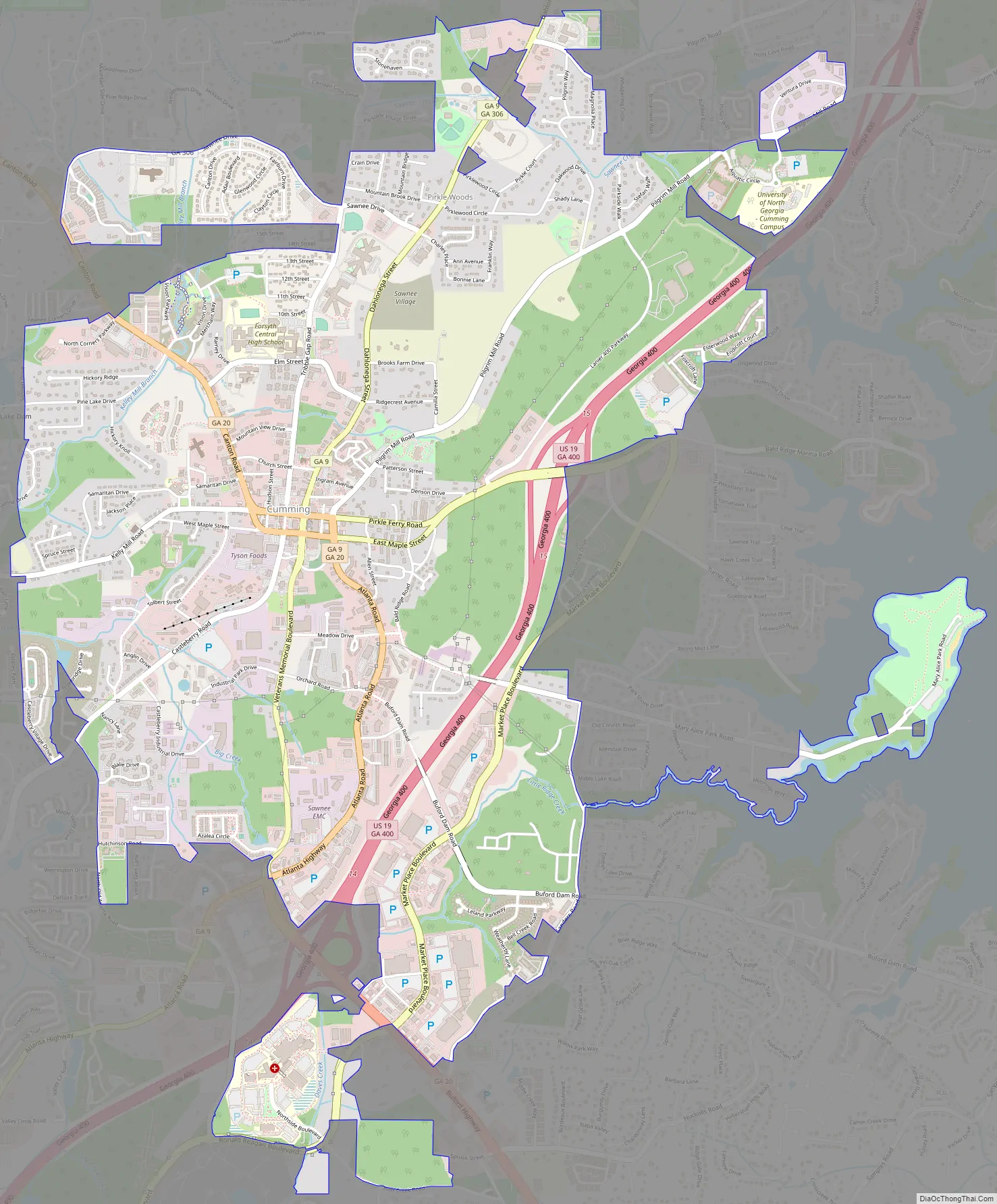
Cumming Road Map
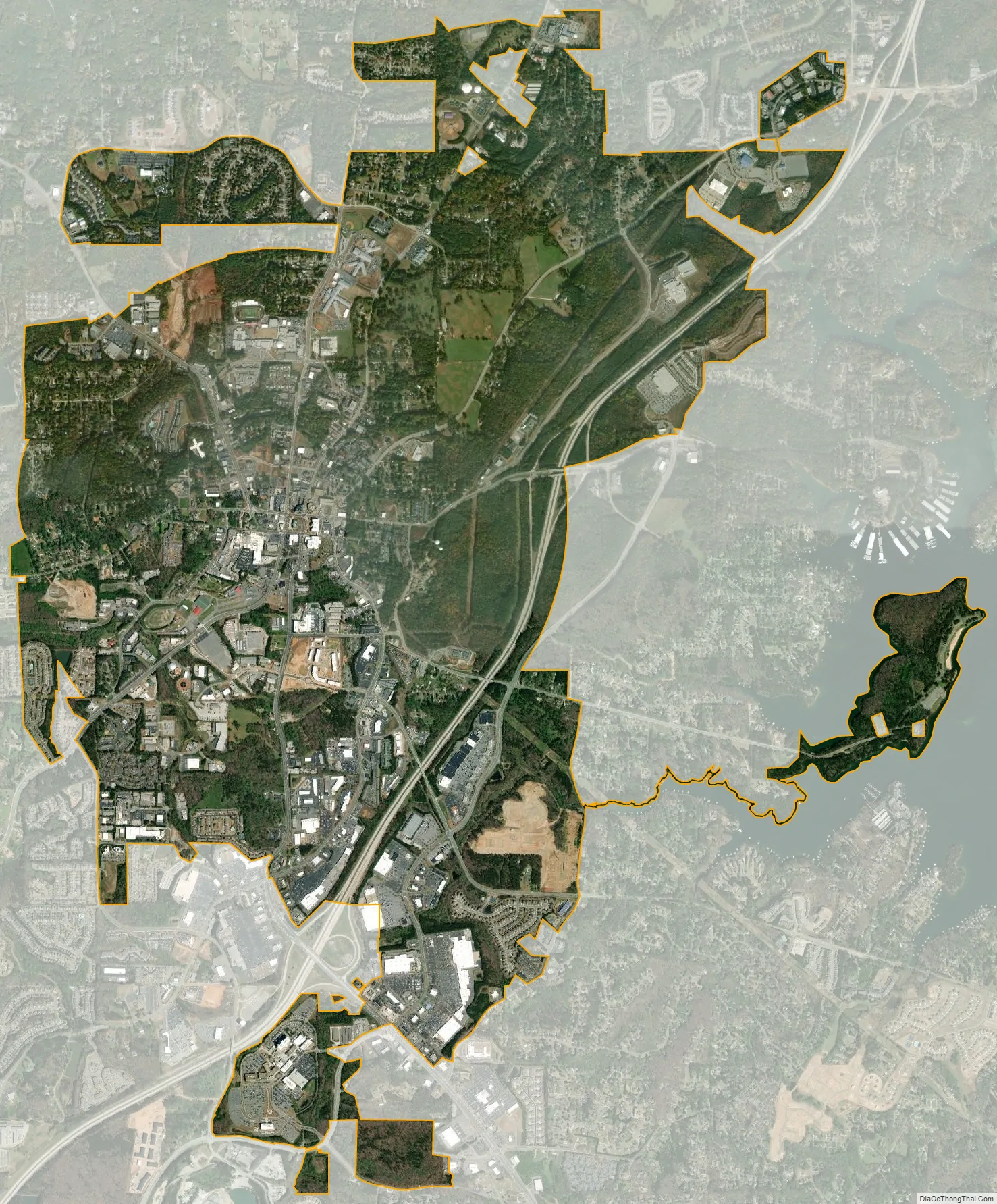
Cumming city Satellite Map
Geography
Cumming is located in the center of Forsyth County at 34°12′30″N 84°8′15″W / 34.20833°N 84.13750°W / 34.20833; -84.13750 (34.208464, -84.137575). It is 39 miles (63 km) northeast of downtown Atlanta and 15 miles (24 km) northeast of Alpharetta.
According to the United States Census Bureau, Cumming has a total area of 6.1 square miles (15.9 km), of which 6.1 square miles (15.8 km) is land and 0.04 square miles (0.1 km), or 0.58%, is water.
See also
Map of Georgia State and its subdivision:- Appling
- Atkinson
- Bacon
- Baker
- Baldwin
- Banks
- Barrow
- Bartow
- Ben Hill
- Berrien
- Bibb
- Bleckley
- Brantley
- Brooks
- Bryan
- Bulloch
- Burke
- Butts
- Calhoun
- Camden
- Candler
- Carroll
- Catoosa
- Charlton
- Chatham
- Chattahoochee
- Chattooga
- Cherokee
- Clarke
- Clay
- Clayton
- Clinch
- Cobb
- Coffee
- Colquitt
- Columbia
- Cook
- Coweta
- Crawford
- Crisp
- Dade
- Dawson
- Decatur
- DeKalb
- Dodge
- Dooly
- Dougherty
- Douglas
- Early
- Echols
- Effingham
- Elbert
- Emanuel
- Evans
- Fannin
- Fayette
- Floyd
- Forsyth
- Franklin
- Fulton
- Gilmer
- Glascock
- Glynn
- Gordon
- Grady
- Greene
- Gwinnett
- Habersham
- Hall
- Hancock
- Haralson
- Harris
- Hart
- Heard
- Henry
- Houston
- Irwin
- Jackson
- Jasper
- Jeff Davis
- Jefferson
- Jenkins
- Johnson
- Jones
- Lamar
- Lanier
- Laurens
- Lee
- Liberty
- Lincoln
- Long
- Lowndes
- Lumpkin
- Macon
- Madison
- Marion
- McDuffie
- McIntosh
- Meriwether
- Miller
- Mitchell
- Monroe
- Montgomery
- Morgan
- Murray
- Muscogee
- Newton
- Oconee
- Oglethorpe
- Paulding
- Peach
- Pickens
- Pierce
- Pike
- Polk
- Pulaski
- Putnam
- Quitman
- Rabun
- Randolph
- Richmond
- Rockdale
- Schley
- Screven
- Seminole
- Spalding
- Stephens
- Stewart
- Sumter
- Talbot
- Taliaferro
- Tattnall
- Taylor
- Telfair
- Terrell
- Thomas
- Tift
- Toombs
- Towns
- Treutlen
- Troup
- Turner
- Twiggs
- Union
- Upson
- Walker
- Walton
- Ware
- Warren
- Washington
- Wayne
- Webster
- Wheeler
- White
- Whitfield
- Wilcox
- Wilkes
- Wilkinson
- Worth
- Alabama
- Alaska
- Arizona
- Arkansas
- California
- Colorado
- Connecticut
- Delaware
- District of Columbia
- Florida
- Georgia
- Hawaii
- Idaho
- Illinois
- Indiana
- Iowa
- Kansas
- Kentucky
- Louisiana
- Maine
- Maryland
- Massachusetts
- Michigan
- Minnesota
- Mississippi
- Missouri
- Montana
- Nebraska
- Nevada
- New Hampshire
- New Jersey
- New Mexico
- New York
- North Carolina
- North Dakota
- Ohio
- Oklahoma
- Oregon
- Pennsylvania
- Rhode Island
- South Carolina
- South Dakota
- Tennessee
- Texas
- Utah
- Vermont
- Virginia
- Washington
- West Virginia
- Wisconsin
- Wyoming