Alpharetta is a city in northern Fulton County, Georgia, United States, and is a part of the Atlanta metropolitan area. As of the 2020 US Census, Alpharetta’s population was 65,818; in 2010, the population was 57,551.
| Name: | Alpharetta city |
|---|---|
| LSAD Code: | 25 |
| LSAD Description: | city (suffix) |
| State: | Georgia |
| County: | Fulton County |
| Incorporated: | December 11, 1858 |
| Elevation: | 1,135 ft (346 m) |
| Total Area: | 27.27 sq mi (70.62 km²) |
| Land Area: | 26.90 sq mi (69.67 km²) |
| Water Area: | 0.37 sq mi (0.95 km²) |
| Total Population: | 65,818 |
| Population Density: | 2,446.77/sq mi (944.70/km²) |
| ZIP code: | 30004, 30005, 30009, 30022 |
| FIPS code: | 1301696 |
| GNISfeature ID: | 0310497 |
| Website: | www.alpharetta.ga.us |
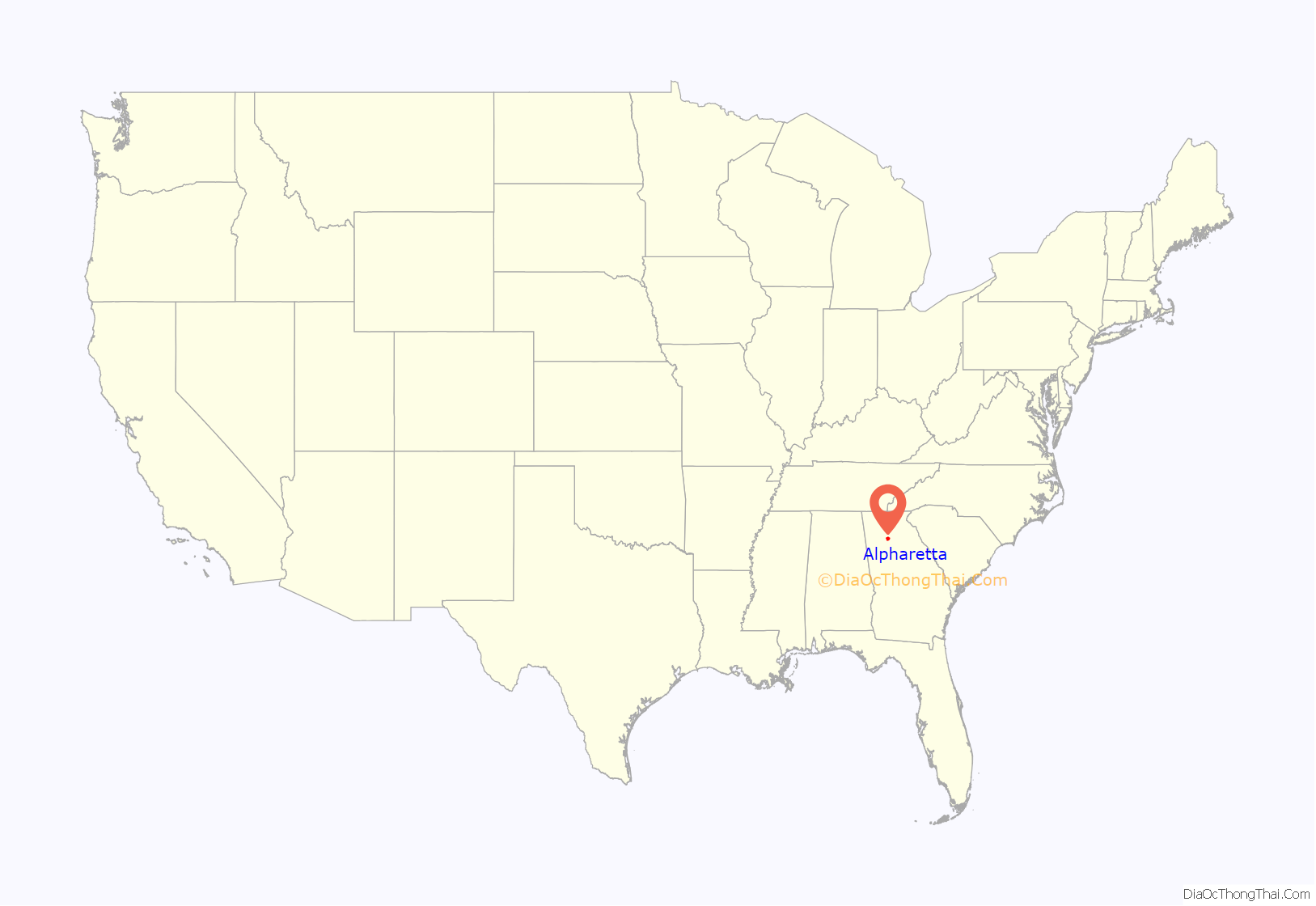
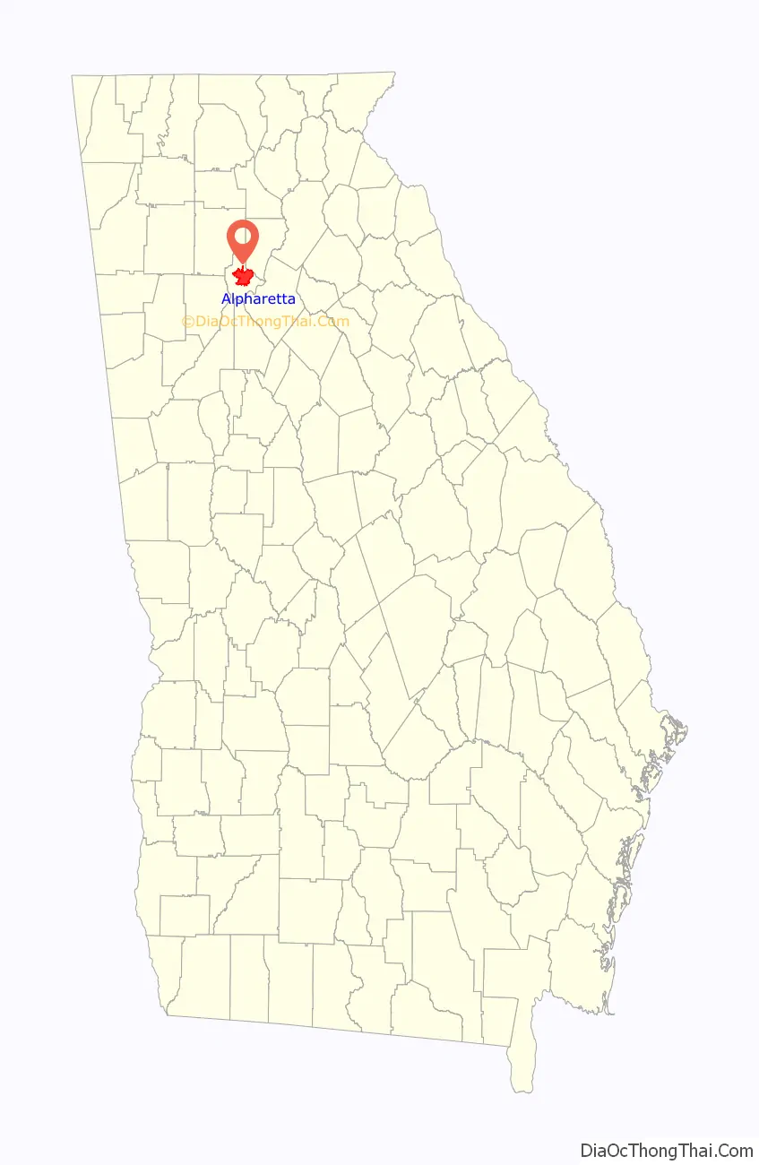
Online Interactive Map
Click on ![]() to view map in "full screen" mode.
to view map in "full screen" mode.
Alpharetta location map. Where is Alpharetta city?
History
In the 1830s, the Cherokee people in Georgia and elsewhere in the South were forcibly relocated to the Indian Territory (present-day Oklahoma) under the Indian Removal Act. Pioneers and farmers later settled on the newly vacated land, situated along a former Cherokee trail stretching from the North Georgia mountains to the Chattahoochee River.
One of the area’s first permanent landmarks was the New Prospect Camp Ground (also known as the Methodist Camp Ground), beside a natural spring near what is now downtown Alpharetta. It later served as a trading post for the exchanging of goods among settlers.
Known as the town of Milton through July 1858, the city of Alpharetta was chartered on December 11, 1858, with boundaries extending in a 0.5-mile (0.80 km) radius from the city courthouse. It served as the county seat of Milton County until 1931, when Milton County merged with Fulton County to avoid bankruptcy during the Great Depression.
The city’s name may be a variation of a fictional Indian girl, Alfarata, in the 19th-century song “The Blue Juniata”; it may also be derived from alpha, the first letter of the Greek alphabet.
The Simeon and Jane Rucker Log House, built in 1833, was listed on the National Register of Historic Places in 1997.
Alpharetta Road Map
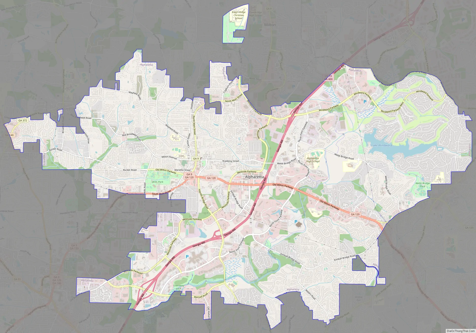
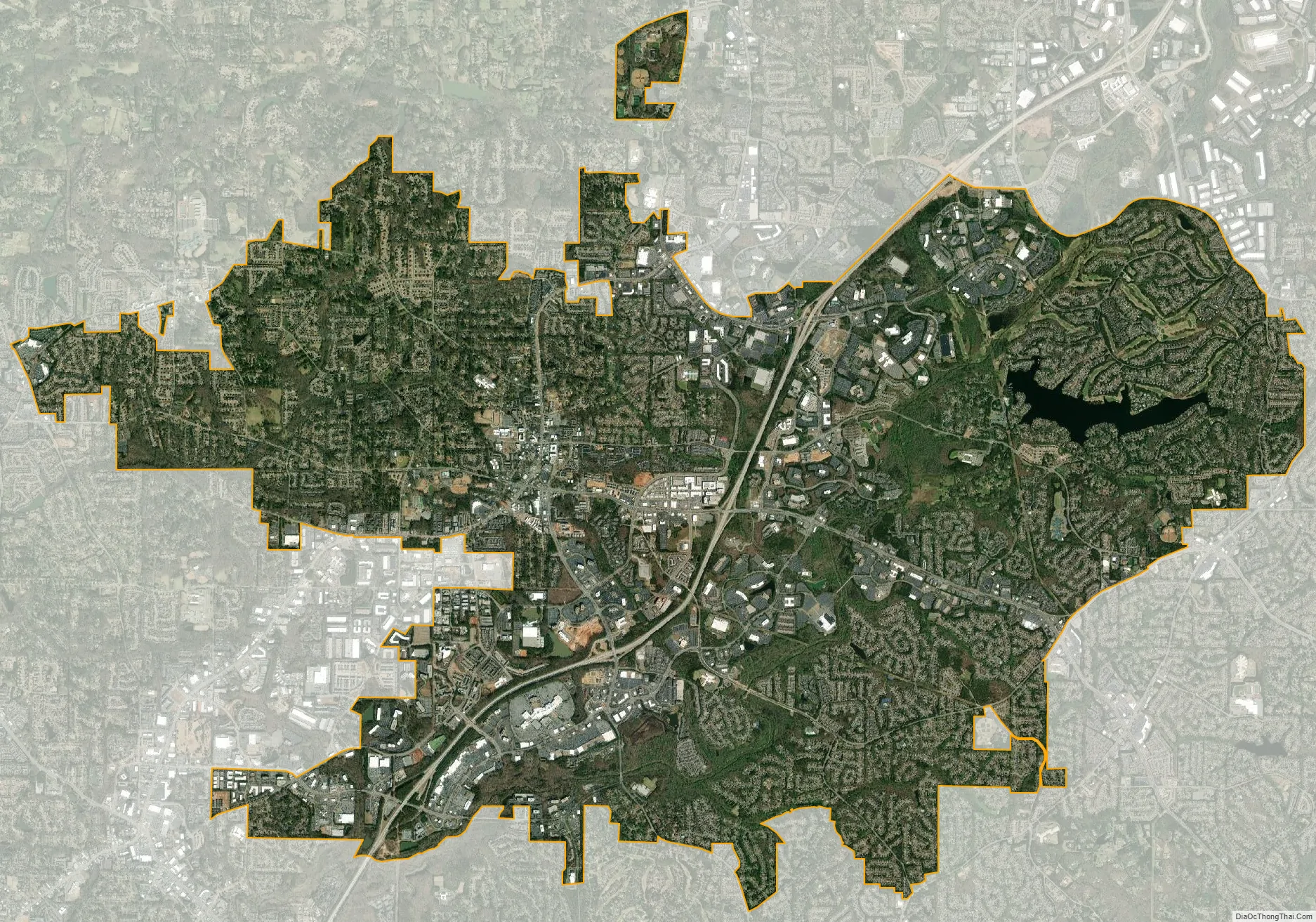
Alpharetta city Satellite Map
Geography
Alpharetta is in northern Fulton County and is bordered to the southeast by Johns Creek, to the south and west by Roswell, to the north by Milton, and to the northeast by unincorporated land in Forsyth County. Downtown Alpharetta is 26 miles (42 km) north of downtown Atlanta.
According to the United States Census Bureau, Alpharetta has an area of 27.3 square miles (70.7 km), of which 26.9 square miles (69.7 km) is land and 0.39 square miles (1.0 km), or 1.37%, is water.
Climate
Alpharetta has a humid subtropical climate (Köppen climate classification Cfa) and is part of USDA hardiness zone 7b.
See also
Map of Georgia State and its subdivision:- Appling
- Atkinson
- Bacon
- Baker
- Baldwin
- Banks
- Barrow
- Bartow
- Ben Hill
- Berrien
- Bibb
- Bleckley
- Brantley
- Brooks
- Bryan
- Bulloch
- Burke
- Butts
- Calhoun
- Camden
- Candler
- Carroll
- Catoosa
- Charlton
- Chatham
- Chattahoochee
- Chattooga
- Cherokee
- Clarke
- Clay
- Clayton
- Clinch
- Cobb
- Coffee
- Colquitt
- Columbia
- Cook
- Coweta
- Crawford
- Crisp
- Dade
- Dawson
- Decatur
- DeKalb
- Dodge
- Dooly
- Dougherty
- Douglas
- Early
- Echols
- Effingham
- Elbert
- Emanuel
- Evans
- Fannin
- Fayette
- Floyd
- Forsyth
- Franklin
- Fulton
- Gilmer
- Glascock
- Glynn
- Gordon
- Grady
- Greene
- Gwinnett
- Habersham
- Hall
- Hancock
- Haralson
- Harris
- Hart
- Heard
- Henry
- Houston
- Irwin
- Jackson
- Jasper
- Jeff Davis
- Jefferson
- Jenkins
- Johnson
- Jones
- Lamar
- Lanier
- Laurens
- Lee
- Liberty
- Lincoln
- Long
- Lowndes
- Lumpkin
- Macon
- Madison
- Marion
- McDuffie
- McIntosh
- Meriwether
- Miller
- Mitchell
- Monroe
- Montgomery
- Morgan
- Murray
- Muscogee
- Newton
- Oconee
- Oglethorpe
- Paulding
- Peach
- Pickens
- Pierce
- Pike
- Polk
- Pulaski
- Putnam
- Quitman
- Rabun
- Randolph
- Richmond
- Rockdale
- Schley
- Screven
- Seminole
- Spalding
- Stephens
- Stewart
- Sumter
- Talbot
- Taliaferro
- Tattnall
- Taylor
- Telfair
- Terrell
- Thomas
- Tift
- Toombs
- Towns
- Treutlen
- Troup
- Turner
- Twiggs
- Union
- Upson
- Walker
- Walton
- Ware
- Warren
- Washington
- Wayne
- Webster
- Wheeler
- White
- Whitfield
- Wilcox
- Wilkes
- Wilkinson
- Worth
- Alabama
- Alaska
- Arizona
- Arkansas
- California
- Colorado
- Connecticut
- Delaware
- District of Columbia
- Florida
- Georgia
- Hawaii
- Idaho
- Illinois
- Indiana
- Iowa
- Kansas
- Kentucky
- Louisiana
- Maine
- Maryland
- Massachusetts
- Michigan
- Minnesota
- Mississippi
- Missouri
- Montana
- Nebraska
- Nevada
- New Hampshire
- New Jersey
- New Mexico
- New York
- North Carolina
- North Dakota
- Ohio
- Oklahoma
- Oregon
- Pennsylvania
- Rhode Island
- South Carolina
- South Dakota
- Tennessee
- Texas
- Utah
- Vermont
- Virginia
- Washington
- West Virginia
- Wisconsin
- Wyoming