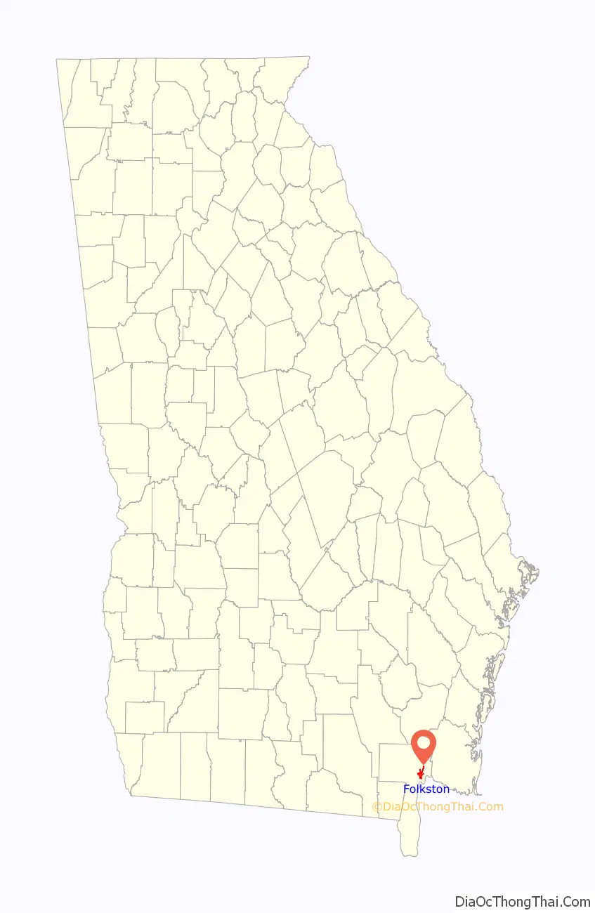
Folkston is a city in and the county seat of Charlton County, Georgia, United States. Folkston is in the Jacksonville Metropolitan Area. The population was 2,502 as of the 2010 census, up from 2,178 in 2000, largely due to the extension of the city boundary to include D. Ray James Prison.
| Name: | Folkston city |
|---|---|
| LSAD Code: | 25 |
| LSAD Description: | city (suffix) |
| State: | Georgia |
| County: | Charlton County |
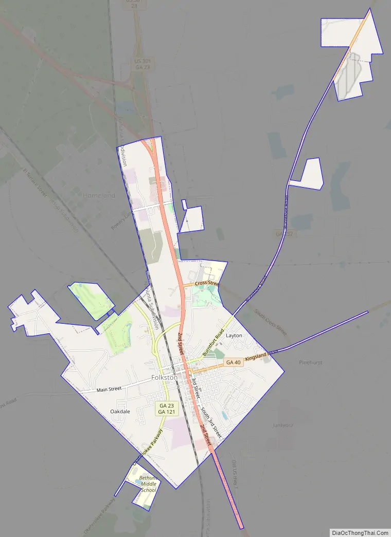
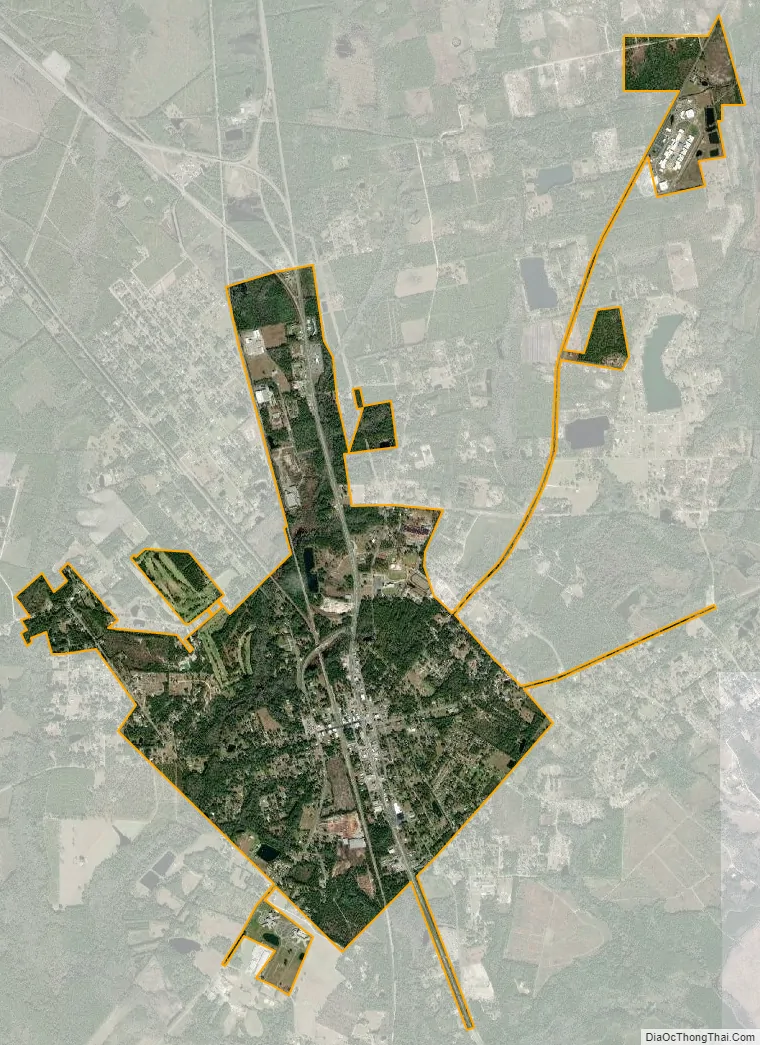
| Total Area: | 4.19 sq mi (10.86 km²) |
| Land Area: | 4.19 sq mi (10.86 km²) |
| Water Area: | 0.00 sq mi (0.00 km²) |
| Total Population: | 4,464 |
| Population Density: | 1,065.14/sq mi (411.21/km²) |
| ZIP code: | 31537 |
| Area code: | 912 |
| FIPS code: | 1330424 |
| Website: | www.folkston.com |
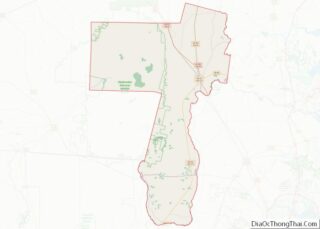
Online Interactive Map
Click on ![]() to view map in "full screen" mode.
to view map in "full screen" mode.
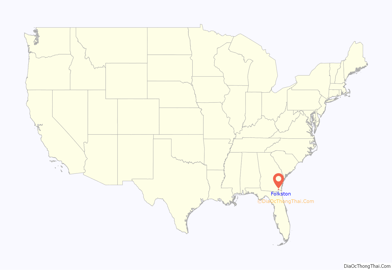
Folkston location map. Where is Folkston city?
History
Folkston was founded on August 19, 1911. The city was named in honor of William Brandon Folks, M.D., a prominent physician and surgeon in his day. In the years 1925 through 1927, many new and commodious residences were built and several modern brick buildings were erected, including the Citizen Bank Block, the Masonic Temple building, a grammar school building, and a courthouse. Shortly after its creation, the village of Folkston was incorporated as a town government and functioned as a town until 1911 when the area was incorporated as a city. For a number of years, Folkston was the self-proclaimed “Marriage Capital of the World”; Floridians who could not endure their state’s waiting period before tying the knot would cross the state line to wed.
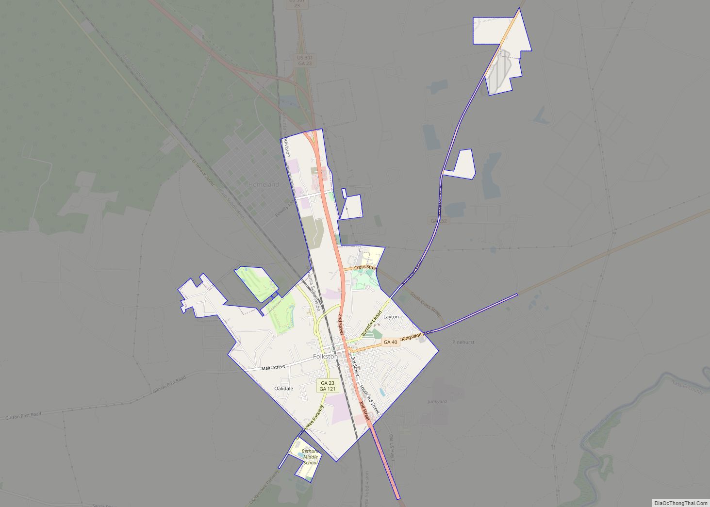
Folkston Road Map
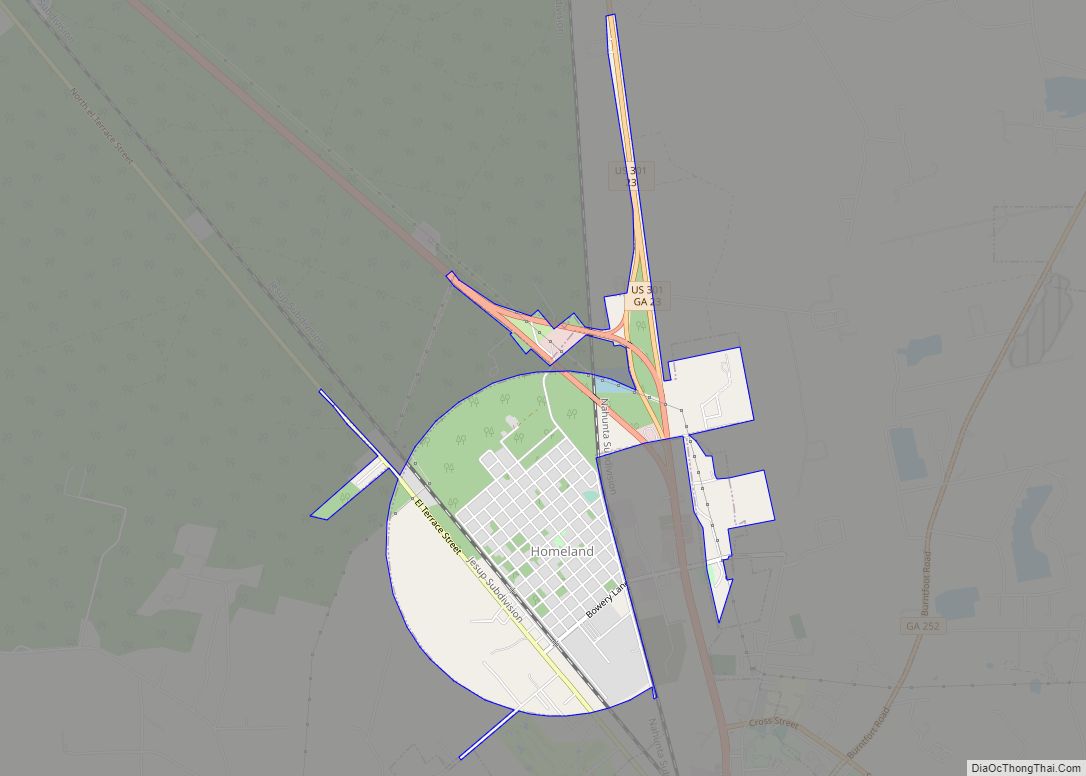
Folkston city Satellite Map
Geography
Folkston is located near the southern boundary of Georgia at 30°50′4″N 82°0′17″W / 30.83444°N 82.00472°W / 30.83444; -82.00472 (30.834437, -82.004829). U.S. Routes 1, 23, and 301 pass through the city as Second Street, leading south 42 miles (68 km) to Jacksonville, Florida. Route 1 and 23 lead northwest 35 miles (56 km) to Waycross, while Route 301 leads north 55 miles (89 km) to Jesup. The eastern entrance to the Okefenokee National Wildlife Refuge is 11 miles (18 km) southwest of Folkston via GA 23 and GA 121.
According to the United States Census Bureau, Folkston has a total area of 4.2 square miles (10.9 km), all land.
See also
Map of Georgia State and its subdivision:- Appling
- Atkinson
- Bacon
- Baker
- Baldwin
- Banks
- Barrow
- Bartow
- Ben Hill
- Berrien
- Bibb
- Bleckley
- Brantley
- Brooks
- Bryan
- Bulloch
- Burke
- Butts
- Calhoun
- Camden
- Candler
- Carroll
- Catoosa
- Charlton
- Chatham
- Chattahoochee
- Chattooga
- Cherokee
- Clarke
- Clay
- Clayton
- Clinch
- Cobb
- Coffee
- Colquitt
- Columbia
- Cook
- Coweta
- Crawford
- Crisp
- Dade
- Dawson
- Decatur
- DeKalb
- Dodge
- Dooly
- Dougherty
- Douglas
- Early
- Echols
- Effingham
- Elbert
- Emanuel
- Evans
- Fannin
- Fayette
- Floyd
- Forsyth
- Franklin
- Fulton
- Gilmer
- Glascock
- Glynn
- Gordon
- Grady
- Greene
- Gwinnett
- Habersham
- Hall
- Hancock
- Haralson
- Harris
- Hart
- Heard
- Henry
- Houston
- Irwin
- Jackson
- Jasper
- Jeff Davis
- Jefferson
- Jenkins
- Johnson
- Jones
- Lamar
- Lanier
- Laurens
- Lee
- Liberty
- Lincoln
- Long
- Lowndes
- Lumpkin
- Macon
- Madison
- Marion
- McDuffie
- McIntosh
- Meriwether
- Miller
- Mitchell
- Monroe
- Montgomery
- Morgan
- Murray
- Muscogee
- Newton
- Oconee
- Oglethorpe
- Paulding
- Peach
- Pickens
- Pierce
- Pike
- Polk
- Pulaski
- Putnam
- Quitman
- Rabun
- Randolph
- Richmond
- Rockdale
- Schley
- Screven
- Seminole
- Spalding
- Stephens
- Stewart
- Sumter
- Talbot
- Taliaferro
- Tattnall
- Taylor
- Telfair
- Terrell
- Thomas
- Tift
- Toombs
- Towns
- Treutlen
- Troup
- Turner
- Twiggs
- Union
- Upson
- Walker
- Walton
- Ware
- Warren
- Washington
- Wayne
- Webster
- Wheeler
- White
- Whitfield
- Wilcox
- Wilkes
- Wilkinson
- Worth
- Alabama
- Alaska
- Arizona
- Arkansas
- California
- Colorado
- Connecticut
- Delaware
- District of Columbia
- Florida
- Georgia
- Hawaii
- Idaho
- Illinois
- Indiana
- Iowa
- Kansas
- Kentucky
- Louisiana
- Maine
- Maryland
- Massachusetts
- Michigan
- Minnesota
- Mississippi
- Missouri
- Montana
- Nebraska
- Nevada
- New Hampshire
- New Jersey
- New Mexico
- New York
- North Carolina
- North Dakota
- Ohio
- Oklahoma
- Oregon
- Pennsylvania
- Rhode Island
- South Carolina
- South Dakota
- Tennessee
- Texas
- Utah
- Vermont
- Virginia
- Washington
- West Virginia
- Wisconsin
- Wyoming