Hephzibah (/ˈhɛpzɪbə/) is a city in southern Richmond County, in the U.S. state of Georgia. It is part of the Augusta metropolitan area. The population was 4,011 at the 2010 census. Hephzibah is a poetic name used in the Book of Isaiah (62:4) to refer to Jerusalem, meaning “My delight is in Her.”
| Name: | Hephzibah city |
|---|---|
| LSAD Code: | 25 |
| LSAD Description: | city (suffix) |
| State: | Georgia |
| County: | Richmond County |
| Total Area: | 19.56 sq mi (50.65 km²) |
| Land Area: | 19.49 sq mi (50.47 km²) |
| Water Area: | 0.07 sq mi (0.18 km²) |
| Total Population: | 3,830 |
| Population Density: | 196.54/sq mi (75.89/km²) |
| ZIP code: | 30815 |
| FIPS code: | 1338040 |
Online Interactive Map
Click on ![]() to view map in "full screen" mode.
to view map in "full screen" mode.
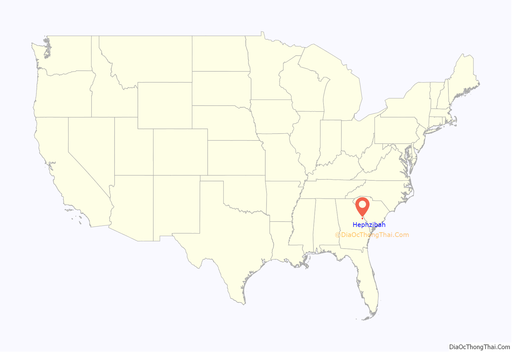
Hephzibah location map. Where is Hephzibah city?
History
Hephzibah was originally named Brothersville, in honor of three brothers who settled near one another. In October 1860, a Baptist seminary was established in Brothersville by a group of Appling residents. They established the Hephzibah Baptist Church in 1862. The prominence of these new religious institutions in the area swayed the state of Georgia to rename the town Hephzibah in 1870. In 1909, Walter A. Clark published a book of local history, named A Lost Arcadia – The Story of My Old Community, detailing the earliest days of Hephzibah.
In 1996 the governments of the city of Augusta and Richmond County combined to form a consolidated government. The residents of Hephzibah and nearby Blythe voted to maintain their separate city governments prior to this action. Some municipal services in Hephzibah are provided by the consolidated Augusta-Richmond County, while water, fire, and police services are maintained by the city.
After years of slow decline, the retail economy in Hephzibah has increased substantially since 2010. New businesses are an IGA grocery store, CrossFit gym, and a branch of the local chain restaurant Wife Saver, specializing in Southern food. The Wife Saver has since closed, but a new Dollar General was opened on Highway 88.
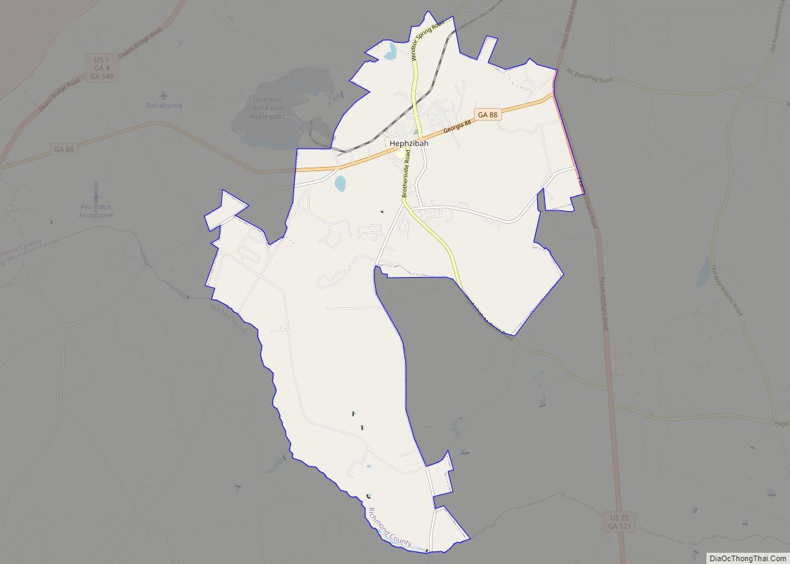
Hephzibah Road Map
Hephzibah city Satellite Map
Geography
Hephzibah is located at 33°18′15″N 82°5′53″W / 33.30417°N 82.09806°W / 33.30417; -82.09806 (33.304126, -82.097923).
According to the United States Census Bureau, the city has a total area of 19.4 square miles (50.2 km), of which 0.07 square miles (0.17 km), or 0.34%, is water.
See also
Map of Georgia State and its subdivision:- Appling
- Atkinson
- Bacon
- Baker
- Baldwin
- Banks
- Barrow
- Bartow
- Ben Hill
- Berrien
- Bibb
- Bleckley
- Brantley
- Brooks
- Bryan
- Bulloch
- Burke
- Butts
- Calhoun
- Camden
- Candler
- Carroll
- Catoosa
- Charlton
- Chatham
- Chattahoochee
- Chattooga
- Cherokee
- Clarke
- Clay
- Clayton
- Clinch
- Cobb
- Coffee
- Colquitt
- Columbia
- Cook
- Coweta
- Crawford
- Crisp
- Dade
- Dawson
- Decatur
- DeKalb
- Dodge
- Dooly
- Dougherty
- Douglas
- Early
- Echols
- Effingham
- Elbert
- Emanuel
- Evans
- Fannin
- Fayette
- Floyd
- Forsyth
- Franklin
- Fulton
- Gilmer
- Glascock
- Glynn
- Gordon
- Grady
- Greene
- Gwinnett
- Habersham
- Hall
- Hancock
- Haralson
- Harris
- Hart
- Heard
- Henry
- Houston
- Irwin
- Jackson
- Jasper
- Jeff Davis
- Jefferson
- Jenkins
- Johnson
- Jones
- Lamar
- Lanier
- Laurens
- Lee
- Liberty
- Lincoln
- Long
- Lowndes
- Lumpkin
- Macon
- Madison
- Marion
- McDuffie
- McIntosh
- Meriwether
- Miller
- Mitchell
- Monroe
- Montgomery
- Morgan
- Murray
- Muscogee
- Newton
- Oconee
- Oglethorpe
- Paulding
- Peach
- Pickens
- Pierce
- Pike
- Polk
- Pulaski
- Putnam
- Quitman
- Rabun
- Randolph
- Richmond
- Rockdale
- Schley
- Screven
- Seminole
- Spalding
- Stephens
- Stewart
- Sumter
- Talbot
- Taliaferro
- Tattnall
- Taylor
- Telfair
- Terrell
- Thomas
- Tift
- Toombs
- Towns
- Treutlen
- Troup
- Turner
- Twiggs
- Union
- Upson
- Walker
- Walton
- Ware
- Warren
- Washington
- Wayne
- Webster
- Wheeler
- White
- Whitfield
- Wilcox
- Wilkes
- Wilkinson
- Worth
- Alabama
- Alaska
- Arizona
- Arkansas
- California
- Colorado
- Connecticut
- Delaware
- District of Columbia
- Florida
- Georgia
- Hawaii
- Idaho
- Illinois
- Indiana
- Iowa
- Kansas
- Kentucky
- Louisiana
- Maine
- Maryland
- Massachusetts
- Michigan
- Minnesota
- Mississippi
- Missouri
- Montana
- Nebraska
- Nevada
- New Hampshire
- New Jersey
- New Mexico
- New York
- North Carolina
- North Dakota
- Ohio
- Oklahoma
- Oregon
- Pennsylvania
- Rhode Island
- South Carolina
- South Dakota
- Tennessee
- Texas
- Utah
- Vermont
- Virginia
- Washington
- West Virginia
- Wisconsin
- Wyoming


