Lindale is an unincorporated community and census-designated place (CDP) in Floyd County, Georgia, United States. It is part of the Rome, Georgia Metropolitan Statistical Area. The population was 4,191 at the 2010 census.
| Name: | Lindale CDP |
|---|---|
| LSAD Code: | 57 |
| LSAD Description: | CDP (suffix) |
| State: | Georgia |
| County: | Floyd County |
| Elevation: | 666 ft (203 m) |
| Total Area: | 5.60 sq mi (14.50 km²) |
| Land Area: | 5.48 sq mi (14.19 km²) |
| Water Area: | 0.12 sq mi (0.32 km²) |
| Total Population: | 4,283 |
| Population Density: | 782.00/sq mi (301.91/km²) |
| ZIP code: | 30147 |
| Area code: | 706/762 |
| FIPS code: | 1346580 |
| GNISfeature ID: | 0332220 |
Online Interactive Map
Click on ![]() to view map in "full screen" mode.
to view map in "full screen" mode.
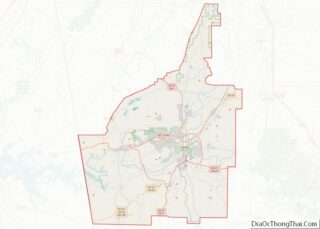
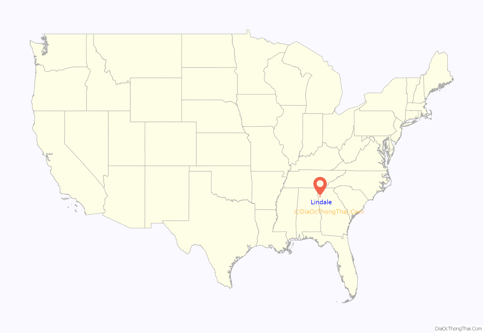
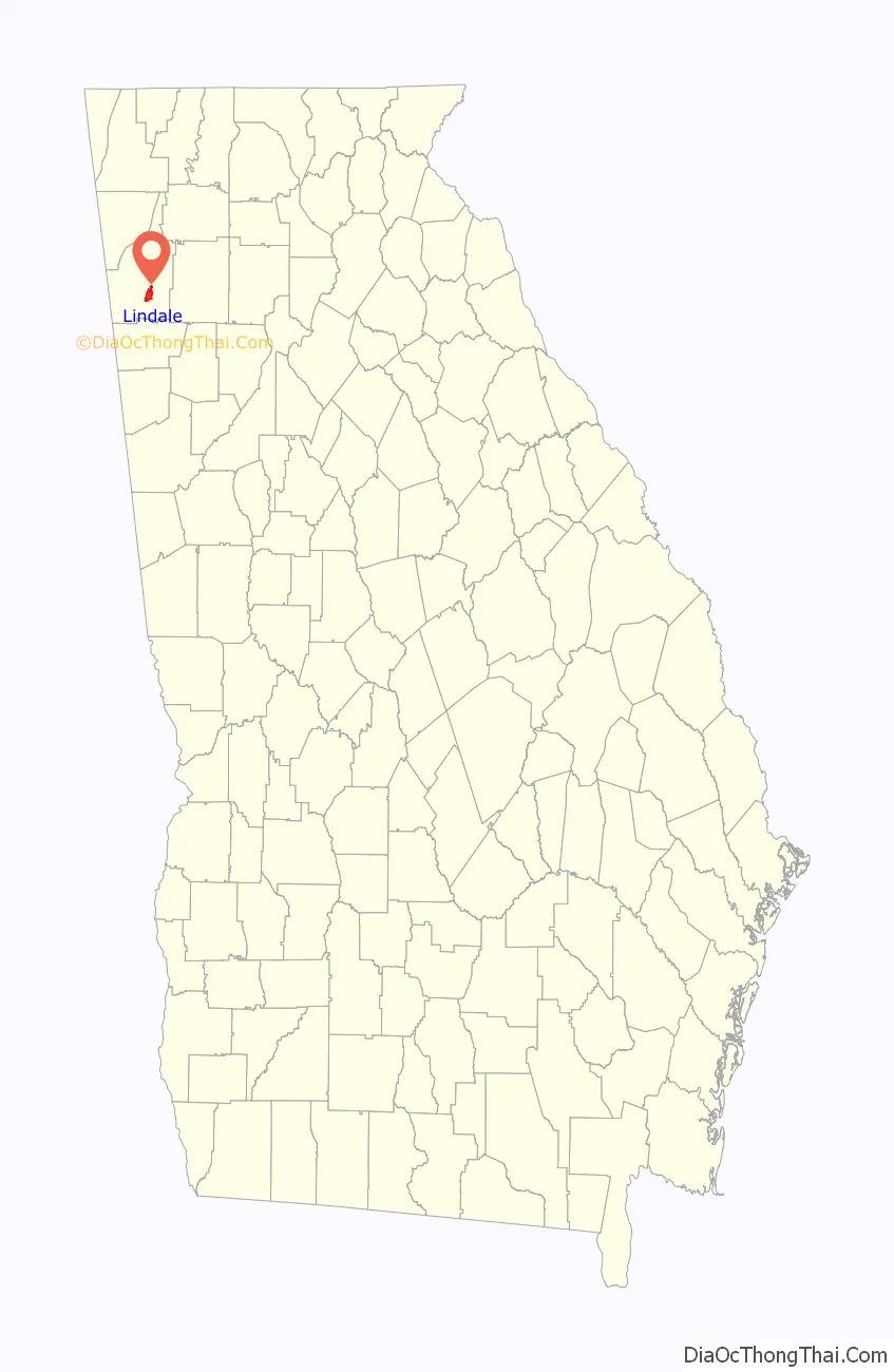
Lindale location map. Where is Lindale CDP?
History
A post office called Lindale has been in operation since 1883. The name Lindale might have been selected from a novel a resident had read.
Throughout the 20th century, the community formed around the Lindale Textile Mill located in the center of the community. Since the early part of the 21st century, the building is abandoned. The Mill was owned by the West Point-Pepperell for the majority of its existence, leading to the Lindale community to be commonly referred to as “Pepperell”. The local schools, which are part of the Floyd County School System, are named after the mill and use the West Point-Pepperell (currently WestPoint Home) Griffin as the mascot, under the name “Pepperell Dragons”.
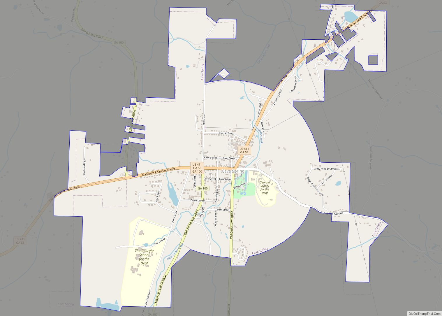
Lindale Road Map
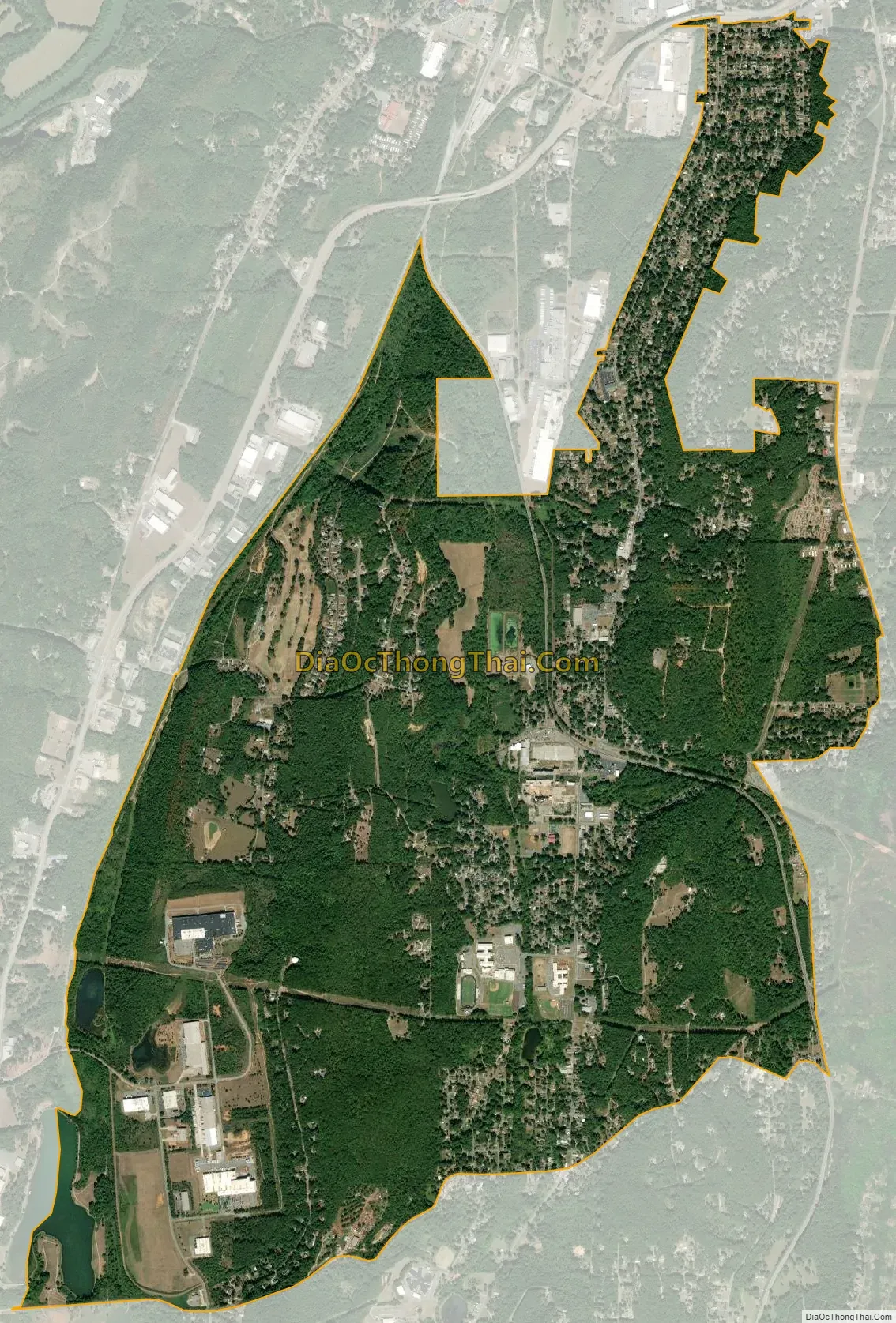
Lindale city Satellite Map
Geography
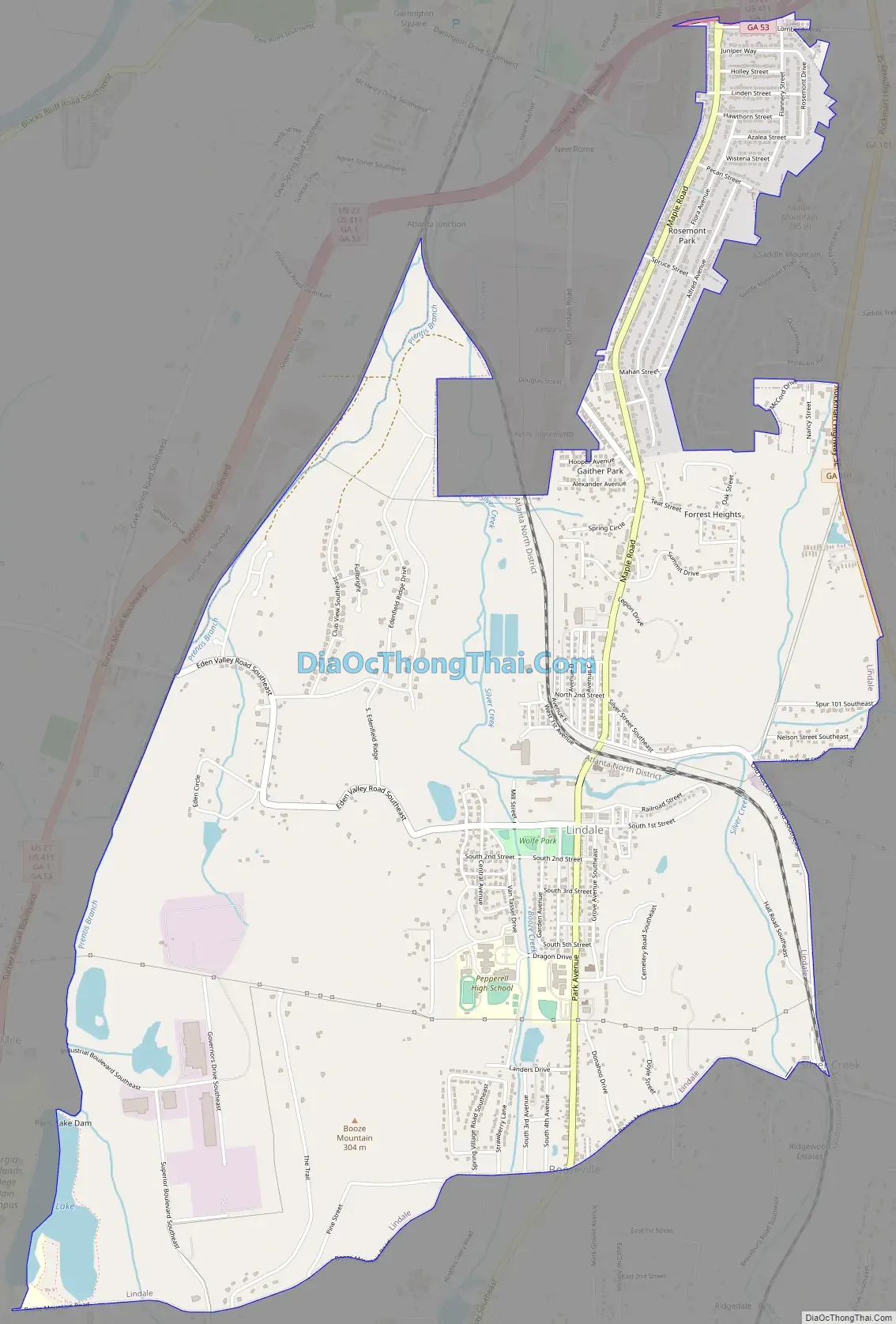
Lindale is located in southeastern Floyd County at 34°11′37″N 85°10′25″W / 34.19361°N 85.17361°W / 34.19361; -85.17361 (34.193495, -85.173713). It is bordered to the north by the city of Rome, the county seat.
According to the United States Census Bureau, the Lindale CDP has a total area of 5.5 square miles (14.3 km), of which 5.4 square miles (14.0 km) is land and 0.1 square miles (0.3 km), or 2.20%, is water.
Lindale’s borders follow local and state roads, including Booze Mountain Road (for the southern border) and Georgia State Route 101 (for the easternmost city limits).
See also
Map of Georgia State and its subdivision:- Appling
- Atkinson
- Bacon
- Baker
- Baldwin
- Banks
- Barrow
- Bartow
- Ben Hill
- Berrien
- Bibb
- Bleckley
- Brantley
- Brooks
- Bryan
- Bulloch
- Burke
- Butts
- Calhoun
- Camden
- Candler
- Carroll
- Catoosa
- Charlton
- Chatham
- Chattahoochee
- Chattooga
- Cherokee
- Clarke
- Clay
- Clayton
- Clinch
- Cobb
- Coffee
- Colquitt
- Columbia
- Cook
- Coweta
- Crawford
- Crisp
- Dade
- Dawson
- Decatur
- DeKalb
- Dodge
- Dooly
- Dougherty
- Douglas
- Early
- Echols
- Effingham
- Elbert
- Emanuel
- Evans
- Fannin
- Fayette
- Floyd
- Forsyth
- Franklin
- Fulton
- Gilmer
- Glascock
- Glynn
- Gordon
- Grady
- Greene
- Gwinnett
- Habersham
- Hall
- Hancock
- Haralson
- Harris
- Hart
- Heard
- Henry
- Houston
- Irwin
- Jackson
- Jasper
- Jeff Davis
- Jefferson
- Jenkins
- Johnson
- Jones
- Lamar
- Lanier
- Laurens
- Lee
- Liberty
- Lincoln
- Long
- Lowndes
- Lumpkin
- Macon
- Madison
- Marion
- McDuffie
- McIntosh
- Meriwether
- Miller
- Mitchell
- Monroe
- Montgomery
- Morgan
- Murray
- Muscogee
- Newton
- Oconee
- Oglethorpe
- Paulding
- Peach
- Pickens
- Pierce
- Pike
- Polk
- Pulaski
- Putnam
- Quitman
- Rabun
- Randolph
- Richmond
- Rockdale
- Schley
- Screven
- Seminole
- Spalding
- Stephens
- Stewart
- Sumter
- Talbot
- Taliaferro
- Tattnall
- Taylor
- Telfair
- Terrell
- Thomas
- Tift
- Toombs
- Towns
- Treutlen
- Troup
- Turner
- Twiggs
- Union
- Upson
- Walker
- Walton
- Ware
- Warren
- Washington
- Wayne
- Webster
- Wheeler
- White
- Whitfield
- Wilcox
- Wilkes
- Wilkinson
- Worth
- Alabama
- Alaska
- Arizona
- Arkansas
- California
- Colorado
- Connecticut
- Delaware
- District of Columbia
- Florida
- Georgia
- Hawaii
- Idaho
- Illinois
- Indiana
- Iowa
- Kansas
- Kentucky
- Louisiana
- Maine
- Maryland
- Massachusetts
- Michigan
- Minnesota
- Mississippi
- Missouri
- Montana
- Nebraska
- Nevada
- New Hampshire
- New Jersey
- New Mexico
- New York
- North Carolina
- North Dakota
- Ohio
- Oklahoma
- Oregon
- Pennsylvania
- Rhode Island
- South Carolina
- South Dakota
- Tennessee
- Texas
- Utah
- Vermont
- Virginia
- Washington
- West Virginia
- Wisconsin
- Wyoming