Montgomery is a census-designated place (CDP) in Chatham County, Georgia, United States. The population was 4,443 at the 2020 United States Census, down slightly from 4,523 in 2010. It is a suburb of Savannah and is part of the Savannah metropolitan area.
| Name: | Montgomery CDP |
|---|---|
| LSAD Code: | 57 |
| LSAD Description: | CDP (suffix) |
| State: | Georgia |
| County: | Chatham County |
| Elevation: | 13 ft (4 m) |
| Total Area: | 6.10 sq mi (15.81 km²) |
| Land Area: | 5.21 sq mi (13.51 km²) |
| Water Area: | 0.89 sq mi (2.30 km²) |
| Total Population: | 4,443 |
| Population Density: | 851.97/sq mi (328.95/km²) |
| FIPS code: | 1352332 |
| GNISfeature ID: | 0332411 |
Online Interactive Map
Click on ![]() to view map in "full screen" mode.
to view map in "full screen" mode.
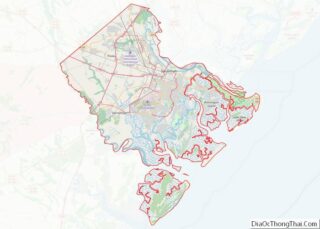
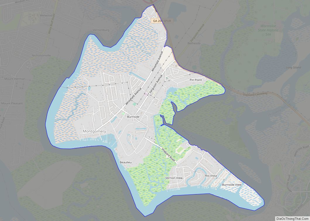
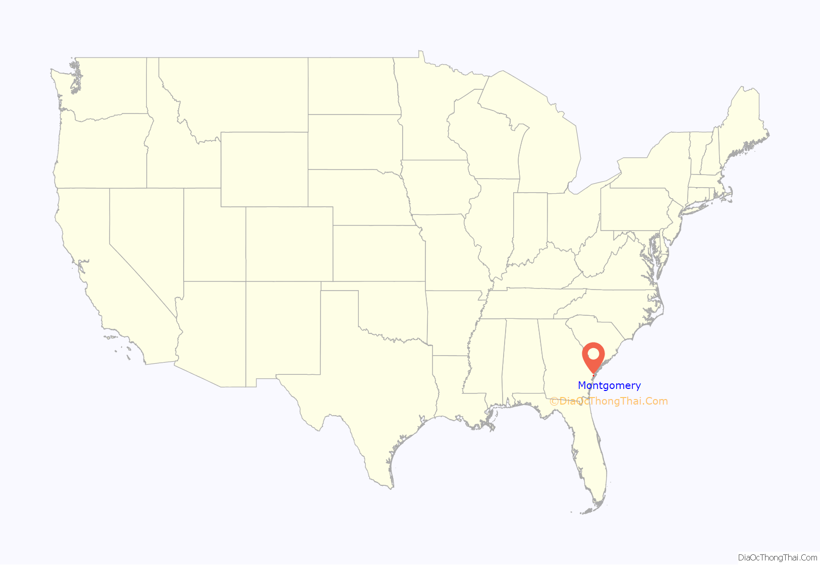
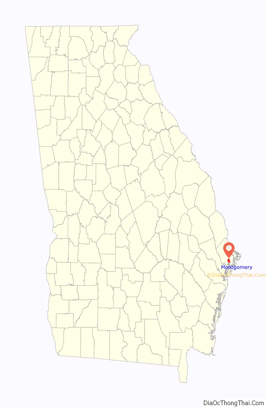
Montgomery location map. Where is Montgomery CDP?
History
Montgomery is believed to be the location of an early settlement in the Savannah area (prior to General Oglethorpe’s land grant in 1733) founded by three brothers who were British baronets: William, James, and Robert Montgomery. They received a land grant in 1677. They failed to maintain a permanent settlement, due to poor location and disease, and therefore lost their grant. The brothers moved to the more established Virginia Colony. The name of the settlement continues in this area of Chatham county, as well as Old Montgomery Road, Montgomery Street, and Montgomery Cross Road.
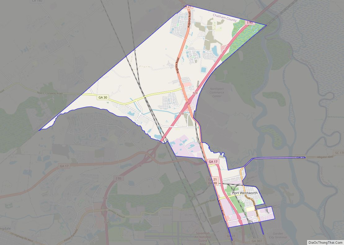
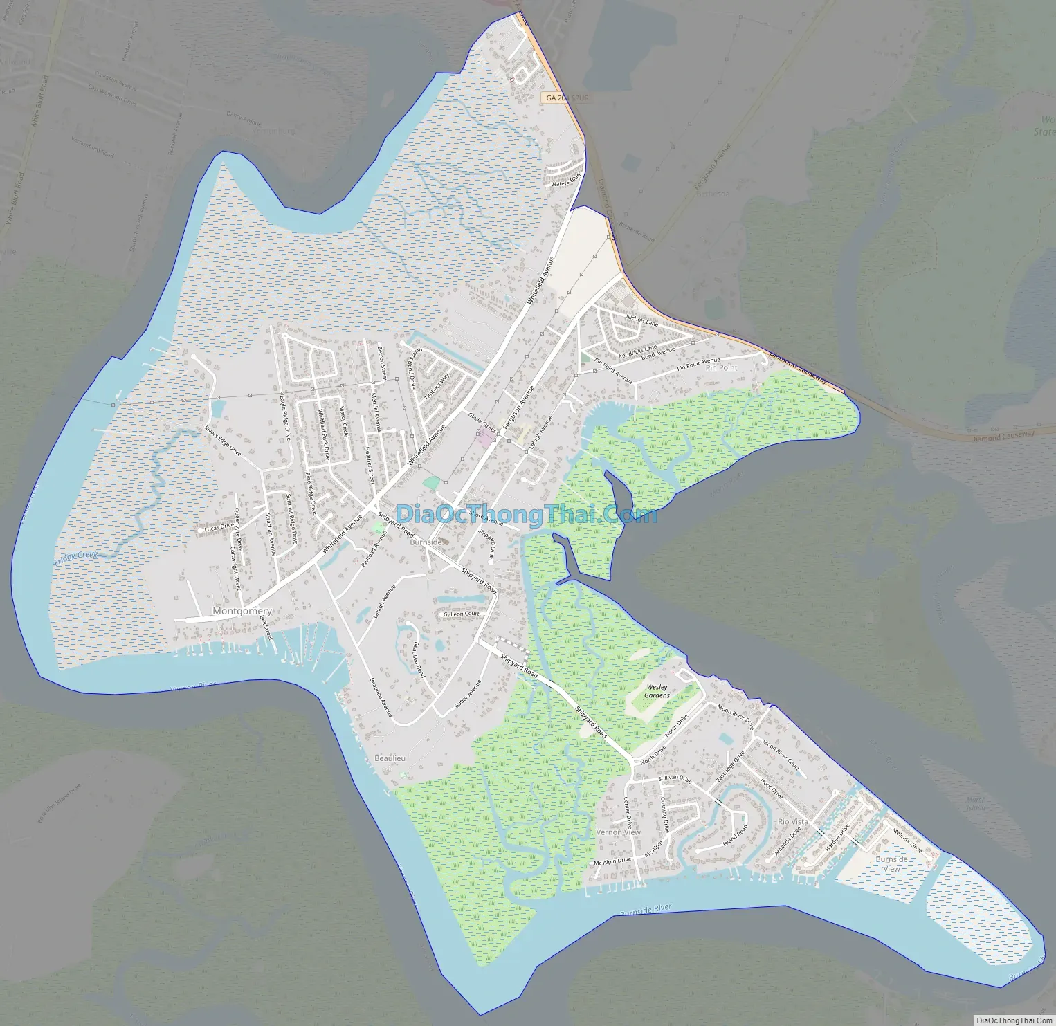
Montgomery Road Map
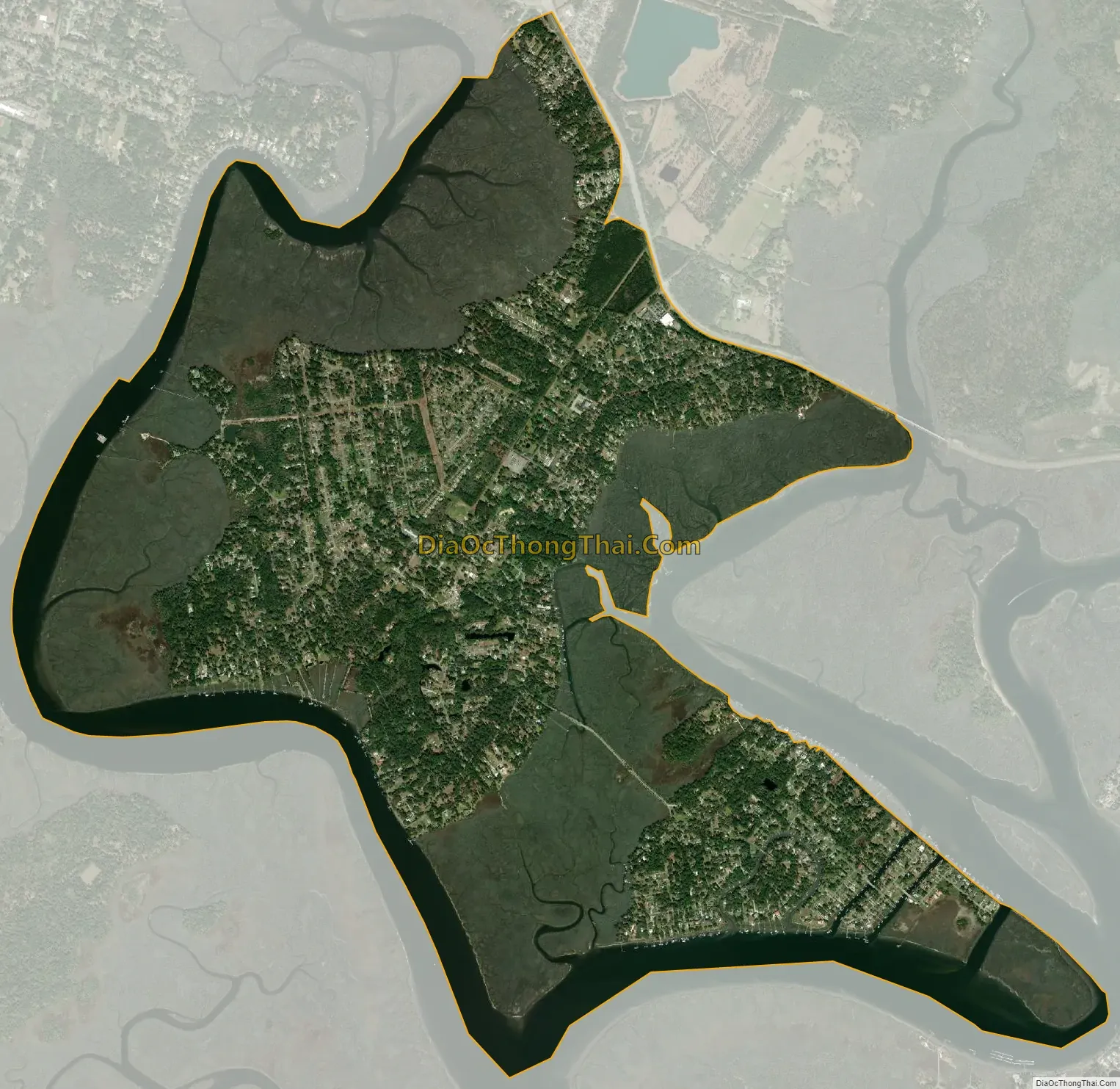
Montgomery city Satellite Map
Geography
Montgomery is located south of the center of Chatham County at 31°56′36″N 81°6′24″W / 31.94333°N 81.10667°W / 31.94333; -81.10667 (31.943237, -81.106648). It occupies a neck of land bordered on the west by the Vernon River, on the east by the Moon River, and on the south by the Burnside River; all of which are tidal. The northeast border of the CDP is formed by Georgia SR 204 Spur, which leads to Skidaway Island. Downtown Savannah is 13 miles (21 km) north of the Montgomery town center.
According to the United States Census Bureau, the CDP has a total area of 6.1 square miles (15.7 km), of which 5.2 square miles (13.5 km) is land and 0.85 square miles (2.2 km), or 13.94%, is water.
See also
Map of Georgia State and its subdivision:- Appling
- Atkinson
- Bacon
- Baker
- Baldwin
- Banks
- Barrow
- Bartow
- Ben Hill
- Berrien
- Bibb
- Bleckley
- Brantley
- Brooks
- Bryan
- Bulloch
- Burke
- Butts
- Calhoun
- Camden
- Candler
- Carroll
- Catoosa
- Charlton
- Chatham
- Chattahoochee
- Chattooga
- Cherokee
- Clarke
- Clay
- Clayton
- Clinch
- Cobb
- Coffee
- Colquitt
- Columbia
- Cook
- Coweta
- Crawford
- Crisp
- Dade
- Dawson
- Decatur
- DeKalb
- Dodge
- Dooly
- Dougherty
- Douglas
- Early
- Echols
- Effingham
- Elbert
- Emanuel
- Evans
- Fannin
- Fayette
- Floyd
- Forsyth
- Franklin
- Fulton
- Gilmer
- Glascock
- Glynn
- Gordon
- Grady
- Greene
- Gwinnett
- Habersham
- Hall
- Hancock
- Haralson
- Harris
- Hart
- Heard
- Henry
- Houston
- Irwin
- Jackson
- Jasper
- Jeff Davis
- Jefferson
- Jenkins
- Johnson
- Jones
- Lamar
- Lanier
- Laurens
- Lee
- Liberty
- Lincoln
- Long
- Lowndes
- Lumpkin
- Macon
- Madison
- Marion
- McDuffie
- McIntosh
- Meriwether
- Miller
- Mitchell
- Monroe
- Montgomery
- Morgan
- Murray
- Muscogee
- Newton
- Oconee
- Oglethorpe
- Paulding
- Peach
- Pickens
- Pierce
- Pike
- Polk
- Pulaski
- Putnam
- Quitman
- Rabun
- Randolph
- Richmond
- Rockdale
- Schley
- Screven
- Seminole
- Spalding
- Stephens
- Stewart
- Sumter
- Talbot
- Taliaferro
- Tattnall
- Taylor
- Telfair
- Terrell
- Thomas
- Tift
- Toombs
- Towns
- Treutlen
- Troup
- Turner
- Twiggs
- Union
- Upson
- Walker
- Walton
- Ware
- Warren
- Washington
- Wayne
- Webster
- Wheeler
- White
- Whitfield
- Wilcox
- Wilkes
- Wilkinson
- Worth
- Alabama
- Alaska
- Arizona
- Arkansas
- California
- Colorado
- Connecticut
- Delaware
- District of Columbia
- Florida
- Georgia
- Hawaii
- Idaho
- Illinois
- Indiana
- Iowa
- Kansas
- Kentucky
- Louisiana
- Maine
- Maryland
- Massachusetts
- Michigan
- Minnesota
- Mississippi
- Missouri
- Montana
- Nebraska
- Nevada
- New Hampshire
- New Jersey
- New Mexico
- New York
- North Carolina
- North Dakota
- Ohio
- Oklahoma
- Oregon
- Pennsylvania
- Rhode Island
- South Carolina
- South Dakota
- Tennessee
- Texas
- Utah
- Vermont
- Virginia
- Washington
- West Virginia
- Wisconsin
- Wyoming