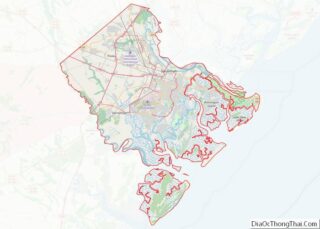
Pooler is a city in Chatham County, Georgia, United States. According to the official 2020 U.S. Census, the population was 25,711, up 34.3% from the 2010 population of 19,140. Pooler is located northwest of Savannah along Interstates 95 and 16. It comprises part of the Savannah metropolitan area.
| Name: | Pooler city |
|---|---|
| LSAD Code: | 25 |
| LSAD Description: | city (suffix) |
| State: | Georgia |
| County: | Chatham County |
| Elevation: | 20 ft (6 m) |
| Total Area: | 27.90 sq mi (72.25 km²) |
| Land Area: | 27.71 sq mi (71.76 km²) |
| Water Area: | 0.19 sq mi (0.49 km²) |
| Total Population: | 25,711 |
| Population Density: | 927.96/sq mi (358.29/km²) |
| ZIP code: | 31322 |
| Area code: | 912 |
| FIPS code: | 1362104 |
| GNISfeature ID: | 0332725 |
| Website: | pooler-ga.gov |
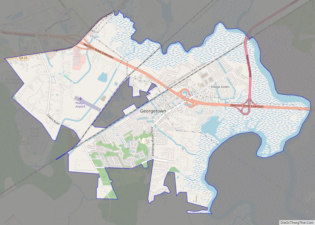
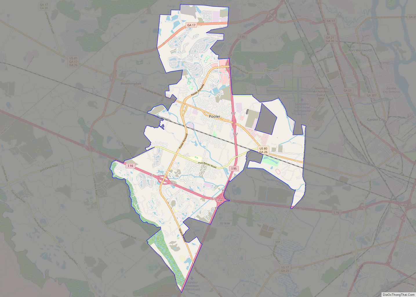
Online Interactive Map
Click on ![]() to view map in "full screen" mode.
to view map in "full screen" mode.
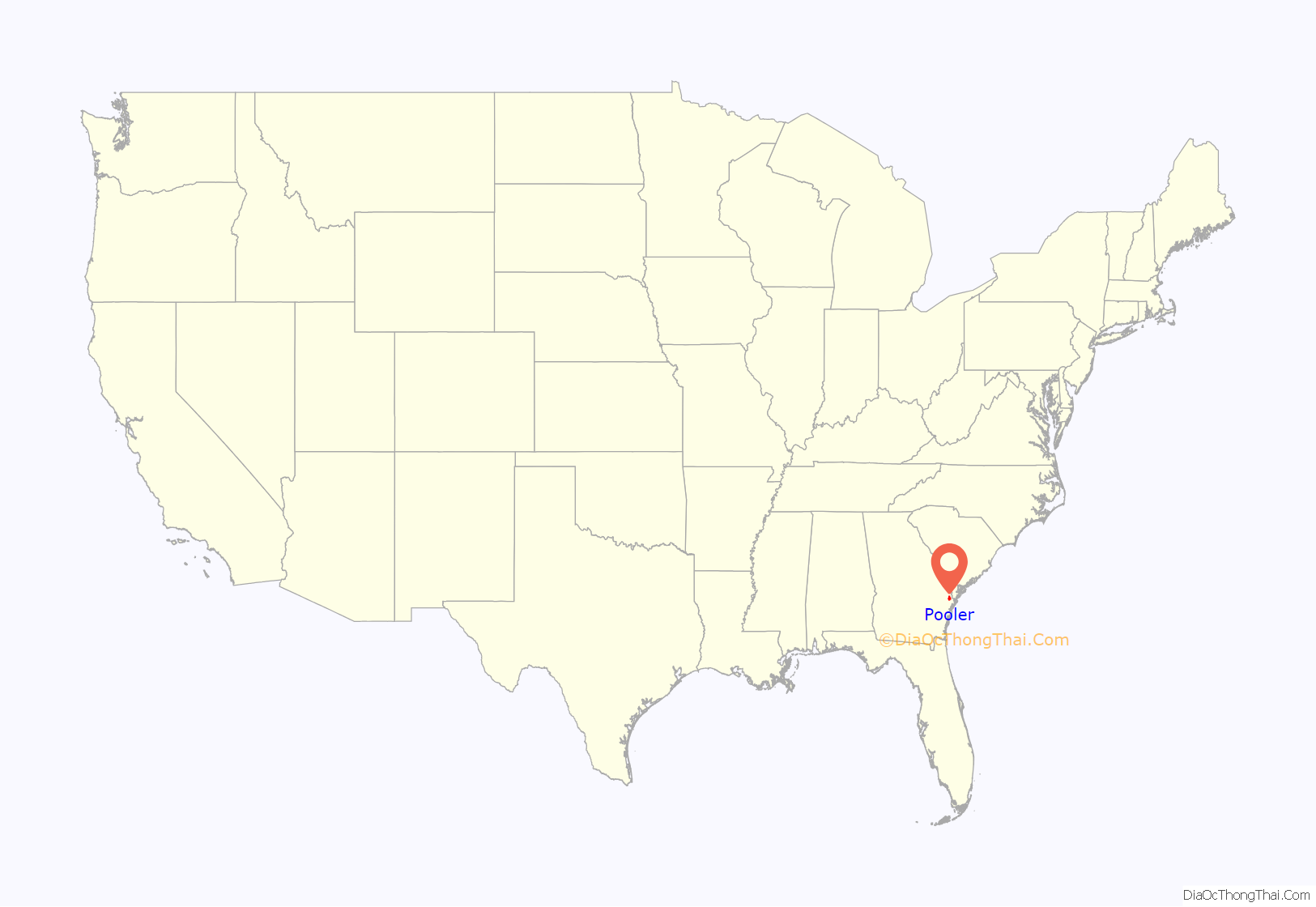
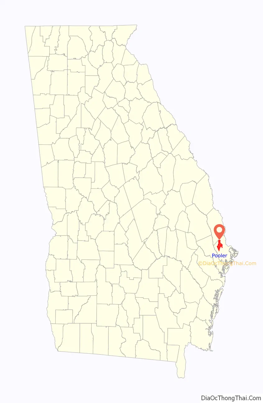
Pooler location map. Where is Pooler city?
History
The city was named for railroad employee Robert William Pooler.
During the Civil War, Pooler was a railway stop called Pooler’s Station—the last stop before Savannah on the Central of Georgia Railway. In December 1864, Pooler was a meeting place for Union officers led by William Tecumseh Sherman, who negotiated with Savannah authorities for the strategic port city’s peaceful surrender.
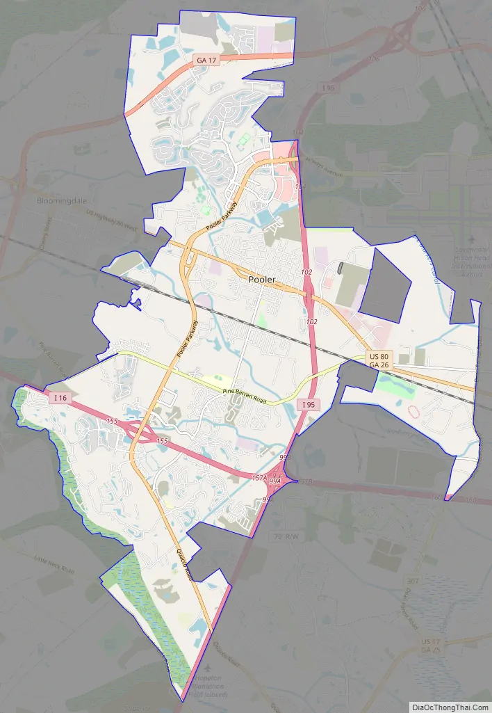
Pooler Road Map
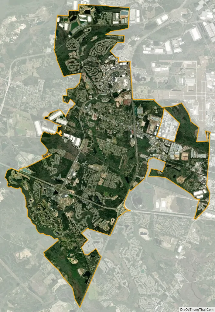
Pooler city Satellite Map
Geography
Pooler is located in northwestern Chatham County at 32°6′17″N 81°15′12″W / 32.10472°N 81.25333°W / 32.10472; -81.25333. It is bordered by Port Wentworth to the north, Garden City to the east, a far-flung portion of Savannah to the north/northeast (Airport) and the southwest, and Bloomingdale to the west. U.S. Route 80 intersects Interstate 95 just east of the city center; US 80 leads 9 miles (14 km) east to downtown Savannah, while I-95 leads north into South Carolina and south 132 miles (212 km) to Jacksonville, Florida.
According to the United States Census Bureau, Pooler has a total area of 30.3 square miles (78.6 km), of which 29.4 square miles (76.1 km) is land and 0.97 square miles (2.5 km), or 3.18%, is water.
See also
Map of Georgia State and its subdivision:- Appling
- Atkinson
- Bacon
- Baker
- Baldwin
- Banks
- Barrow
- Bartow
- Ben Hill
- Berrien
- Bibb
- Bleckley
- Brantley
- Brooks
- Bryan
- Bulloch
- Burke
- Butts
- Calhoun
- Camden
- Candler
- Carroll
- Catoosa
- Charlton
- Chatham
- Chattahoochee
- Chattooga
- Cherokee
- Clarke
- Clay
- Clayton
- Clinch
- Cobb
- Coffee
- Colquitt
- Columbia
- Cook
- Coweta
- Crawford
- Crisp
- Dade
- Dawson
- Decatur
- DeKalb
- Dodge
- Dooly
- Dougherty
- Douglas
- Early
- Echols
- Effingham
- Elbert
- Emanuel
- Evans
- Fannin
- Fayette
- Floyd
- Forsyth
- Franklin
- Fulton
- Gilmer
- Glascock
- Glynn
- Gordon
- Grady
- Greene
- Gwinnett
- Habersham
- Hall
- Hancock
- Haralson
- Harris
- Hart
- Heard
- Henry
- Houston
- Irwin
- Jackson
- Jasper
- Jeff Davis
- Jefferson
- Jenkins
- Johnson
- Jones
- Lamar
- Lanier
- Laurens
- Lee
- Liberty
- Lincoln
- Long
- Lowndes
- Lumpkin
- Macon
- Madison
- Marion
- McDuffie
- McIntosh
- Meriwether
- Miller
- Mitchell
- Monroe
- Montgomery
- Morgan
- Murray
- Muscogee
- Newton
- Oconee
- Oglethorpe
- Paulding
- Peach
- Pickens
- Pierce
- Pike
- Polk
- Pulaski
- Putnam
- Quitman
- Rabun
- Randolph
- Richmond
- Rockdale
- Schley
- Screven
- Seminole
- Spalding
- Stephens
- Stewart
- Sumter
- Talbot
- Taliaferro
- Tattnall
- Taylor
- Telfair
- Terrell
- Thomas
- Tift
- Toombs
- Towns
- Treutlen
- Troup
- Turner
- Twiggs
- Union
- Upson
- Walker
- Walton
- Ware
- Warren
- Washington
- Wayne
- Webster
- Wheeler
- White
- Whitfield
- Wilcox
- Wilkes
- Wilkinson
- Worth
- Alabama
- Alaska
- Arizona
- Arkansas
- California
- Colorado
- Connecticut
- Delaware
- District of Columbia
- Florida
- Georgia
- Hawaii
- Idaho
- Illinois
- Indiana
- Iowa
- Kansas
- Kentucky
- Louisiana
- Maine
- Maryland
- Massachusetts
- Michigan
- Minnesota
- Mississippi
- Missouri
- Montana
- Nebraska
- Nevada
- New Hampshire
- New Jersey
- New Mexico
- New York
- North Carolina
- North Dakota
- Ohio
- Oklahoma
- Oregon
- Pennsylvania
- Rhode Island
- South Carolina
- South Dakota
- Tennessee
- Texas
- Utah
- Vermont
- Virginia
- Washington
- West Virginia
- Wisconsin
- Wyoming