Nashville is a city in and the county seat of Berrien County, Georgia, United States. The population was 7,029 at the 2022 census. It is called the “City of Dogwoods”, as the tree grows in large numbers around the area.
| Name: | Nashville city |
|---|---|
| LSAD Code: | 25 |
| LSAD Description: | city (suffix) |
| State: | Georgia |
| County: | Berrien County |
| Elevation: | 240 ft (73 m) |
| Total Area: | 4.91 sq mi (12.72 km²) |
| Land Area: | 4.86 sq mi (12.58 km²) |
| Water Area: | 0.05 sq mi (0.14 km²) |
| Total Population: | 7,029 |
| Population Density: | 1,018.74/sq mi (393.30/km²) |
| ZIP code: | 31639,31620 |
| Area code: | 229,912 |
| FIPS code: | 1354264 |
| GNISfeature ID: | 0332466 |
| Website: | www.cityofnashvillega.net |
Online Interactive Map
Click on ![]() to view map in "full screen" mode.
to view map in "full screen" mode.
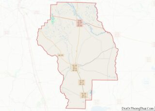
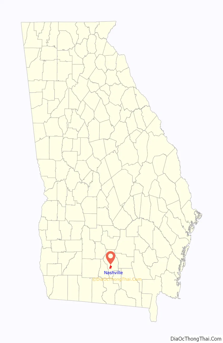
Nashville location map. Where is Nashville city?

History
Nashville was founded about 1840. In 1856, Nashville was designated seat of the newly formed Berrien County. It was incorporated as a town in 1892 and as a city in 1900. While some say the city is named after Francis Nash (1742–1777), an officer in the American Revolutionary War, many historical articles in the local newspaper claim otherwise. The Berrien Press published an article in its November 22, 2006 edition under the title of Will the Naming of Nashville Controversy Ever Be Truly Settled? The 2006 article pointed to The Griffin Papers, written in the 1930s, and several articles from The Nashville Herald – December 24, 1909, October 14, 1910, January 19, 1933, June 13, 1935, June 29, 1944, October 12, 1950, November 27, 1952, and March 5, 1953. Every one of these articles, and the 1956 Berrien County Centennial plates all lay claim to Nashville being named after Simon W. Nash, a local citizen of the 1850s and 1860s.
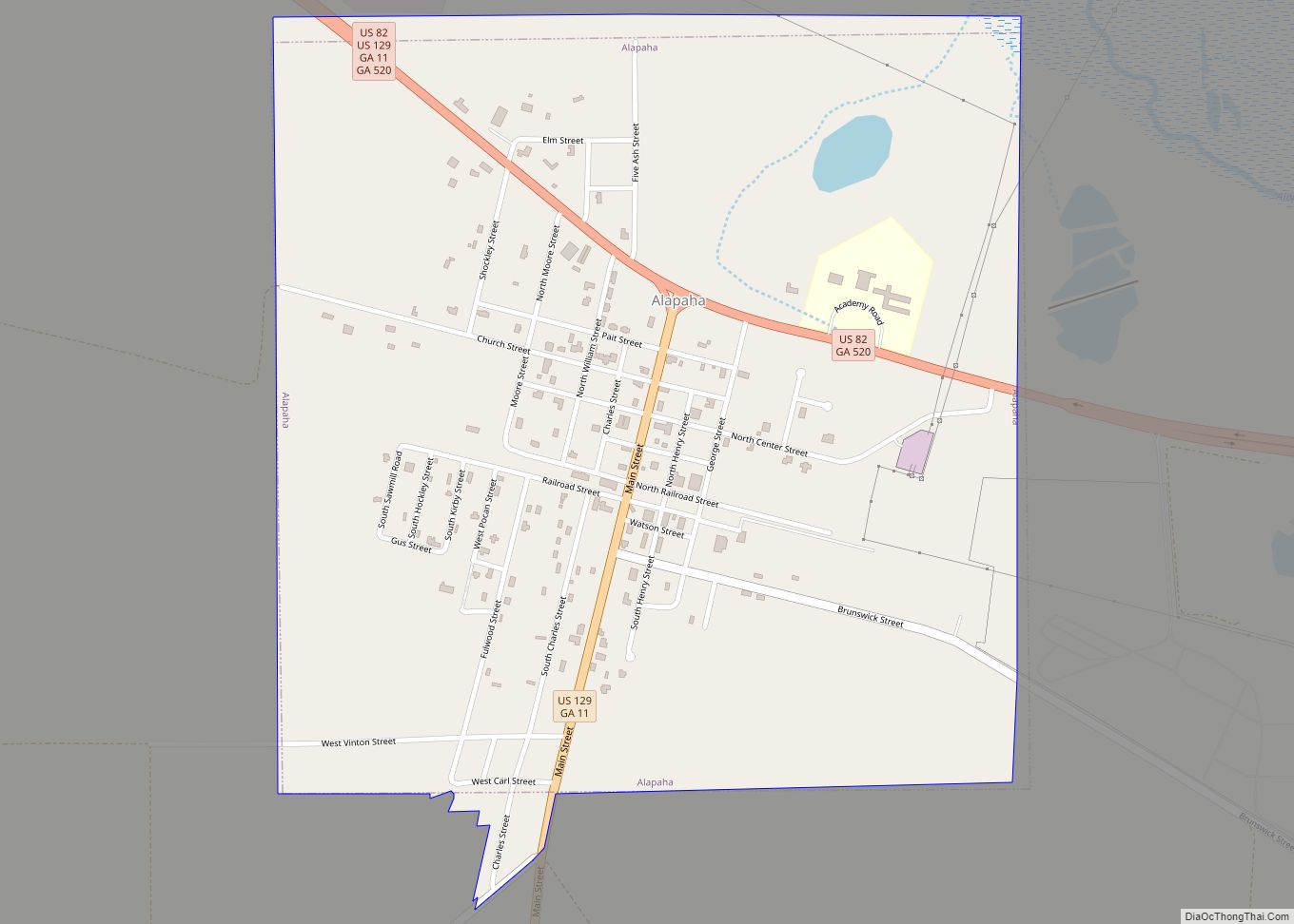
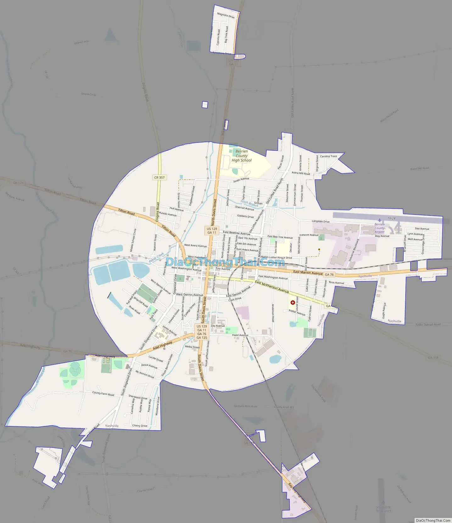
Nashville Road Map
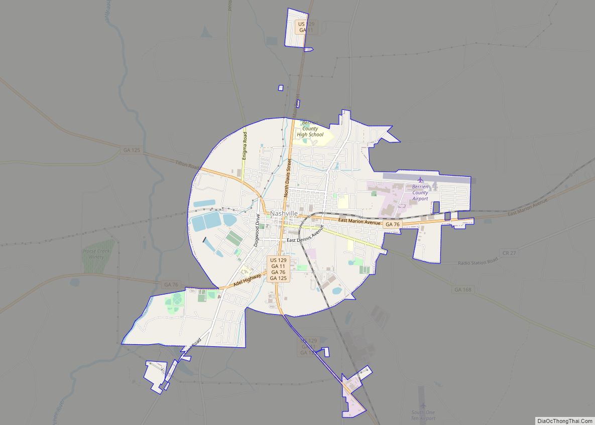
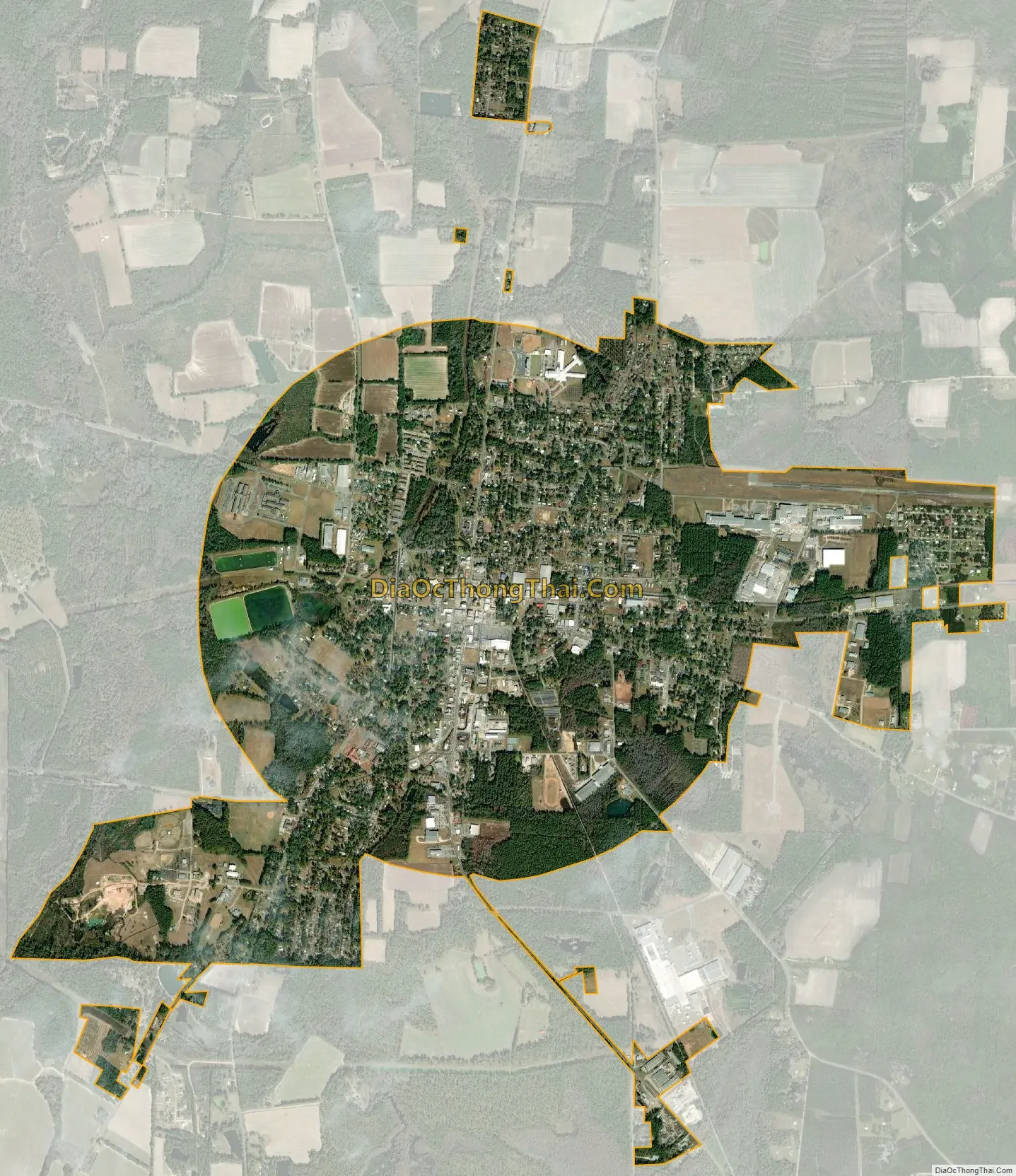
Nashville city Satellite Map
Geography
According to the United States Census Bureau, the city has a total area of 4.7 square miles (12.2 km), of which 4.6 square miles (12.0 km) is land and 0.039 square miles (0.1 km), or 1.13%, is water.
See also
Map of Georgia State and its subdivision:- Appling
- Atkinson
- Bacon
- Baker
- Baldwin
- Banks
- Barrow
- Bartow
- Ben Hill
- Berrien
- Bibb
- Bleckley
- Brantley
- Brooks
- Bryan
- Bulloch
- Burke
- Butts
- Calhoun
- Camden
- Candler
- Carroll
- Catoosa
- Charlton
- Chatham
- Chattahoochee
- Chattooga
- Cherokee
- Clarke
- Clay
- Clayton
- Clinch
- Cobb
- Coffee
- Colquitt
- Columbia
- Cook
- Coweta
- Crawford
- Crisp
- Dade
- Dawson
- Decatur
- DeKalb
- Dodge
- Dooly
- Dougherty
- Douglas
- Early
- Echols
- Effingham
- Elbert
- Emanuel
- Evans
- Fannin
- Fayette
- Floyd
- Forsyth
- Franklin
- Fulton
- Gilmer
- Glascock
- Glynn
- Gordon
- Grady
- Greene
- Gwinnett
- Habersham
- Hall
- Hancock
- Haralson
- Harris
- Hart
- Heard
- Henry
- Houston
- Irwin
- Jackson
- Jasper
- Jeff Davis
- Jefferson
- Jenkins
- Johnson
- Jones
- Lamar
- Lanier
- Laurens
- Lee
- Liberty
- Lincoln
- Long
- Lowndes
- Lumpkin
- Macon
- Madison
- Marion
- McDuffie
- McIntosh
- Meriwether
- Miller
- Mitchell
- Monroe
- Montgomery
- Morgan
- Murray
- Muscogee
- Newton
- Oconee
- Oglethorpe
- Paulding
- Peach
- Pickens
- Pierce
- Pike
- Polk
- Pulaski
- Putnam
- Quitman
- Rabun
- Randolph
- Richmond
- Rockdale
- Schley
- Screven
- Seminole
- Spalding
- Stephens
- Stewart
- Sumter
- Talbot
- Taliaferro
- Tattnall
- Taylor
- Telfair
- Terrell
- Thomas
- Tift
- Toombs
- Towns
- Treutlen
- Troup
- Turner
- Twiggs
- Union
- Upson
- Walker
- Walton
- Ware
- Warren
- Washington
- Wayne
- Webster
- Wheeler
- White
- Whitfield
- Wilcox
- Wilkes
- Wilkinson
- Worth
- Alabama
- Alaska
- Arizona
- Arkansas
- California
- Colorado
- Connecticut
- Delaware
- District of Columbia
- Florida
- Georgia
- Hawaii
- Idaho
- Illinois
- Indiana
- Iowa
- Kansas
- Kentucky
- Louisiana
- Maine
- Maryland
- Massachusetts
- Michigan
- Minnesota
- Mississippi
- Missouri
- Montana
- Nebraska
- Nevada
- New Hampshire
- New Jersey
- New Mexico
- New York
- North Carolina
- North Dakota
- Ohio
- Oklahoma
- Oregon
- Pennsylvania
- Rhode Island
- South Carolina
- South Dakota
- Tennessee
- Texas
- Utah
- Vermont
- Virginia
- Washington
- West Virginia
- Wisconsin
- Wyoming