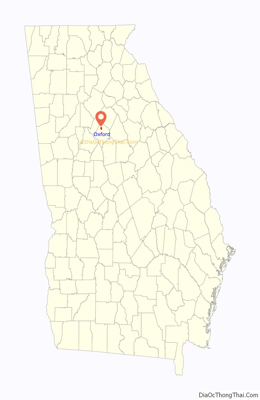
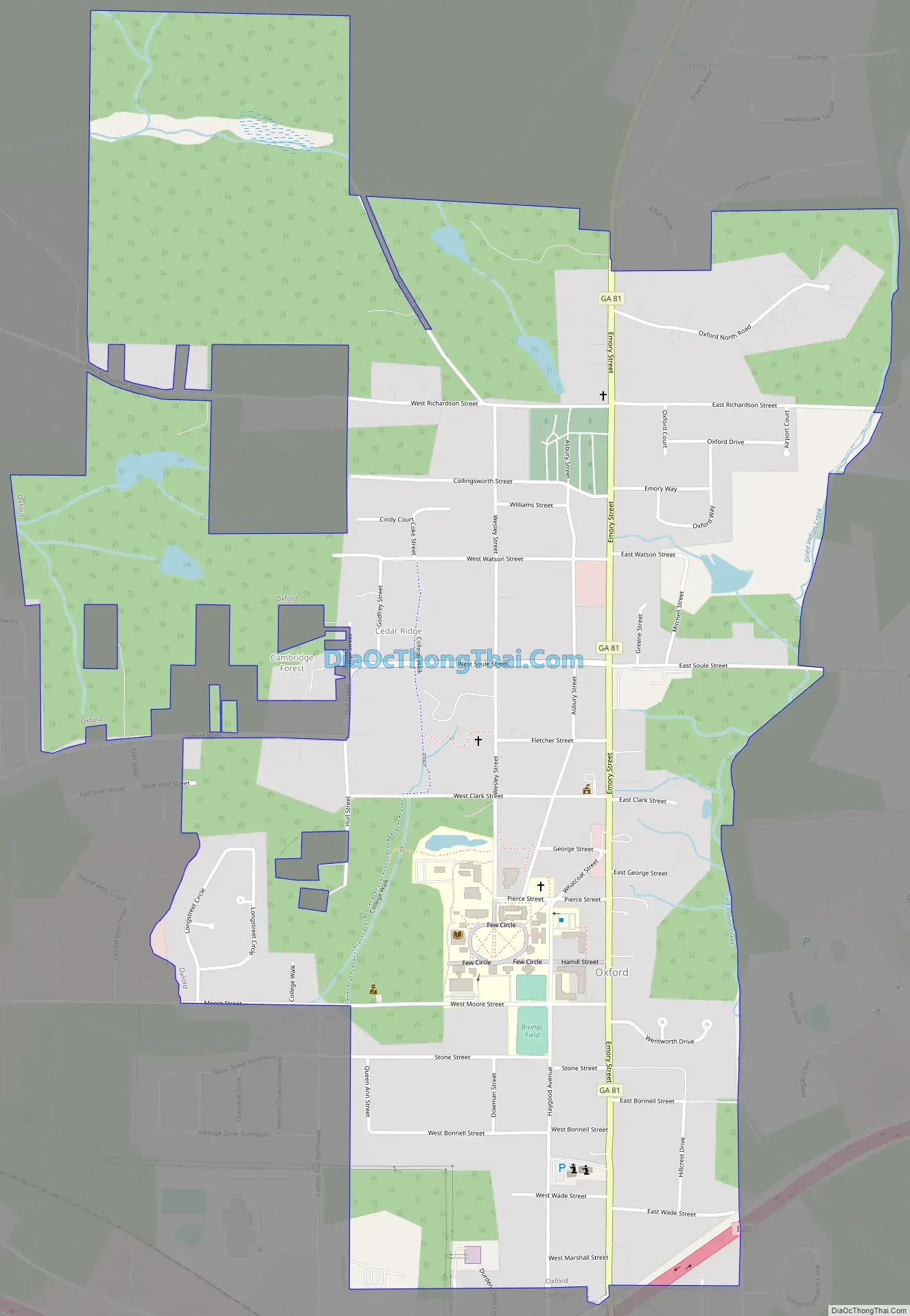
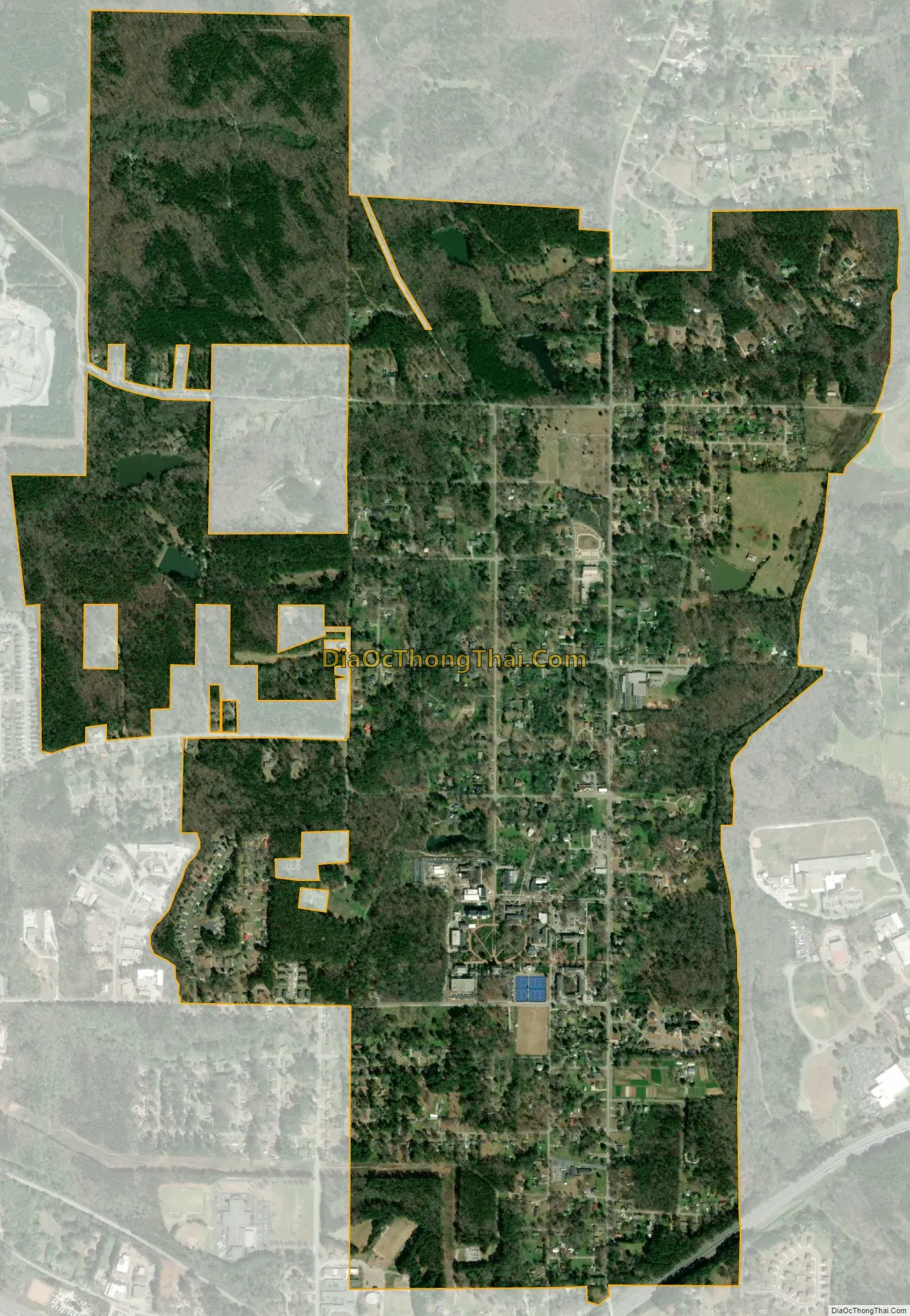
Oxford is a city in Newton County, Georgia, United States. As of the 2010 census, the city population was 2,134. It is the location of Oxford College of Emory University.
Much of the city is part of the National Parks-designated Oxford Historic District.
| Name: | Oxford city |
|---|---|
| LSAD Code: | 25 |
| LSAD Description: | city (suffix) |
| State: | Georgia |
| County: | Newton County |
| Elevation: | 761 ft (232 m) |
| Total Area: | 2.18 sq mi (5.64 km²) |
| Land Area: | 2.15 sq mi (5.58 km²) |
| Water Area: | 0.02 sq mi (0.06 km²) |
| Total Population: | 2,308 |
| Population Density: | 1,071.99/sq mi (413.81/km²) |
| ZIP code: | 30054 |
| Area code: | 470/678/770 |
| FIPS code: | 1358744 |
| GNISfeature ID: | 0332587 |
| Website: | oxfordgeorgia.org |
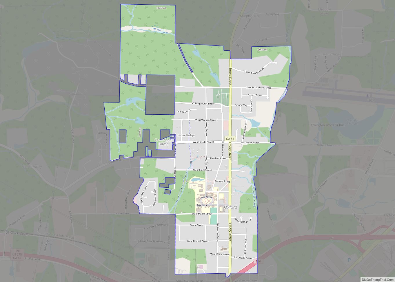
Online Interactive Map
Click on ![]() to view map in "full screen" mode.
to view map in "full screen" mode.
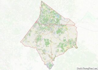
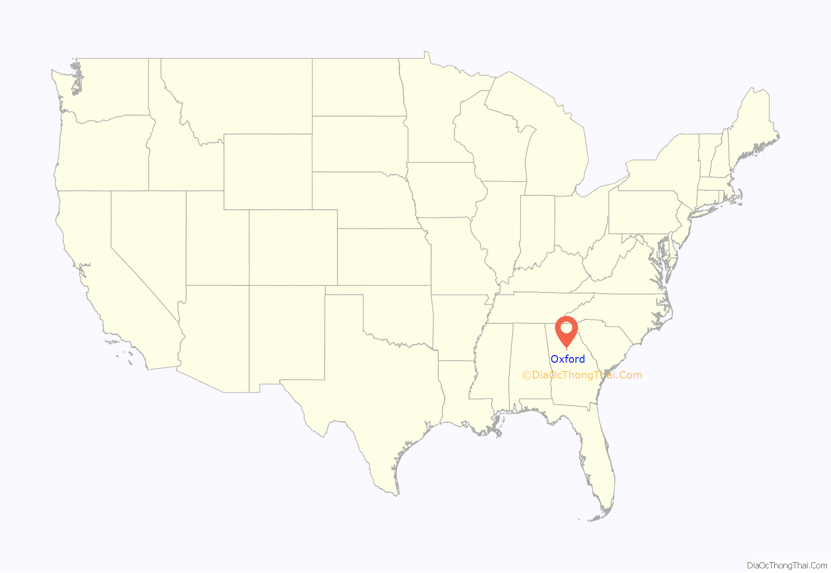
Oxford location map. Where is Oxford city?
History
Oxford was established as a town by the Methodist Episcopal Church in 1839 as the birthplace of Oxford College of Emory University and incorporated as a city in 1914.
The town was named after Oxford University, the alma mater of the founders of Oxford College. The entire town is also designated as a shrine of the United Methodist Church. Additionally, Confederate soldiers are buried in a small cemetery on the grounds of Oxford College.
Properties in Oxford listed on the National Register of Historic Places include: Oxford Historic District and the Orna Villa, a mansion, which was built in 1825, which was used as a hospital during the American Civil War.
The Dukes of Hazzard filmed a car-jump scene on the grounds of the college, and other scenes around the town.
Oxford Road Map
Oxford city Satellite Map
Geography
Oxford is located at 33°37′27″N 83°52′12″W / 33.62417°N 83.87000°W / 33.62417; -83.87000 (33.624210, -83.869885).
According to the United States Census Bureau, the city has a total area of 2.6 square miles (6.7 km), all land.
See also
Map of Georgia State and its subdivision:- Appling
- Atkinson
- Bacon
- Baker
- Baldwin
- Banks
- Barrow
- Bartow
- Ben Hill
- Berrien
- Bibb
- Bleckley
- Brantley
- Brooks
- Bryan
- Bulloch
- Burke
- Butts
- Calhoun
- Camden
- Candler
- Carroll
- Catoosa
- Charlton
- Chatham
- Chattahoochee
- Chattooga
- Cherokee
- Clarke
- Clay
- Clayton
- Clinch
- Cobb
- Coffee
- Colquitt
- Columbia
- Cook
- Coweta
- Crawford
- Crisp
- Dade
- Dawson
- Decatur
- DeKalb
- Dodge
- Dooly
- Dougherty
- Douglas
- Early
- Echols
- Effingham
- Elbert
- Emanuel
- Evans
- Fannin
- Fayette
- Floyd
- Forsyth
- Franklin
- Fulton
- Gilmer
- Glascock
- Glynn
- Gordon
- Grady
- Greene
- Gwinnett
- Habersham
- Hall
- Hancock
- Haralson
- Harris
- Hart
- Heard
- Henry
- Houston
- Irwin
- Jackson
- Jasper
- Jeff Davis
- Jefferson
- Jenkins
- Johnson
- Jones
- Lamar
- Lanier
- Laurens
- Lee
- Liberty
- Lincoln
- Long
- Lowndes
- Lumpkin
- Macon
- Madison
- Marion
- McDuffie
- McIntosh
- Meriwether
- Miller
- Mitchell
- Monroe
- Montgomery
- Morgan
- Murray
- Muscogee
- Newton
- Oconee
- Oglethorpe
- Paulding
- Peach
- Pickens
- Pierce
- Pike
- Polk
- Pulaski
- Putnam
- Quitman
- Rabun
- Randolph
- Richmond
- Rockdale
- Schley
- Screven
- Seminole
- Spalding
- Stephens
- Stewart
- Sumter
- Talbot
- Taliaferro
- Tattnall
- Taylor
- Telfair
- Terrell
- Thomas
- Tift
- Toombs
- Towns
- Treutlen
- Troup
- Turner
- Twiggs
- Union
- Upson
- Walker
- Walton
- Ware
- Warren
- Washington
- Wayne
- Webster
- Wheeler
- White
- Whitfield
- Wilcox
- Wilkes
- Wilkinson
- Worth
- Alabama
- Alaska
- Arizona
- Arkansas
- California
- Colorado
- Connecticut
- Delaware
- District of Columbia
- Florida
- Georgia
- Hawaii
- Idaho
- Illinois
- Indiana
- Iowa
- Kansas
- Kentucky
- Louisiana
- Maine
- Maryland
- Massachusetts
- Michigan
- Minnesota
- Mississippi
- Missouri
- Montana
- Nebraska
- Nevada
- New Hampshire
- New Jersey
- New Mexico
- New York
- North Carolina
- North Dakota
- Ohio
- Oklahoma
- Oregon
- Pennsylvania
- Rhode Island
- South Carolina
- South Dakota
- Tennessee
- Texas
- Utah
- Vermont
- Virginia
- Washington
- West Virginia
- Wisconsin
- Wyoming