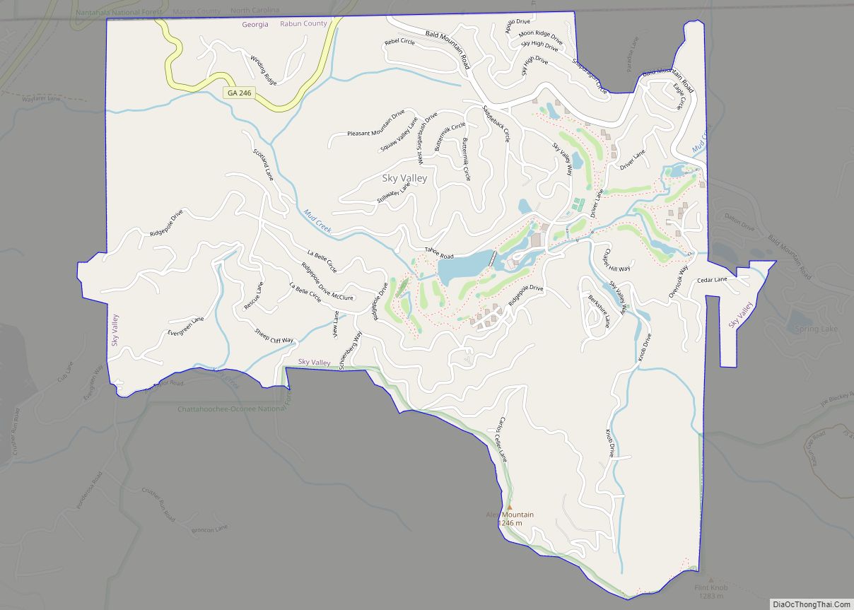
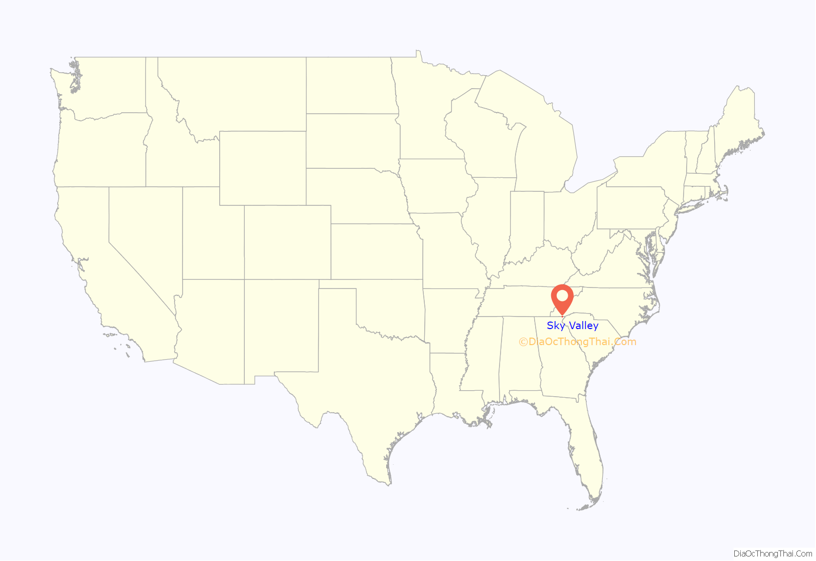
Sky Valley is a city in Rabun County, Georgia, United States and is nestled in a mountain valley on the northwest slopes of Rabun Bald, Georgia’s second-highest peak. Incorporated in March 1978, it recorded a total population of 250 as of the 2000 U.S. census, and 482 as of 2020. Sky Valley shares ZIP code 30537 with nearby Dillard.
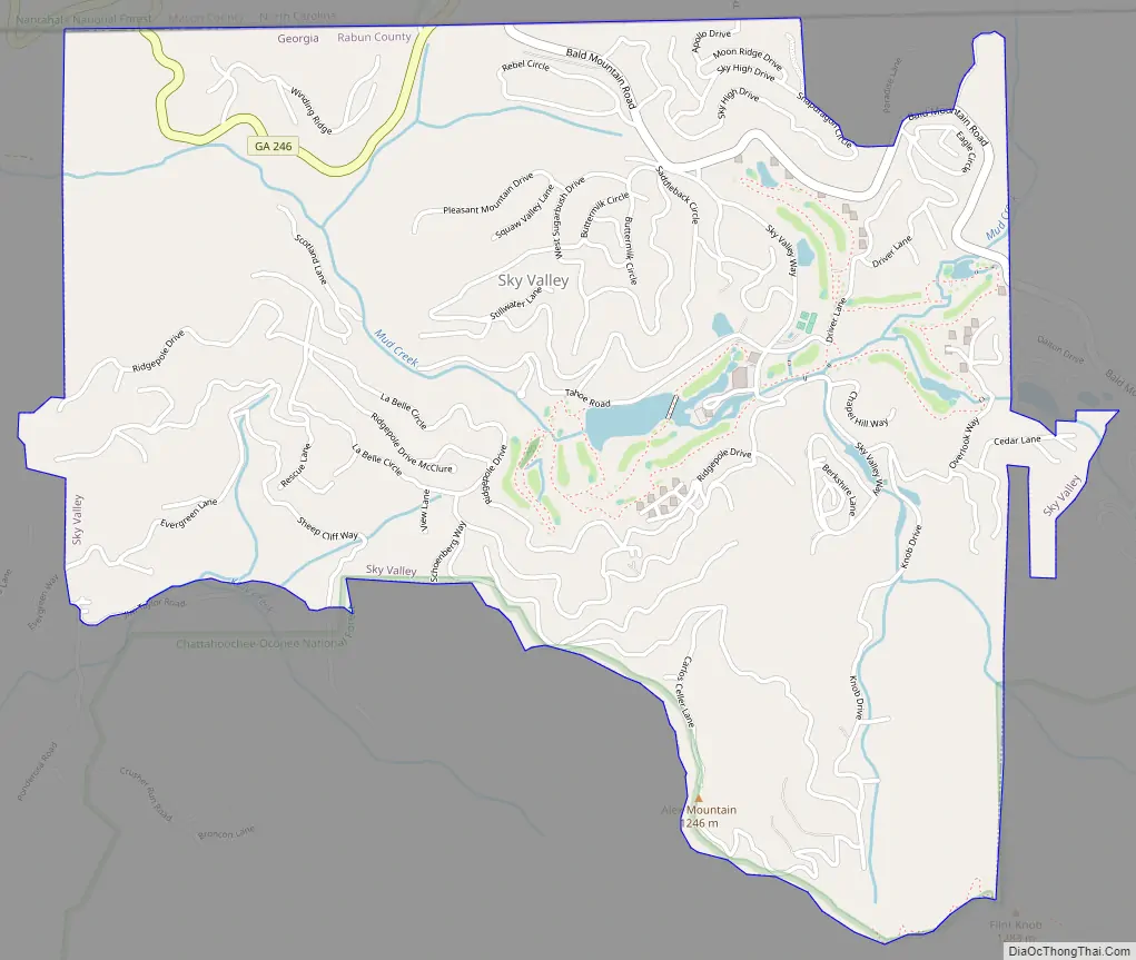
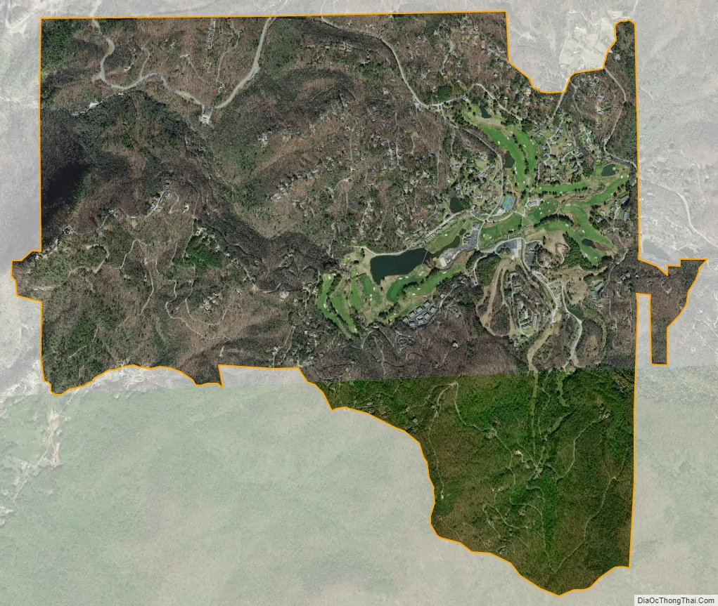
Since 1969, it is home to Sky Valley Resort (now renamed Sky Valley Country Club), which features championship golf, championship croquet, tennis, and swimming, and formerly downhill skiing.
| Name: | Sky Valley city |
|---|---|
| LSAD Code: | 25 |
| LSAD Description: | city (suffix) |
| State: | Georgia |
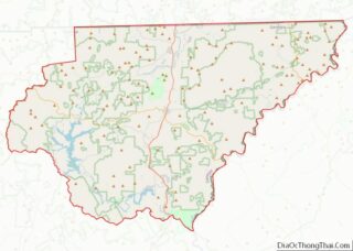
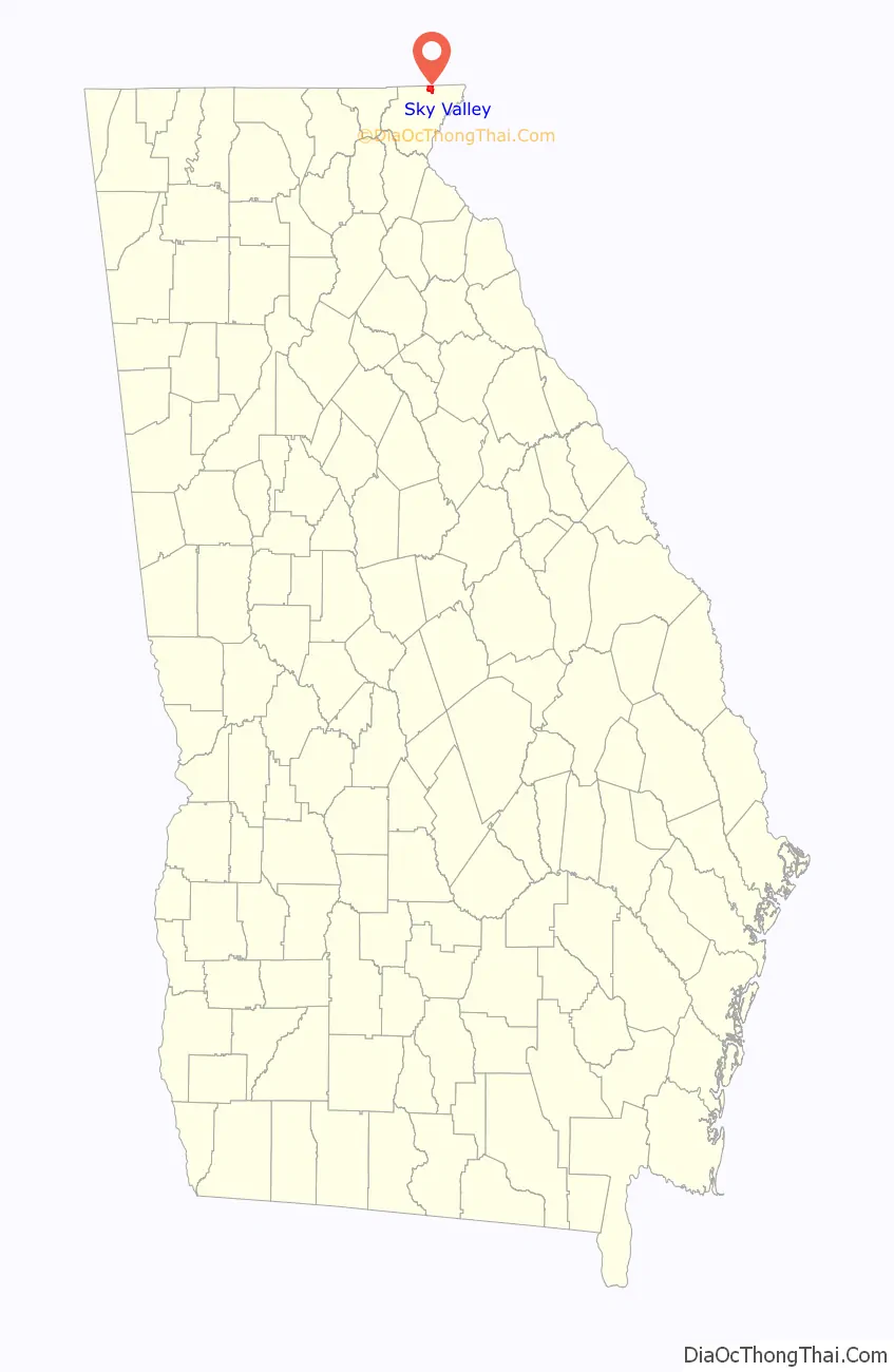
| County: | Rabun County |
| Elevation: | 3,124 ft (952 m) |
| Total Area: | 3.07 sq mi (7.94 km²) |
| Land Area: | 3.04 sq mi (7.87 km²) |
| Water Area: | 0.03 sq mi (0.08 km²) |
| Total Population: | 482 |
| Population Density: | 158.71/sq mi (61.28/km²) |
| ZIP code: | 30537 |
| Area code: | 706 |
| FIPS code: | 1371282 |
| GNISfeature ID: | 2405468 |
| Website: | www.skyvalleyga.com |
Online Interactive Map
Click on ![]() to view map in "full screen" mode.
to view map in "full screen" mode.
Sky Valley location map. Where is Sky Valley city?
Sky Valley Road Map
Sky Valley city Satellite Map
Geography
Based on latitude, Sky Valley is the northernmost city in the state.
According to the United States Census Bureau, the city has a total area of 3.0 square miles (7.8 km), all land. The elevation of the valley floor is approximately 3100 feet above sea level, while areas within the city limits on the slopes of Rabun Bald exceed 4200 feet. Sky Valley is Georgia’s highest incorporated city and one of the highest municipalities in the eastern United States.
Under the Köppen climate classification, Sky Valley has a temperate subtropical highland climate (Köppen Cfb), a rarity in the southeastern US, due to its high elevation. The city is also one of the coldest locations in Georgia with the January average temperature 34.0 °F (1.1 °C) and the July average temperature of 69.0 °F (20.6 °C).
See also
Map of Georgia State and its subdivision:- Appling
- Atkinson
- Bacon
- Baker
- Baldwin
- Banks
- Barrow
- Bartow
- Ben Hill
- Berrien
- Bibb
- Bleckley
- Brantley
- Brooks
- Bryan
- Bulloch
- Burke
- Butts
- Calhoun
- Camden
- Candler
- Carroll
- Catoosa
- Charlton
- Chatham
- Chattahoochee
- Chattooga
- Cherokee
- Clarke
- Clay
- Clayton
- Clinch
- Cobb
- Coffee
- Colquitt
- Columbia
- Cook
- Coweta
- Crawford
- Crisp
- Dade
- Dawson
- Decatur
- DeKalb
- Dodge
- Dooly
- Dougherty
- Douglas
- Early
- Echols
- Effingham
- Elbert
- Emanuel
- Evans
- Fannin
- Fayette
- Floyd
- Forsyth
- Franklin
- Fulton
- Gilmer
- Glascock
- Glynn
- Gordon
- Grady
- Greene
- Gwinnett
- Habersham
- Hall
- Hancock
- Haralson
- Harris
- Hart
- Heard
- Henry
- Houston
- Irwin
- Jackson
- Jasper
- Jeff Davis
- Jefferson
- Jenkins
- Johnson
- Jones
- Lamar
- Lanier
- Laurens
- Lee
- Liberty
- Lincoln
- Long
- Lowndes
- Lumpkin
- Macon
- Madison
- Marion
- McDuffie
- McIntosh
- Meriwether
- Miller
- Mitchell
- Monroe
- Montgomery
- Morgan
- Murray
- Muscogee
- Newton
- Oconee
- Oglethorpe
- Paulding
- Peach
- Pickens
- Pierce
- Pike
- Polk
- Pulaski
- Putnam
- Quitman
- Rabun
- Randolph
- Richmond
- Rockdale
- Schley
- Screven
- Seminole
- Spalding
- Stephens
- Stewart
- Sumter
- Talbot
- Taliaferro
- Tattnall
- Taylor
- Telfair
- Terrell
- Thomas
- Tift
- Toombs
- Towns
- Treutlen
- Troup
- Turner
- Twiggs
- Union
- Upson
- Walker
- Walton
- Ware
- Warren
- Washington
- Wayne
- Webster
- Wheeler
- White
- Whitfield
- Wilcox
- Wilkes
- Wilkinson
- Worth
- Alabama
- Alaska
- Arizona
- Arkansas
- California
- Colorado
- Connecticut
- Delaware
- District of Columbia
- Florida
- Georgia
- Hawaii
- Idaho
- Illinois
- Indiana
- Iowa
- Kansas
- Kentucky
- Louisiana
- Maine
- Maryland
- Massachusetts
- Michigan
- Minnesota
- Mississippi
- Missouri
- Montana
- Nebraska
- Nevada
- New Hampshire
- New Jersey
- New Mexico
- New York
- North Carolina
- North Dakota
- Ohio
- Oklahoma
- Oregon
- Pennsylvania
- Rhode Island
- South Carolina
- South Dakota
- Tennessee
- Texas
- Utah
- Vermont
- Virginia
- Washington
- West Virginia
- Wisconsin
- Wyoming