Thomson (originally called Slashes) is a city in McDuffie County, Georgia, United States. The population was 6,814 at the 2020 census. The city is the county seat of McDuffie County. Thomson’s nickname is “The Camellia City of the South”, in honor of the thousands of camellia plants throughout the city. Thomson was founded in 1837 as a depot on the Georgia Railroad. It was renamed in 1853 for railroad official John Edgar Thomson and incorporated February 15, 1854 as a town and in 1870 as a city. It is part of the Augusta – Richmond County Metropolitan Statistical Area.
| Name: | Thomson city |
|---|---|
| LSAD Code: | 25 |
| LSAD Description: | city (suffix) |
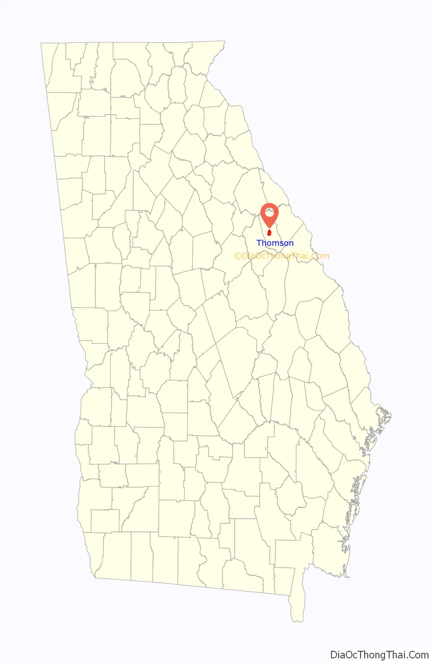
| State: | Georgia |
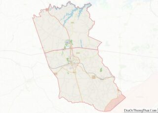
| County: | McDuffie County |
| Elevation: | 531 ft (162 m) |
| Total Area: | 4.79 sq mi (12.42 km²) |
| Land Area: | 4.78 sq mi (12.38 km²) |
| Water Area: | 0.01 sq mi (0.04 km²) |
| Total Population: | 6,814 |
| Population Density: | 1,425.52/sq mi (550.43/km²) |
| ZIP code: | 30824 |
| Area code: | 706 |
| FIPS code: | 1376280 |
| GNISfeature ID: | 0356589 |
| Website: | www.thomson-mcduffie.gov |
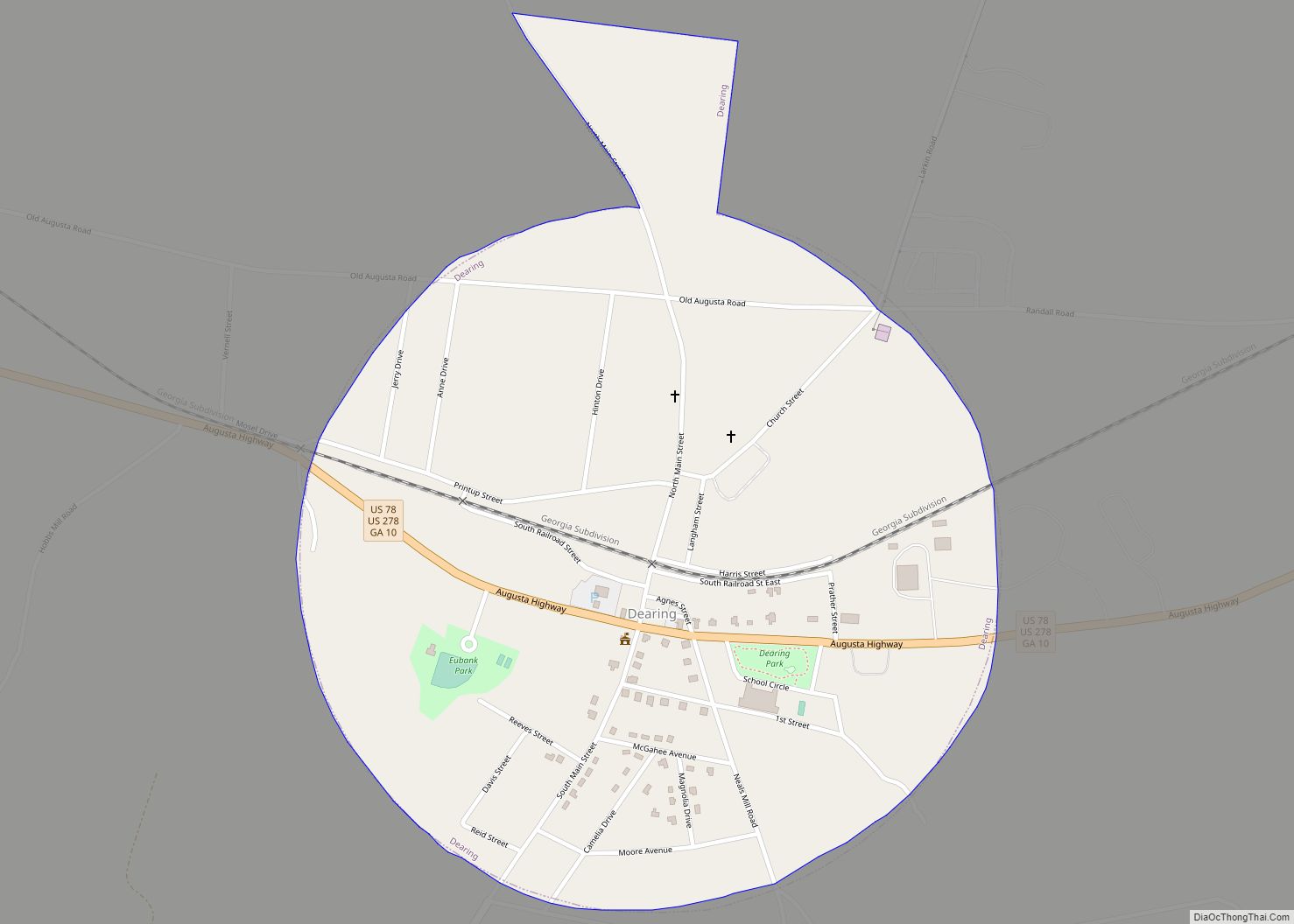
Online Interactive Map
Click on ![]() to view map in "full screen" mode.
to view map in "full screen" mode.
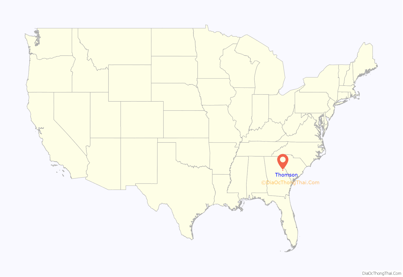
Thomson location map. Where is Thomson city?
History
Thomson, originally called “Slashes”, was founded in 1837 as a depot on the Georgia Railroad. It was renamed in 1853 for railroad official John Edgar Thomson. In 1870, Thomson was designated seat of the newly formed McDuffie County. It was incorporated as a town in 1854 and as a city in 1870.
The Old Rock House, built in 1785, is said to be one of Georgia’s oldest documented houses with its original design intact. Built by Thomas Ansley, the home is said to be the home of ancestors of former president Jimmy Carter.
Thomson was home to minor league baseball. An affiliate of the Baltimore Orioles, the Thomson Orioles became members of the 1956 six–team the Class D level Georgia State League. Playing home games at The Brickyard, Thomson led the league in attendance and qualified for the playoffs. The Georgia State League permanently folded following the 1956 season.
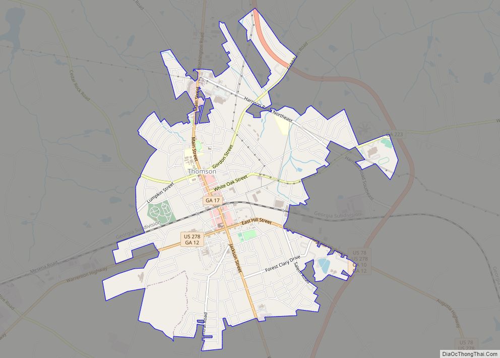
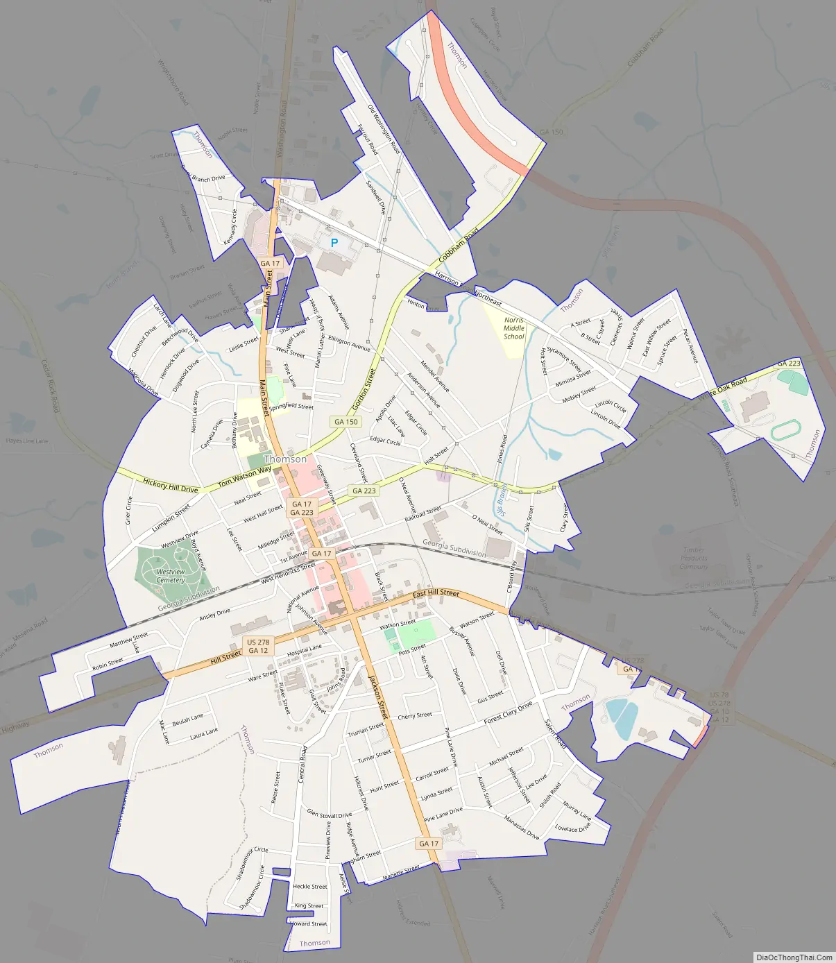
Thomson Road Map
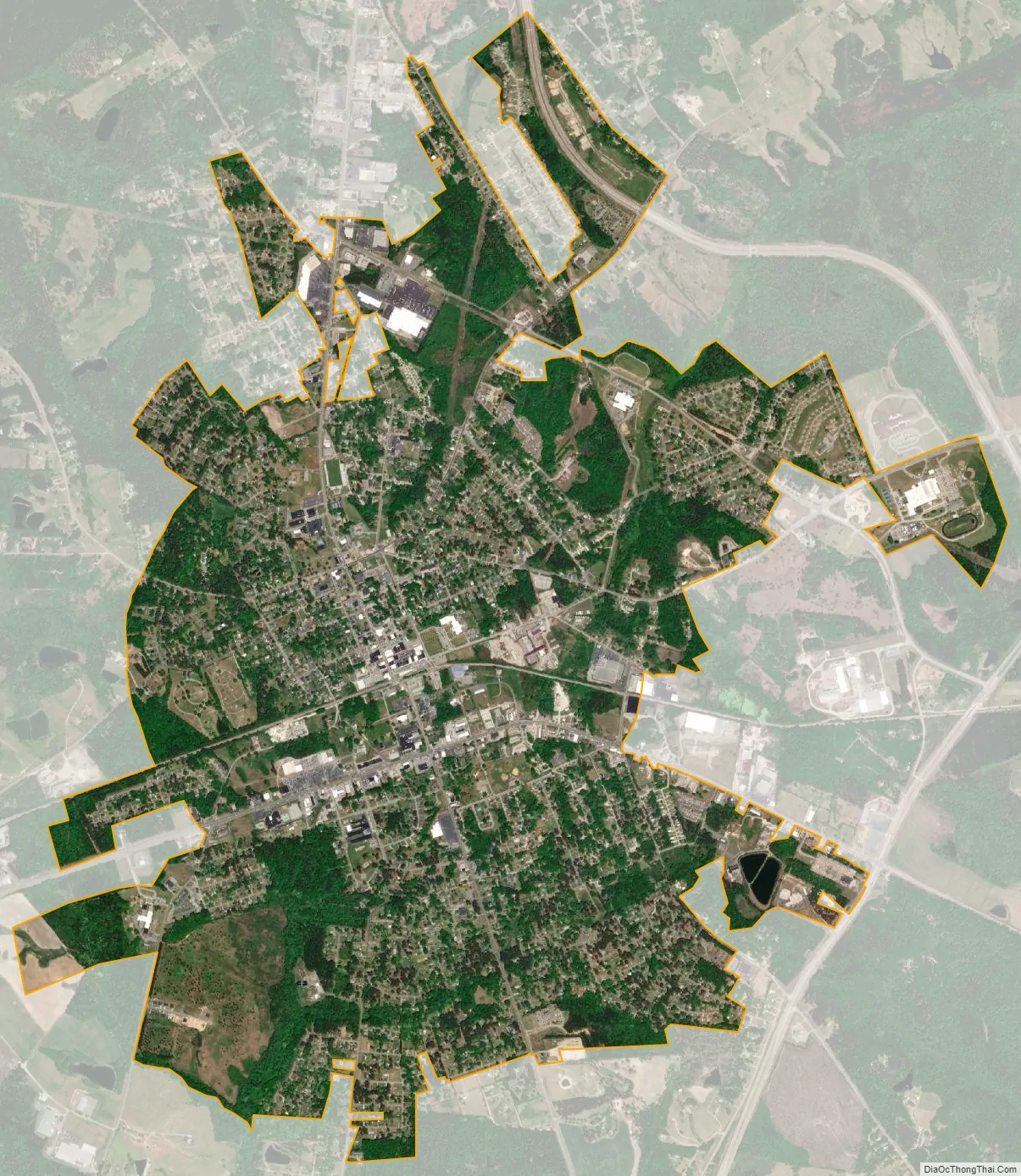
Thomson city Satellite Map
Geography
Thomson is located at 33°28′2″N 82°29′58″W / 33.46722°N 82.49944°W / 33.46722; -82.49944 (33.467346, −82.499450).
According to the United States Census Bureau, the city has a total area of 1.95 square miles (5.1 km), all land.
Thomson is considered part of the Central Savannah River Area geographical designation.
See also
Map of Georgia State and its subdivision:- Appling
- Atkinson
- Bacon
- Baker
- Baldwin
- Banks
- Barrow
- Bartow
- Ben Hill
- Berrien
- Bibb
- Bleckley
- Brantley
- Brooks
- Bryan
- Bulloch
- Burke
- Butts
- Calhoun
- Camden
- Candler
- Carroll
- Catoosa
- Charlton
- Chatham
- Chattahoochee
- Chattooga
- Cherokee
- Clarke
- Clay
- Clayton
- Clinch
- Cobb
- Coffee
- Colquitt
- Columbia
- Cook
- Coweta
- Crawford
- Crisp
- Dade
- Dawson
- Decatur
- DeKalb
- Dodge
- Dooly
- Dougherty
- Douglas
- Early
- Echols
- Effingham
- Elbert
- Emanuel
- Evans
- Fannin
- Fayette
- Floyd
- Forsyth
- Franklin
- Fulton
- Gilmer
- Glascock
- Glynn
- Gordon
- Grady
- Greene
- Gwinnett
- Habersham
- Hall
- Hancock
- Haralson
- Harris
- Hart
- Heard
- Henry
- Houston
- Irwin
- Jackson
- Jasper
- Jeff Davis
- Jefferson
- Jenkins
- Johnson
- Jones
- Lamar
- Lanier
- Laurens
- Lee
- Liberty
- Lincoln
- Long
- Lowndes
- Lumpkin
- Macon
- Madison
- Marion
- McDuffie
- McIntosh
- Meriwether
- Miller
- Mitchell
- Monroe
- Montgomery
- Morgan
- Murray
- Muscogee
- Newton
- Oconee
- Oglethorpe
- Paulding
- Peach
- Pickens
- Pierce
- Pike
- Polk
- Pulaski
- Putnam
- Quitman
- Rabun
- Randolph
- Richmond
- Rockdale
- Schley
- Screven
- Seminole
- Spalding
- Stephens
- Stewart
- Sumter
- Talbot
- Taliaferro
- Tattnall
- Taylor
- Telfair
- Terrell
- Thomas
- Tift
- Toombs
- Towns
- Treutlen
- Troup
- Turner
- Twiggs
- Union
- Upson
- Walker
- Walton
- Ware
- Warren
- Washington
- Wayne
- Webster
- Wheeler
- White
- Whitfield
- Wilcox
- Wilkes
- Wilkinson
- Worth
- Alabama
- Alaska
- Arizona
- Arkansas
- California
- Colorado
- Connecticut
- Delaware
- District of Columbia
- Florida
- Georgia
- Hawaii
- Idaho
- Illinois
- Indiana
- Iowa
- Kansas
- Kentucky
- Louisiana
- Maine
- Maryland
- Massachusetts
- Michigan
- Minnesota
- Mississippi
- Missouri
- Montana
- Nebraska
- Nevada
- New Hampshire
- New Jersey
- New Mexico
- New York
- North Carolina
- North Dakota
- Ohio
- Oklahoma
- Oregon
- Pennsylvania
- Rhode Island
- South Carolina
- South Dakota
- Tennessee
- Texas
- Utah
- Vermont
- Virginia
- Washington
- West Virginia
- Wisconsin
- Wyoming