The city of Adel /ˈeɪdɛl/ is the county seat of Cook County, Georgia, United States, located fifty-two miles (84 km) southeast of Albany. As of the 2020 census, the city had a population of 5,571.
| Name: | Adel city |
|---|---|
| LSAD Code: | 25 |
| LSAD Description: | city (suffix) |
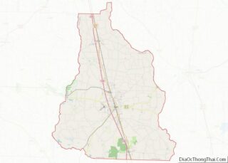
| State: | Georgia |
| County: | Cook County |
| Elevation: | 240 ft (73 m) |
| Total Area: | 9.46 sq mi (24.50 km²) |
| Land Area: | 9.30 sq mi (24.09 km²) |
| Water Area: | 0.16 sq mi (0.42 km²) |
| Total Population: | 5,571 |
| Population Density: | 599.03/sq mi (231.28/km²) |
| ZIP code: | 31620 |
| Area code: | 229 |
| FIPS code: | 1300576 |
| GNISfeature ID: | 0354262 |
| Website: | www.cityofadel.us |
Online Interactive Map
Click on ![]() to view map in "full screen" mode.
to view map in "full screen" mode.
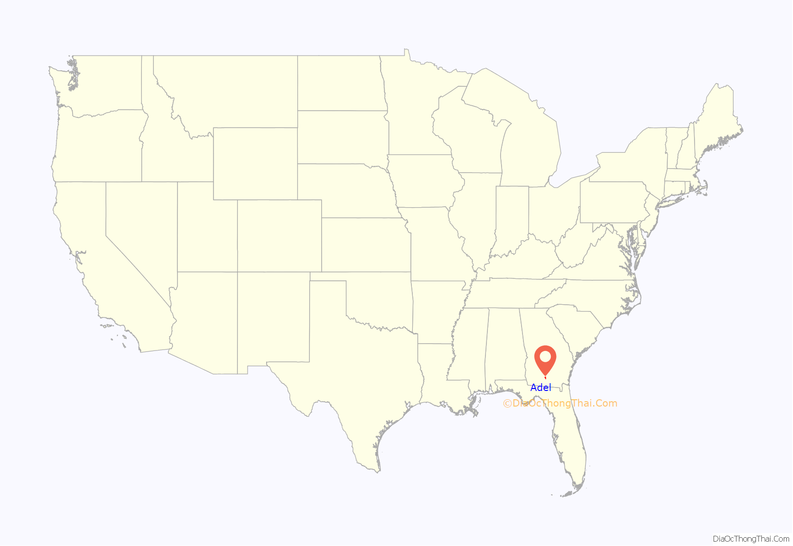
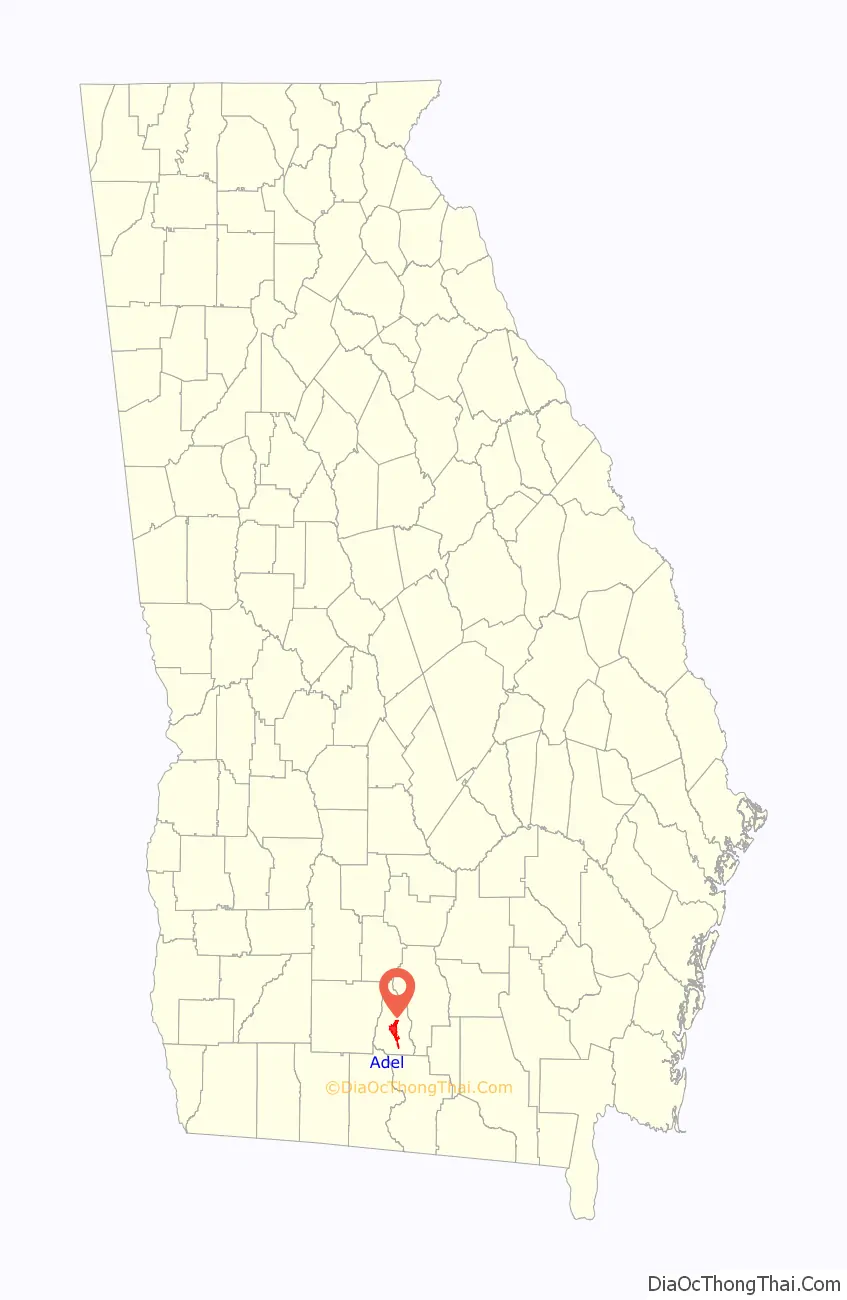
Adel location map. Where is Adel city?
History
The original name of the city was Puddleville. The city’s first postmaster, Joel “Uncle Jack” Parrish, wanted to change the name of the city. It is believed that he saw the name “Philadelphia” on a croaker sack and struck out the first and last four letters to create the present name of Adel.
The Georgia Southern and Florida Railway arrived in Adel in the 1880s. Adel was incorporated as a town in 1889.
Tornadoes
On January 22, 2017, a low-end EF3 tornado struck the extreme southern portion of Adel. Sunshine Acres, a local mobile home park, experienced severe damage, with over 20 homes destroyed and others damaged; seven residents were killed and an indeterminate number were injured or displaced. The tornado ultimately killed 14 people. An EF1 tornado also moved through the city on April 23, 2020 On January 22, 2023, a low-end EF2 tornado caused major damage on the north side of town.
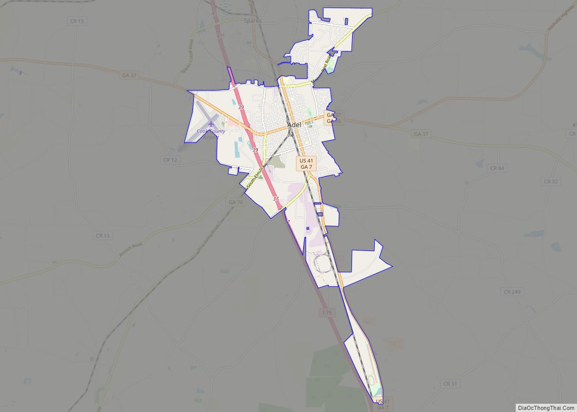
Adel Road Map
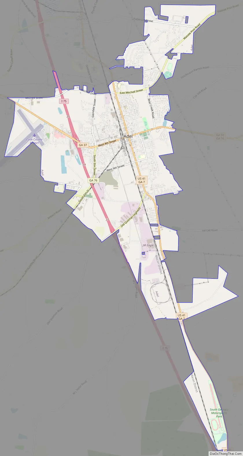
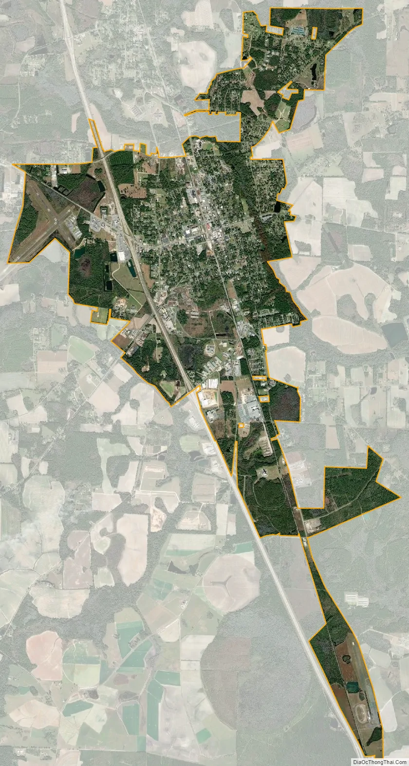
Adel city Satellite Map
Geography
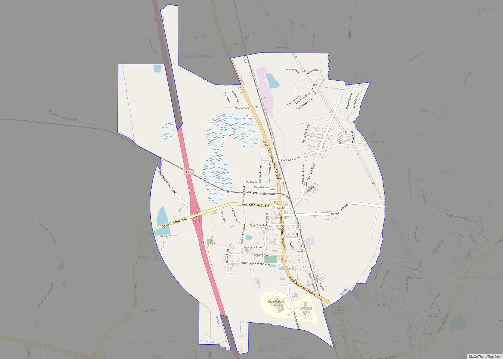
Adel is located just south of the center of Cook County at 31°8′18″N 83°25′33″W / 31.13833°N 83.42583°W / 31.13833; -83.42583 (31.138466, -83.425944). It is bordered to the north by Sparks. U.S. Route 41 passes through the center of town as Hutchinson Avenue, and Interstate 75 passes through the western side of the city, with access from Exit 39. Valdosta is 26 miles (42 km) to the south, and Tifton is 23 miles (37 km) to the north.
According to the United States Census Bureau, Adel has a total area of 8.2 square miles (21.3 km), of which 8.1 square miles (20.9 km) is land and 0.19 square miles (0.5 km), or 2.21%, is water.
See also
Map of Georgia State and its subdivision:- Appling
- Atkinson
- Bacon
- Baker
- Baldwin
- Banks
- Barrow
- Bartow
- Ben Hill
- Berrien
- Bibb
- Bleckley
- Brantley
- Brooks
- Bryan
- Bulloch
- Burke
- Butts
- Calhoun
- Camden
- Candler
- Carroll
- Catoosa
- Charlton
- Chatham
- Chattahoochee
- Chattooga
- Cherokee
- Clarke
- Clay
- Clayton
- Clinch
- Cobb
- Coffee
- Colquitt
- Columbia
- Cook
- Coweta
- Crawford
- Crisp
- Dade
- Dawson
- Decatur
- DeKalb
- Dodge
- Dooly
- Dougherty
- Douglas
- Early
- Echols
- Effingham
- Elbert
- Emanuel
- Evans
- Fannin
- Fayette
- Floyd
- Forsyth
- Franklin
- Fulton
- Gilmer
- Glascock
- Glynn
- Gordon
- Grady
- Greene
- Gwinnett
- Habersham
- Hall
- Hancock
- Haralson
- Harris
- Hart
- Heard
- Henry
- Houston
- Irwin
- Jackson
- Jasper
- Jeff Davis
- Jefferson
- Jenkins
- Johnson
- Jones
- Lamar
- Lanier
- Laurens
- Lee
- Liberty
- Lincoln
- Long
- Lowndes
- Lumpkin
- Macon
- Madison
- Marion
- McDuffie
- McIntosh
- Meriwether
- Miller
- Mitchell
- Monroe
- Montgomery
- Morgan
- Murray
- Muscogee
- Newton
- Oconee
- Oglethorpe
- Paulding
- Peach
- Pickens
- Pierce
- Pike
- Polk
- Pulaski
- Putnam
- Quitman
- Rabun
- Randolph
- Richmond
- Rockdale
- Schley
- Screven
- Seminole
- Spalding
- Stephens
- Stewart
- Sumter
- Talbot
- Taliaferro
- Tattnall
- Taylor
- Telfair
- Terrell
- Thomas
- Tift
- Toombs
- Towns
- Treutlen
- Troup
- Turner
- Twiggs
- Union
- Upson
- Walker
- Walton
- Ware
- Warren
- Washington
- Wayne
- Webster
- Wheeler
- White
- Whitfield
- Wilcox
- Wilkes
- Wilkinson
- Worth
- Alabama
- Alaska
- Arizona
- Arkansas
- California
- Colorado
- Connecticut
- Delaware
- District of Columbia
- Florida
- Georgia
- Hawaii
- Idaho
- Illinois
- Indiana
- Iowa
- Kansas
- Kentucky
- Louisiana
- Maine
- Maryland
- Massachusetts
- Michigan
- Minnesota
- Mississippi
- Missouri
- Montana
- Nebraska
- Nevada
- New Hampshire
- New Jersey
- New Mexico
- New York
- North Carolina
- North Dakota
- Ohio
- Oklahoma
- Oregon
- Pennsylvania
- Rhode Island
- South Carolina
- South Dakota
- Tennessee
- Texas
- Utah
- Vermont
- Virginia
- Washington
- West Virginia
- Wisconsin
- Wyoming