Alma is a city in Bacon County, Georgia, United States, and the county seat. As of the 2020 census, the city had a population of 3,433.
Alma is known as Georgia’s blueberry capital, and hosts a Blueberry Festival each June.
| Name: | Alma city |
|---|---|
| LSAD Code: | 25 |
| LSAD Description: | city (suffix) |
| State: | Georgia |
| County: | Bacon County |
| Elevation: | 200 ft (61 m) |
| Total Area: | 6.22 sq mi (16.11 km²) |
| Land Area: | 6.09 sq mi (15.78 km²) |
| Water Area: | 0.13 sq mi (0.33 km²) |
| Total Population: | 3,433 |
| Population Density: | 563.53/sq mi (217.57/km²) |
| ZIP code: | 31510 |
| Area code: | 912 |
| FIPS code: | 1301612 |
| GNISfeature ID: | 0310492 |
| Website: | www.cityofalmaga.gov |
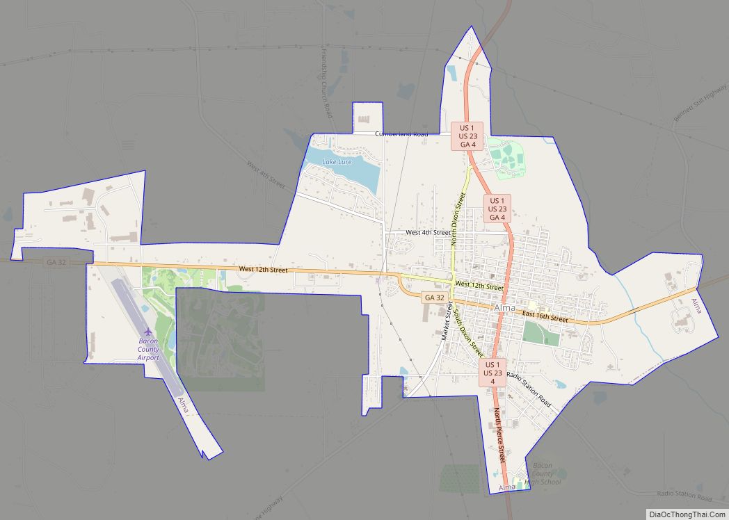
Online Interactive Map
Click on ![]() to view map in "full screen" mode.
to view map in "full screen" mode.
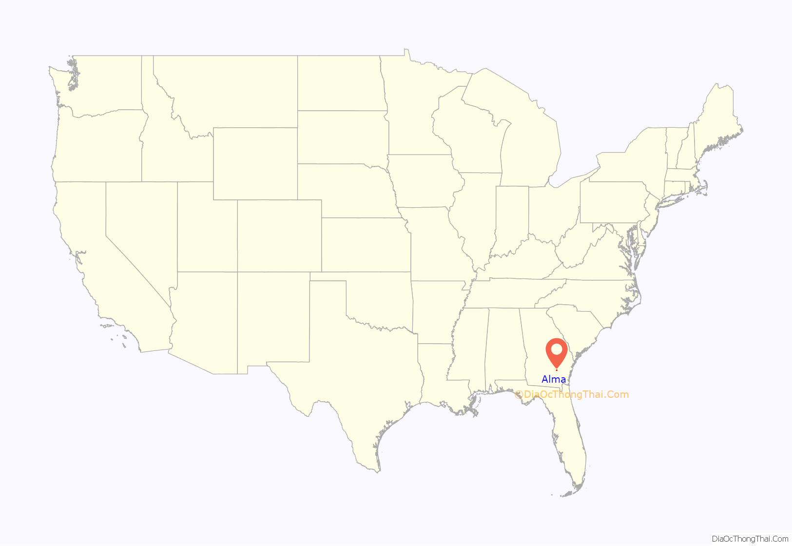
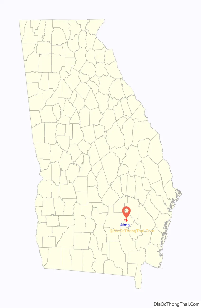
Alma location map. Where is Alma city?
History
Alma was founded in 1900 as a stop on the Atlantic Coast Line Railroad. It was incorporated as a city in 1906 and designated seat of the newly formed Bacon County in 1914. There are two theories about the origin of the name of the town. The first is that it was named for the wife of a traveling salesmen, Alma Sheridan; the other is that it was named for the initial letter of the four state capitals Georgia has had: Augusta, Louisville, Milledgeville, and Atlanta.
There are four sites in Alma listed on the National Register of Historic Places: Alma Depot, Bacon County Courthouse, Bacon County School, and the Rabinowitz Building.
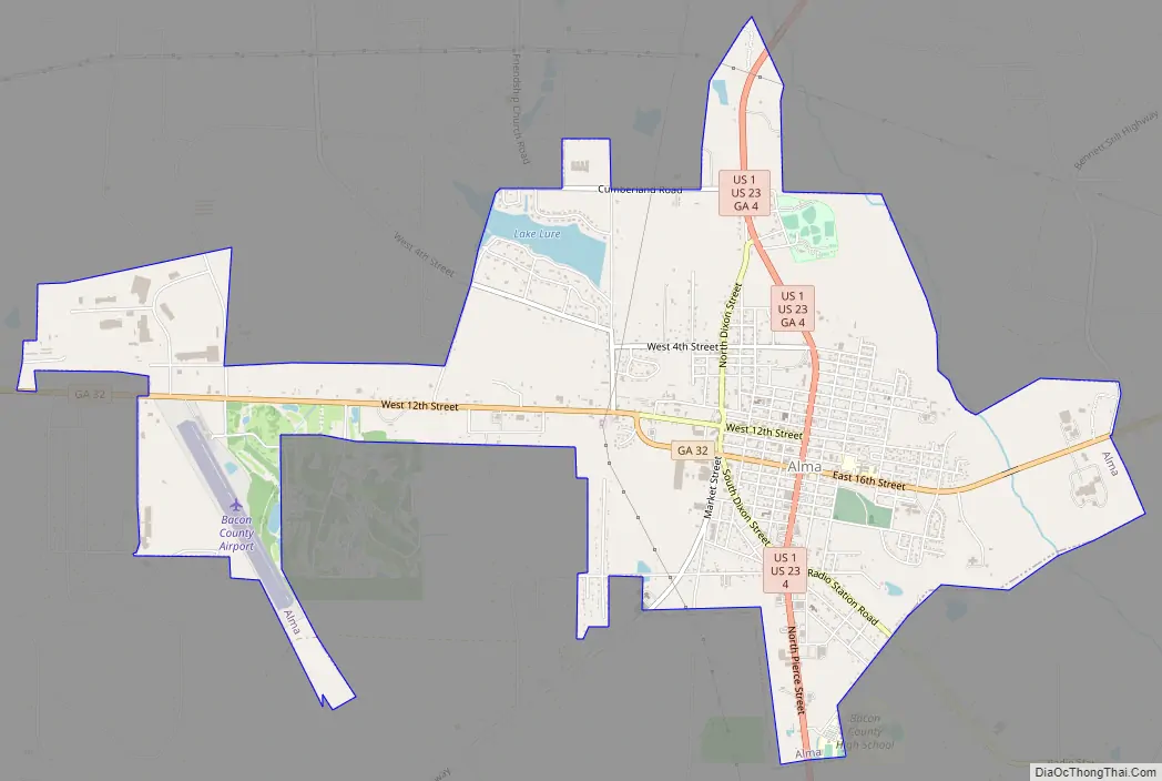
Alma Road Map
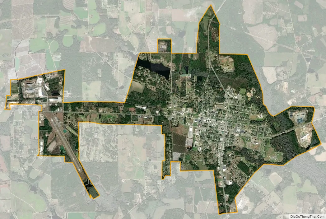
Alma city Satellite Map
Geography
Alma is located in southeastern Georgia at 31°32′30″N 82°28′0″W / 31.54167°N 82.46667°W / 31.54167; -82.46667 (31.541543, -82.466666).
The city is located along U.S. Routes 1 and 23. The two run through the center of the city together before splitting just north of the city. U.S. 1 connects the city with Baxley, 19 mi (31 km) to the north, and U.S. 23 connects the city with Hazlehurst, 25 mi (40 km) to the northwest. U.S. 1/23 also lead south together 29 mi (47 km) to Waycross. Other highways that run through the city include Georgia State Routes 32 and 64.
According to the United States Census Bureau, the city has a total area of 6.2 square miles (16.1 km), of which 5.5 square miles (14.3 km) is land and 0.69 square miles (1.8 km), or 11.27%, is water.
See also
Map of Georgia State and its subdivision:- Appling
- Atkinson
- Bacon
- Baker
- Baldwin
- Banks
- Barrow
- Bartow
- Ben Hill
- Berrien
- Bibb
- Bleckley
- Brantley
- Brooks
- Bryan
- Bulloch
- Burke
- Butts
- Calhoun
- Camden
- Candler
- Carroll
- Catoosa
- Charlton
- Chatham
- Chattahoochee
- Chattooga
- Cherokee
- Clarke
- Clay
- Clayton
- Clinch
- Cobb
- Coffee
- Colquitt
- Columbia
- Cook
- Coweta
- Crawford
- Crisp
- Dade
- Dawson
- Decatur
- DeKalb
- Dodge
- Dooly
- Dougherty
- Douglas
- Early
- Echols
- Effingham
- Elbert
- Emanuel
- Evans
- Fannin
- Fayette
- Floyd
- Forsyth
- Franklin
- Fulton
- Gilmer
- Glascock
- Glynn
- Gordon
- Grady
- Greene
- Gwinnett
- Habersham
- Hall
- Hancock
- Haralson
- Harris
- Hart
- Heard
- Henry
- Houston
- Irwin
- Jackson
- Jasper
- Jeff Davis
- Jefferson
- Jenkins
- Johnson
- Jones
- Lamar
- Lanier
- Laurens
- Lee
- Liberty
- Lincoln
- Long
- Lowndes
- Lumpkin
- Macon
- Madison
- Marion
- McDuffie
- McIntosh
- Meriwether
- Miller
- Mitchell
- Monroe
- Montgomery
- Morgan
- Murray
- Muscogee
- Newton
- Oconee
- Oglethorpe
- Paulding
- Peach
- Pickens
- Pierce
- Pike
- Polk
- Pulaski
- Putnam
- Quitman
- Rabun
- Randolph
- Richmond
- Rockdale
- Schley
- Screven
- Seminole
- Spalding
- Stephens
- Stewart
- Sumter
- Talbot
- Taliaferro
- Tattnall
- Taylor
- Telfair
- Terrell
- Thomas
- Tift
- Toombs
- Towns
- Treutlen
- Troup
- Turner
- Twiggs
- Union
- Upson
- Walker
- Walton
- Ware
- Warren
- Washington
- Wayne
- Webster
- Wheeler
- White
- Whitfield
- Wilcox
- Wilkes
- Wilkinson
- Worth
- Alabama
- Alaska
- Arizona
- Arkansas
- California
- Colorado
- Connecticut
- Delaware
- District of Columbia
- Florida
- Georgia
- Hawaii
- Idaho
- Illinois
- Indiana
- Iowa
- Kansas
- Kentucky
- Louisiana
- Maine
- Maryland
- Massachusetts
- Michigan
- Minnesota
- Mississippi
- Missouri
- Montana
- Nebraska
- Nevada
- New Hampshire
- New Jersey
- New Mexico
- New York
- North Carolina
- North Dakota
- Ohio
- Oklahoma
- Oregon
- Pennsylvania
- Rhode Island
- South Carolina
- South Dakota
- Tennessee
- Texas
- Utah
- Vermont
- Virginia
- Washington
- West Virginia
- Wisconsin
- Wyoming