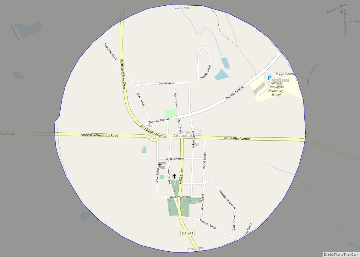
Attapulgus is a city in Decatur County, Georgia, United States. As of the 2020 census, the city had a population of 454.
The town’s name is an Indian word meaning “Dogwood”; due to the abundance of attapulgite, which makes up the clay soil throughout much of the Southeast, the mineral was named after the town.
Attapulgus was the birthplace of civil rights leader Hosea Williams (1926-2000), who is said to have been run out of town by a lynch mob at the age of 13. He is remembered around the world for his close association with Dr. Martin Luther King Jr., and for leading, with John Lewis, the famous march across the Edmund Pettus Bridge in Selma, Alabama, in 1965 that led to the passage of the landmark Voting Rights Act of 1965. Williams served on the Atlanta City Council, the DeKalb County Commission, and in the Georgia Senate. He also started a program to feed the hungry that has continued long after his death.
| Name: | Attapulgus city |
|---|---|
| LSAD Code: | 25 |
| LSAD Description: | city (suffix) |
| State: | Georgia |
| County: | Decatur County |
| Elevation: | 318 ft (97 m) |
| Total Area: | 0.80 sq mi (2.06 km²) |
| Land Area: | 0.80 sq mi (2.06 km²) |
| Water Area: | 0.00 sq mi (0.00 km²) |
| Total Population: | 454 |
| Population Density: | 570.35/sq mi (220.14/km²) |
| ZIP code: | 31715, 39815 |
| Area code: | 229 |
| FIPS code: | 1304084 |
| GNISfeature ID: | 0354409 |
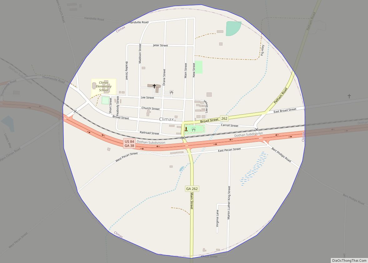
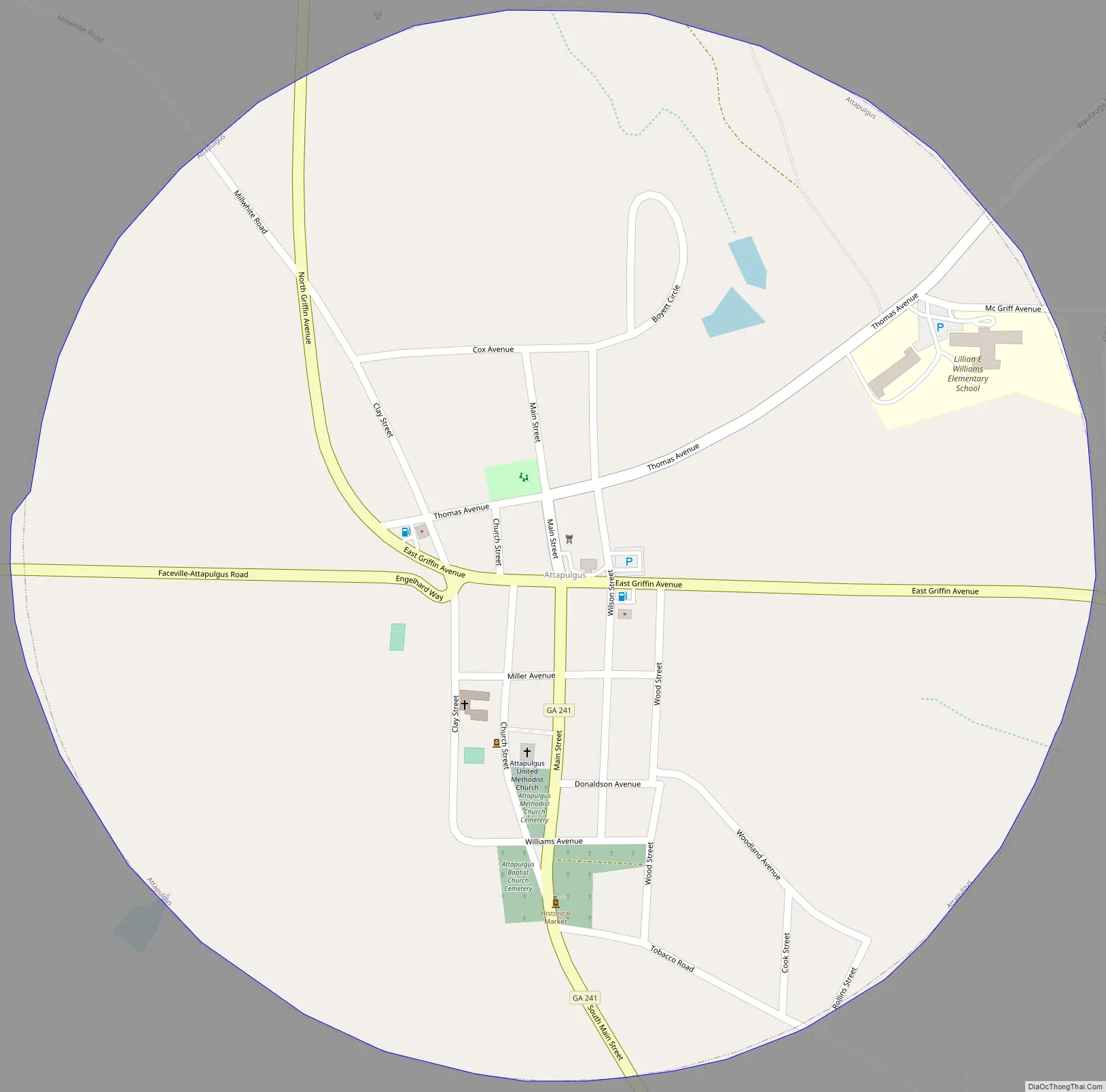
Online Interactive Map
Click on ![]() to view map in "full screen" mode.
to view map in "full screen" mode.
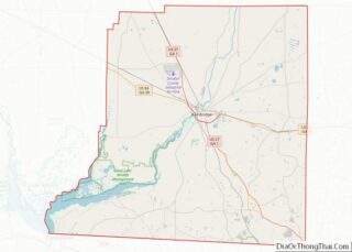
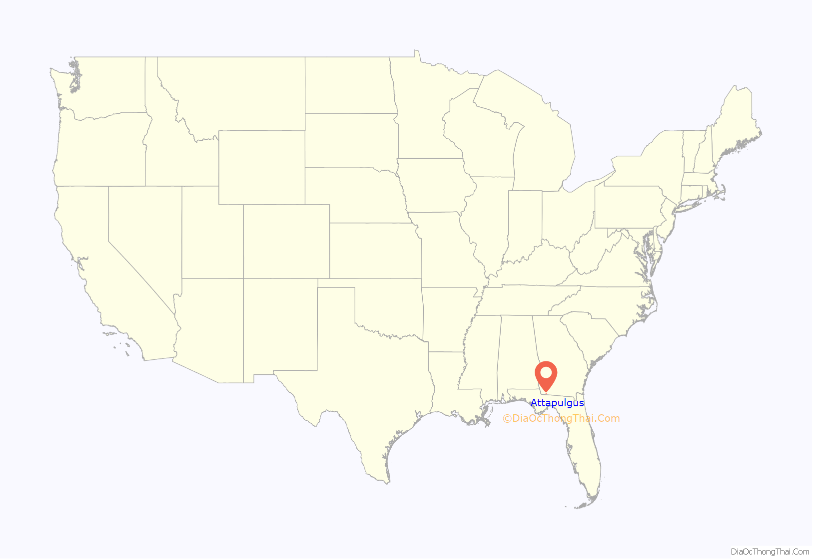
Attapulgus location map. Where is Attapulgus city?
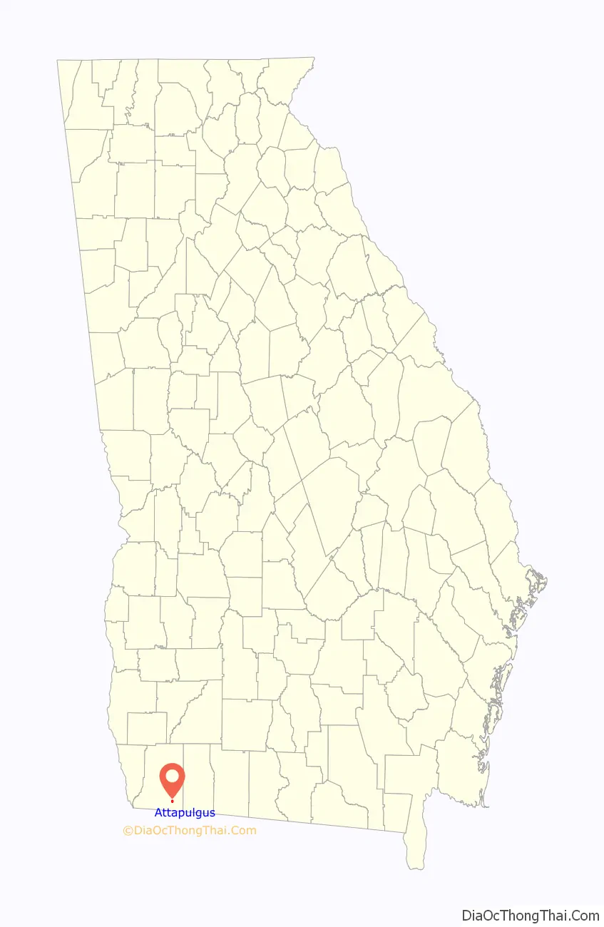
Attapulgus Road Map
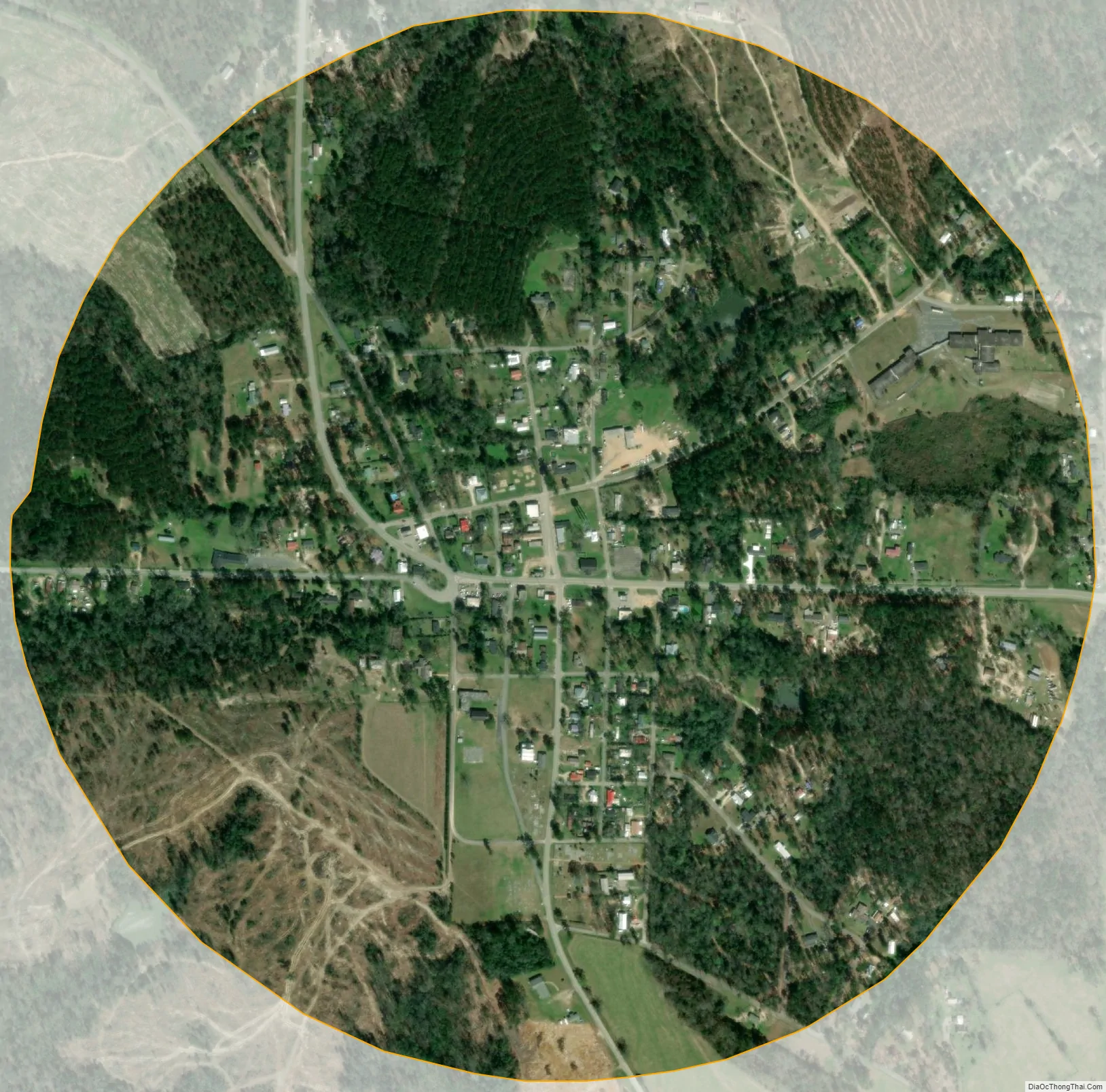
Attapulgus city Satellite Map
Geography
Attapulgus is located at 30°44′54″N 84°29′2″W / 30.74833°N 84.48389°W / 30.74833; -84.48389 (30.748243, -84.483810).
The city is located near the Georgia-Florida state line. U.S. Route 27 bypasses the city to the east, leading northwest 13 mi (21 km) to Bainbridge, the Decatur County seat, and southeast 30 mi (48 km) to Tallahassee, Florida. Georgia State Route 241 connects the city with the Florida state line 6 mi (9.7 km) to the southwest.
According to the United States Census Bureau, the city has a total area of 0.8 square miles (2.1 km), all land.
See also
Map of Georgia State and its subdivision:- Appling
- Atkinson
- Bacon
- Baker
- Baldwin
- Banks
- Barrow
- Bartow
- Ben Hill
- Berrien
- Bibb
- Bleckley
- Brantley
- Brooks
- Bryan
- Bulloch
- Burke
- Butts
- Calhoun
- Camden
- Candler
- Carroll
- Catoosa
- Charlton
- Chatham
- Chattahoochee
- Chattooga
- Cherokee
- Clarke
- Clay
- Clayton
- Clinch
- Cobb
- Coffee
- Colquitt
- Columbia
- Cook
- Coweta
- Crawford
- Crisp
- Dade
- Dawson
- Decatur
- DeKalb
- Dodge
- Dooly
- Dougherty
- Douglas
- Early
- Echols
- Effingham
- Elbert
- Emanuel
- Evans
- Fannin
- Fayette
- Floyd
- Forsyth
- Franklin
- Fulton
- Gilmer
- Glascock
- Glynn
- Gordon
- Grady
- Greene
- Gwinnett
- Habersham
- Hall
- Hancock
- Haralson
- Harris
- Hart
- Heard
- Henry
- Houston
- Irwin
- Jackson
- Jasper
- Jeff Davis
- Jefferson
- Jenkins
- Johnson
- Jones
- Lamar
- Lanier
- Laurens
- Lee
- Liberty
- Lincoln
- Long
- Lowndes
- Lumpkin
- Macon
- Madison
- Marion
- McDuffie
- McIntosh
- Meriwether
- Miller
- Mitchell
- Monroe
- Montgomery
- Morgan
- Murray
- Muscogee
- Newton
- Oconee
- Oglethorpe
- Paulding
- Peach
- Pickens
- Pierce
- Pike
- Polk
- Pulaski
- Putnam
- Quitman
- Rabun
- Randolph
- Richmond
- Rockdale
- Schley
- Screven
- Seminole
- Spalding
- Stephens
- Stewart
- Sumter
- Talbot
- Taliaferro
- Tattnall
- Taylor
- Telfair
- Terrell
- Thomas
- Tift
- Toombs
- Towns
- Treutlen
- Troup
- Turner
- Twiggs
- Union
- Upson
- Walker
- Walton
- Ware
- Warren
- Washington
- Wayne
- Webster
- Wheeler
- White
- Whitfield
- Wilcox
- Wilkes
- Wilkinson
- Worth
- Alabama
- Alaska
- Arizona
- Arkansas
- California
- Colorado
- Connecticut
- Delaware
- District of Columbia
- Florida
- Georgia
- Hawaii
- Idaho
- Illinois
- Indiana
- Iowa
- Kansas
- Kentucky
- Louisiana
- Maine
- Maryland
- Massachusetts
- Michigan
- Minnesota
- Mississippi
- Missouri
- Montana
- Nebraska
- Nevada
- New Hampshire
- New Jersey
- New Mexico
- New York
- North Carolina
- North Dakota
- Ohio
- Oklahoma
- Oregon
- Pennsylvania
- Rhode Island
- South Carolina
- South Dakota
- Tennessee
- Texas
- Utah
- Vermont
- Virginia
- Washington
- West Virginia
- Wisconsin
- Wyoming