Cohutta /kəˈhʌtə/ is a town in Whitfield County, Georgia, United States. It is part of the Dalton Metropolitan Statistical Area. The population was 764 at the 2020 census.
| Name: | Cohutta city |
|---|---|
| LSAD Code: | 25 |
| LSAD Description: | city (suffix) |
| State: | Georgia |
| County: | Whitfield County |
| Elevation: | 863 ft (263 m) |
| Total Area: | 4.92 sq mi (12.73 km²) |
| Land Area: | 4.92 sq mi (12.73 km²) |
| Water Area: | 0.00 sq mi (0.00 km²) |
| Total Population: | 764 |
| Population Density: | 155.44/sq mi (60.02/km²) |
| ZIP code: | 30710 |
| Area code: | 706/762 |
| FIPS code: | 1317496 |
| GNISfeature ID: | 0331428 |
| Website: | https://cohuttaga.com/ |
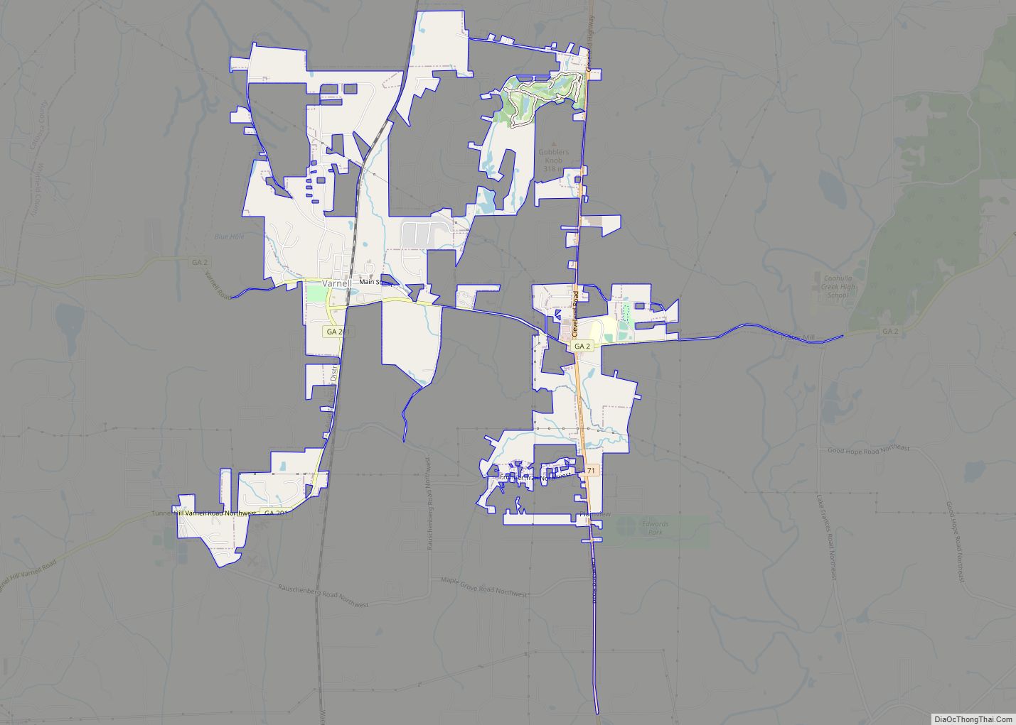
Online Interactive Map
Click on ![]() to view map in "full screen" mode.
to view map in "full screen" mode.
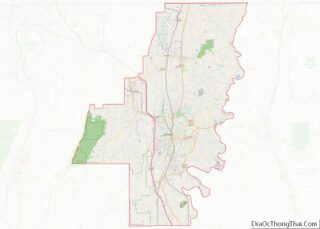
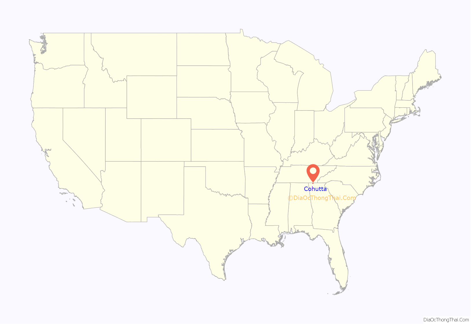
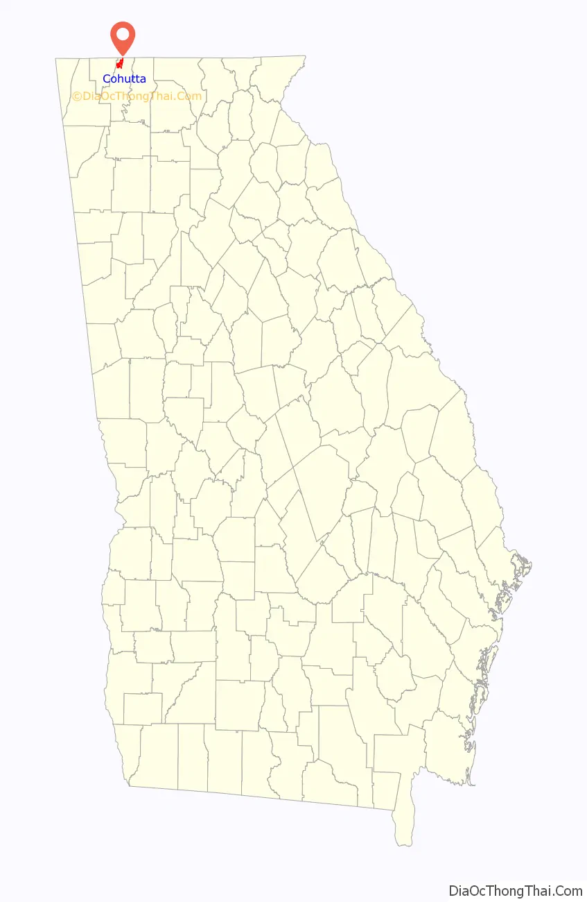
Cohutta location map. Where is Cohutta city?
History
The architecture of the small city gives the impression that it once displayed a vibrant downtown; this is perhaps due to the once-booming railroad system that still rumbles through Cohutta. Cohutta reflects the trajectory of many smaller towns in the United States. The town emerged as a stop on the railroad from Cleveland, Tennessee, to Dalton, Georgia, and served as a transportation and commercial center for the surrounding farming areas. According to local lore, the town was originally known as “Shakerag,” from the rag would-be passengers would wave to stop trains passing through.
In the 1920s, the town had a bank and a hotel, as well a high school, and was frequented especially in summer by inhabitants of Chattanooga seeking cooler temperatures. The high school burned down in 1952 and was not rebuilt.
As recently as the late 1960s, Cohutta had a small supermarket, three smaller “sundry” stores, a feed and seed, and a hair salon. The improvement of roads and the ease of access to larger cities (in this case, Dalton) drew shoppers away, so that by the 1990s, Cohutta had no large businesses at all with the exception of a downtown hardware store, a general store near the main road leading downtown from SR-71, and two convenience stores located at each end of town on the state highway route. Over the last decade, the surrounding area has become something of a bedroom community for Dalton, with housing developments taking over many of the farms in the area. Regardless, Cohutta maintained all town services during this time as required by the charter to include town police, fire, and sanitation services to incorporated properties.
Town services are still fully maintained in 2022 with two town clerks, a staffed public works department, municipal court staff with judge and solicitor, an environmental court, and a full-service town police department which is available 24-7-365. In 2021-2022 the town has approximately 20+ employees in various roles and positions.
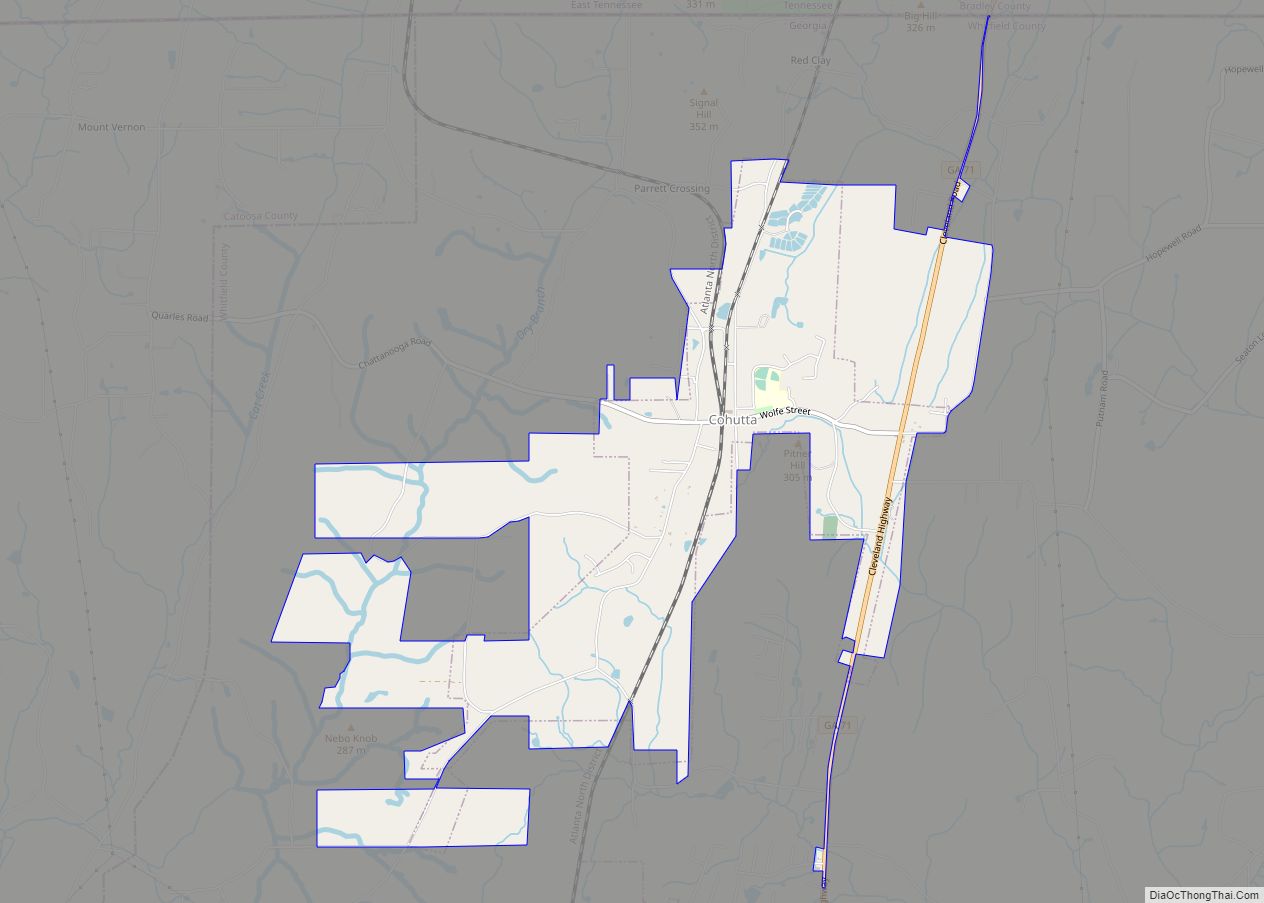
Cohutta Road Map
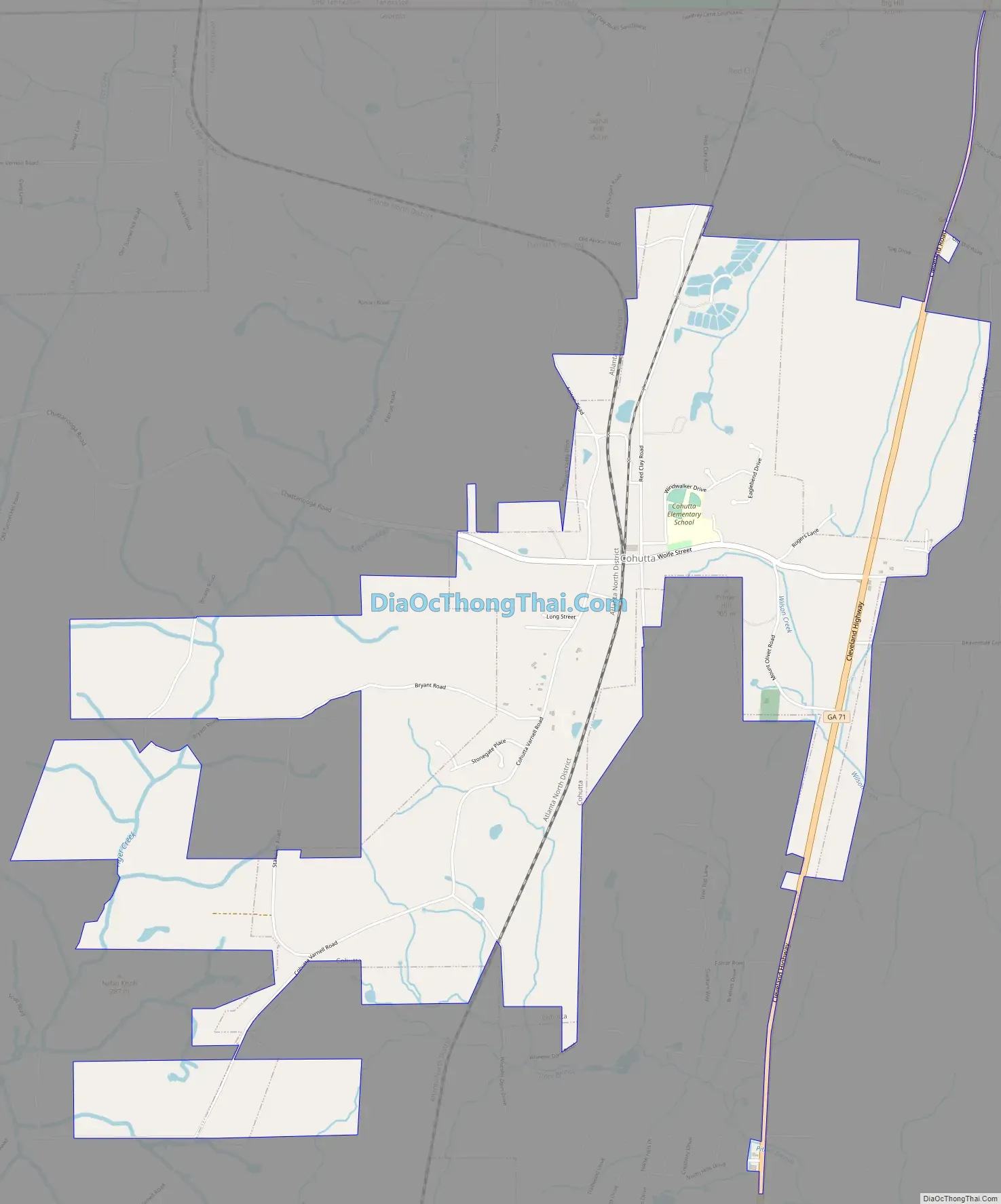
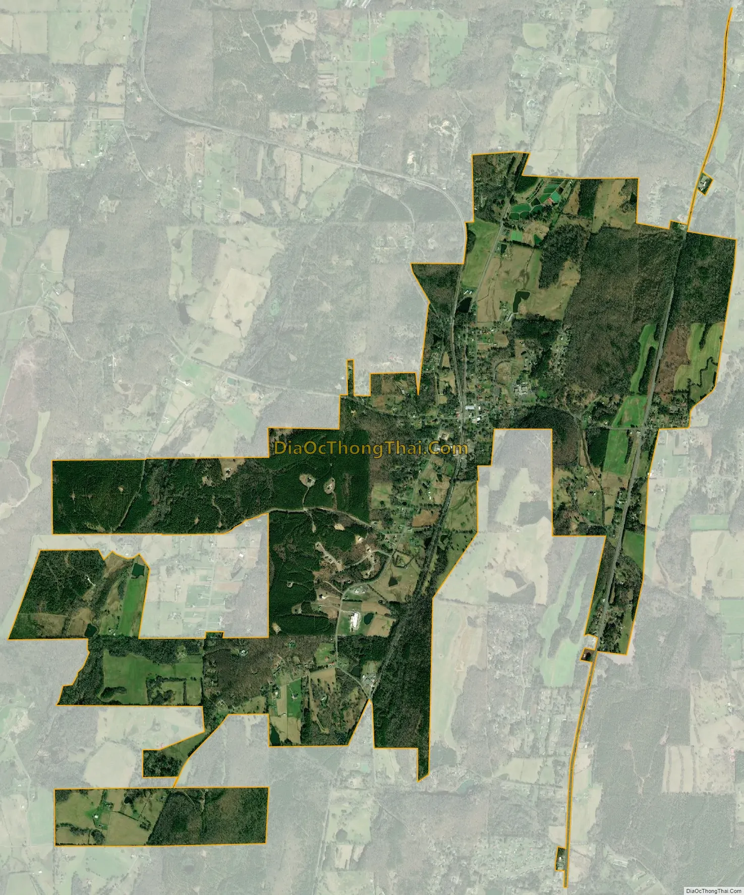
Cohutta city Satellite Map
Geography
Cohutta is located at 34°57′33″N 84°57′10″W / 34.95917°N 84.95278°W / 34.95917; -84.95278 (34.959202, -84.952908).
According to the United States Census Bureau, the town has a total area of 2.5 square miles (6.5 km), of which 2.5 square miles (6.5 km) is land and 0.04 square miles (0.10 km) (1.59%) is water. Cohutta also has 4.2 miles of state highway (SR-71 also known as Cleveland Highway), from the Tennessee state line to Bank of Dalton Drive in their jurisdiction, per Georgia state databases.
See also
Map of Georgia State and its subdivision:- Appling
- Atkinson
- Bacon
- Baker
- Baldwin
- Banks
- Barrow
- Bartow
- Ben Hill
- Berrien
- Bibb
- Bleckley
- Brantley
- Brooks
- Bryan
- Bulloch
- Burke
- Butts
- Calhoun
- Camden
- Candler
- Carroll
- Catoosa
- Charlton
- Chatham
- Chattahoochee
- Chattooga
- Cherokee
- Clarke
- Clay
- Clayton
- Clinch
- Cobb
- Coffee
- Colquitt
- Columbia
- Cook
- Coweta
- Crawford
- Crisp
- Dade
- Dawson
- Decatur
- DeKalb
- Dodge
- Dooly
- Dougherty
- Douglas
- Early
- Echols
- Effingham
- Elbert
- Emanuel
- Evans
- Fannin
- Fayette
- Floyd
- Forsyth
- Franklin
- Fulton
- Gilmer
- Glascock
- Glynn
- Gordon
- Grady
- Greene
- Gwinnett
- Habersham
- Hall
- Hancock
- Haralson
- Harris
- Hart
- Heard
- Henry
- Houston
- Irwin
- Jackson
- Jasper
- Jeff Davis
- Jefferson
- Jenkins
- Johnson
- Jones
- Lamar
- Lanier
- Laurens
- Lee
- Liberty
- Lincoln
- Long
- Lowndes
- Lumpkin
- Macon
- Madison
- Marion
- McDuffie
- McIntosh
- Meriwether
- Miller
- Mitchell
- Monroe
- Montgomery
- Morgan
- Murray
- Muscogee
- Newton
- Oconee
- Oglethorpe
- Paulding
- Peach
- Pickens
- Pierce
- Pike
- Polk
- Pulaski
- Putnam
- Quitman
- Rabun
- Randolph
- Richmond
- Rockdale
- Schley
- Screven
- Seminole
- Spalding
- Stephens
- Stewart
- Sumter
- Talbot
- Taliaferro
- Tattnall
- Taylor
- Telfair
- Terrell
- Thomas
- Tift
- Toombs
- Towns
- Treutlen
- Troup
- Turner
- Twiggs
- Union
- Upson
- Walker
- Walton
- Ware
- Warren
- Washington
- Wayne
- Webster
- Wheeler
- White
- Whitfield
- Wilcox
- Wilkes
- Wilkinson
- Worth
- Alabama
- Alaska
- Arizona
- Arkansas
- California
- Colorado
- Connecticut
- Delaware
- District of Columbia
- Florida
- Georgia
- Hawaii
- Idaho
- Illinois
- Indiana
- Iowa
- Kansas
- Kentucky
- Louisiana
- Maine
- Maryland
- Massachusetts
- Michigan
- Minnesota
- Mississippi
- Missouri
- Montana
- Nebraska
- Nevada
- New Hampshire
- New Jersey
- New Mexico
- New York
- North Carolina
- North Dakota
- Ohio
- Oklahoma
- Oregon
- Pennsylvania
- Rhode Island
- South Carolina
- South Dakota
- Tennessee
- Texas
- Utah
- Vermont
- Virginia
- Washington
- West Virginia
- Wisconsin
- Wyoming