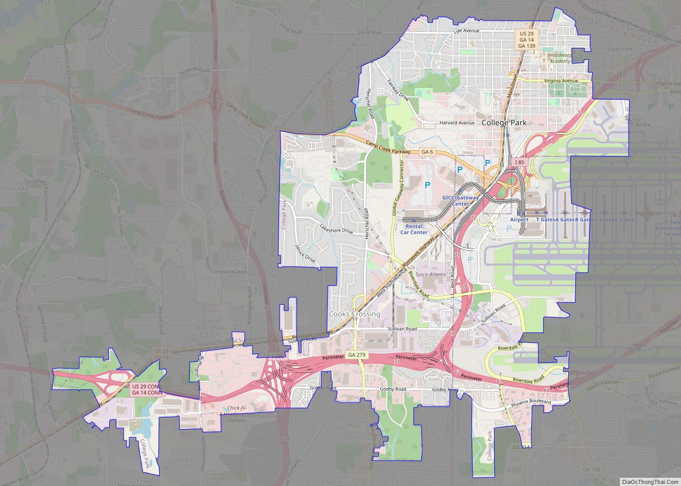
College Park is a city in Fulton and Clayton counties, Georgia, United States, adjacent to the southern boundary of the city of Atlanta. As of the 2020 census, the population was 13,930. Hartsfield–Jackson Atlanta International Airport is partially located in the city’s boundaries (including the domestic terminal, Concourse T, Concourse A, and about two-thirds of Concourse B), and the Georgia International Convention Center, owned and operated by the City of College Park, is within the city limits. The city is home to the fourth-largest urban historical district registered with the National Register of Historic Places in the state of Georgia. The city is also home to the Gateway Center Arena, home of the College Park Skyhawks and Atlanta Dream.
| Name: | College Park city |
|---|---|
| LSAD Code: | 25 |
| LSAD Description: | city (suffix) |
| State: | Georgia |
| County: | Clayton County, Fulton County |
| Elevation: | 1,037 ft (316 m) |
| Total Area: | 11.21 sq mi (29.03 km²) |
| Land Area: | 11.16 sq mi (28.91 km²) |
| Water Area: | 0.05 sq mi (0.12 km²) |
| Total Population: | 13,930 |
| Population Density: | 1,248.10/sq mi (481.91/km²) |
| ZIP code: | 30337, 30349 |
| Area code: | 404/678/470 |
| FIPS code: | 1317776 |
| GNISfeature ID: | 2404098 |
| Website: | www.collegeparkga.com |
Online Interactive Map
Click on ![]() to view map in "full screen" mode.
to view map in "full screen" mode.
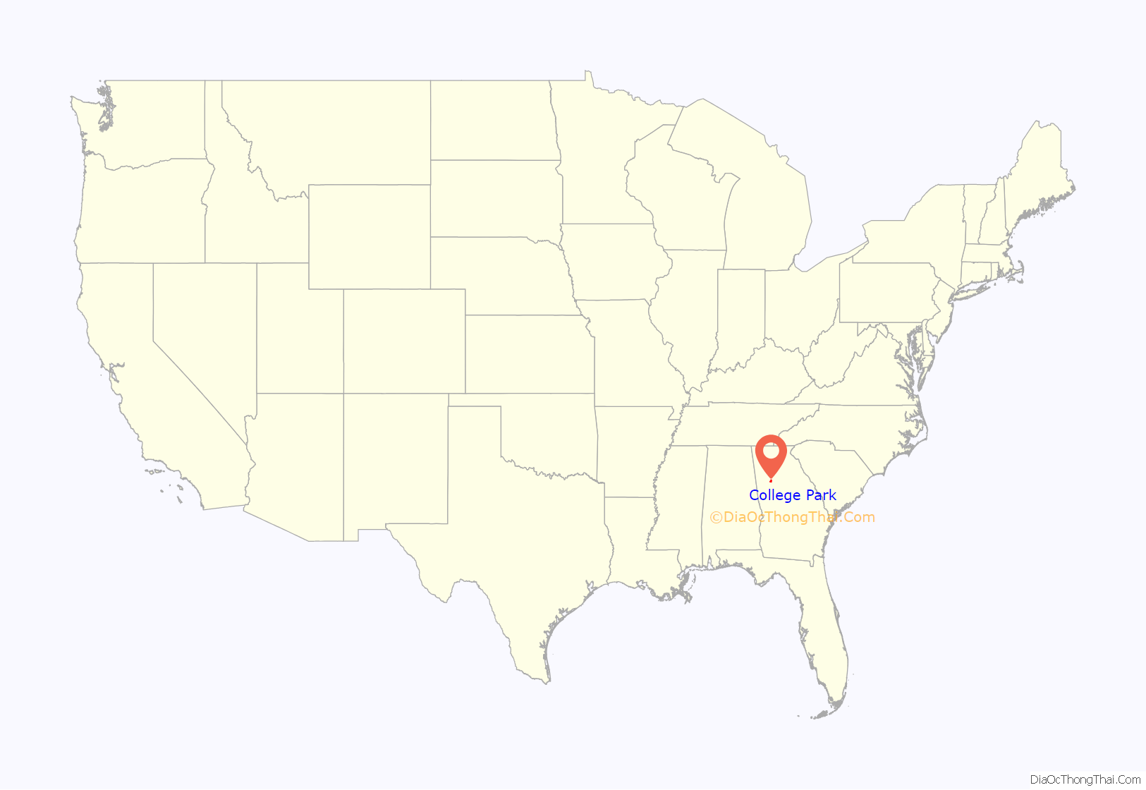
College Park location map. Where is College Park city?
History
19th century
The community that would become College Park was founded as Atlantic City in 1890 as a depot on the Atlanta and West Point Railroad. The town was renamed Manchester when it was incorporated as a city in 1891. It was renamed again as the city of College Park in 1896. The city’s name came from being the home of Cox College (where the city hall and other buildings now stand) and Georgia Military Academy (now the Woodward Academy). The east–west avenues in College Park are named for Ivy League colleges, and the north–south streets are named for influential College Park residents.
20th century
During World War I, the name of “Wilhelm Street” was changed to “Victoria street” in “solidarity with our British brethren.” At the same time “Berlin Avenue” was changed to “Cambridge Avenue” and the name of “German Lane” was changed to “English Lane.” The history of College Park has been closely linked with what is now known as Hartsfield–Jackson Atlanta International Airport—airport development having spurred several radical changes to the landscape of the municipality over the course of the 20th century. In 1966, a study funded by the Department of Housing and Urban Development suggested that the introduction and expansion of jet aircraft travel would place the airport and surrounding communities, including College Park, into conflict; ultimately, the study concluded that “the only effective way to control the use of land is to own it,” suggesting that the airport would have to acquire the properties it would be in conflict with in order to expand.
In the 1970s and 1980s, large swaths of property in College Park were purchased using information detailed in The Hartsfield-Jackson Atlanta International Airport Noise Land Reuse Plan, which allowed the airport to apply for federal funding to purchase property deemed to be in so-called “noise land.” The 1985 Chuck Norris film Invasion U.S.A. was notoriously filmed in these abandoned portions of College Park; houses owned by the City of Atlanta and the FAA were allowed to be blown up to simulate bazooka attacks, a decision that has faced modern day criticism due to the fact that nearby properties were still in the process of being purchased. This site would eventually, in 2003, in part be home to the Georgia International Convention Center; the center officially opened in 1985 at a separate location, but was relocated to the area in response to planned airport runway expansions. Today, the GICC is the second largest convention center in Georgia, featuring a carpeted ballroom and multiple spaces for meetings, conferences and conventions. It is the only convention center in the country that also houses a SkyTrain with direct rail access to an international airport. Directly next to the Georgia International Convention Center is the Gateway Center Arena, which opened in November 2019, home to the NBA’s G-League College Park Skyhawks and where the WNBA’s Atlanta Dream will play their 2020 season.
In 1978, the College Park Historical Society was founded in order to combat proposed northward expansion of the airport; the society succeeded in lobbying against proposed flight paths over the neighborhood colloquially known as Historic College Park, as well as registered swaths of homes and the Main Street commercial district with the National Register of Historic Places, eventually resulting in the establishment of the College Park Historic District.
Between the 1980s and the early 2000s, as part of continued execution of the FAA noise abatement program, the City of Atlanta and the FAA purchased roughly 320 acres of property (containing residential structures, churches, and some small commercial buildings) immediately adjacent to the west side of downtown College Park, resulting in a multitude of properties sitting abandoned for decades. The totality of these eventually abandoned properties purchased between the 1970s and the 2000s have been described as a major player in shaping a negative public image of the city, second only to the perception of crime in the area.
Recent history
Although the Atlanta hip hop music scene in the 1980s and 1990s was largely credited to artists from nearby suburban Decatur, College Park and the adjacent city of East Point have been strongly associated with artists and record producers from “SWATS” (“Southwest Atlanta, Too Strong”), who have substantially contributed to the evolution of the southern hip hop genre over the course of the 2000s.
While the controversial process of gentrification started in the larger Atlanta Metropolitan Area in the 1970s, it was only in the latter 2010s that redevelopment substantially spread to College Park proper. In 2016, the College Park government embarked on a 20-year development plan which included goals “to expand its economic base while keeping its small town historic characteristics,” and to “make use of its available land to attract new employers and residential opportunities.” 2017 saw the construction of a mixed-use project which contained the first mid-rise apartments to be constructed in the city since 1969. From the 1990s and into the 2010s, the City of College Park succeeded in repurchasing the entirety of the 320 acres adjacent to downtown; in 2018, concurrent with substantial commercial and residential development in the area, the City of College Park announced major redevelopment of this abandoned area, now referred to as “Airport City,” as part of a larger transit-oriented revitalization plan referred to as “Aerotropolis.”
Historic district
The city center is part of the College Park Historic District, a 606-acre historic district listed with the National Register of Historic Places. According to the federal agency, the district contains 853 recognized historical resources constructed in the late 19th and early 20th centuries.
The majority of the 852 historic structures are homes of the Queen Anne style, various Late 19th and 20th Century Revivals, and bungalows of the American Craftsman style, all dating from 1882 to 1946. Other major historical structures include: The College Park Woman’s Clubhouse at Camellia Hall (1927); the College Park First United Methodist Church (1904); a United States Postal Service Office (1937); four schools (constructed between 1914 and 1942); and the College Park Depot (pre-1900), part of the Atlanta & West Point Railroad.
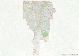
College Park Road Map
College Park city Satellite Map
Geography
College Park is located on the border of Fulton and Clayton counties.
According to the United States Census Bureau, the city has a total area of 10.1 square miles (26.1 km), of which 0.019 square miles (0.05 km), or 0.19%, is water.
See also
Map of Georgia State and its subdivision:- Appling
- Atkinson
- Bacon
- Baker
- Baldwin
- Banks
- Barrow
- Bartow
- Ben Hill
- Berrien
- Bibb
- Bleckley
- Brantley
- Brooks
- Bryan
- Bulloch
- Burke
- Butts
- Calhoun
- Camden
- Candler
- Carroll
- Catoosa
- Charlton
- Chatham
- Chattahoochee
- Chattooga
- Cherokee
- Clarke
- Clay
- Clayton
- Clinch
- Cobb
- Coffee
- Colquitt
- Columbia
- Cook
- Coweta
- Crawford
- Crisp
- Dade
- Dawson
- Decatur
- DeKalb
- Dodge
- Dooly
- Dougherty
- Douglas
- Early
- Echols
- Effingham
- Elbert
- Emanuel
- Evans
- Fannin
- Fayette
- Floyd
- Forsyth
- Franklin
- Fulton
- Gilmer
- Glascock
- Glynn
- Gordon
- Grady
- Greene
- Gwinnett
- Habersham
- Hall
- Hancock
- Haralson
- Harris
- Hart
- Heard
- Henry
- Houston
- Irwin
- Jackson
- Jasper
- Jeff Davis
- Jefferson
- Jenkins
- Johnson
- Jones
- Lamar
- Lanier
- Laurens
- Lee
- Liberty
- Lincoln
- Long
- Lowndes
- Lumpkin
- Macon
- Madison
- Marion
- McDuffie
- McIntosh
- Meriwether
- Miller
- Mitchell
- Monroe
- Montgomery
- Morgan
- Murray
- Muscogee
- Newton
- Oconee
- Oglethorpe
- Paulding
- Peach
- Pickens
- Pierce
- Pike
- Polk
- Pulaski
- Putnam
- Quitman
- Rabun
- Randolph
- Richmond
- Rockdale
- Schley
- Screven
- Seminole
- Spalding
- Stephens
- Stewart
- Sumter
- Talbot
- Taliaferro
- Tattnall
- Taylor
- Telfair
- Terrell
- Thomas
- Tift
- Toombs
- Towns
- Treutlen
- Troup
- Turner
- Twiggs
- Union
- Upson
- Walker
- Walton
- Ware
- Warren
- Washington
- Wayne
- Webster
- Wheeler
- White
- Whitfield
- Wilcox
- Wilkes
- Wilkinson
- Worth
- Alabama
- Alaska
- Arizona
- Arkansas
- California
- Colorado
- Connecticut
- Delaware
- District of Columbia
- Florida
- Georgia
- Hawaii
- Idaho
- Illinois
- Indiana
- Iowa
- Kansas
- Kentucky
- Louisiana
- Maine
- Maryland
- Massachusetts
- Michigan
- Minnesota
- Mississippi
- Missouri
- Montana
- Nebraska
- Nevada
- New Hampshire
- New Jersey
- New Mexico
- New York
- North Carolina
- North Dakota
- Ohio
- Oklahoma
- Oregon
- Pennsylvania
- Rhode Island
- South Carolina
- South Dakota
- Tennessee
- Texas
- Utah
- Vermont
- Virginia
- Washington
- West Virginia
- Wisconsin
- Wyoming
