Decatur (/dəˈkeɪtər/) is a city in, and the county seat of, DeKalb County, Georgia, which is part of the Atlanta metropolitan area. With a population of 24,928 in the 2020 census, the municipality is sometimes assumed to be larger since multiple ZIP Codes in unincorporated DeKalb County bear Decatur as the address. The city is served by three MARTA rail stations (Decatur, East Lake, and Avondale). The city is located approximately five miles (eight kilometers) northeast of Downtown Atlanta and shares its western border with both the city of Atlanta (the Kirkwood and Lake Claire neighborhoods) and unincorporated DeKalb County. The Druid Hills neighborhood is to the northwest of Decatur. The unofficial motto of Decatur used by some residents is “Everything is Greater in Decatur.”
| Name: | Decatur city |
|---|---|
| LSAD Code: | 25 |
| LSAD Description: | city (suffix) |
| State: | Georgia |
| County: | DeKalb County |
| Incorporated: | December 10, 1823; 199 years ago (1823-12-10) |
| Elevation: | 1,043 ft (318 m) |
| Total Area: | 4.60 sq mi (11.92 km²) |
| Land Area: | 4.60 sq mi (11.91 km²) |
| Water Area: | 0.01 sq mi (0.01 km²) |
| Total Population: | 24,928 |
| Population Density: | 5,422.67/sq mi (2,093.77/km²) |
| Area code: | 404, 678 and 470 |
| FIPS code: | 1322052 |
| GNISfeature ID: | 0331532 |
| Website: | decaturga.com |
Online Interactive Map
Click on ![]() to view map in "full screen" mode.
to view map in "full screen" mode.
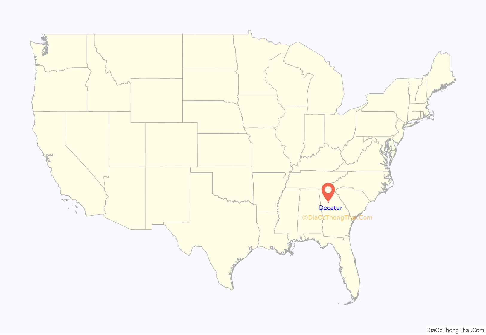
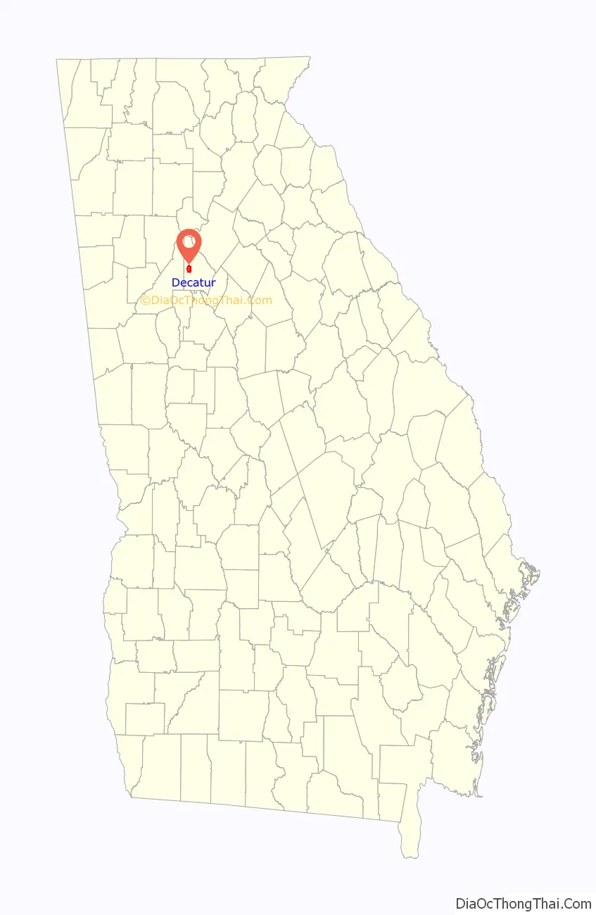
Decatur location map. Where is Decatur city?
History
Early history
Prior to European settlement, the Decatur area was largely forested (a remnant of old-growth forest near Decatur is preserved as Fernbank Forest). Decatur was established at the intersection of two Native American trails: the Sandtown, which led east from the Chattahoochee River at Utoy Creek, and the Shallowford, which follows today’s Clairmont Road, and eventually crossed near Roswell. A site for the DeKalb County courthouse was designated in 1822 in what would become downtown Decatur; the city of Decatur was incorporated on December 10, 1823. It was named for United States Navy Commodore Stephen Decatur.
American Civil War
During the American Civil War, Decatur became a strategic site in Sherman’s Atlanta Campaign. In July 1864, Major-General James McPherson occupied the town to cut off the Confederates’ supply line from Augusta. On July 22, during the Battle of Atlanta, Confederate cavalry under Major-General Joseph Wheeler attacked McPherson’s supply wagons and the Union troops left to defend the wagons. A historical marker at the old courthouse marks the site of this skirmish.
20th century
In the second half of the twentieth century the metropolitan area of Atlanta expanded into unincorporated DeKalb County, eventually surrounding two sides of the town of Decatur. Concurrently many well-to-do and middle class white Americans fled the area to more distant suburbs. The 1960s and 1970s witnessed dramatic drops in property values. However, more recently the city has regained economic vigor, partially thanks to several long-term downtown development plans that have come to fruition, making Decatur a trendy small mixed-use district with easy transit to downtown Atlanta. Over the past twenty years, it has gained a local and national reputation as a progressive city with a high level of citizen involvement that retains a small-town feel despite its proximity to Atlanta.
Decatur Road Map
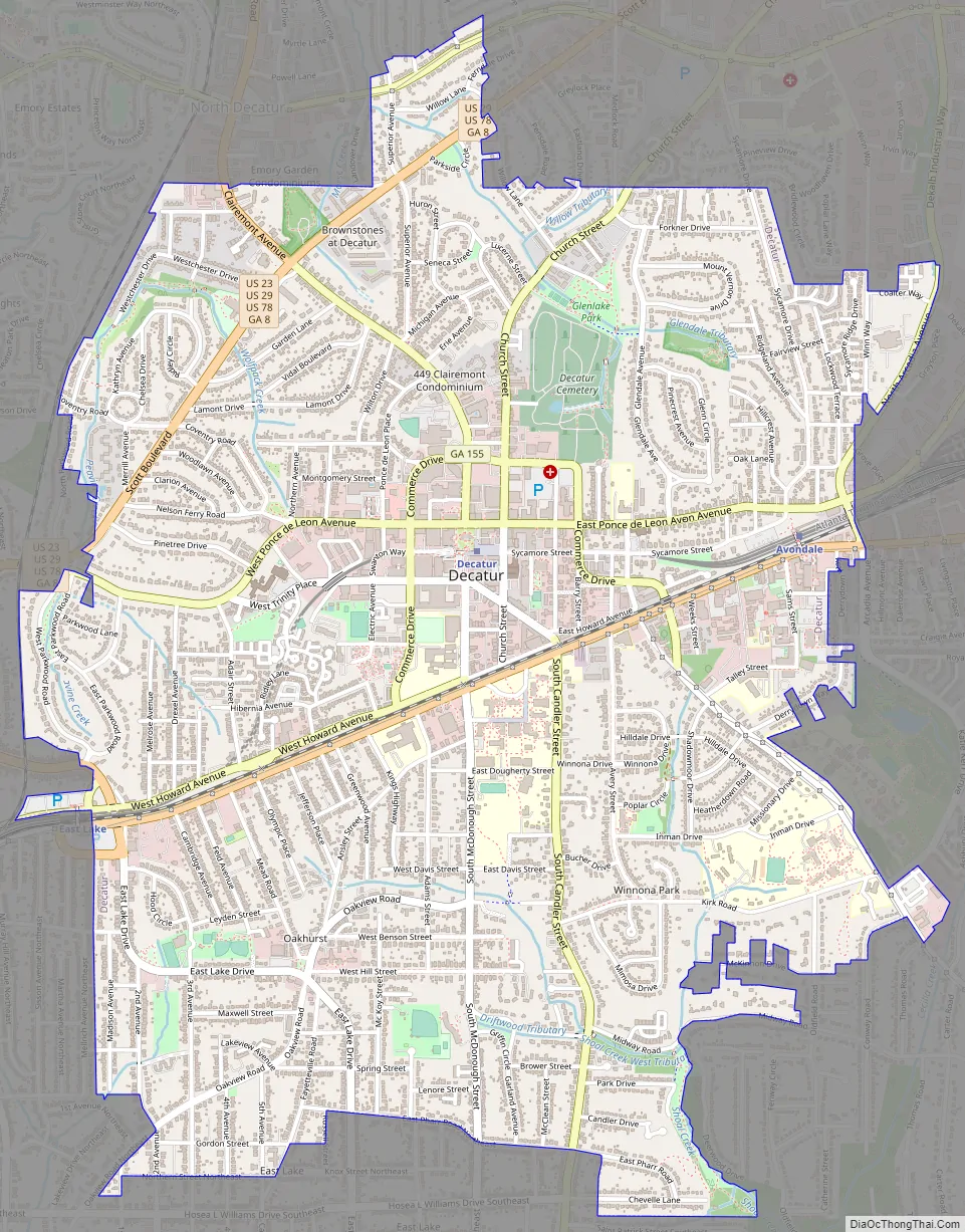
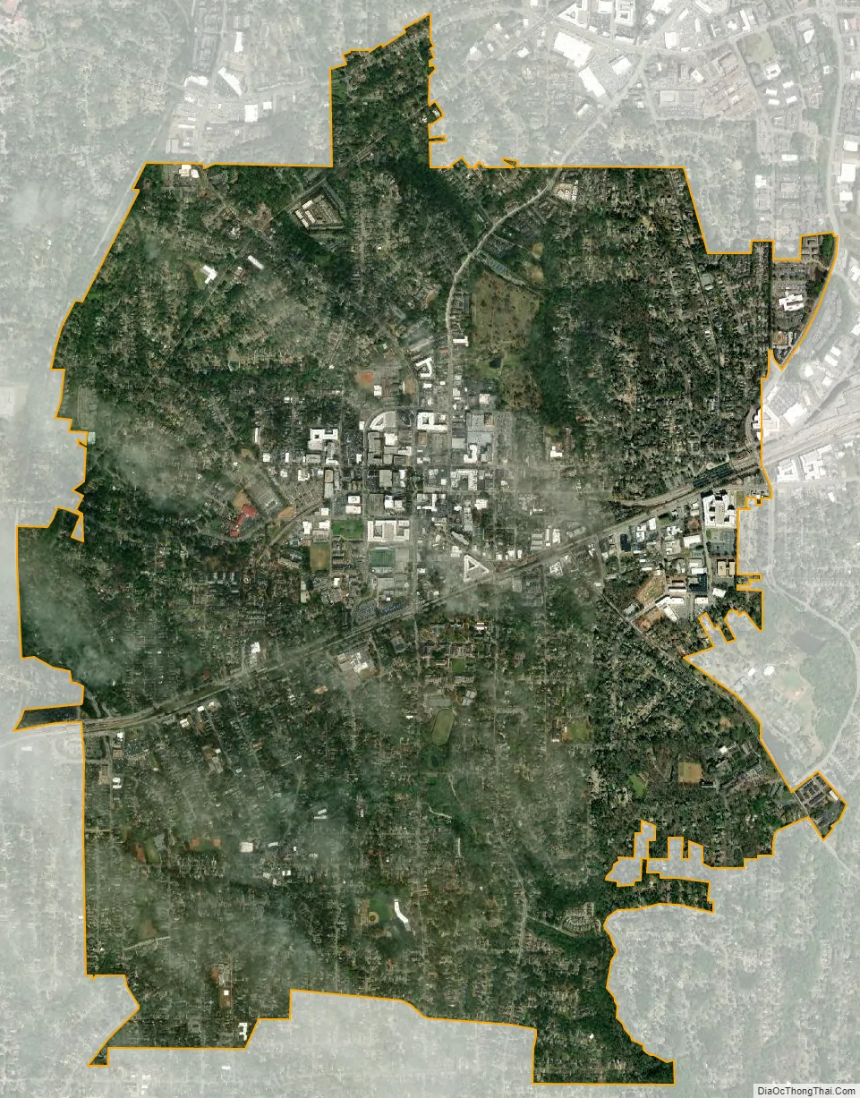
Decatur city Satellite Map
Geography
Decatur is located at 33°46′17″N 84°17′52″W / 33.77139°N 84.29778°W / 33.77139; -84.29778 (33.771355, -84.297732).
According to the United States Census Bureau, the city has a total area of 4.2 square miles (11 square kilometers), all land.
The Eastern Continental Divide bisects the city along the CSX (formerly Georgia Railroad) trackage right of way.
See also
Map of Georgia State and its subdivision:- Appling
- Atkinson
- Bacon
- Baker
- Baldwin
- Banks
- Barrow
- Bartow
- Ben Hill
- Berrien
- Bibb
- Bleckley
- Brantley
- Brooks
- Bryan
- Bulloch
- Burke
- Butts
- Calhoun
- Camden
- Candler
- Carroll
- Catoosa
- Charlton
- Chatham
- Chattahoochee
- Chattooga
- Cherokee
- Clarke
- Clay
- Clayton
- Clinch
- Cobb
- Coffee
- Colquitt
- Columbia
- Cook
- Coweta
- Crawford
- Crisp
- Dade
- Dawson
- Decatur
- DeKalb
- Dodge
- Dooly
- Dougherty
- Douglas
- Early
- Echols
- Effingham
- Elbert
- Emanuel
- Evans
- Fannin
- Fayette
- Floyd
- Forsyth
- Franklin
- Fulton
- Gilmer
- Glascock
- Glynn
- Gordon
- Grady
- Greene
- Gwinnett
- Habersham
- Hall
- Hancock
- Haralson
- Harris
- Hart
- Heard
- Henry
- Houston
- Irwin
- Jackson
- Jasper
- Jeff Davis
- Jefferson
- Jenkins
- Johnson
- Jones
- Lamar
- Lanier
- Laurens
- Lee
- Liberty
- Lincoln
- Long
- Lowndes
- Lumpkin
- Macon
- Madison
- Marion
- McDuffie
- McIntosh
- Meriwether
- Miller
- Mitchell
- Monroe
- Montgomery
- Morgan
- Murray
- Muscogee
- Newton
- Oconee
- Oglethorpe
- Paulding
- Peach
- Pickens
- Pierce
- Pike
- Polk
- Pulaski
- Putnam
- Quitman
- Rabun
- Randolph
- Richmond
- Rockdale
- Schley
- Screven
- Seminole
- Spalding
- Stephens
- Stewart
- Sumter
- Talbot
- Taliaferro
- Tattnall
- Taylor
- Telfair
- Terrell
- Thomas
- Tift
- Toombs
- Towns
- Treutlen
- Troup
- Turner
- Twiggs
- Union
- Upson
- Walker
- Walton
- Ware
- Warren
- Washington
- Wayne
- Webster
- Wheeler
- White
- Whitfield
- Wilcox
- Wilkes
- Wilkinson
- Worth
- Alabama
- Alaska
- Arizona
- Arkansas
- California
- Colorado
- Connecticut
- Delaware
- District of Columbia
- Florida
- Georgia
- Hawaii
- Idaho
- Illinois
- Indiana
- Iowa
- Kansas
- Kentucky
- Louisiana
- Maine
- Maryland
- Massachusetts
- Michigan
- Minnesota
- Mississippi
- Missouri
- Montana
- Nebraska
- Nevada
- New Hampshire
- New Jersey
- New Mexico
- New York
- North Carolina
- North Dakota
- Ohio
- Oklahoma
- Oregon
- Pennsylvania
- Rhode Island
- South Carolina
- South Dakota
- Tennessee
- Texas
- Utah
- Vermont
- Virginia
- Washington
- West Virginia
- Wisconsin
- Wyoming