Columbus is a consolidated city-county located on the west-central border of the U.S. state of Georgia. Columbus lies on the Chattahoochee River directly across from Phenix City, Alabama. It is the county seat of Muscogee County, with which it officially merged in 1970. Columbus is the second-largest city in Georgia (after Atlanta), and fields the state’s fourth-largest metropolitan area. At the 2020 census, Columbus had a population of 206,922, with 328,883 in the Columbus metropolitan area. The metro area joins the nearby Alabama cities of Auburn and Opelika to form the Columbus–Auburn–Opelika Combined Statistical Area, which had an estimated population of 486,645 in 2019.
Columbus lies 100 miles (160 km) southwest of Atlanta. Fort Moore, the United States Army’s Maneuver Center of Excellence and a major employer, is located south of the city in southern Muscogee and Chattahoochee counties. Columbus is home to museums and tourism sites, including the National Infantry Museum, dedicated to the U.S. Army’s Infantry Branch. It has the longest urban whitewater rafting course in the world constructed on the Chattahoochee River.
| Name: | Columbus city |
|---|---|
| LSAD Code: | 25 |
| LSAD Description: | city (suffix) |
| State: | Georgia |
| County: | Muscogee County |
| Founded: | 1828 |
| Elevation: | 243 ft (74 m) |
| Land Area: | 216.50 sq mi (560.73 km²) |
| Water Area: | 4.51 sq mi (11.68 km²) |
| Population Density: | 955.76/sq mi (369.02/km²) |
| ZIP code: | 31820, 31829, 31900–09, 31914, 31917, 31993–94, 31997–99 |
| Area code: | 706, 762 |
| FIPS code: | 1319000 |
| GNISfeature ID: | 0331158 |
| Website: | www.columbusga.gov |
Online Interactive Map
Click on ![]() to view map in "full screen" mode.
to view map in "full screen" mode.
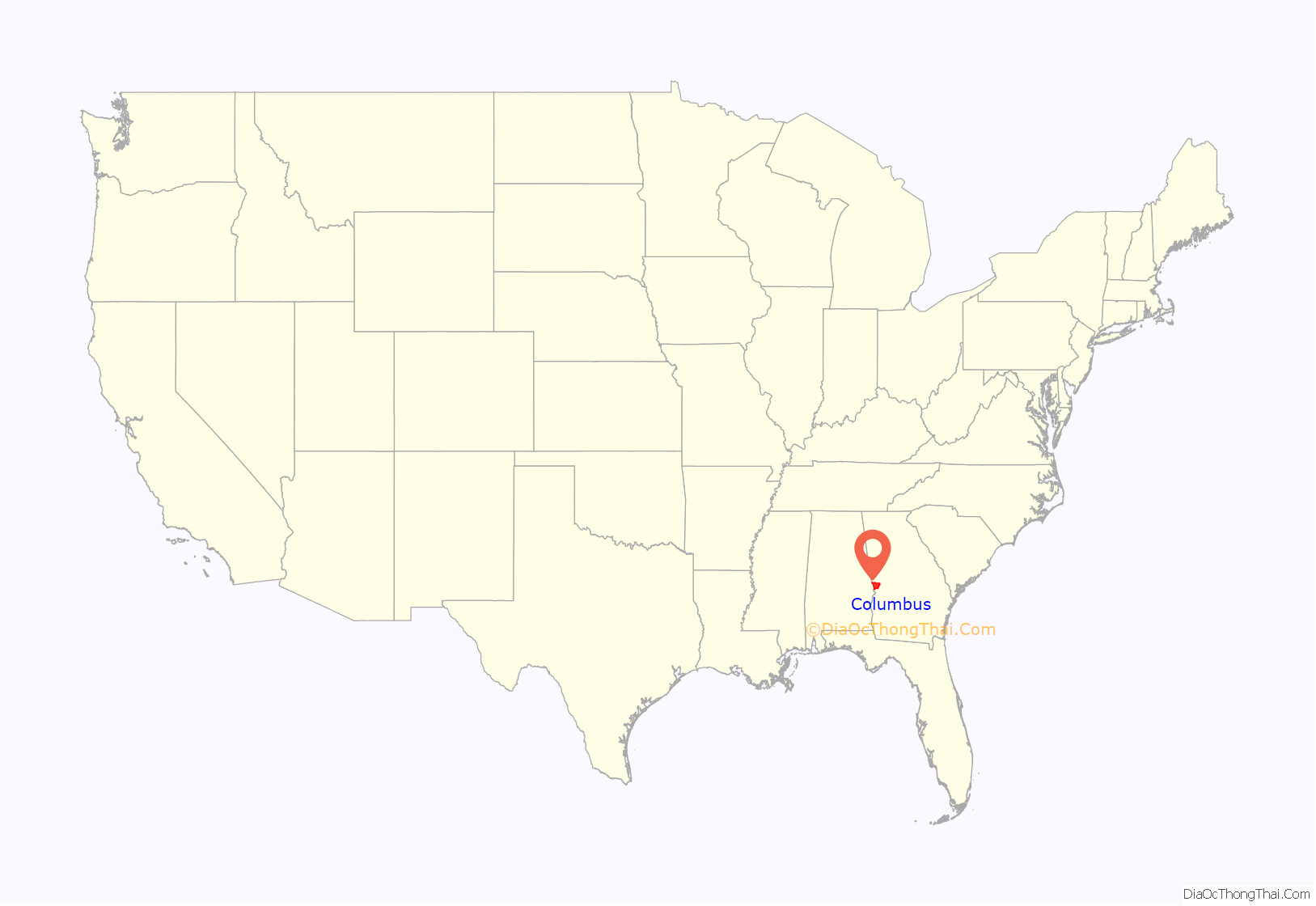
Columbus location map. Where is Columbus city?
History
Beginnings
This was for centuries the traditional territory of the Creek Indians, who became known as one of the Five Civilized Tribes of the Southeast after European contact. Those who lived closest to white-occupied areas conducted considerable trading and adopted some European-American ways.
Founded in 1828 by an act of the Georgia Legislature, Columbus was situated at the beginning of the navigable portion of the Chattahoochee River and on the last stretch of the Federal Road before entering Alabama. The city was named for Christopher Columbus. The plan for the city was drawn up by Dr. Edwin L. DeGraffenried, who placed the town on a bluff overlooking the river. Across the river to the west, where Phenix City, Alabama, is now located, lived several tribes of the Creek and other Georgia and Alabama indigenous peoples. Most Creeks moved west with the 1826 Treaty of Washington. Those who stayed and made war were forcibly removed in 1836.
The river served as Columbus’s connection to the world, particularly enabling it to ship its commodity cotton crops from the plantations to the international cotton market via New Orleans and ultimately Liverpool, England. The city’s commercial importance increased in the 1850s with the arrival of the railroad. In addition, textile mills were developed along the river, bringing industry to an area reliant upon agriculture. By 1860, the city was one of the more important industrial centers of the South, earning it the nickname the Lowell of the South, referring to an important textile mill town in Massachusetts.
Civil War and Reconstruction
When the Civil War broke out in 1861, the industries of Columbus expanded their production; this became one of the most important centers of industry in the Confederacy. During the war, Columbus ranked second to Richmond in the manufacture of supplies for the Confederate army. The Eagle Manufacturing Company made various textiles, especially woolens for Confederate uniforms. The Columbus Iron Works manufactured cannons and machinery for the nearby Confederate Navy shipyard, Greenwood and Gray made firearms, and Louis and Elias Haimon produced swords and bayonets. Smaller firms provided additional munitions and sundries. As the war turned in favor of the Union, each industry faced exponentially growing shortages of raw materials and skilled labor, as well as worsening financial opportunities.
Unaware of Lee’s surrender to Grant and the assassination of Abraham Lincoln, Union and Confederates clashed in the Battle of Columbus, Georgia, on Easter Sunday, April 16, 1865, when a Union detachment of two cavalry divisions under Maj. Gen. James H. Wilson attacked the lightly defended city and burned many of the industrial buildings. John Stith Pemberton, who later developed Coca-Cola in Columbus, was wounded in this battle. Col. Charles Augustus Lafayette Lamar, owner of the last slave ship in America, was also killed here. A historic marker erected in Columbus notes that this was the site of the “Last Land Battle in the War from 1861 to 1865”.
Reconstruction began almost immediately and prosperity followed. Factories such as the Eagle and Phenix Mills were revived and the industrialization of the town led to rapid growth, causing the city to outgrow its original plan. The Springer Opera House was built during this time, attracting such notables as Irish writer Oscar Wilde. The Springer is now the official State Theater of Georgia.
By the time of the Spanish–American War, the city’s modernization included the addition of a new waterworks, as well as trolleys extending to outlying neighborhoods such as Rose Hill and Lakebottom. Mayor Lucius Chappell also brought a training camp for soldiers to the area. This training camp, named Camp Benning, grew into present-day Fort Benning, named for General Henry L. Benning, a native of the city.
Confederate Memorial Day
In the spring of 1866, the Ladies Memorial Association of Columbus passed a resolution to set aside one day annually to memorialize the Confederate dead. The secretary of the association, Mary Ann Williams, was directed to write a letter inviting the ladies of every Southern state to join them in the observance. The letter was written in March 1866 and sent to representatives of all of the principal cities in the South, including Atlanta, Macon, Montgomery, Memphis, Richmond, St. Louis, Alexandria, Columbia, and New Orleans. This was the beginning of the influential work by ladies’ organizations to honor the war dead.
The date for the holiday was selected by Elizabeth Rutherford Ellis. She chose April 26, the first anniversary of Confederate General Johnston’s final surrender to Union General Sherman at Bennett Place, North Carolina. For many in the South, that act marked the official end of the Civil War.
In 1868, General John A. Logan, commander in chief of the Union Civil War Veterans Fraternity called the Grand Army of the Republic, launched the Memorial Day holiday that is now observed across the entire United States. General Logan’s wife said he had borrowed from practices of Confederate Memorial Day. She wrote that Logan “said it was not too late for the Union men of the nation to follow the example of the people of the South in perpetuating the memory of their friends who had died for the cause they thought just and right.”
While two dozen cities across the country claim to have originated the Memorial Day holiday, Bellware and Gardiner firmly establish that the holiday began in Columbus. In The Genesis of the Memorial Day Holiday in America, they show that the Columbus Ladies Memorial Association’s call to observe a day annually to decorate soldiers’ graves inaugurated a movement first in the South and then in the North to honor the soldiers who died during the Civil War.
20th century
With the expansion of the city, leaders established Columbus College, a two-year institution, which later evolved into Columbus State University, now a comprehensive center of higher learning and part of the University System of Georgia.
The city government and the county consolidated in 1971, the first such consolidation in Georgia and one of only 16 in the U.S. at the time.
Expanding on its industrial base of textile mills, the city is the home of the headquarters for Aflac, Synovus, and TSYS.
From the 1960s through the 1980s, the subsidized construction of highways and suburbs resulted in drawing off the middle and upper classes, with urban blight, white flight, and prostitution in much of downtown Columbus and adjacent neighborhoods. Early efforts to halt the gradual deterioration of downtown began with the saving and restoration of the Springer Opera House in 1965. It was designated as the State Theatre of Georgia, helping spark a movement to preserve the city’s history. This effort has documented and preserved various historic districts in and around downtown.
Through the late 1960s and early 1970s, large residential neighborhoods were built to accommodate the soldiers coming back from the Vietnam War and for those associated with Fort Benning. These range from Wesley Woods to Leesburg to Brittney and Willowbrook and the high-end Sears Woods and Windsor Park. Large tracts of blighted areas were cleaned up. A modern Columbus Consolidated Government Center was constructed in the city center. A significant period of urban renewal and revitalization followed in the mid- to late 1990s.
With these improvements, the city has attracted residents and businesses to formerly blighted areas. Municipal projects have included construction of a softball complex, which hosted the 1996 Olympic softball competition; the Chattahoochee RiverWalk; the National Civil War Naval Museum at Port Columbus; and the Coca-Cola Space Science Center. Other notable projects were the expansion of the Columbus Museum and road improvements to include a new downtown bridge crossing the Chattahoochee River and into Phenix City. During the late 1990s, commercial activity expanded north of downtown along the I-185 corridor.
21st century
During the 2000s, the city began a major initiative to revitalize the downtown area. The project began with the South Commons, an area south of downtown containing the softball complex, A. J. McClung Memorial Stadium, Golden Park, the Columbus Civic Center, and the Jonathan Hatcher Skateboard Park. The National Infantry Museum was constructed in South Columbus, located outside the Fort Benning main gate.
In 2002, Columbus State University, which previously faced expansion limits due to existing residential and commercial districts surrounding it, began a second campus downtown, starting by moving the music department into the newly-opened RiverCenter for the Performing Arts. The university’s art, drama, and nursing departments also moved to downtown locations. Such initiatives have provided Columbus with a cultural niche; downtown features modern architecture mixed among older brick facades.
The Ready to Raft 2012 project created an estimated 700 new jobs and is projected to bring in $42 million annually to the Columbus area. Demolishing an up-river dam allowed the project to construct the longest urban whitewater rafting course in the world. According to the Columbus Convention and Visitors Bureau, this initiative, in addition to other outdoor and indoor tourist attractions, led to around 1.8 million visitors coming to Columbus during the city’s 2015 fiscal year.
The city predicts that an additional 30,000 soldiers will be trained annually at Fort Benning in upcoming years due to base realignment and closure of other facilities. As a result, Columbus is expected to experience a major population increase.
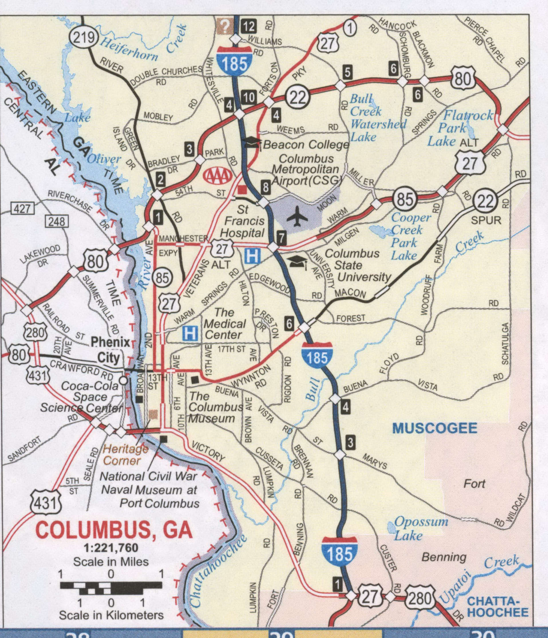
Columbus Road Map
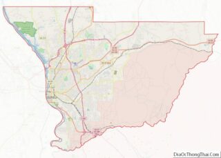
Columbus city Satellite Map
Geography
Columbus is one of Georgia’s three Fall Line Cities, along with Augusta and Macon. The Fall Line is where the hilly lands of the Piedmont plateau meet the flat terrain of the coastal plain. As such, Columbus has a varied landscape of rolling hills on the north side and flat plains on the south. The fall line causes rivers in the area to decline rapidly towards sea level. Textile mills were established here in the 19th and early 20th centuries to take advantage of the water power from the falls.
Interstate 185 runs north-south through the middle of the city, with nine exits within Muscogee County. I-185 runs north about 50 mi (80 km) from its beginning to a junction with I-85 just east of LaGrange and about 60 mi (97 km) southwest of Atlanta. U.S. Route 27, U.S. Route 280, and Georgia State Route 520 (known as South Georgia Parkway) all meet in the interior of the city. U.S. Route 80 runs through the northern part of the city, locally known as J.R. Allen Parkway; Alternate U.S. Route 27 and Georgia State Route 85 run northeast from the city, locally known as Manchester Expressway.
The city is located at 32°29′23″N 84°56′26″W / 32.489608°N 84.940422°W / 32.489608; -84.940422.
According to the US Census Bureau, the city has a total area of 221.0 square miles (572 km), of which 216.3 square miles (560 km) are land and 4.7 square miles (12 km) (2.14%) are covered by water.
Climate
Columbus has a humid subtropical climate (Köppen Cfa). Daytime summer temperatures often reach highs in the mid-90°Fs, and low temperatures in the winter average in the upper 30s. Columbus is often considered a dividing line or “natural snowline” of the southeastern United States with areas north of the city receiving snowfall annually, with areas to the south typically not receiving snowfall every year or at all. Columbus is within USDA hardiness zone 8b in the city center and zone 8a in the suburbs.
Cityscape
Columbus is divided into five geographic areas:
- Downtown, also sometimes called “Uptown” (though “Uptown” is actually the title given to both a nonprofit organization operating to encourage area growth and development or “urban renewal” in the city and also to the actual physical area of that development itself, which is an expanding subsection of the downtown district located in the areas from Broadway to the Chattahoochee River) is the city’s central business district, and home to multiple historic districts, homes, and churches, such as the Columbus Historic Riverfront Industrial District, the Mott House, and the Church of the Holy Family.
- East Columbus is a predominantly residential area located east of MidTown.
- MidTown is a residential and commercial area located directly east of Downtown; several historic districts have been designated. It is the location of the corporate headquarters of Aflac.
- North Columbus, also called Northside, is a diverse suburban area, home to established neighborhoods and subdivisions, such as Green Island Hills and Oldtown. It has multiple shopping and lifestyle areas.
- South Columbus is situated just south of the MidTown region, and directly north of Fort Benning. It is the site of the National Infantry Museum, honoring the history of infantry forces in the U.S. Army. The museum was located here in an effort to introduce jobs and attract visitors to stimulate a variety of activities. It has had bars, honky tonks, and other businesses that appeal to young male soldiers from Fort Benning.
Surrounding cities and towns
The Columbus Metropolitan Area includes four counties in Georgia, and one in Alabama. The Columbus-Auburn-Opelika, GA-AL Combined Statistical Area includes two additional counties in Alabama. A 2013 Census estimate showed 316,554 in the metro area, with 501,649 in the combined statistical area.
See also
Map of Georgia State and its subdivision:- Appling
- Atkinson
- Bacon
- Baker
- Baldwin
- Banks
- Barrow
- Bartow
- Ben Hill
- Berrien
- Bibb
- Bleckley
- Brantley
- Brooks
- Bryan
- Bulloch
- Burke
- Butts
- Calhoun
- Camden
- Candler
- Carroll
- Catoosa
- Charlton
- Chatham
- Chattahoochee
- Chattooga
- Cherokee
- Clarke
- Clay
- Clayton
- Clinch
- Cobb
- Coffee
- Colquitt
- Columbia
- Cook
- Coweta
- Crawford
- Crisp
- Dade
- Dawson
- Decatur
- DeKalb
- Dodge
- Dooly
- Dougherty
- Douglas
- Early
- Echols
- Effingham
- Elbert
- Emanuel
- Evans
- Fannin
- Fayette
- Floyd
- Forsyth
- Franklin
- Fulton
- Gilmer
- Glascock
- Glynn
- Gordon
- Grady
- Greene
- Gwinnett
- Habersham
- Hall
- Hancock
- Haralson
- Harris
- Hart
- Heard
- Henry
- Houston
- Irwin
- Jackson
- Jasper
- Jeff Davis
- Jefferson
- Jenkins
- Johnson
- Jones
- Lamar
- Lanier
- Laurens
- Lee
- Liberty
- Lincoln
- Long
- Lowndes
- Lumpkin
- Macon
- Madison
- Marion
- McDuffie
- McIntosh
- Meriwether
- Miller
- Mitchell
- Monroe
- Montgomery
- Morgan
- Murray
- Muscogee
- Newton
- Oconee
- Oglethorpe
- Paulding
- Peach
- Pickens
- Pierce
- Pike
- Polk
- Pulaski
- Putnam
- Quitman
- Rabun
- Randolph
- Richmond
- Rockdale
- Schley
- Screven
- Seminole
- Spalding
- Stephens
- Stewart
- Sumter
- Talbot
- Taliaferro
- Tattnall
- Taylor
- Telfair
- Terrell
- Thomas
- Tift
- Toombs
- Towns
- Treutlen
- Troup
- Turner
- Twiggs
- Union
- Upson
- Walker
- Walton
- Ware
- Warren
- Washington
- Wayne
- Webster
- Wheeler
- White
- Whitfield
- Wilcox
- Wilkes
- Wilkinson
- Worth
- Alabama
- Alaska
- Arizona
- Arkansas
- California
- Colorado
- Connecticut
- Delaware
- District of Columbia
- Florida
- Georgia
- Hawaii
- Idaho
- Illinois
- Indiana
- Iowa
- Kansas
- Kentucky
- Louisiana
- Maine
- Maryland
- Massachusetts
- Michigan
- Minnesota
- Mississippi
- Missouri
- Montana
- Nebraska
- Nevada
- New Hampshire
- New Jersey
- New Mexico
- New York
- North Carolina
- North Dakota
- Ohio
- Oklahoma
- Oregon
- Pennsylvania
- Rhode Island
- South Carolina
- South Dakota
- Tennessee
- Texas
- Utah
- Vermont
- Virginia
- Washington
- West Virginia
- Wisconsin
- Wyoming


