Country Club Estates is an unincorporated area and census-designated place (CDP) in Glynn County, Georgia, United States. It is part of the Brunswick, Georgia Metropolitan Statistical Area. The population was 8,373 at the 2020 census, down from 8,545 in 2010.
| Name: | Country Club Estates CDP |
|---|---|
| LSAD Code: | 57 |
| LSAD Description: | CDP (suffix) |
| State: | Georgia |
| County: | Glynn County |
| Elevation: | 12 ft (4 m) |
| Total Area: | 4.76 sq mi (12.33 km²) |
| Land Area: | 4.63 sq mi (11.99 km²) |
| Water Area: | 0.13 sq mi (0.34 km²) |
| Total Population: | 8,373 |
| Population Density: | 1,808.42/sq mi (698.23/km²) |
| FIPS code: | 1319830 |
| GNISfeature ID: | 1867238 |
Online Interactive Map
Click on ![]() to view map in "full screen" mode.
to view map in "full screen" mode.
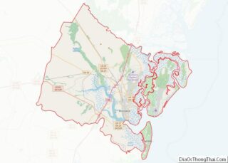
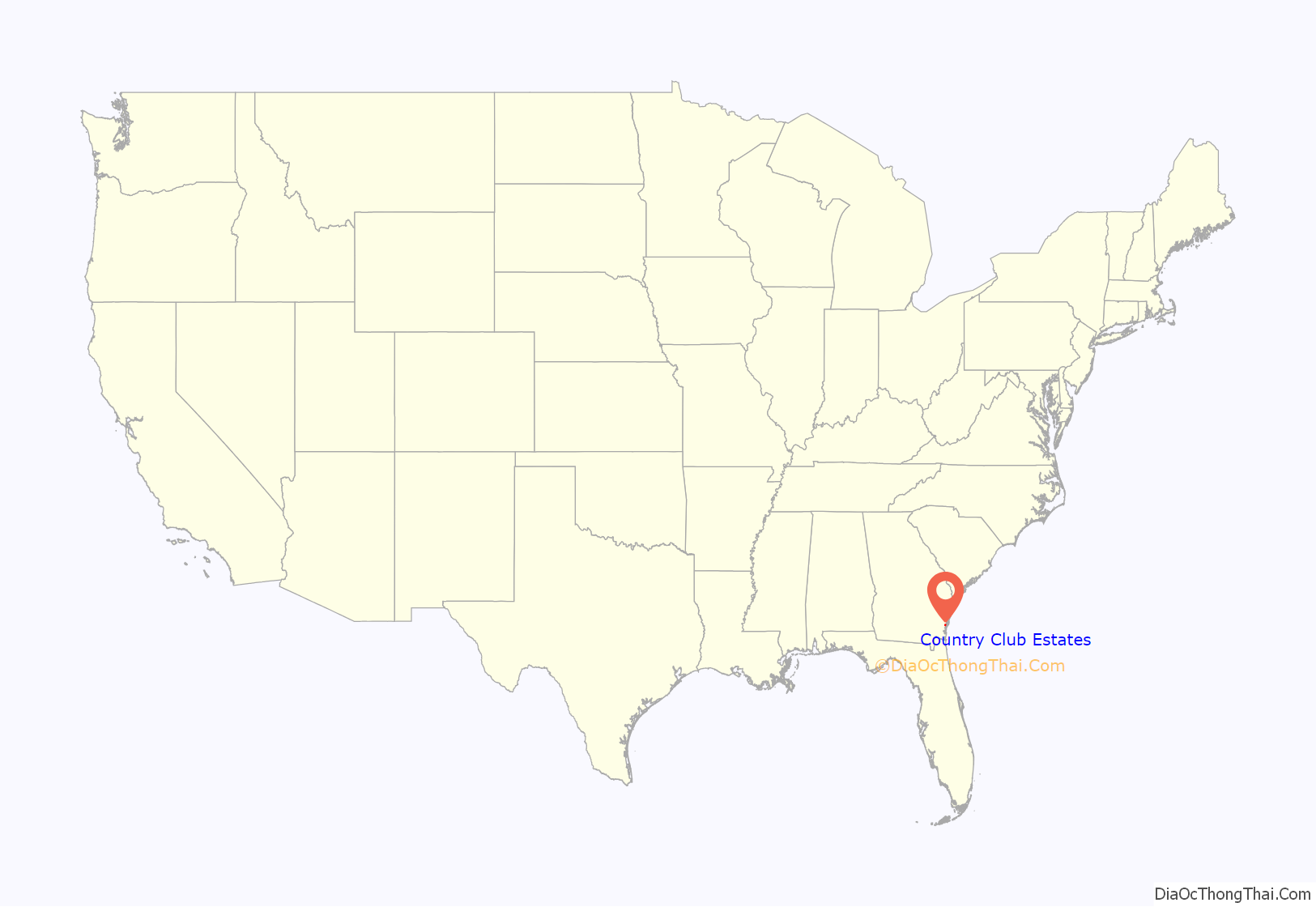
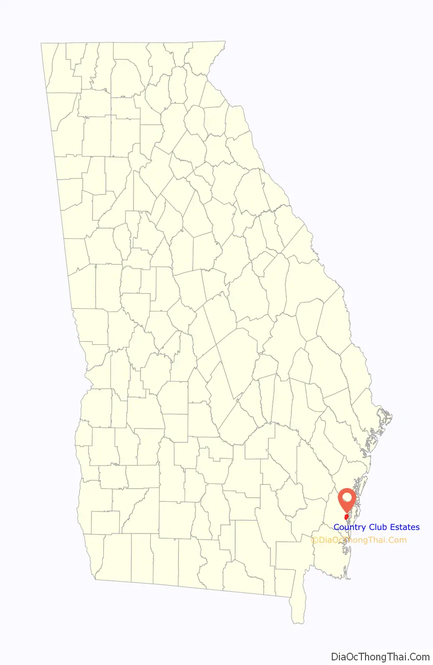
Country Club Estates location map. Where is Country Club Estates CDP?
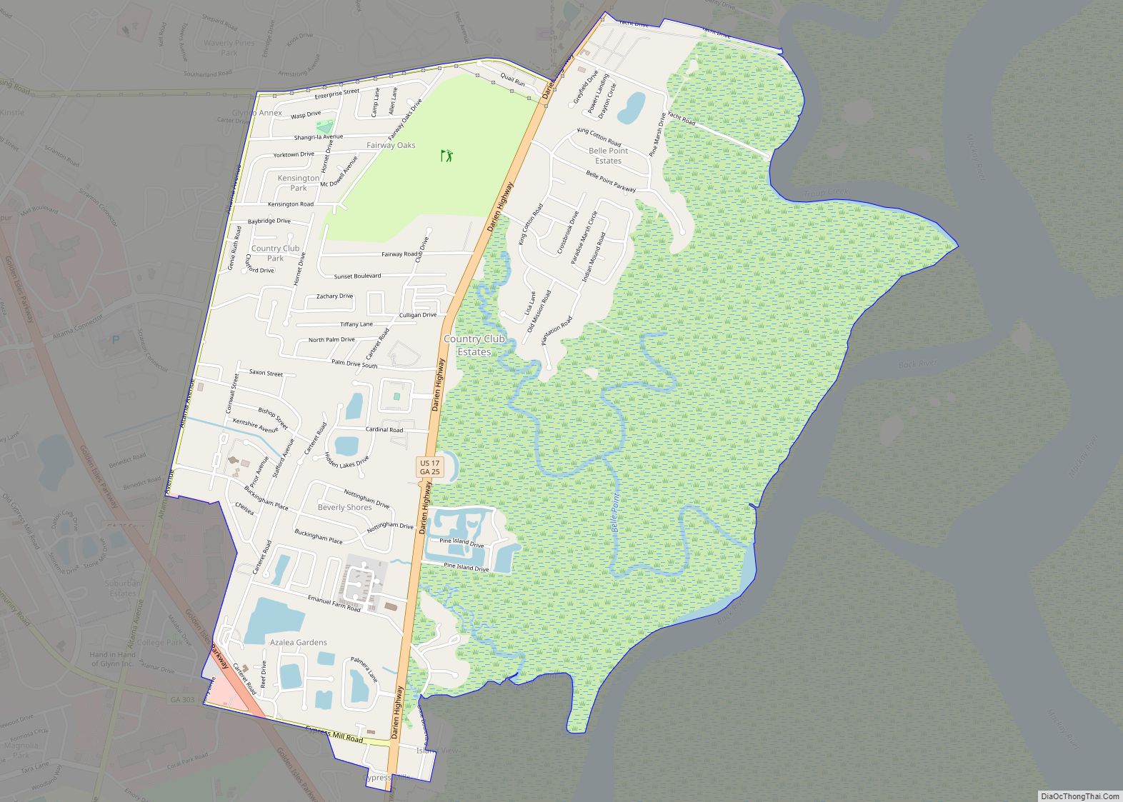
Country Club Estates Road Map
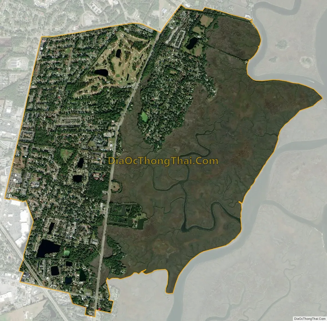
Country Club Estates city Satellite Map
Geography
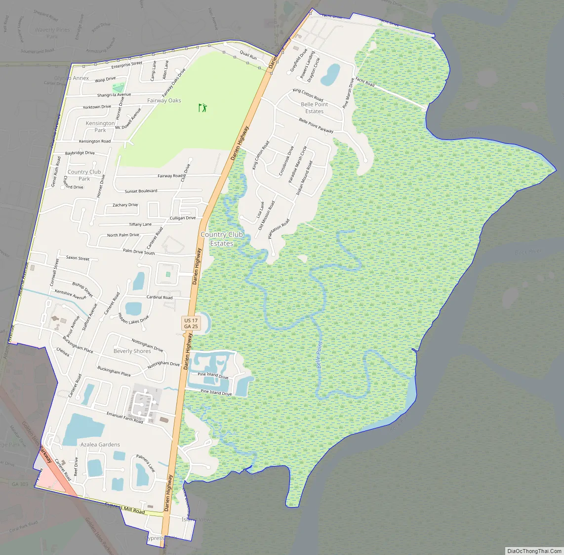
Country Club Estates is located at 31°12′41″N 81°28′7″W / 31.21139°N 81.46861°W / 31.21139; -81.46861 (31.211438, -81.468663). It is bordered to the south by the city of Brunswick and to the east by the Back River, an arm of the tidal Mackay River. U.S. Route 17 passes through the center of the CDP, leading south 5 miles (8 km) into downtown Brunswick and north 12 miles (19 km) to Darien. The CDP extends north as far as Chapel Crossing Road west of US 17 and Yacht Drive east of US 17.
According to the United States Census Bureau, the CDP has a total area of 4.7 square miles (12.3 km), of which 4.6 square miles (12.0 km) is land and 0.1 square miles (0.3 km), or 2.23%, is water.
See also
Map of Georgia State and its subdivision:- Appling
- Atkinson
- Bacon
- Baker
- Baldwin
- Banks
- Barrow
- Bartow
- Ben Hill
- Berrien
- Bibb
- Bleckley
- Brantley
- Brooks
- Bryan
- Bulloch
- Burke
- Butts
- Calhoun
- Camden
- Candler
- Carroll
- Catoosa
- Charlton
- Chatham
- Chattahoochee
- Chattooga
- Cherokee
- Clarke
- Clay
- Clayton
- Clinch
- Cobb
- Coffee
- Colquitt
- Columbia
- Cook
- Coweta
- Crawford
- Crisp
- Dade
- Dawson
- Decatur
- DeKalb
- Dodge
- Dooly
- Dougherty
- Douglas
- Early
- Echols
- Effingham
- Elbert
- Emanuel
- Evans
- Fannin
- Fayette
- Floyd
- Forsyth
- Franklin
- Fulton
- Gilmer
- Glascock
- Glynn
- Gordon
- Grady
- Greene
- Gwinnett
- Habersham
- Hall
- Hancock
- Haralson
- Harris
- Hart
- Heard
- Henry
- Houston
- Irwin
- Jackson
- Jasper
- Jeff Davis
- Jefferson
- Jenkins
- Johnson
- Jones
- Lamar
- Lanier
- Laurens
- Lee
- Liberty
- Lincoln
- Long
- Lowndes
- Lumpkin
- Macon
- Madison
- Marion
- McDuffie
- McIntosh
- Meriwether
- Miller
- Mitchell
- Monroe
- Montgomery
- Morgan
- Murray
- Muscogee
- Newton
- Oconee
- Oglethorpe
- Paulding
- Peach
- Pickens
- Pierce
- Pike
- Polk
- Pulaski
- Putnam
- Quitman
- Rabun
- Randolph
- Richmond
- Rockdale
- Schley
- Screven
- Seminole
- Spalding
- Stephens
- Stewart
- Sumter
- Talbot
- Taliaferro
- Tattnall
- Taylor
- Telfair
- Terrell
- Thomas
- Tift
- Toombs
- Towns
- Treutlen
- Troup
- Turner
- Twiggs
- Union
- Upson
- Walker
- Walton
- Ware
- Warren
- Washington
- Wayne
- Webster
- Wheeler
- White
- Whitfield
- Wilcox
- Wilkes
- Wilkinson
- Worth
- Alabama
- Alaska
- Arizona
- Arkansas
- California
- Colorado
- Connecticut
- Delaware
- District of Columbia
- Florida
- Georgia
- Hawaii
- Idaho
- Illinois
- Indiana
- Iowa
- Kansas
- Kentucky
- Louisiana
- Maine
- Maryland
- Massachusetts
- Michigan
- Minnesota
- Mississippi
- Missouri
- Montana
- Nebraska
- Nevada
- New Hampshire
- New Jersey
- New Mexico
- New York
- North Carolina
- North Dakota
- Ohio
- Oklahoma
- Oregon
- Pennsylvania
- Rhode Island
- South Carolina
- South Dakota
- Tennessee
- Texas
- Utah
- Vermont
- Virginia
- Washington
- West Virginia
- Wisconsin
- Wyoming