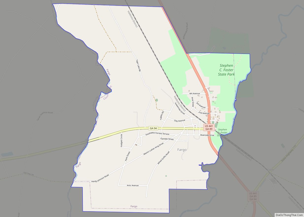
Fargo is a city in Clinch County, Georgia, United States. As of the 2020 census, the city had a population of 250. Formerly a town, it was incorporated by the Georgia state legislature in 1992, effective on April 1 of that year.
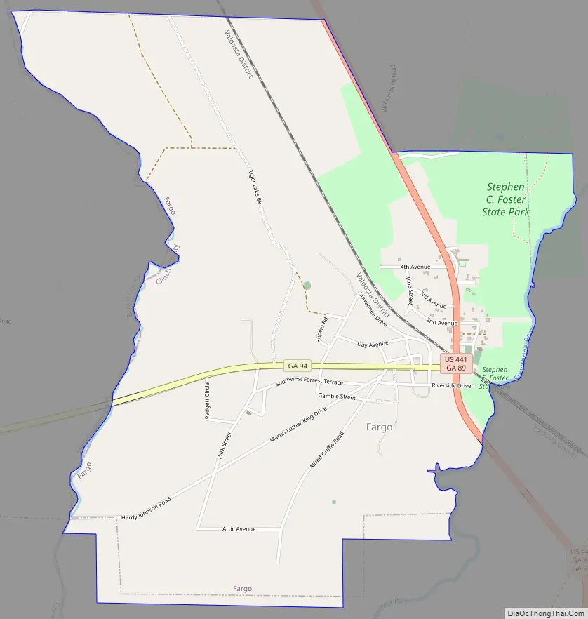
Fargo is located near the Okefenokee Swamp and is the western gateway to the Okefenokee National Wildlife Refuge. Also nearby is Stephen C. Foster State Park.
The city was threatened in April and May 2007 by the Bugaboo Scrub Fire, the largest wildfire in Georgia’s history.
| Name: | Fargo city |
|---|---|
| LSAD Code: | 25 |
| LSAD Description: | city (suffix) |
| State: | Georgia |
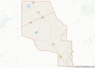
| County: | Clinch County |
| Elevation: | 112 ft (34 m) |
| Total Area: | 2.76 sq mi (7.14 km²) |
| Land Area: | 2.74 sq mi (7.11 km²) |
| Water Area: | 0.01 sq mi (0.03 km²) |
| Total Population: | 250 |
| Population Density: | 91.11/sq mi (35.18/km²) |
| ZIP code: | 31631 |
| Area code: | 912 |
| FIPS code: | 1328744 |
| GNISfeature ID: | 0314079 |
Online Interactive Map
Click on ![]() to view map in "full screen" mode.
to view map in "full screen" mode.
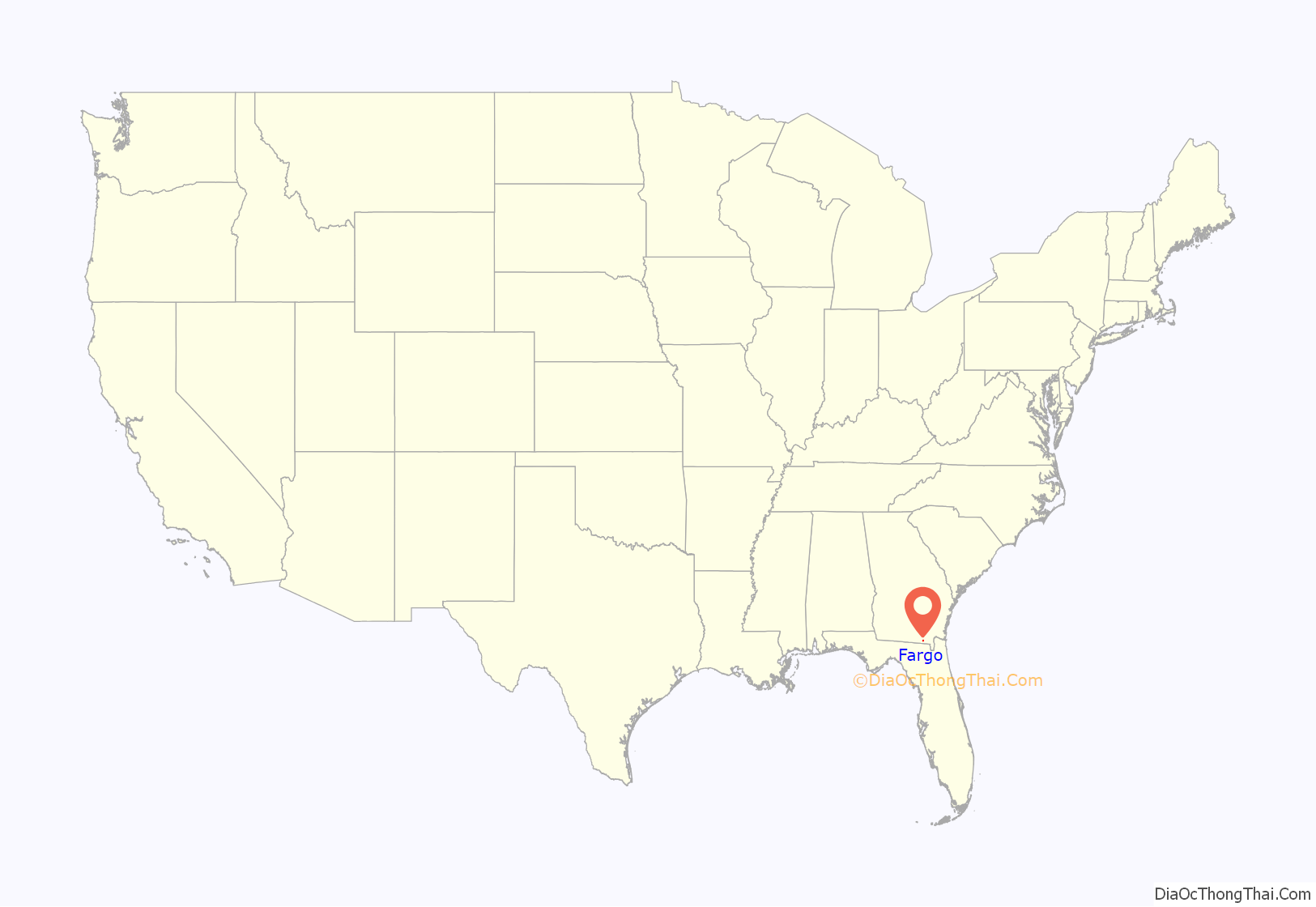
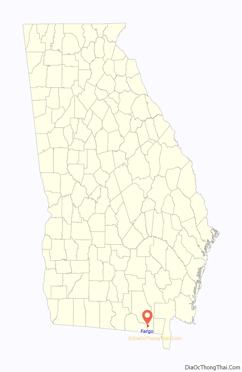
Fargo location map. Where is Fargo city?
Fargo Road Map
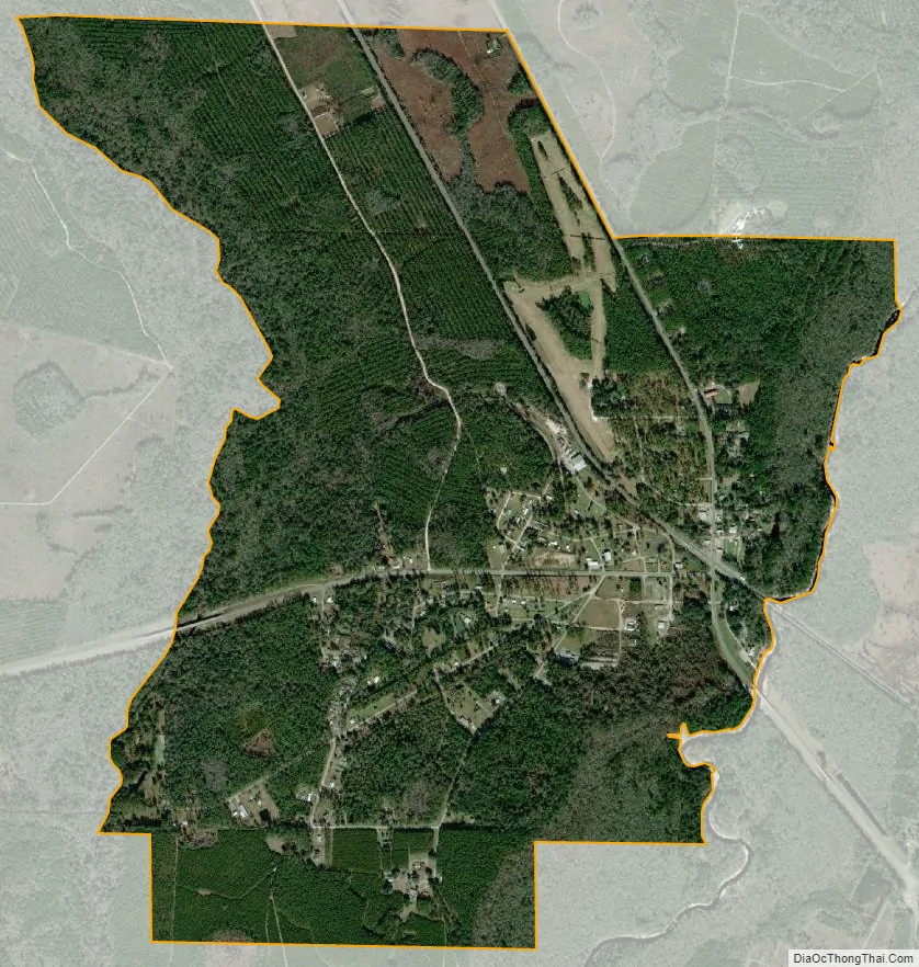
Fargo city Satellite Map
Geography
Fargo is located in southern Clinch County at 30°41′12″N 82°34′1″W / 30.68667°N 82.56694°W / 30.68667; -82.56694 (30.686698, −82.567076). Its western border is formed by Suwannoochee Creek, which is also the Echols County line. The Suwannee River forms the eastern border of the city.
U.S. Route 441 passes through the eastern side of the city, leading north 28 miles (45 km) to Homerville, Georgia, and south 39 miles (63 km) to Lake City, Florida. Georgia State Route 177 leads northeast 17 miles (27 km) to its end in the Okefenokee Swamp at Stephen C. Foster State Park.
According to the United States Census Bureau, Fargo has a total area of 2.7 square miles (7.1 km), of which 0.01 square miles (0.03 km), or 0.46%, is water.
See also
Map of Georgia State and its subdivision:- Appling
- Atkinson
- Bacon
- Baker
- Baldwin
- Banks
- Barrow
- Bartow
- Ben Hill
- Berrien
- Bibb
- Bleckley
- Brantley
- Brooks
- Bryan
- Bulloch
- Burke
- Butts
- Calhoun
- Camden
- Candler
- Carroll
- Catoosa
- Charlton
- Chatham
- Chattahoochee
- Chattooga
- Cherokee
- Clarke
- Clay
- Clayton
- Clinch
- Cobb
- Coffee
- Colquitt
- Columbia
- Cook
- Coweta
- Crawford
- Crisp
- Dade
- Dawson
- Decatur
- DeKalb
- Dodge
- Dooly
- Dougherty
- Douglas
- Early
- Echols
- Effingham
- Elbert
- Emanuel
- Evans
- Fannin
- Fayette
- Floyd
- Forsyth
- Franklin
- Fulton
- Gilmer
- Glascock
- Glynn
- Gordon
- Grady
- Greene
- Gwinnett
- Habersham
- Hall
- Hancock
- Haralson
- Harris
- Hart
- Heard
- Henry
- Houston
- Irwin
- Jackson
- Jasper
- Jeff Davis
- Jefferson
- Jenkins
- Johnson
- Jones
- Lamar
- Lanier
- Laurens
- Lee
- Liberty
- Lincoln
- Long
- Lowndes
- Lumpkin
- Macon
- Madison
- Marion
- McDuffie
- McIntosh
- Meriwether
- Miller
- Mitchell
- Monroe
- Montgomery
- Morgan
- Murray
- Muscogee
- Newton
- Oconee
- Oglethorpe
- Paulding
- Peach
- Pickens
- Pierce
- Pike
- Polk
- Pulaski
- Putnam
- Quitman
- Rabun
- Randolph
- Richmond
- Rockdale
- Schley
- Screven
- Seminole
- Spalding
- Stephens
- Stewart
- Sumter
- Talbot
- Taliaferro
- Tattnall
- Taylor
- Telfair
- Terrell
- Thomas
- Tift
- Toombs
- Towns
- Treutlen
- Troup
- Turner
- Twiggs
- Union
- Upson
- Walker
- Walton
- Ware
- Warren
- Washington
- Wayne
- Webster
- Wheeler
- White
- Whitfield
- Wilcox
- Wilkes
- Wilkinson
- Worth
- Alabama
- Alaska
- Arizona
- Arkansas
- California
- Colorado
- Connecticut
- Delaware
- District of Columbia
- Florida
- Georgia
- Hawaii
- Idaho
- Illinois
- Indiana
- Iowa
- Kansas
- Kentucky
- Louisiana
- Maine
- Maryland
- Massachusetts
- Michigan
- Minnesota
- Mississippi
- Missouri
- Montana
- Nebraska
- Nevada
- New Hampshire
- New Jersey
- New Mexico
- New York
- North Carolina
- North Dakota
- Ohio
- Oklahoma
- Oregon
- Pennsylvania
- Rhode Island
- South Carolina
- South Dakota
- Tennessee
- Texas
- Utah
- Vermont
- Virginia
- Washington
- West Virginia
- Wisconsin
- Wyoming