Homerville is a city in Clinch County, Georgia, United States. Its population was 2,456 at the 2010 census, a decrease of 12.38% from 2,803 in 2000. It is the county seat of Clinch County. It was incorporated February 15, 1869.
| Name: | Homerville city |
|---|---|
| LSAD Code: | 25 |
| LSAD Description: | city (suffix) |
| State: | Georgia |
| County: | Clinch County |
| Elevation: | 177 ft (54 m) |
| Total Area: | 3.51 sq mi (9.09 km²) |
| Land Area: | 3.49 sq mi (9.05 km²) |
| Water Area: | 0.02 sq mi (0.04 km²) |
| Total Population: | 2,344 |
| Population Density: | 671.06/sq mi (259.10/km²) |
| ZIP code: | 31634 |
| Area code: | 912 |
| FIPS code: | 1339748 |
| GNISfeature ID: | 0356319 |
| Website: | www.cityofhomerville.com |
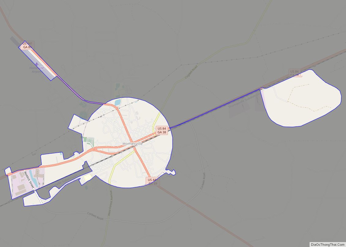
Online Interactive Map
Click on ![]() to view map in "full screen" mode.
to view map in "full screen" mode.
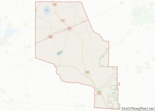
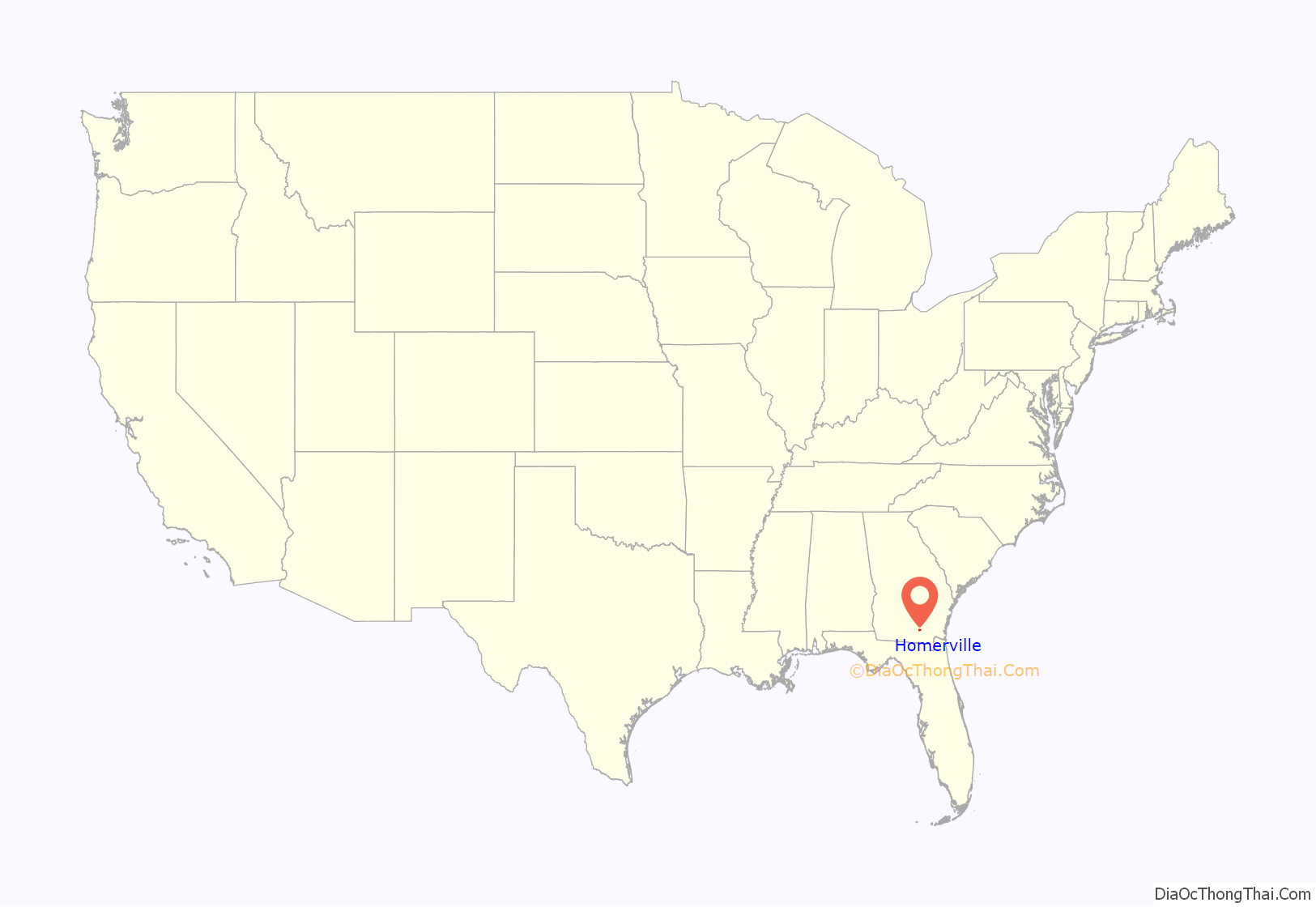
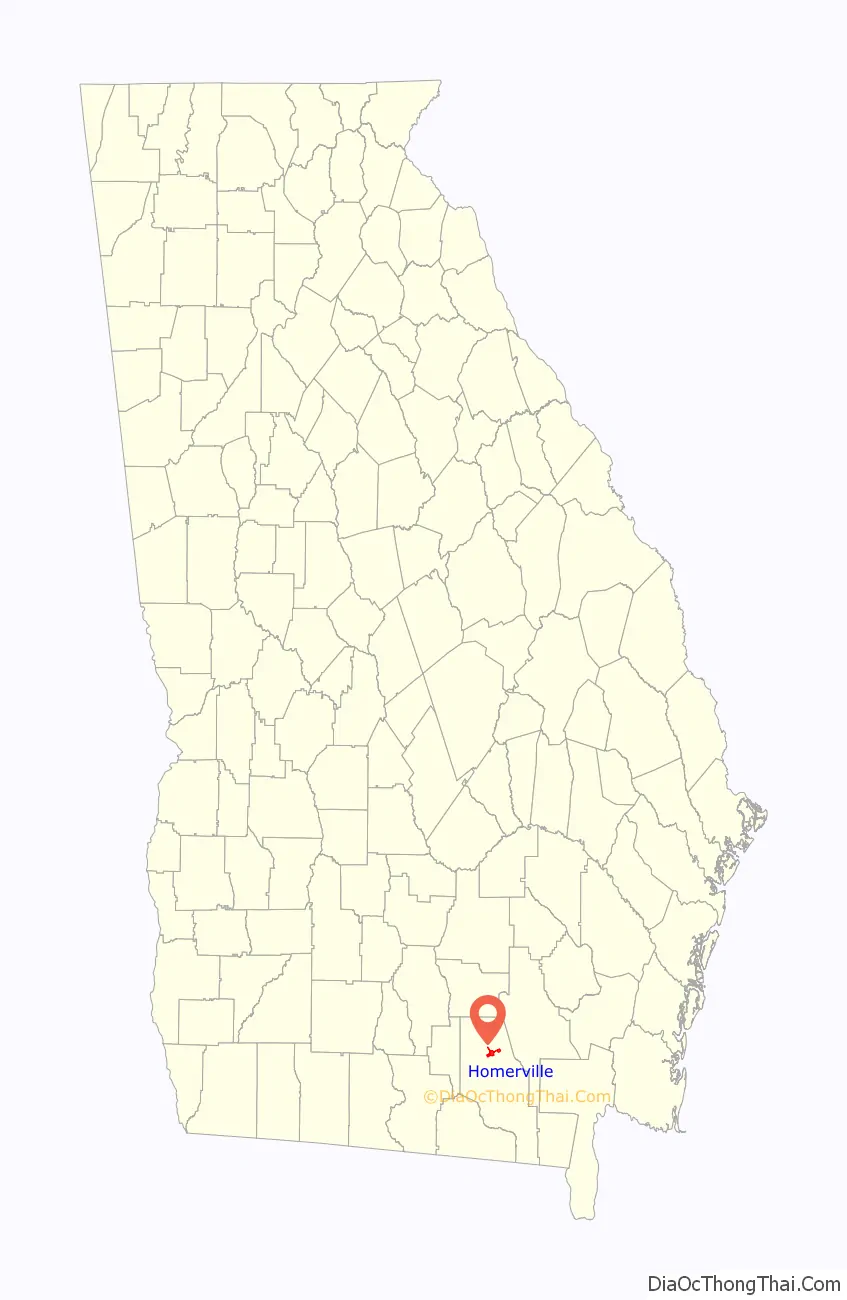
Homerville location map. Where is Homerville city?
History
Clinch County was created on February 14, 1850, by an act of the Georgia General Assembly, and was named for General Duncan Lamont Clinch, a decorated United States brigadier general and Georgia congressman who had recently died. Clinch, Georgia’s 95th county, was formed from land originally inhabited by the Oconee people and consolidated portions of Ware County and Lowndes County. The act creating the county named Elijah Mattox, Simon W. Nichol, Timothy Kirkland, Benjamin Sirmans, and John J. Johnson as commissioners charged with selecting a county seat and constructing a courthouse.
The designated commissioners quickly settled on a site just southwest of the present-day Homerville, and in memory of President James K. Polk decided to name the county seat “Polk”. Two years later, however, the Georgia General Assembly inexplicably changed the name of the county seat to “Magnolia”, just as the county’s first courthouse was completed. The first courthouse was quite small and was destroyed in 1856 when a citizen, presumably dissatisfied with legal proceedings brought against him, decided to destroy the courthouse by fire.
In February 1853, Dr. John Homer Mattox and his family moved from their former home on the Suwannee River and settled on a tract of land adjacent to the Magnolia stage route. In recognition of his family name, he called the settlement Homersville. Shortly thereafter the Atlantic and Gulf Railroad expansion replaced the stage route, and Mattox’s settlement was simply known as “Station No.11”.
Over time the settlement grew, and in 1860 approximately 275 citizens of Clinch County petitioned the Georgia General Assembly to move the county seat from the nearby Magnolia to Mattox’s settlement. Later the same year, the legislature relented and officially named Station No. 11 the county seat of Clinch County. By 1863, the town of Homersville was known as Forest. It would take approximately nine more years for the legislature to officially recognize the name Homerville and incorporate the city; however, Homerville shows up as the name of the county seat in newspapers by March 1864.
Dr. John Homer Mattox’s original dwelling is now the home of the Clinch County Chamber of Commerce and Welcome Center. The home recently underwent an extensive restoration that not only restored many of the rooms to their former glory but also added modern plumbing and central heat and air for the convenience of visitors. The structure now holds the administrative offices of the chamber and a museum dedicated to the early days of Clinch County.
Homerville Road Map
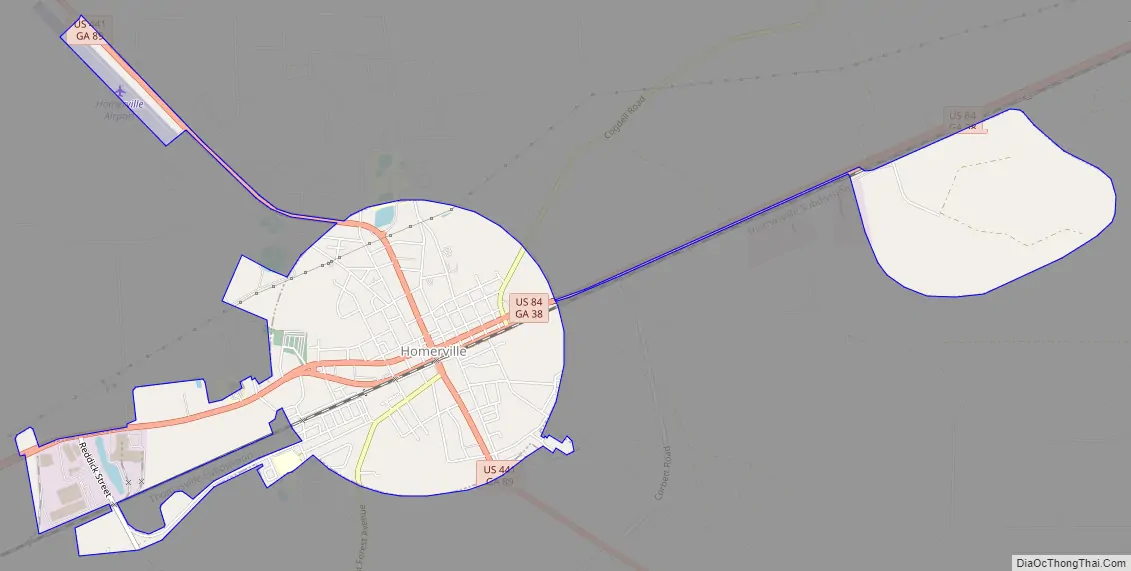
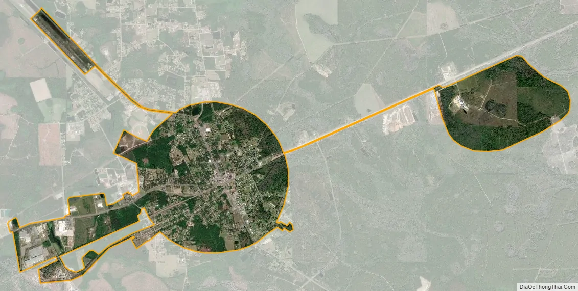
Homerville city Satellite Map
Geography
Homerville is located in north-central Clinch County at 31°2′13″N 82°45′5″W / 31.03694°N 82.75139°W / 31.03694; -82.75139 (31.036832, -82.751302). U.S. Routes 84 and 441 cross in the center of town. US 84 leads east 27 miles (43 km) to Waycross and west 35 miles (56 km) to Valdosta, while US 441 leads north 35 miles (56 km) to Douglas, Georgia, and south 67 miles (108 km) to Lake City, Florida.
According to the United States Census Bureau, the city has a total area of 3.5 square miles (9.1 km), of which 0.02 square miles (0.04 km), or 0.50%, is water. Wooded areas and swampy marshes surround the city.
See also
Map of Georgia State and its subdivision:- Appling
- Atkinson
- Bacon
- Baker
- Baldwin
- Banks
- Barrow
- Bartow
- Ben Hill
- Berrien
- Bibb
- Bleckley
- Brantley
- Brooks
- Bryan
- Bulloch
- Burke
- Butts
- Calhoun
- Camden
- Candler
- Carroll
- Catoosa
- Charlton
- Chatham
- Chattahoochee
- Chattooga
- Cherokee
- Clarke
- Clay
- Clayton
- Clinch
- Cobb
- Coffee
- Colquitt
- Columbia
- Cook
- Coweta
- Crawford
- Crisp
- Dade
- Dawson
- Decatur
- DeKalb
- Dodge
- Dooly
- Dougherty
- Douglas
- Early
- Echols
- Effingham
- Elbert
- Emanuel
- Evans
- Fannin
- Fayette
- Floyd
- Forsyth
- Franklin
- Fulton
- Gilmer
- Glascock
- Glynn
- Gordon
- Grady
- Greene
- Gwinnett
- Habersham
- Hall
- Hancock
- Haralson
- Harris
- Hart
- Heard
- Henry
- Houston
- Irwin
- Jackson
- Jasper
- Jeff Davis
- Jefferson
- Jenkins
- Johnson
- Jones
- Lamar
- Lanier
- Laurens
- Lee
- Liberty
- Lincoln
- Long
- Lowndes
- Lumpkin
- Macon
- Madison
- Marion
- McDuffie
- McIntosh
- Meriwether
- Miller
- Mitchell
- Monroe
- Montgomery
- Morgan
- Murray
- Muscogee
- Newton
- Oconee
- Oglethorpe
- Paulding
- Peach
- Pickens
- Pierce
- Pike
- Polk
- Pulaski
- Putnam
- Quitman
- Rabun
- Randolph
- Richmond
- Rockdale
- Schley
- Screven
- Seminole
- Spalding
- Stephens
- Stewart
- Sumter
- Talbot
- Taliaferro
- Tattnall
- Taylor
- Telfair
- Terrell
- Thomas
- Tift
- Toombs
- Towns
- Treutlen
- Troup
- Turner
- Twiggs
- Union
- Upson
- Walker
- Walton
- Ware
- Warren
- Washington
- Wayne
- Webster
- Wheeler
- White
- Whitfield
- Wilcox
- Wilkes
- Wilkinson
- Worth
- Alabama
- Alaska
- Arizona
- Arkansas
- California
- Colorado
- Connecticut
- Delaware
- District of Columbia
- Florida
- Georgia
- Hawaii
- Idaho
- Illinois
- Indiana
- Iowa
- Kansas
- Kentucky
- Louisiana
- Maine
- Maryland
- Massachusetts
- Michigan
- Minnesota
- Mississippi
- Missouri
- Montana
- Nebraska
- Nevada
- New Hampshire
- New Jersey
- New Mexico
- New York
- North Carolina
- North Dakota
- Ohio
- Oklahoma
- Oregon
- Pennsylvania
- Rhode Island
- South Carolina
- South Dakota
- Tennessee
- Texas
- Utah
- Vermont
- Virginia
- Washington
- West Virginia
- Wisconsin
- Wyoming