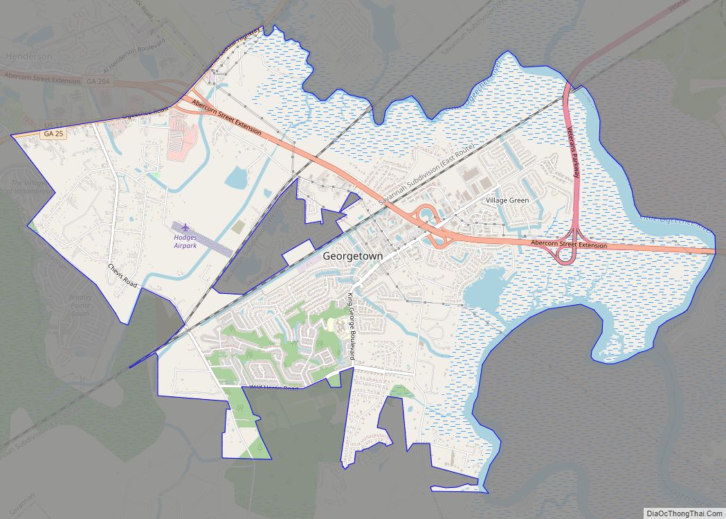
Georgetown is a census-designated place (CDP) in Chatham County, Georgia, United States. The population was 11,916 at the 2020 U.S. Census. Georgetown lies across the Little Ogeechee River (and city limits) from Savannah, Georgia, and is a suburban “bedroom community” of Savannah, where most of its adult residents work. It is part of the Savannah Metropolitan Statistical Area.
Georgetown was constructed mostly in the late 1970s and early 1980s, but new subdivisions have been built recently. Shopping facilities are now more plentiful and continue to be added. Two schools in Georgetown are units of the Savannah-Chatham public school system: Georgetown Elementary and Southwest Middle School. Georgetown’s public high school students attend Windsor Forest High School in Savannah.
| Name: | Georgetown CDP |
|---|---|
| LSAD Code: | 57 |
| LSAD Description: | CDP (suffix) |
| State: | Georgia |
| County: | Chatham County |
| Elevation: | 13 ft (4 m) |
| Total Area: | 8.87 sq mi (22.96 km²) |
| Land Area: | 8.24 sq mi (21.34 km²) |
| Water Area: | 0.62 sq mi (1.61 km²) |
| Total Population: | 11,916 |
| Population Density: | 1,445.94/sq mi (558.27/km²) |
| FIPS code: | 1332482 |
| GNISfeature ID: | 1694531 |
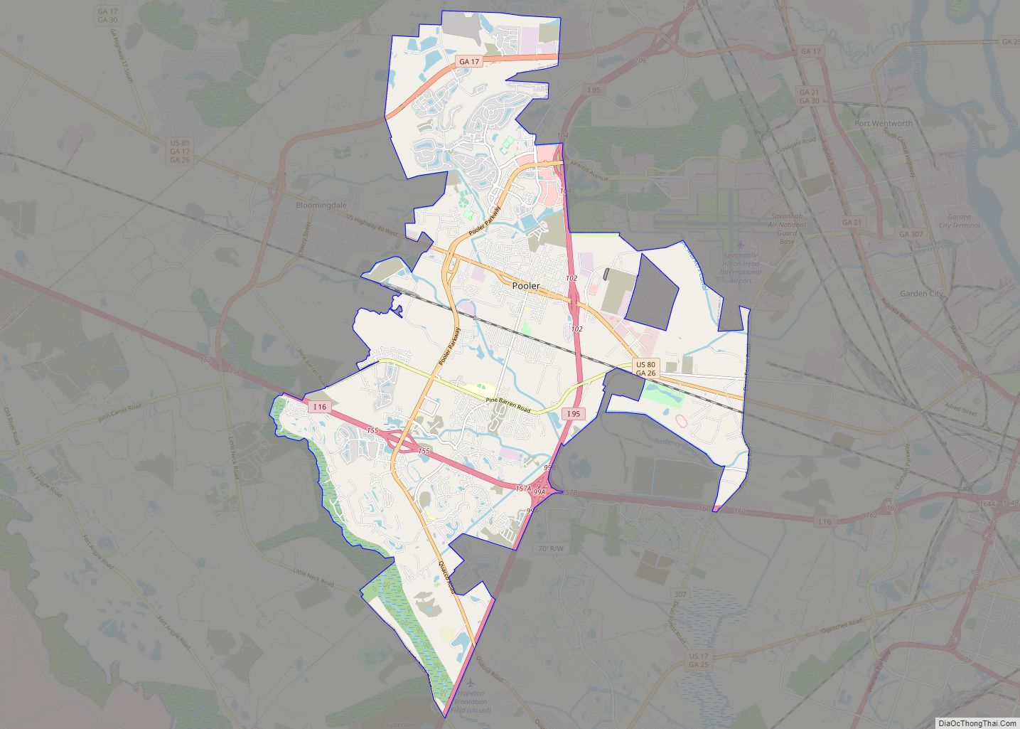
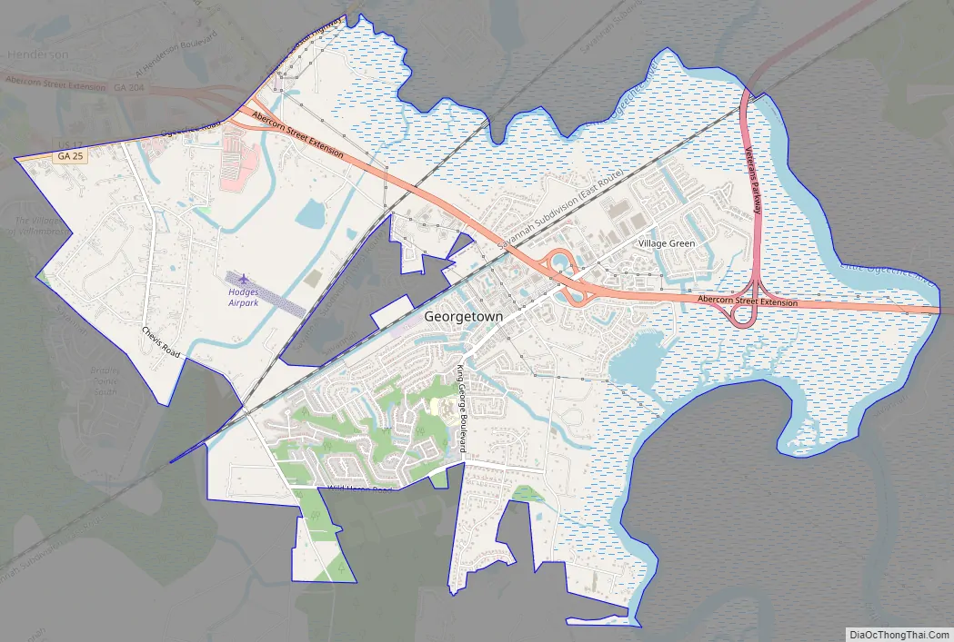
Online Interactive Map
Click on ![]() to view map in "full screen" mode.
to view map in "full screen" mode.
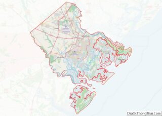
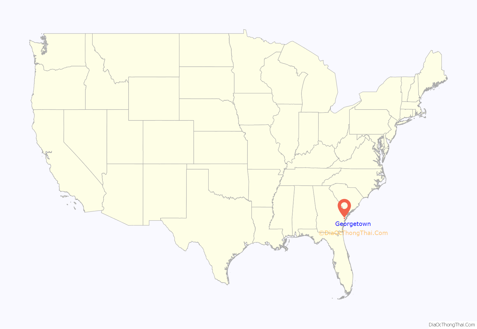
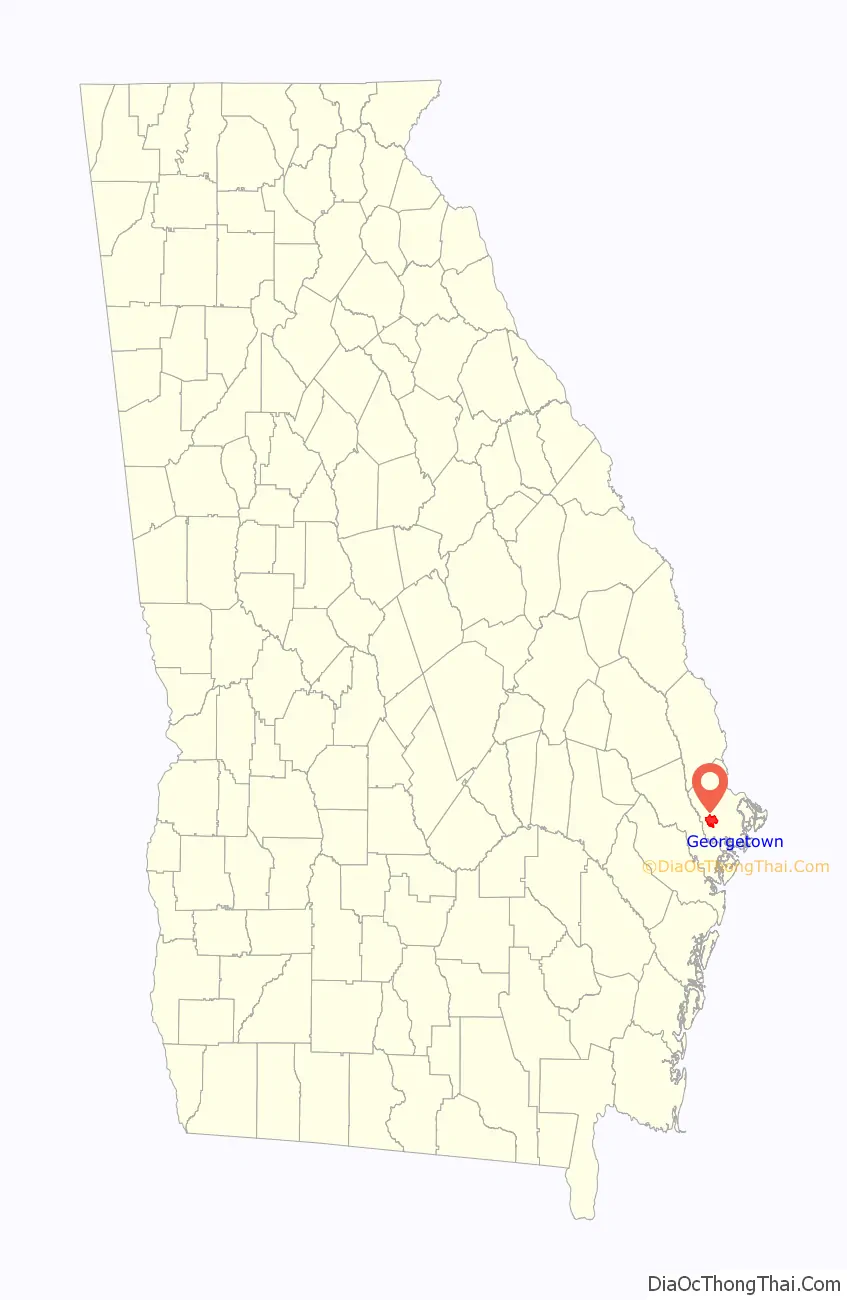
Georgetown location map. Where is Georgetown CDP?
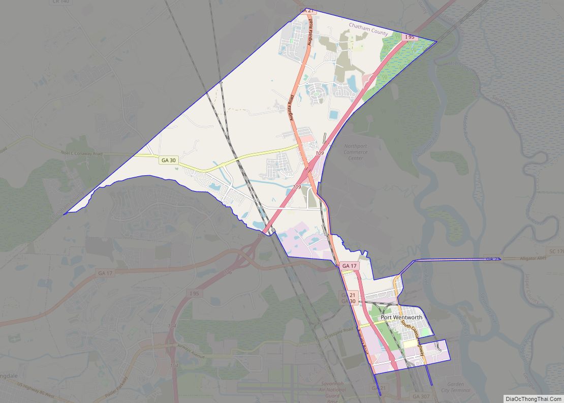
Georgetown Road Map
Georgetown city Satellite Map

Geography
Georgetown is located in western Chatham County at 31°58′47″N 81°13′56″W / 31.979612°N 81.232118°W / 31.979612; -81.232118Coordinates: 31°58′47″N 81°13′56″W / 31.979612°N 81.232118°W / 31.979612; -81.232118. It is bordered to the east, south, and west by portions of the city of Savannah and has lost area since the 2000 census due to annexations by city. To the northwest is the unincorporated community of Henderson. U.S. Route 17 forms the northwestern edge of Georgetown, and leads northeast 11 miles (18 km) to downtown Savannah and southwest 5 miles (8 km) to Richmond Hill. Veterans Parkway begins in the eastern part of Georgetown and also leads 11 miles (18 km) to the center of Savannah.
According to the United States Census Bureau, the Georgetown CDP has a total area of 8.8 square miles (22.7 km), of which 8.2 square miles (21.3 km) is land and 0.54 square miles (1.4 km), or 6.30%, is water.
See also
Map of Georgia State and its subdivision:- Appling
- Atkinson
- Bacon
- Baker
- Baldwin
- Banks
- Barrow
- Bartow
- Ben Hill
- Berrien
- Bibb
- Bleckley
- Brantley
- Brooks
- Bryan
- Bulloch
- Burke
- Butts
- Calhoun
- Camden
- Candler
- Carroll
- Catoosa
- Charlton
- Chatham
- Chattahoochee
- Chattooga
- Cherokee
- Clarke
- Clay
- Clayton
- Clinch
- Cobb
- Coffee
- Colquitt
- Columbia
- Cook
- Coweta
- Crawford
- Crisp
- Dade
- Dawson
- Decatur
- DeKalb
- Dodge
- Dooly
- Dougherty
- Douglas
- Early
- Echols
- Effingham
- Elbert
- Emanuel
- Evans
- Fannin
- Fayette
- Floyd
- Forsyth
- Franklin
- Fulton
- Gilmer
- Glascock
- Glynn
- Gordon
- Grady
- Greene
- Gwinnett
- Habersham
- Hall
- Hancock
- Haralson
- Harris
- Hart
- Heard
- Henry
- Houston
- Irwin
- Jackson
- Jasper
- Jeff Davis
- Jefferson
- Jenkins
- Johnson
- Jones
- Lamar
- Lanier
- Laurens
- Lee
- Liberty
- Lincoln
- Long
- Lowndes
- Lumpkin
- Macon
- Madison
- Marion
- McDuffie
- McIntosh
- Meriwether
- Miller
- Mitchell
- Monroe
- Montgomery
- Morgan
- Murray
- Muscogee
- Newton
- Oconee
- Oglethorpe
- Paulding
- Peach
- Pickens
- Pierce
- Pike
- Polk
- Pulaski
- Putnam
- Quitman
- Rabun
- Randolph
- Richmond
- Rockdale
- Schley
- Screven
- Seminole
- Spalding
- Stephens
- Stewart
- Sumter
- Talbot
- Taliaferro
- Tattnall
- Taylor
- Telfair
- Terrell
- Thomas
- Tift
- Toombs
- Towns
- Treutlen
- Troup
- Turner
- Twiggs
- Union
- Upson
- Walker
- Walton
- Ware
- Warren
- Washington
- Wayne
- Webster
- Wheeler
- White
- Whitfield
- Wilcox
- Wilkes
- Wilkinson
- Worth
- Alabama
- Alaska
- Arizona
- Arkansas
- California
- Colorado
- Connecticut
- Delaware
- District of Columbia
- Florida
- Georgia
- Hawaii
- Idaho
- Illinois
- Indiana
- Iowa
- Kansas
- Kentucky
- Louisiana
- Maine
- Maryland
- Massachusetts
- Michigan
- Minnesota
- Mississippi
- Missouri
- Montana
- Nebraska
- Nevada
- New Hampshire
- New Jersey
- New Mexico
- New York
- North Carolina
- North Dakota
- Ohio
- Oklahoma
- Oregon
- Pennsylvania
- Rhode Island
- South Carolina
- South Dakota
- Tennessee
- Texas
- Utah
- Vermont
- Virginia
- Washington
- West Virginia
- Wisconsin
- Wyoming