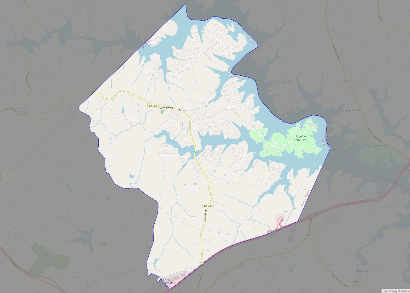
Gumlog is an unincorporated lakeside community and census-designated place in Franklin County, Georgia, United States. The population was 2,146 at the 2010 census.
| Name: | Gumlog CDP |
|---|---|
| LSAD Code: | 57 |
| LSAD Description: | CDP (suffix) |
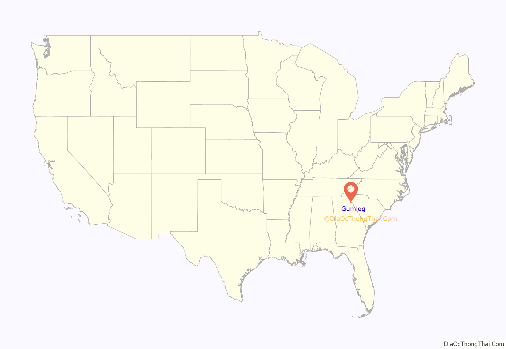
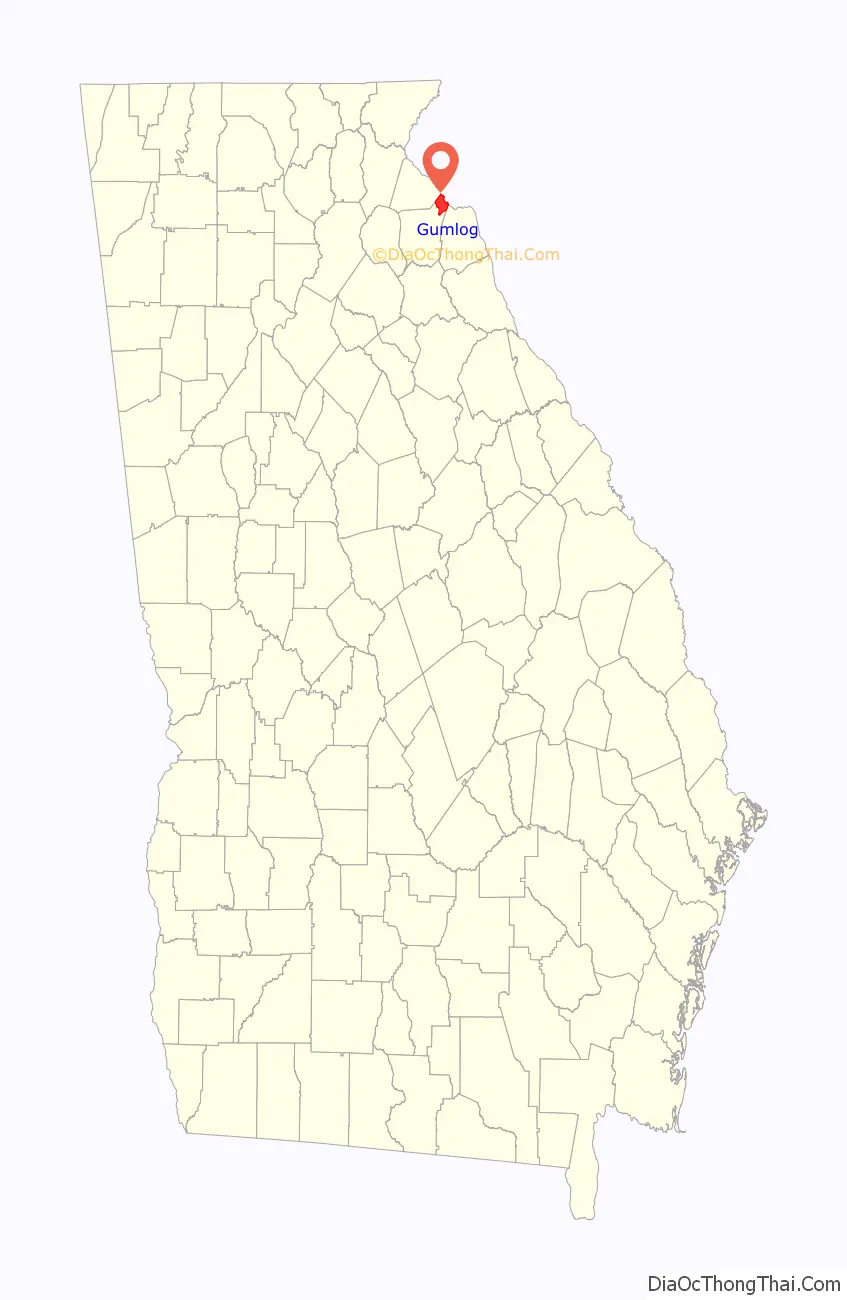
| State: | Georgia |
| County: | Franklin County |
| Elevation: | 732 ft (223 m) |
| Total Area: | 16.11 sq mi (41.71 km²) |
| Land Area: | 13.49 sq mi (34.94 km²) |
| Water Area: | 2.62 sq mi (6.77 km²) |
| Total Population: | 2,358 |
| Population Density: | 174.80/sq mi (67.49/km²) |
| FIPS code: | 1335814 |
| GNISfeature ID: | 1867242 |
Online Interactive Map
Click on ![]() to view map in "full screen" mode.
to view map in "full screen" mode.
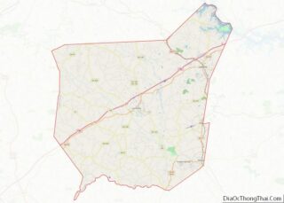
Gumlog location map. Where is Gumlog CDP?
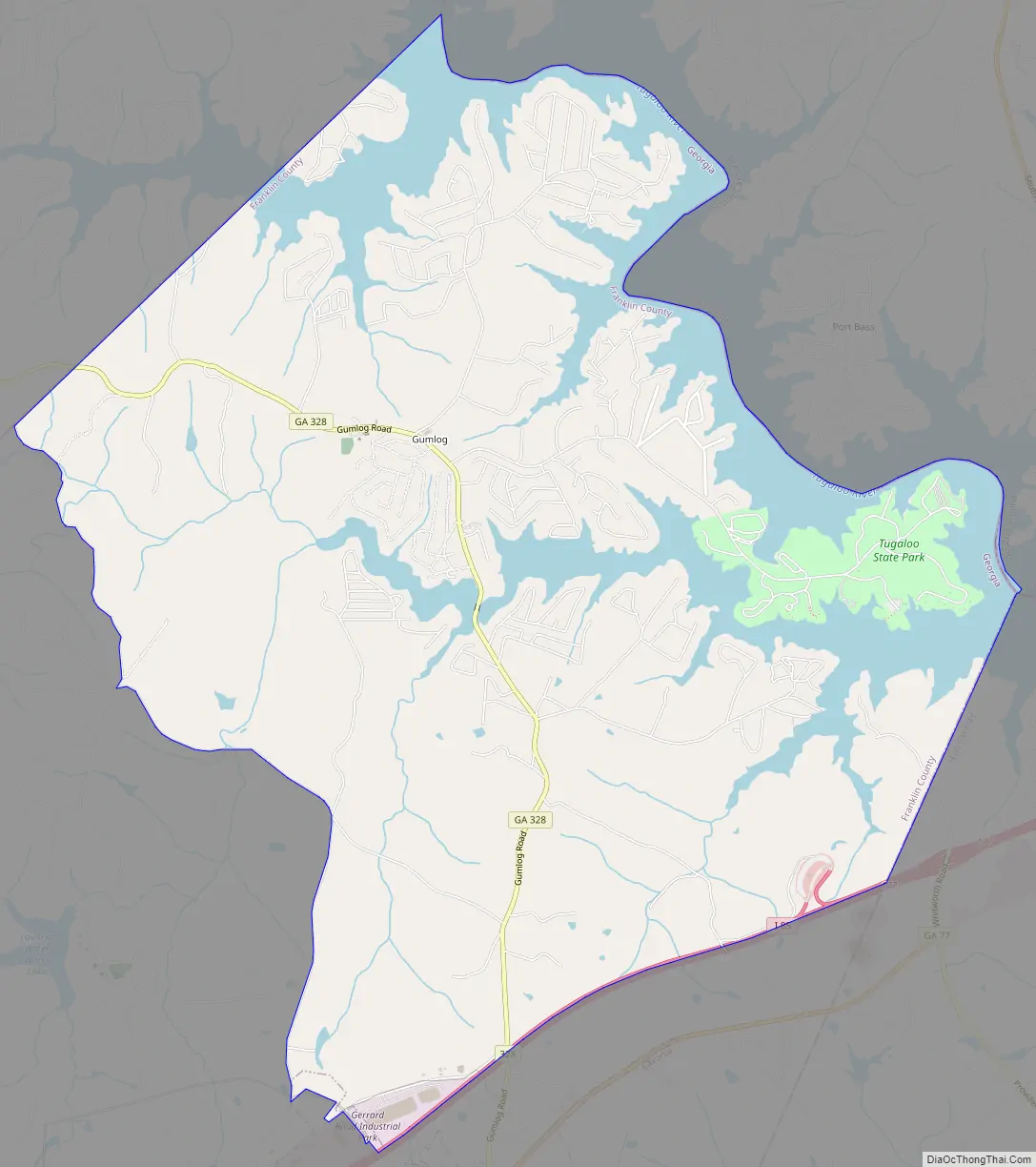
Gumlog Road Map
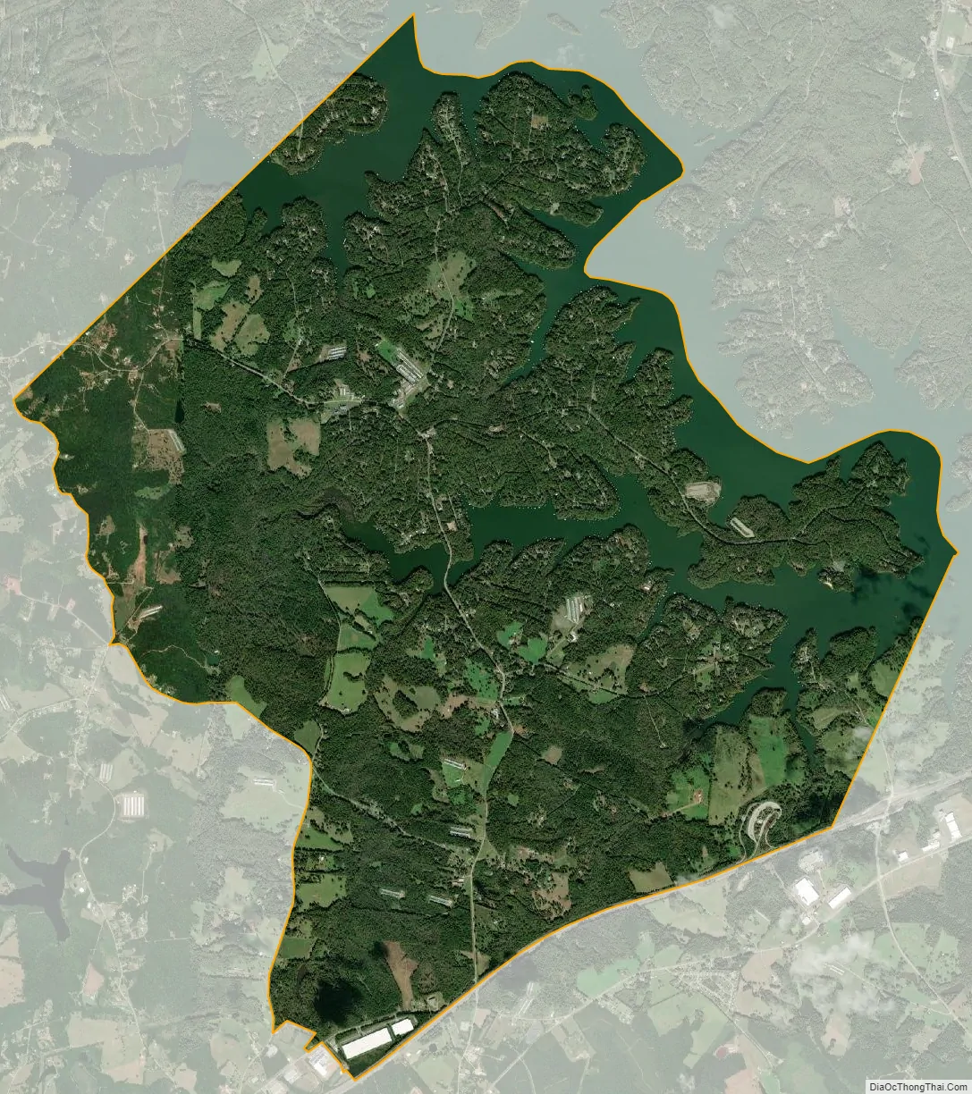
Gumlog city Satellite Map
Geography
Gumlog is located in the northeast corner of Franklin County at primary coordinate point 34°30′16.4″N 83°6′16.4″W / 34.504556°N 83.104556°W / 34.504556; -83.104556 (34.504556, -83.104556). It consists of extensive residential neighborhoods along the shores of Lake Hartwell on the Savannah River. The northeast border of the CDP is the centerline of the main stem of the lake, which also forms the state line with South Carolina. To the northwest, the CDP is bordered by Stephens County, and to the southeast it is bordered by Hart County. The southern edge of the CDP follows Interstate 85, and the southwest corner of the CDP borders the city of Lavonia. Access from I-85 is from Exit 173 (Georgia Highway 17) in Lavonia.
According to the United States Census Bureau, the Gumlog CDP has a total area of 16.1 square miles (41.6 km), of which 13.4 square miles (34.8 km) is land and 2.6 square miles (6.8 km), or 16.32%, is water. Tugaloo State Park occupies a peninsula on Lake Hartwell in the eastern part of the CDP.
Georgia Highway 328, known locally as Gumlog Road, is nearly the only way in and out of the community of Gumlog. It is 10 miles (16 km) long and crosses over the Gumlog Cove branch of Lake Hartwell. Gumlog Road runs from Highway 59 in Lavonia to a junction with Highway 17 in Avalon. Gumlog Creek also starts near the same junction in Avalon. Avalon was going to be named “Gumlog” after Gumlog Creek, but when the charter came back from the State Legislature, the name had been changed instead to Avalon.
See also
Map of Georgia State and its subdivision:- Appling
- Atkinson
- Bacon
- Baker
- Baldwin
- Banks
- Barrow
- Bartow
- Ben Hill
- Berrien
- Bibb
- Bleckley
- Brantley
- Brooks
- Bryan
- Bulloch
- Burke
- Butts
- Calhoun
- Camden
- Candler
- Carroll
- Catoosa
- Charlton
- Chatham
- Chattahoochee
- Chattooga
- Cherokee
- Clarke
- Clay
- Clayton
- Clinch
- Cobb
- Coffee
- Colquitt
- Columbia
- Cook
- Coweta
- Crawford
- Crisp
- Dade
- Dawson
- Decatur
- DeKalb
- Dodge
- Dooly
- Dougherty
- Douglas
- Early
- Echols
- Effingham
- Elbert
- Emanuel
- Evans
- Fannin
- Fayette
- Floyd
- Forsyth
- Franklin
- Fulton
- Gilmer
- Glascock
- Glynn
- Gordon
- Grady
- Greene
- Gwinnett
- Habersham
- Hall
- Hancock
- Haralson
- Harris
- Hart
- Heard
- Henry
- Houston
- Irwin
- Jackson
- Jasper
- Jeff Davis
- Jefferson
- Jenkins
- Johnson
- Jones
- Lamar
- Lanier
- Laurens
- Lee
- Liberty
- Lincoln
- Long
- Lowndes
- Lumpkin
- Macon
- Madison
- Marion
- McDuffie
- McIntosh
- Meriwether
- Miller
- Mitchell
- Monroe
- Montgomery
- Morgan
- Murray
- Muscogee
- Newton
- Oconee
- Oglethorpe
- Paulding
- Peach
- Pickens
- Pierce
- Pike
- Polk
- Pulaski
- Putnam
- Quitman
- Rabun
- Randolph
- Richmond
- Rockdale
- Schley
- Screven
- Seminole
- Spalding
- Stephens
- Stewart
- Sumter
- Talbot
- Taliaferro
- Tattnall
- Taylor
- Telfair
- Terrell
- Thomas
- Tift
- Toombs
- Towns
- Treutlen
- Troup
- Turner
- Twiggs
- Union
- Upson
- Walker
- Walton
- Ware
- Warren
- Washington
- Wayne
- Webster
- Wheeler
- White
- Whitfield
- Wilcox
- Wilkes
- Wilkinson
- Worth
- Alabama
- Alaska
- Arizona
- Arkansas
- California
- Colorado
- Connecticut
- Delaware
- District of Columbia
- Florida
- Georgia
- Hawaii
- Idaho
- Illinois
- Indiana
- Iowa
- Kansas
- Kentucky
- Louisiana
- Maine
- Maryland
- Massachusetts
- Michigan
- Minnesota
- Mississippi
- Missouri
- Montana
- Nebraska
- Nevada
- New Hampshire
- New Jersey
- New Mexico
- New York
- North Carolina
- North Dakota
- Ohio
- Oklahoma
- Oregon
- Pennsylvania
- Rhode Island
- South Carolina
- South Dakota
- Tennessee
- Texas
- Utah
- Vermont
- Virginia
- Washington
- West Virginia
- Wisconsin
- Wyoming