Carnesville is a city in Franklin County, Georgia, United States, and the county seat. The population was 741 at the 2020 census.
| Name: | Carnesville city |
|---|---|
| LSAD Code: | 25 |
| LSAD Description: | city (suffix) |
| State: | Georgia |
| County: | Franklin County |
| Elevation: | 709 ft (216 m) |
| Total Area: | 3.17 sq mi (8.21 km²) |
| Land Area: | 3.14 sq mi (8.14 km²) |
| Water Area: | 0.03 sq mi (0.07 km²) |
| Total Population: | 713 |
| Population Density: | 226.85/sq mi (87.60/km²) |
| ZIP code: | 30521 |
| Area code: | 706 |
| FIPS code: | 1313352 |
| GNISfeature ID: | 0312348 |
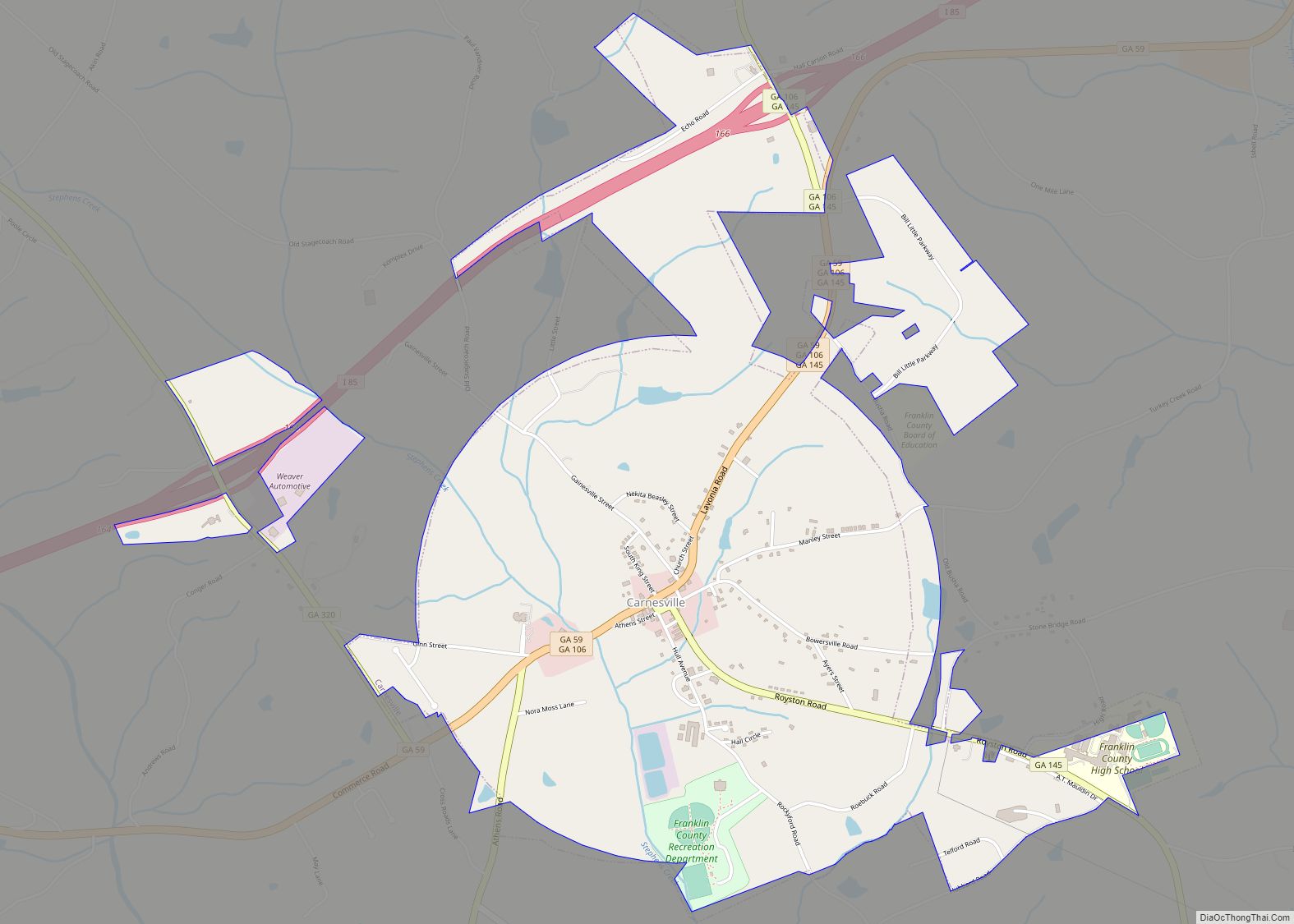
Online Interactive Map
Click on ![]() to view map in "full screen" mode.
to view map in "full screen" mode.
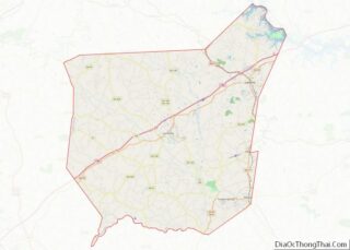
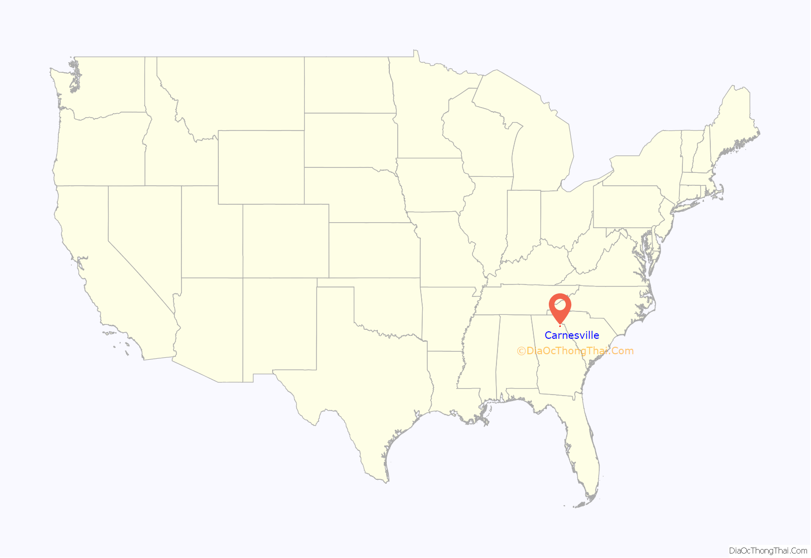
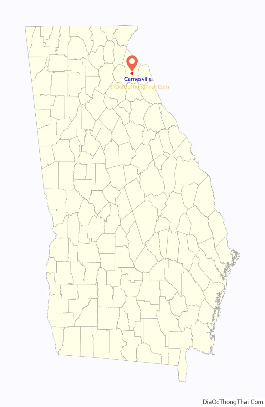
Carnesville location map. Where is Carnesville city?
History
Carnesville was founded in 1805 as the seat of Franklin County. It was incorporated as a town in 1819 and as a city in 1901. The town is named after Judge Thomas P. Carnes, a lawyer and congressman of the Revolutionary War era.
In the 1850 census, the area around Carnesville had a free population of 9,131, and a slave population of 2,382.
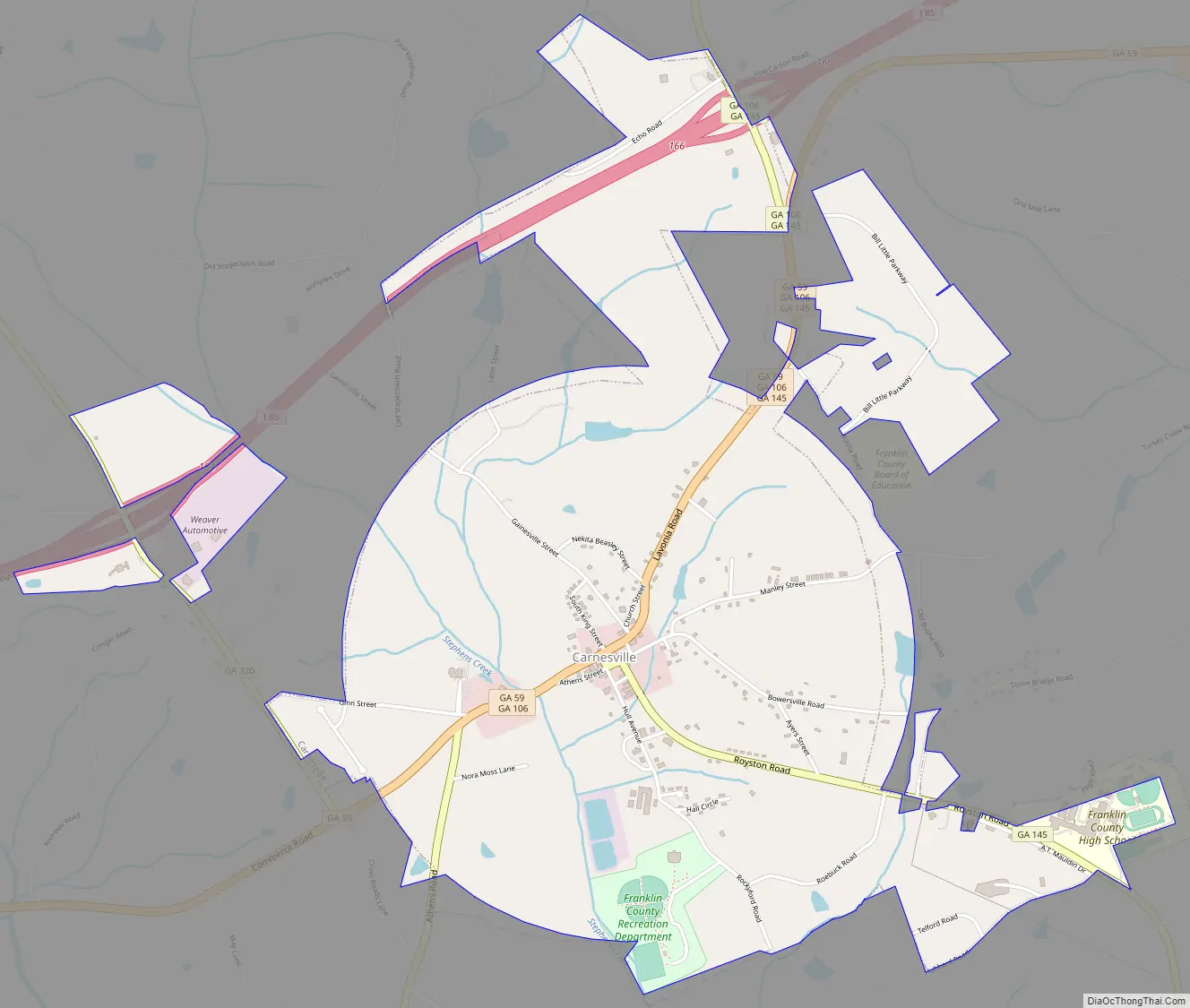
Carnesville Road Map
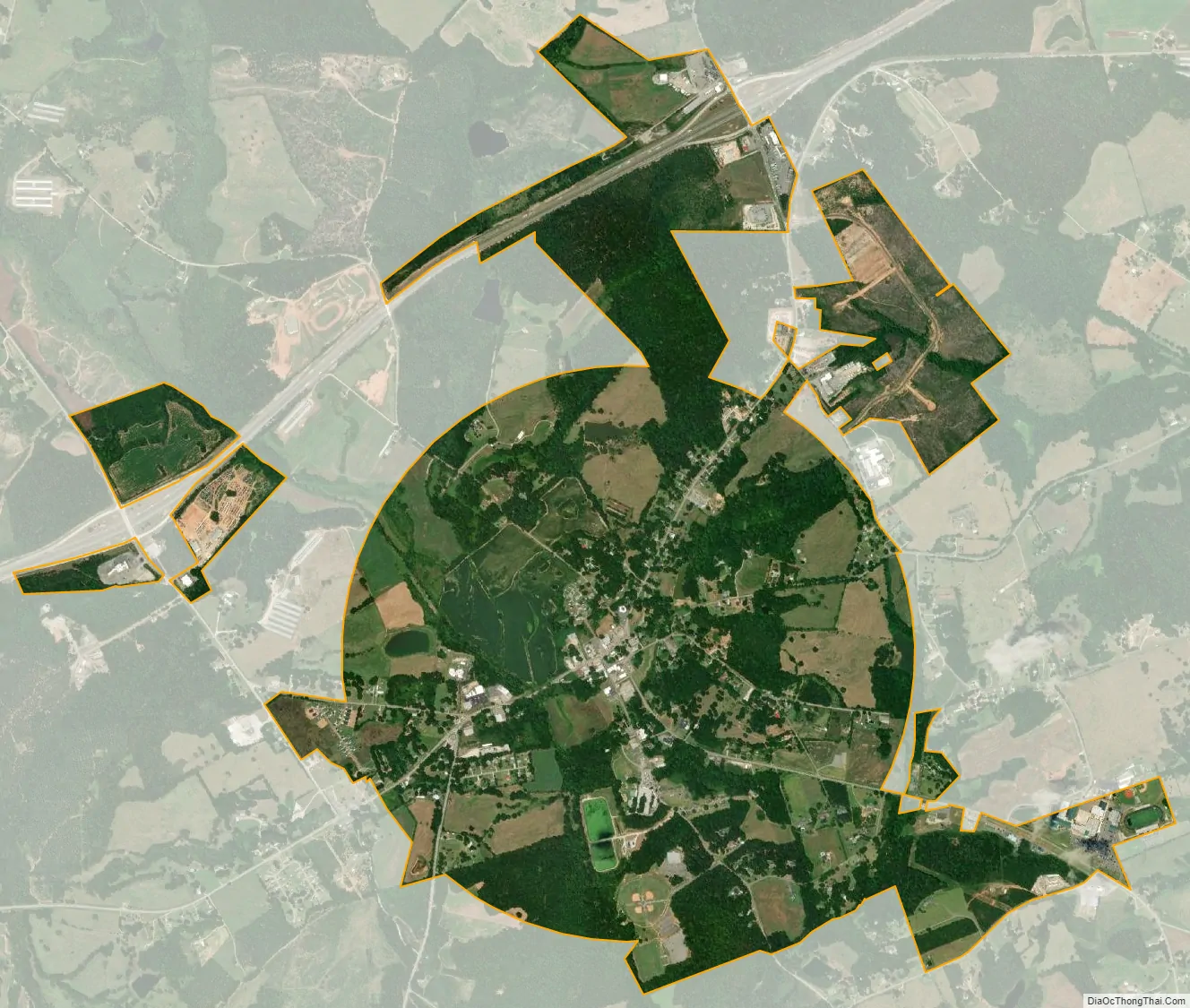
Carnesville city Satellite Map
Geography
Carnesville is located in the center of Franklin County in northeastern Georgia. Interstate 85 passes northwest of the city, with access from Exits 164 and 166. I-85 leads southwest 85 miles (137 km) to Atlanta and northeast 62 miles (100 km) to Greenville, South Carolina.
According to the United States Census Bureau, Carnesville has a total area of 2.6 square miles (6.8 km), of which 0.02 square miles (0.06 km), or 0.86%, is water. Carnesville is situated in the watershed of the Broad River, a tributary of the Savannah River.
See also
Map of Georgia State and its subdivision:- Appling
- Atkinson
- Bacon
- Baker
- Baldwin
- Banks
- Barrow
- Bartow
- Ben Hill
- Berrien
- Bibb
- Bleckley
- Brantley
- Brooks
- Bryan
- Bulloch
- Burke
- Butts
- Calhoun
- Camden
- Candler
- Carroll
- Catoosa
- Charlton
- Chatham
- Chattahoochee
- Chattooga
- Cherokee
- Clarke
- Clay
- Clayton
- Clinch
- Cobb
- Coffee
- Colquitt
- Columbia
- Cook
- Coweta
- Crawford
- Crisp
- Dade
- Dawson
- Decatur
- DeKalb
- Dodge
- Dooly
- Dougherty
- Douglas
- Early
- Echols
- Effingham
- Elbert
- Emanuel
- Evans
- Fannin
- Fayette
- Floyd
- Forsyth
- Franklin
- Fulton
- Gilmer
- Glascock
- Glynn
- Gordon
- Grady
- Greene
- Gwinnett
- Habersham
- Hall
- Hancock
- Haralson
- Harris
- Hart
- Heard
- Henry
- Houston
- Irwin
- Jackson
- Jasper
- Jeff Davis
- Jefferson
- Jenkins
- Johnson
- Jones
- Lamar
- Lanier
- Laurens
- Lee
- Liberty
- Lincoln
- Long
- Lowndes
- Lumpkin
- Macon
- Madison
- Marion
- McDuffie
- McIntosh
- Meriwether
- Miller
- Mitchell
- Monroe
- Montgomery
- Morgan
- Murray
- Muscogee
- Newton
- Oconee
- Oglethorpe
- Paulding
- Peach
- Pickens
- Pierce
- Pike
- Polk
- Pulaski
- Putnam
- Quitman
- Rabun
- Randolph
- Richmond
- Rockdale
- Schley
- Screven
- Seminole
- Spalding
- Stephens
- Stewart
- Sumter
- Talbot
- Taliaferro
- Tattnall
- Taylor
- Telfair
- Terrell
- Thomas
- Tift
- Toombs
- Towns
- Treutlen
- Troup
- Turner
- Twiggs
- Union
- Upson
- Walker
- Walton
- Ware
- Warren
- Washington
- Wayne
- Webster
- Wheeler
- White
- Whitfield
- Wilcox
- Wilkes
- Wilkinson
- Worth
- Alabama
- Alaska
- Arizona
- Arkansas
- California
- Colorado
- Connecticut
- Delaware
- District of Columbia
- Florida
- Georgia
- Hawaii
- Idaho
- Illinois
- Indiana
- Iowa
- Kansas
- Kentucky
- Louisiana
- Maine
- Maryland
- Massachusetts
- Michigan
- Minnesota
- Mississippi
- Missouri
- Montana
- Nebraska
- Nevada
- New Hampshire
- New Jersey
- New Mexico
- New York
- North Carolina
- North Dakota
- Ohio
- Oklahoma
- Oregon
- Pennsylvania
- Rhode Island
- South Carolina
- South Dakota
- Tennessee
- Texas
- Utah
- Vermont
- Virginia
- Washington
- West Virginia
- Wisconsin
- Wyoming