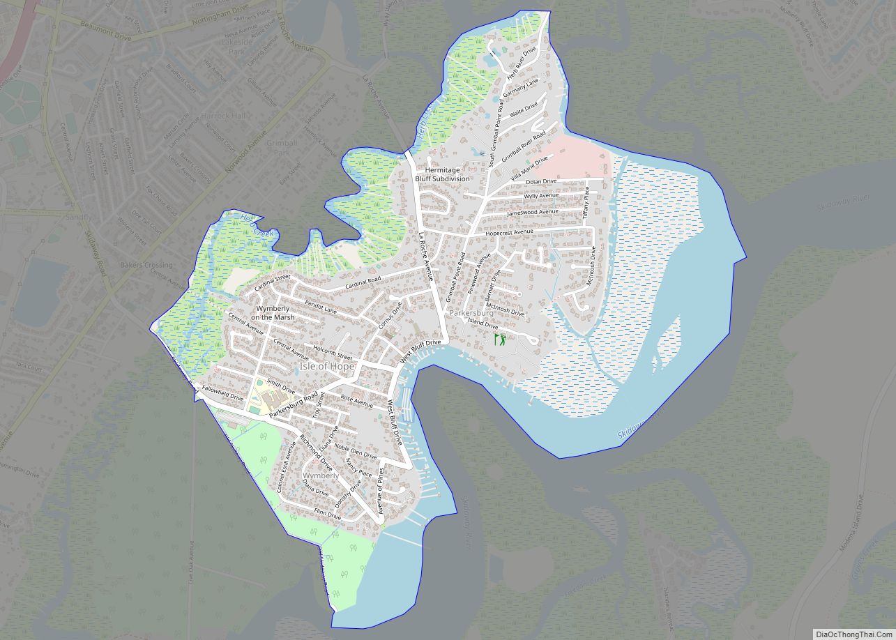
Isle of Hope is a census-designated place (CDP) in Chatham County, Georgia, United States. It is part of the Savannah Metropolitan Statistical Area, and at the 2020 U.S. census its population was 2,357. The island is one of the most affluent communities in the state and is well known for its historic plantations and exclusive waterfront properties.
| Name: | Isle of Hope CDP |
|---|---|
| LSAD Code: | 57 |
| LSAD Description: | CDP (suffix) |
| State: | Georgia |
| County: | Chatham County |
| Elevation: | 13 ft (4 m) |
| Total Area: | 2.28 sq mi (5.91 km²) |
| Land Area: | 1.96 sq mi (5.08 km²) |
| Water Area: | 0.32 sq mi (0.83 km²) |
| Total Population: | 2,357 |
| Population Density: | 1,201.94/sq mi (464.12/km²) |
| FIPS code: | 1341484 |
| GNISfeature ID: | 0332069 |
Online Interactive Map
Click on ![]() to view map in "full screen" mode.
to view map in "full screen" mode.
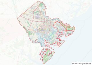
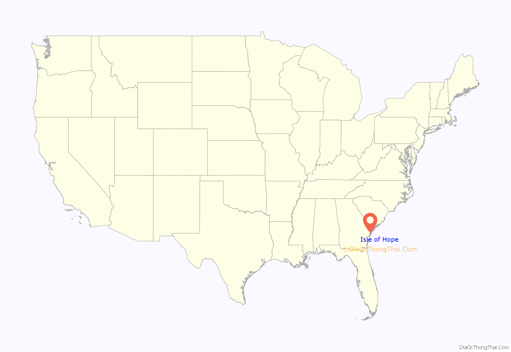
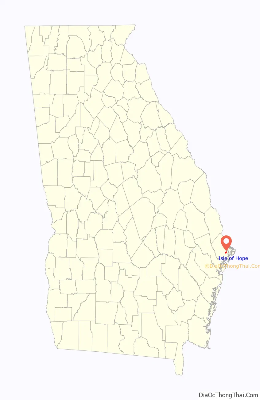
Isle of Hope location map. Where is Isle of Hope CDP?
History
Isle of Hope is an island surrounded on all sides by water at high tide. Early maps referred to in French as “L’Isle Desperance” (modern French: L’Île d’Espérance). Legends abound of pirates using the island to hide their booty, and generations of children have gone digging for this treasure. Legend also states that French Huguenots used the island as a place of refuge for fleeing persecution.
In 1733, when General James Oglethorpe founded the Georgia colony, a surveyor named Noble Jones was granted a tract on the island that was eventually named Wormsloe, possibly after an English estate but more probably due to the mulberry trees that were grown there, the worms of which, it was hoped, would form the basis for a silk industry. A Colonial-era fortified home made of tabby was built at the Skidaway Narrows (now Jones’ Narrows) and today can be visited as part of Wormsloe Historic Site.
Jones, along with James Fallowfield and Henry Parker, settled permanently on the island. During nearby Savannah’s frequent yellow fever epidemics, the island was host to Savannahians fleeing the miasma of the city’s fevers. As greater numbers of people discovered the island, the former plantation lands were subdivided and the lots sold, and it became a fashionable summer retreat. Several homes from the antebellum period remain, including the 1820 former caretaker’s cottage of Carsten Hall plantation. Although the plantation itself burned in the early 20th century, the family moved into the caretaker’s cottage overlooking the Intracoastal Waterway.
In the early 20th century, with better transportation options, the summer resort became the year-round home of many, and the terrapin farm at Barbee’s Pavilion became world-famous for the export of terrapins for stew, including to the major restaurants of New York City and to the Czar of Russia. It was also the destination of race car drivers from around the world for the International Grand Prix races.
The Isle of Hope United Methodist Church is another historic location on the island. Built before the Civil War, the property was used by the Confederates as an encampment and the church building as a hospital. During their recuperation, soldiers carved their initials into the pews, which they used for makeshift beds. When the old church burned down during its 1984 renovation, the pews had been removed and were saved. Thirty-three Confederate soldiers are buried in the churchyard. In 2000, the church finished construction of transepts to the main sanctuary structure.
The island’s beauty and history has attracted a number of Hollywood film productions, including the Oscar-winning Glory, the original Cape Fear, The Last of the Belles, Forrest Gump, and The Last Song.
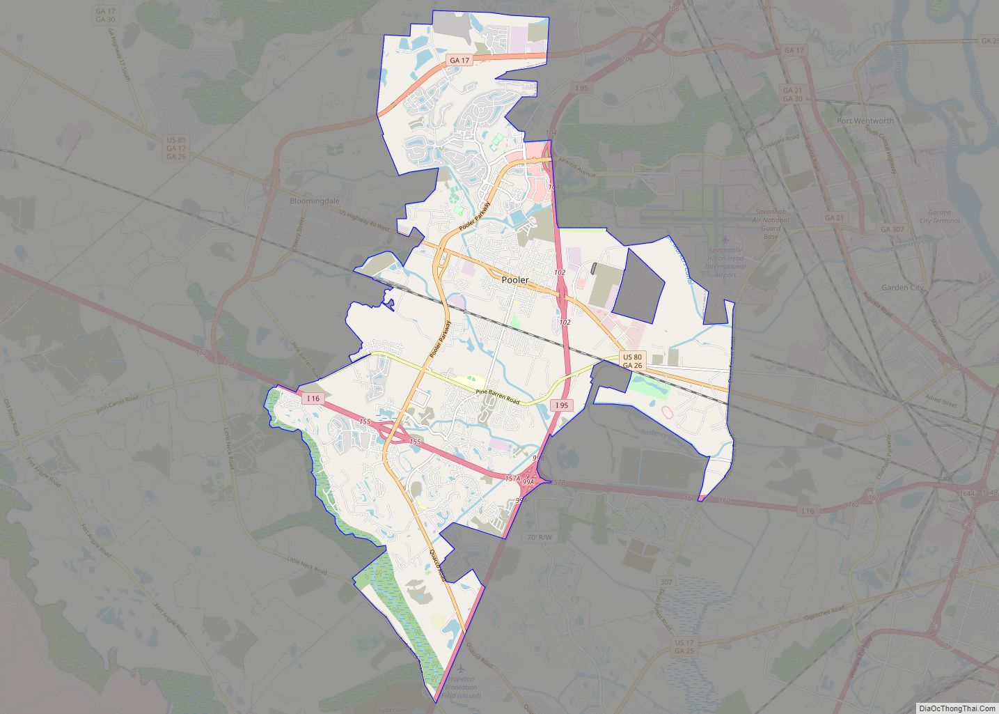
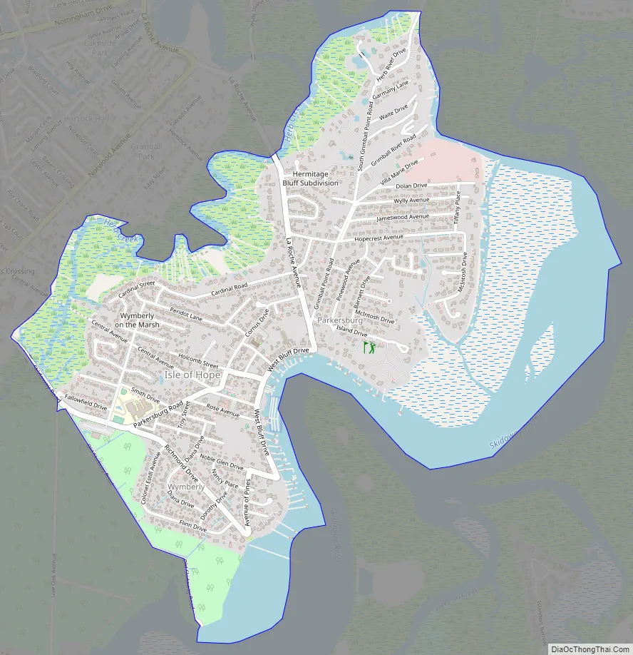
Isle of Hope Road Map
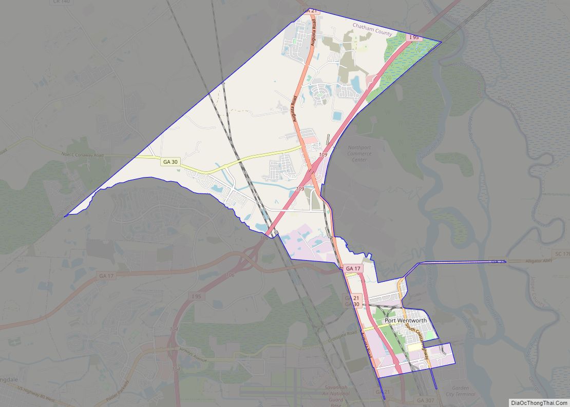
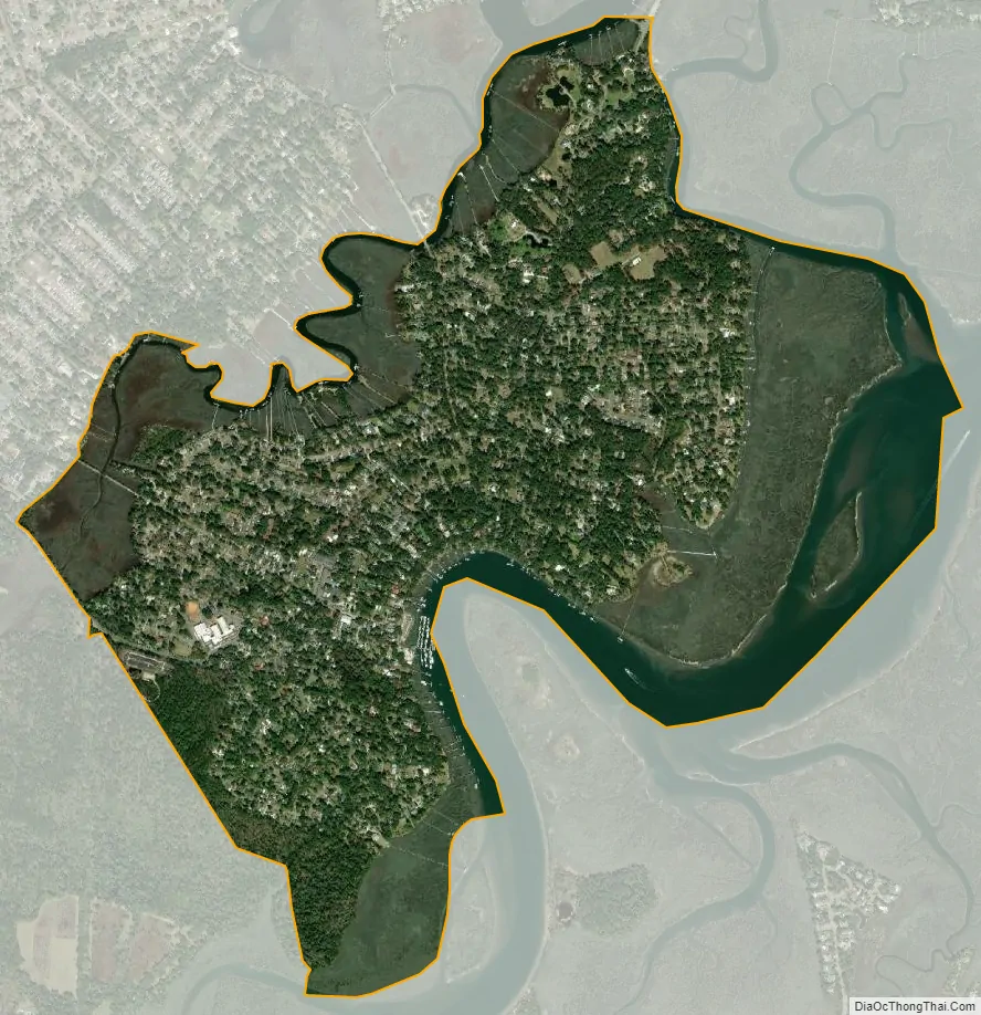
Isle of Hope city Satellite Map
Geography
Isle of Hope is located southeast of Savannah at 31°59′0″N 81°3′20″W / 31.98333°N 81.05556°W / 31.98333; -81.05556 (31.983380, -81.055686). It consists of the northern half of the physical Isle of Hope, a body of land surrounded by tidal inlets: the Moon River and Herb River to the northwest, Grimball Creek to the northeast, and the Skidaway River and Skidaway Narrows, part of the Intracoastal Waterway, to the southeast. The CDP is bordered by the Dutch Island CDP to the northeast and the Skidaway Island CDP to the southeast. The Isle of Hope CDP includes the communities of Parkersburg and Wymberley.
According to the United States Census Bureau, the CDP has a total area of 2.3 square miles (5.9 km), of which 1.8 square miles (4.7 km) is land and 0.46 square miles (1.2 km), or 20.61%, is water.
See also
Map of Georgia State and its subdivision:- Appling
- Atkinson
- Bacon
- Baker
- Baldwin
- Banks
- Barrow
- Bartow
- Ben Hill
- Berrien
- Bibb
- Bleckley
- Brantley
- Brooks
- Bryan
- Bulloch
- Burke
- Butts
- Calhoun
- Camden
- Candler
- Carroll
- Catoosa
- Charlton
- Chatham
- Chattahoochee
- Chattooga
- Cherokee
- Clarke
- Clay
- Clayton
- Clinch
- Cobb
- Coffee
- Colquitt
- Columbia
- Cook
- Coweta
- Crawford
- Crisp
- Dade
- Dawson
- Decatur
- DeKalb
- Dodge
- Dooly
- Dougherty
- Douglas
- Early
- Echols
- Effingham
- Elbert
- Emanuel
- Evans
- Fannin
- Fayette
- Floyd
- Forsyth
- Franklin
- Fulton
- Gilmer
- Glascock
- Glynn
- Gordon
- Grady
- Greene
- Gwinnett
- Habersham
- Hall
- Hancock
- Haralson
- Harris
- Hart
- Heard
- Henry
- Houston
- Irwin
- Jackson
- Jasper
- Jeff Davis
- Jefferson
- Jenkins
- Johnson
- Jones
- Lamar
- Lanier
- Laurens
- Lee
- Liberty
- Lincoln
- Long
- Lowndes
- Lumpkin
- Macon
- Madison
- Marion
- McDuffie
- McIntosh
- Meriwether
- Miller
- Mitchell
- Monroe
- Montgomery
- Morgan
- Murray
- Muscogee
- Newton
- Oconee
- Oglethorpe
- Paulding
- Peach
- Pickens
- Pierce
- Pike
- Polk
- Pulaski
- Putnam
- Quitman
- Rabun
- Randolph
- Richmond
- Rockdale
- Schley
- Screven
- Seminole
- Spalding
- Stephens
- Stewart
- Sumter
- Talbot
- Taliaferro
- Tattnall
- Taylor
- Telfair
- Terrell
- Thomas
- Tift
- Toombs
- Towns
- Treutlen
- Troup
- Turner
- Twiggs
- Union
- Upson
- Walker
- Walton
- Ware
- Warren
- Washington
- Wayne
- Webster
- Wheeler
- White
- Whitfield
- Wilcox
- Wilkes
- Wilkinson
- Worth
- Alabama
- Alaska
- Arizona
- Arkansas
- California
- Colorado
- Connecticut
- Delaware
- District of Columbia
- Florida
- Georgia
- Hawaii
- Idaho
- Illinois
- Indiana
- Iowa
- Kansas
- Kentucky
- Louisiana
- Maine
- Maryland
- Massachusetts
- Michigan
- Minnesota
- Mississippi
- Missouri
- Montana
- Nebraska
- Nevada
- New Hampshire
- New Jersey
- New Mexico
- New York
- North Carolina
- North Dakota
- Ohio
- Oklahoma
- Oregon
- Pennsylvania
- Rhode Island
- South Carolina
- South Dakota
- Tennessee
- Texas
- Utah
- Vermont
- Virginia
- Washington
- West Virginia
- Wisconsin
- Wyoming