Lakeland is a city in Lanier County, Georgia, United States. The city is the county seat of Lanier County. It is part of the Valdosta, Georgia Metropolitan Statistical Area. The population was 3,366 at the 2010 census.
Originally called Alapaha and then Milltown or Mill Town, Lakeland received its current name in 1925 in honor of its proximity to Grand Bay Lake, Lake Irma, and Banks Lake. For many years, Lakeland owned and operated its own railroad.
| Name: | Lakeland city |
|---|---|
| LSAD Code: | 25 |
| LSAD Description: | city (suffix) |
| State: | Georgia |
| County: | Lanier County |
| Elevation: | 200 ft (61 m) |
| Total Area: | 3.15 sq mi (8.16 km²) |
| Land Area: | 3.10 sq mi (8.04 km²) |
| Water Area: | 0.05 sq mi (0.12 km²) |
| Total Population: | 2,875 |
| Population Density: | 926.52/sq mi (357.79/km²) |
| ZIP code: | 31635 |
| Area code: | 229 |
| FIPS code: | 1344592 |
| GNISfeature ID: | 0356347 |
Online Interactive Map
Click on ![]() to view map in "full screen" mode.
to view map in "full screen" mode.
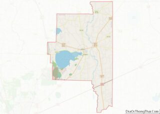
Lakeland location map. Where is Lakeland city?


History
By the late 1830s, a community known as Alapaha had come into existence along the road from Waresboro, Georgia to Troupville, Georgia near the mill established by Joshua Lee on what is now Banks Lake National Wildlife Refuge. In 1838, a post office was established and was officially named Alapaha after the nearby Alapaha River. In 1848, Joshua Lee sold his mill to William Lastinger. In the 1850s, additional mills were established in the area and the population of the community continued to grow. In 1857, Alapaha was renamed Milltown. During the American Civil, William Lastinger sold his mill to Henry Banks. Milltown was incorporated in 1901. In 1919, Milltown was designated seat of the newly formed Lanier County. In 1928, the city was incorporated and renamed to its present form of Lakeland.
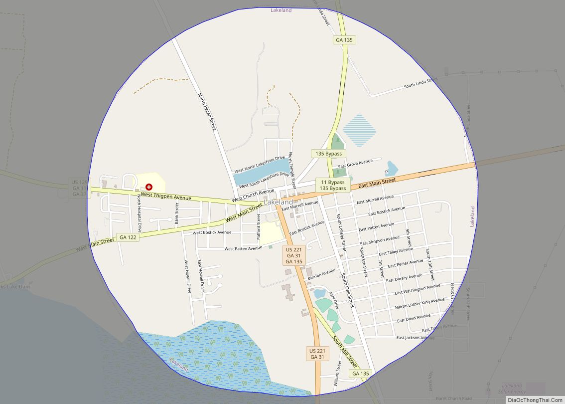
Lakeland Road Map
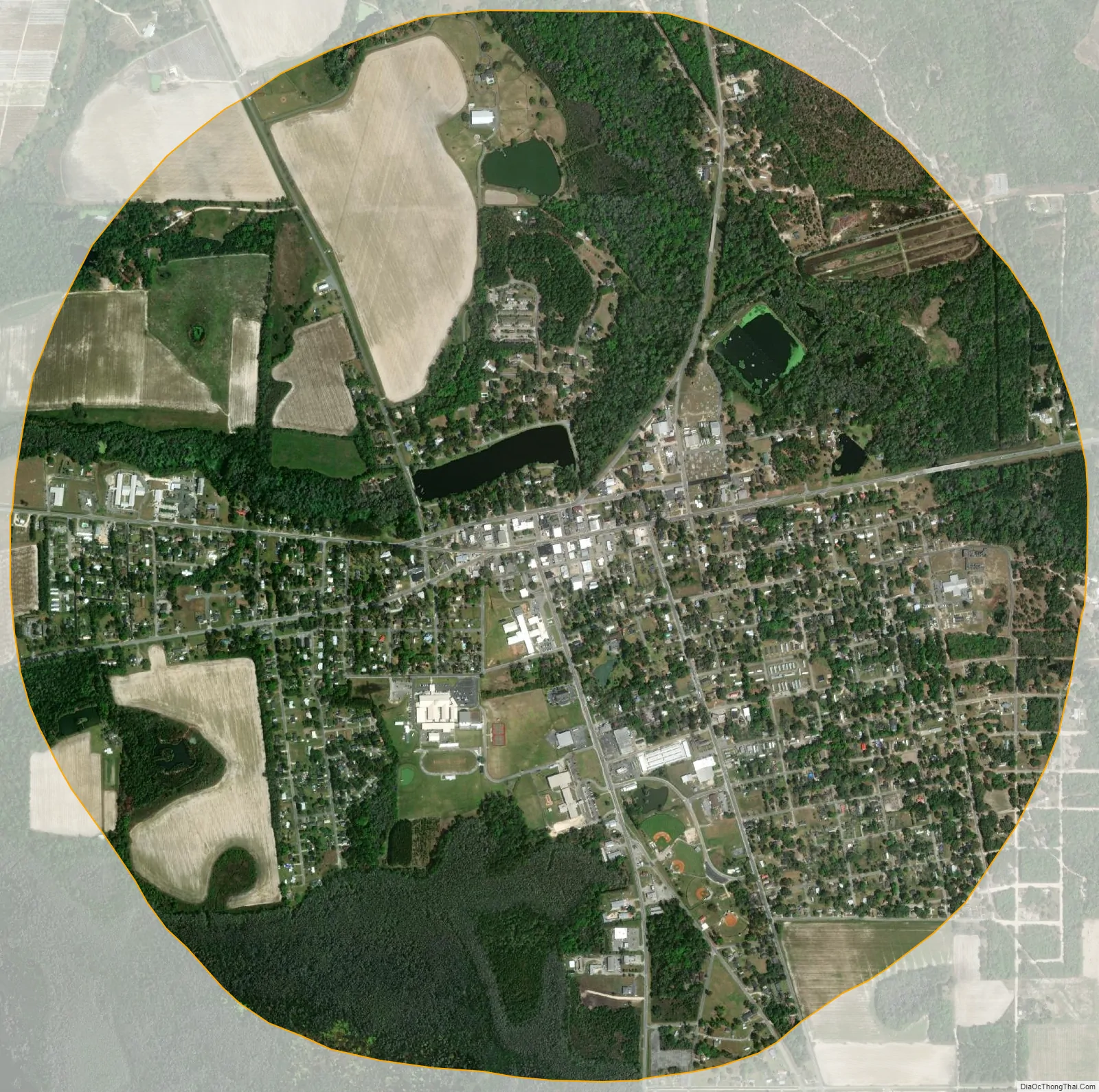
Lakeland city Satellite Map
Geography
Lakeland is located at 31°2′21″N 83°4′13″W / 31.03917°N 83.07028°W / 31.03917; -83.07028 (31.039214, -83.070397).
According to the United States Census Bureau, the city has a total area of 3.1 square miles (8.0 km), of which 3.1 square miles (8.0 km) is land and 0.04 square miles (0.10 km) (1.28%) is water.
See also
Map of Georgia State and its subdivision:- Appling
- Atkinson
- Bacon
- Baker
- Baldwin
- Banks
- Barrow
- Bartow
- Ben Hill
- Berrien
- Bibb
- Bleckley
- Brantley
- Brooks
- Bryan
- Bulloch
- Burke
- Butts
- Calhoun
- Camden
- Candler
- Carroll
- Catoosa
- Charlton
- Chatham
- Chattahoochee
- Chattooga
- Cherokee
- Clarke
- Clay
- Clayton
- Clinch
- Cobb
- Coffee
- Colquitt
- Columbia
- Cook
- Coweta
- Crawford
- Crisp
- Dade
- Dawson
- Decatur
- DeKalb
- Dodge
- Dooly
- Dougherty
- Douglas
- Early
- Echols
- Effingham
- Elbert
- Emanuel
- Evans
- Fannin
- Fayette
- Floyd
- Forsyth
- Franklin
- Fulton
- Gilmer
- Glascock
- Glynn
- Gordon
- Grady
- Greene
- Gwinnett
- Habersham
- Hall
- Hancock
- Haralson
- Harris
- Hart
- Heard
- Henry
- Houston
- Irwin
- Jackson
- Jasper
- Jeff Davis
- Jefferson
- Jenkins
- Johnson
- Jones
- Lamar
- Lanier
- Laurens
- Lee
- Liberty
- Lincoln
- Long
- Lowndes
- Lumpkin
- Macon
- Madison
- Marion
- McDuffie
- McIntosh
- Meriwether
- Miller
- Mitchell
- Monroe
- Montgomery
- Morgan
- Murray
- Muscogee
- Newton
- Oconee
- Oglethorpe
- Paulding
- Peach
- Pickens
- Pierce
- Pike
- Polk
- Pulaski
- Putnam
- Quitman
- Rabun
- Randolph
- Richmond
- Rockdale
- Schley
- Screven
- Seminole
- Spalding
- Stephens
- Stewart
- Sumter
- Talbot
- Taliaferro
- Tattnall
- Taylor
- Telfair
- Terrell
- Thomas
- Tift
- Toombs
- Towns
- Treutlen
- Troup
- Turner
- Twiggs
- Union
- Upson
- Walker
- Walton
- Ware
- Warren
- Washington
- Wayne
- Webster
- Wheeler
- White
- Whitfield
- Wilcox
- Wilkes
- Wilkinson
- Worth
- Alabama
- Alaska
- Arizona
- Arkansas
- California
- Colorado
- Connecticut
- Delaware
- District of Columbia
- Florida
- Georgia
- Hawaii
- Idaho
- Illinois
- Indiana
- Iowa
- Kansas
- Kentucky
- Louisiana
- Maine
- Maryland
- Massachusetts
- Michigan
- Minnesota
- Mississippi
- Missouri
- Montana
- Nebraska
- Nevada
- New Hampshire
- New Jersey
- New Mexico
- New York
- North Carolina
- North Dakota
- Ohio
- Oklahoma
- Oregon
- Pennsylvania
- Rhode Island
- South Carolina
- South Dakota
- Tennessee
- Texas
- Utah
- Vermont
- Virginia
- Washington
- West Virginia
- Wisconsin
- Wyoming