Oak Park is a city in Emanuel County, Georgia, United States. In 1934 the town got national attention when it elected a municipal government that entirely consisted of women. The population was 484 at the 2010 census, up from 366 in 2000.
| Name: | Oak Park town |
|---|---|
| LSAD Code: | 43 |
| LSAD Description: | town (suffix) |
| State: | Georgia |
| County: | Emanuel County |
| Elevation: | 259 ft (79 m) |
| Total Area: | 7.22 sq mi (18.71 km²) |
| Land Area: | 7.07 sq mi (18.30 km²) |
| Water Area: | 0.16 sq mi (0.41 km²) |
| Total Population: | 512 |
| Population Density: | 72.45/sq mi (27.97/km²) |
| ZIP code: | 30401 |
| Area code: | 478 |
| FIPS code: | 1357232 |
| GNISfeature ID: | 0332536 |
| Website: | www.oakparkga.org |
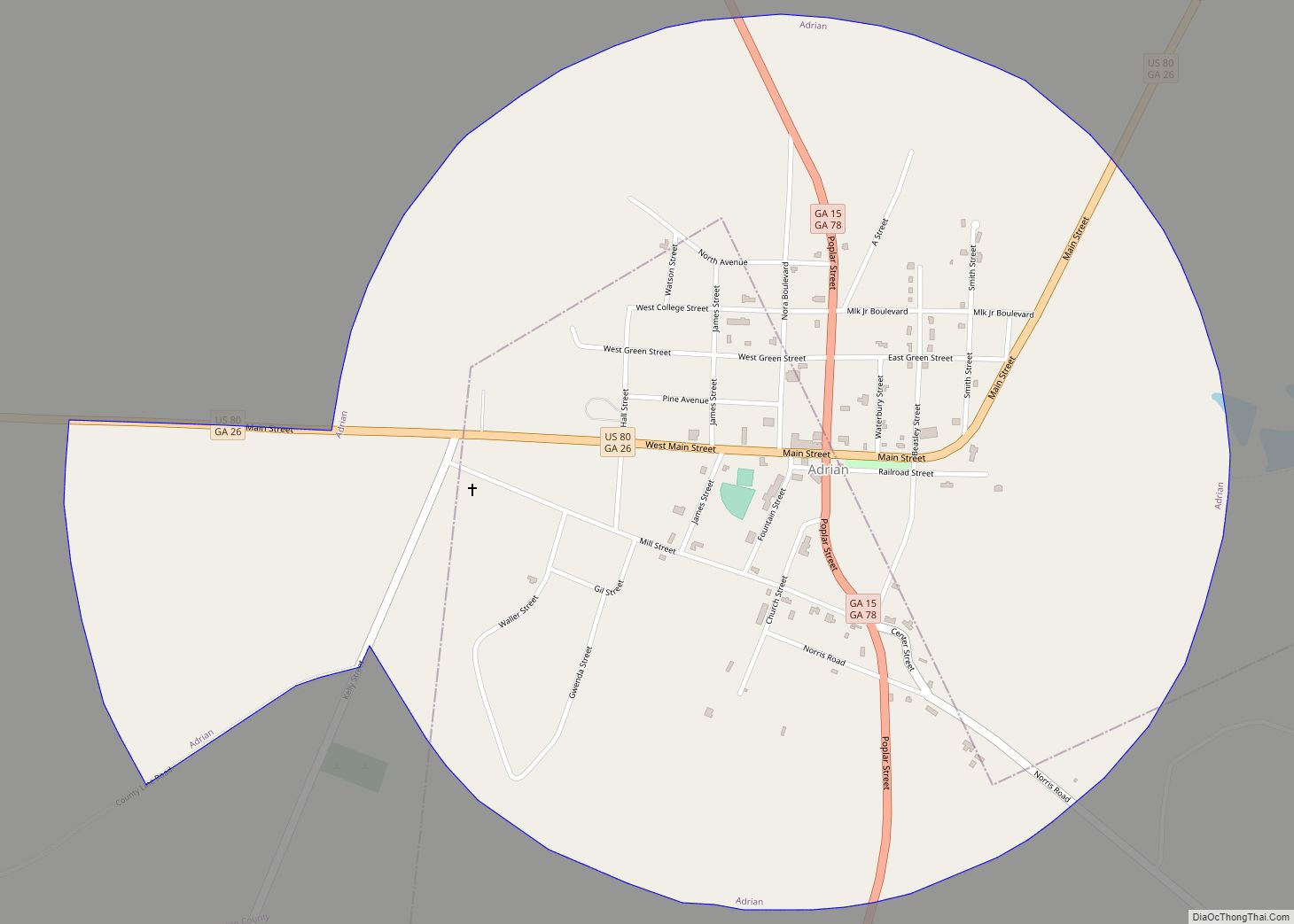
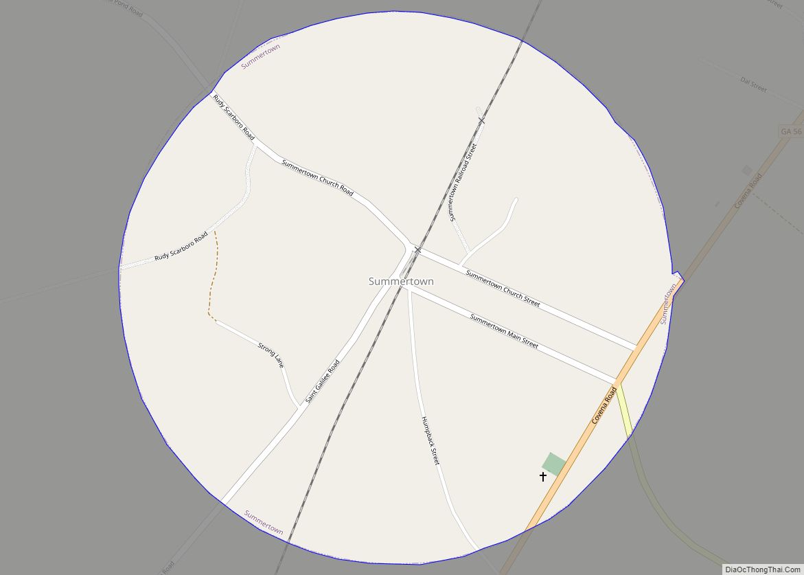
Online Interactive Map
Click on ![]() to view map in "full screen" mode.
to view map in "full screen" mode.
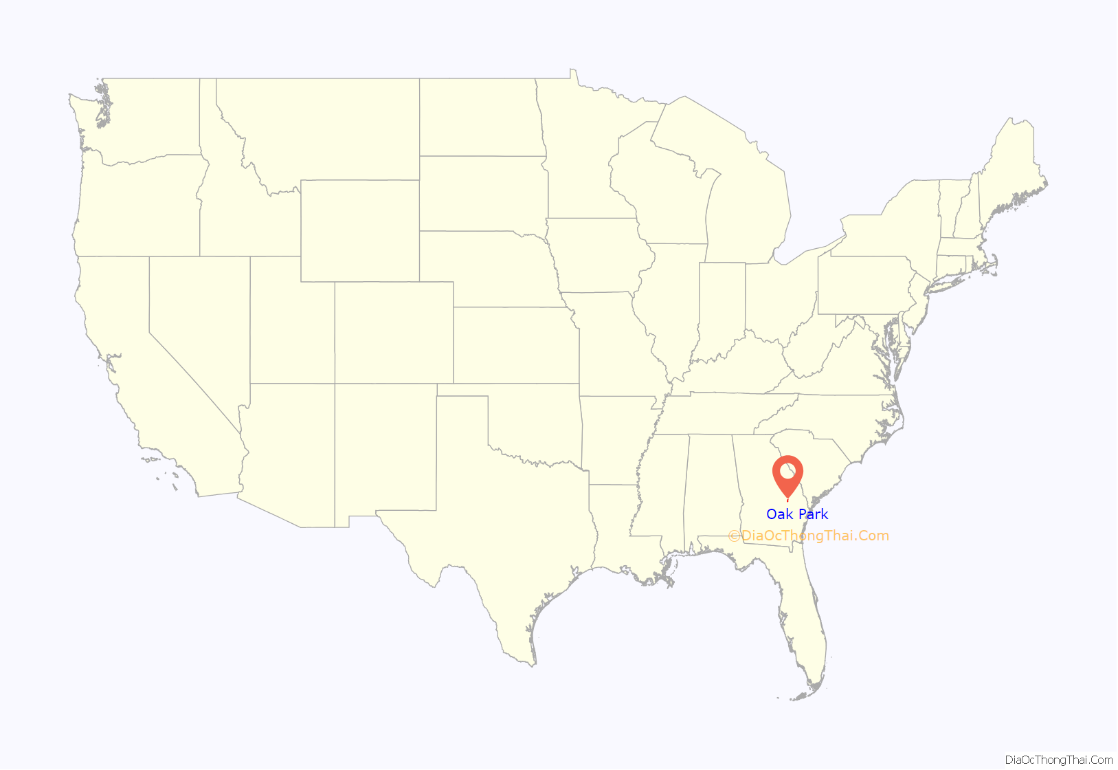
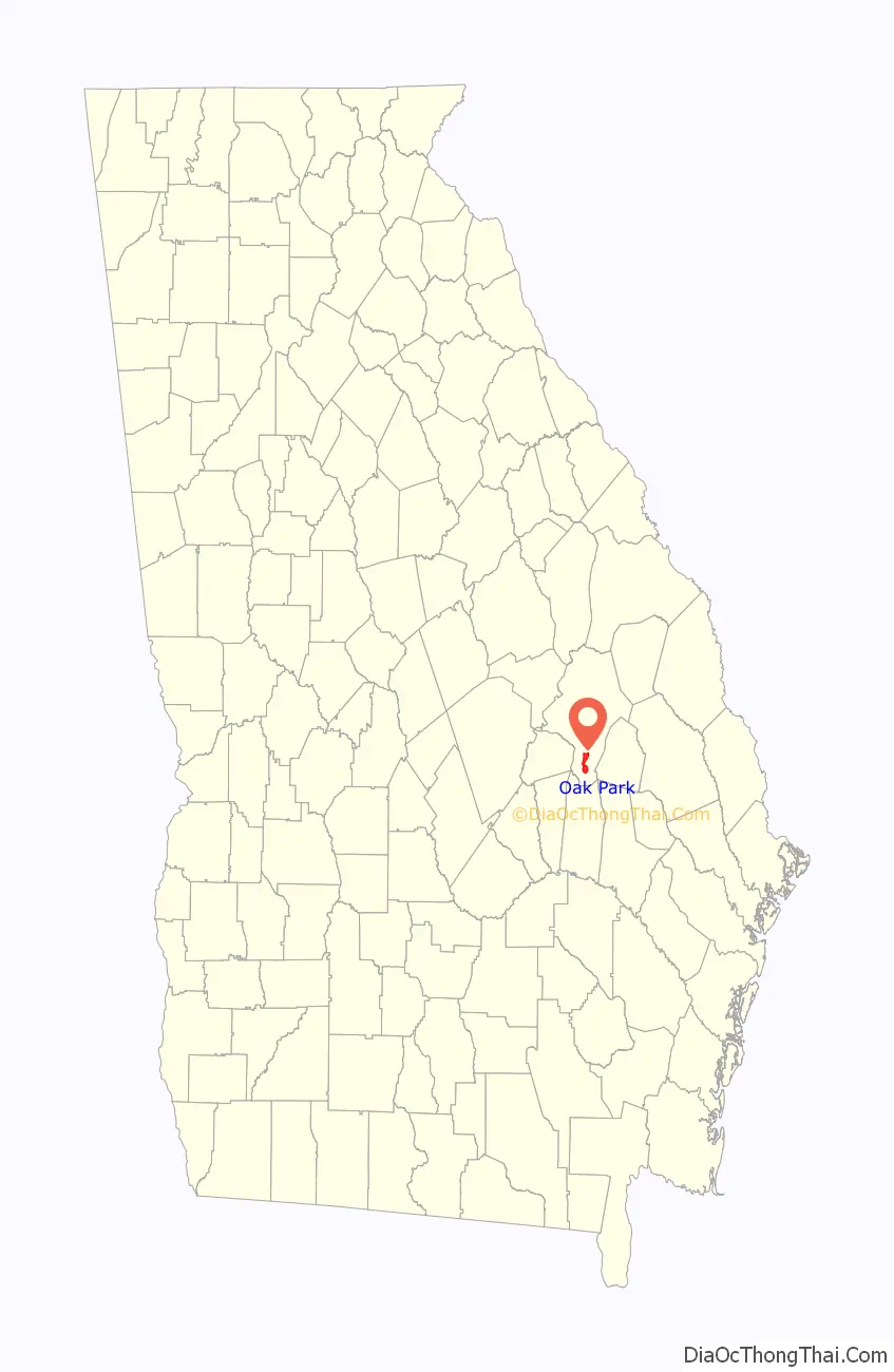
Oak Park location map. Where is Oak Park town?
History
The town was originally named Sol, Georgia from June to August of 1880 then the town name was changed to Horace, Georgia. The town name was later changed to Oak Park, Georgia in 1904.
In 1914 a murder–suicide committed by local farmer J.A. Eubanks got national news coverage. He murdered his wife and two daughters with an axe, set fire to some farm buildings, and shot himself in the head. Before killing himself, he woke a neighbor and told them what he had done. He did leave a suicide note. Several structures were destroyed in the fire, including houses of others. He had even cut the rope for the well bucket to keep the fire from being put out.
In a December 14, 1934 municipal election, Oak Park elected a mayor and five-person town council composed entirely of women. The election of an all-woman government was a first for Georgia, and novel enough that the event was covered by Associated Press and United Press news stories, both calling it “Petticoat Rule”. It was not a surprise to the town however, as the all-woman slate had been nominated by men when the previous mayor retired and no men volunteered to replace him.
Some in the town apparently dissented, as the jail was set ablaze the night before the election and dynamite blasts were set off after it, damaging buildings. Despite that, Mrs. Solomon S. Youmans (the wife of a local physician) was elected mayor, and the council consisted of Mrs. J.D. Tyson, Mrs. G.C. Corbin, Mrs. J.J. Powell, Mrs. G.C. Williamson and Miss Ada Belle Thompson.
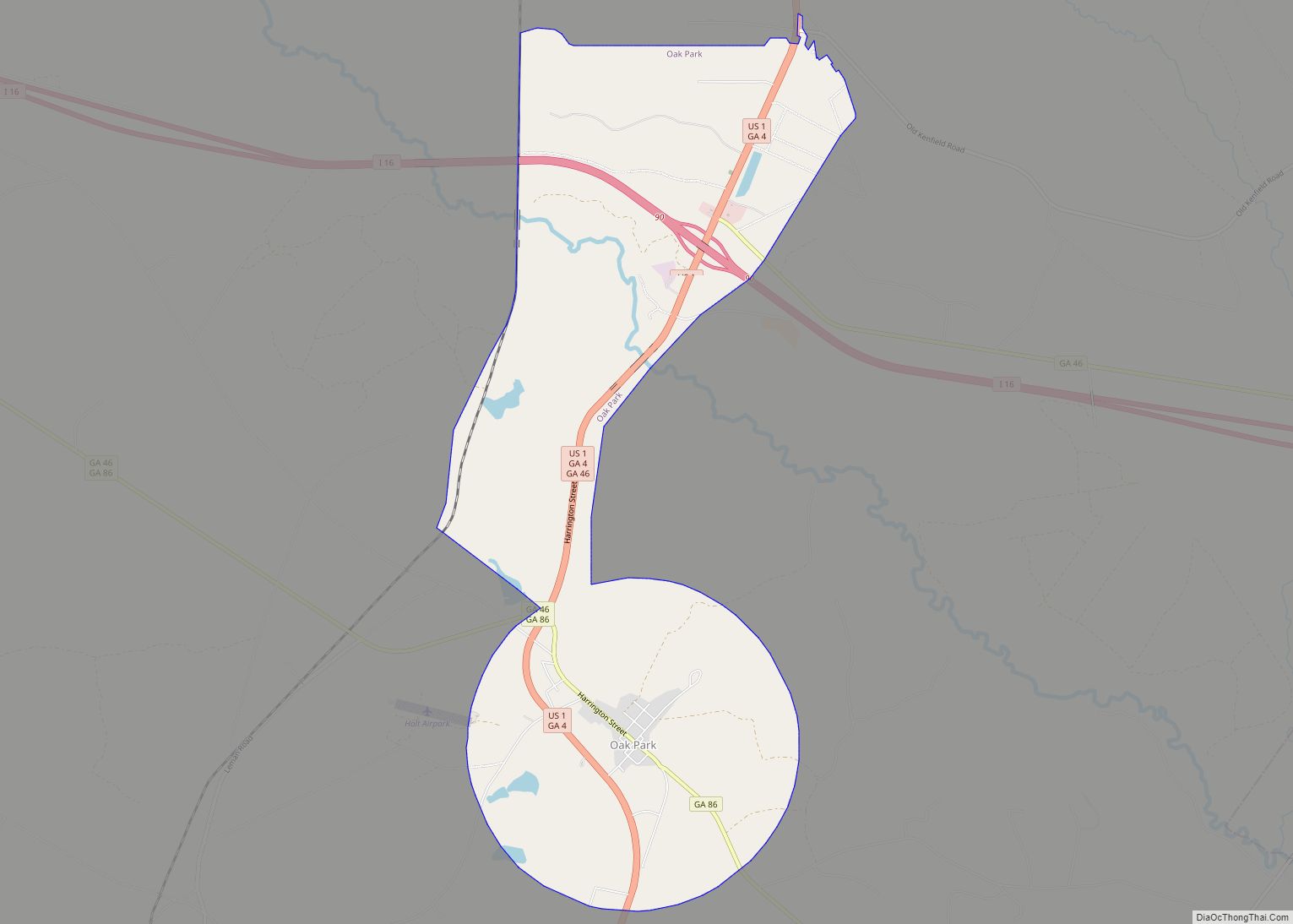
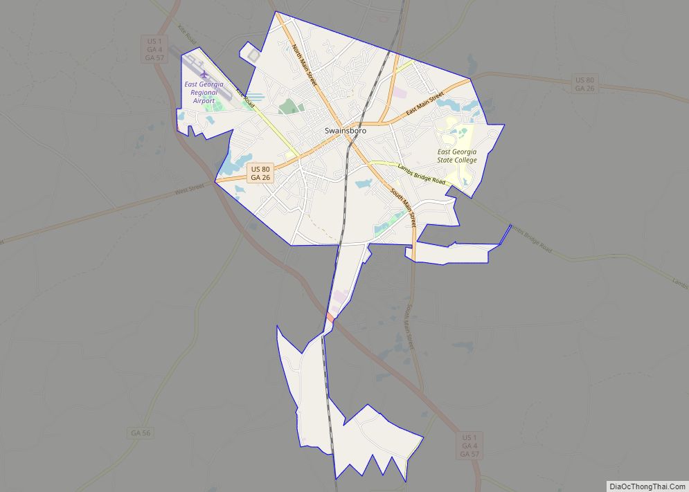
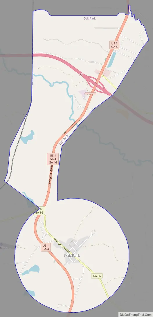
Oak Park Road Map
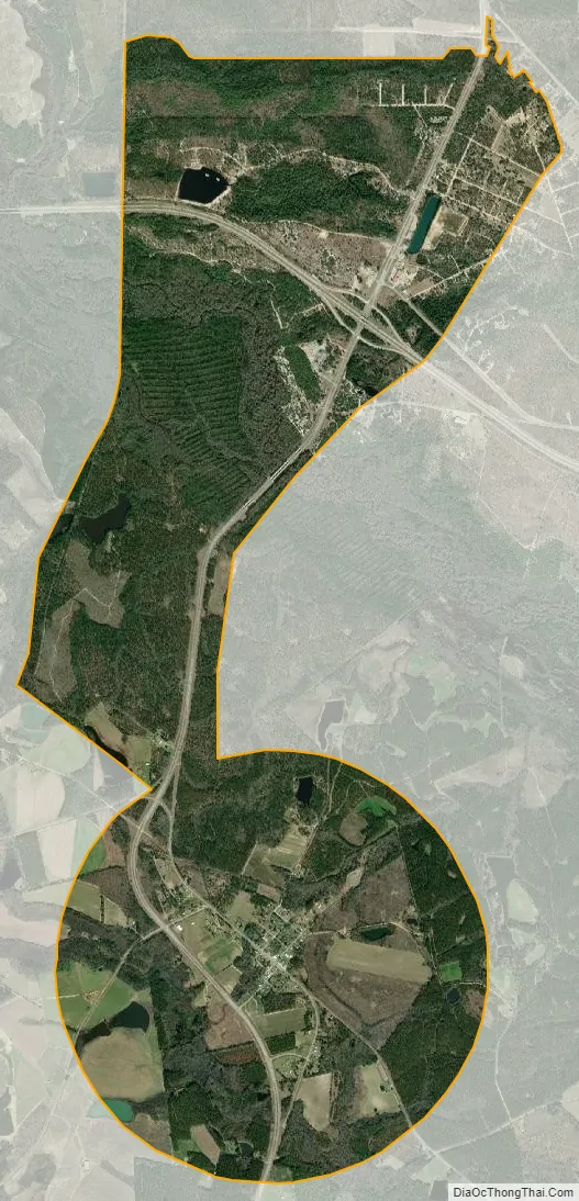
Oak Park city Satellite Map
Geography
Oak Park is located in southern Emanuel County at 32°22′15″N 82°18′36″W / 32.37083°N 82.31000°W / 32.37083; -82.31000 (32.370747, -82.309915), along U.S. Route 1. Interstate 16 passes through the northern part of the town, 3 miles (5 km) north of the original town center, with access to US 1 from Exit 90. I-16 leads east 77 miles (124 km) to Savannah and west 88 miles (142 km) to Macon, while US 1 leads north 18 miles (29 km) to Swainsboro, the Emanuel County seat, and south 11 miles (18 km) to Lyons.
According to the United States Census Bureau, Oak Park has a total area of 7.2 square miles (18.7 km), of which 7.1 square miles (18.3 km) is land and 0.15 square miles (0.4 km), or 2.17%, is water.
See also
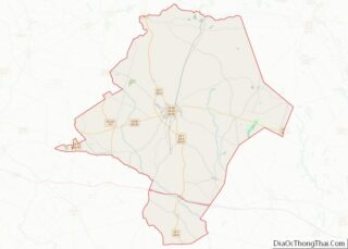
Map of Georgia State and its subdivision:- Appling
- Atkinson
- Bacon
- Baker
- Baldwin
- Banks
- Barrow
- Bartow
- Ben Hill
- Berrien
- Bibb
- Bleckley
- Brantley
- Brooks
- Bryan
- Bulloch
- Burke
- Butts
- Calhoun
- Camden
- Candler
- Carroll
- Catoosa
- Charlton
- Chatham
- Chattahoochee
- Chattooga
- Cherokee
- Clarke
- Clay
- Clayton
- Clinch
- Cobb
- Coffee
- Colquitt
- Columbia
- Cook
- Coweta
- Crawford
- Crisp
- Dade
- Dawson
- Decatur
- DeKalb
- Dodge
- Dooly
- Dougherty
- Douglas
- Early
- Echols
- Effingham
- Elbert
- Emanuel
- Evans
- Fannin
- Fayette
- Floyd
- Forsyth
- Franklin
- Fulton
- Gilmer
- Glascock
- Glynn
- Gordon
- Grady
- Greene
- Gwinnett
- Habersham
- Hall
- Hancock
- Haralson
- Harris
- Hart
- Heard
- Henry
- Houston
- Irwin
- Jackson
- Jasper
- Jeff Davis
- Jefferson
- Jenkins
- Johnson
- Jones
- Lamar
- Lanier
- Laurens
- Lee
- Liberty
- Lincoln
- Long
- Lowndes
- Lumpkin
- Macon
- Madison
- Marion
- McDuffie
- McIntosh
- Meriwether
- Miller
- Mitchell
- Monroe
- Montgomery
- Morgan
- Murray
- Muscogee
- Newton
- Oconee
- Oglethorpe
- Paulding
- Peach
- Pickens
- Pierce
- Pike
- Polk
- Pulaski
- Putnam
- Quitman
- Rabun
- Randolph
- Richmond
- Rockdale
- Schley
- Screven
- Seminole
- Spalding
- Stephens
- Stewart
- Sumter
- Talbot
- Taliaferro
- Tattnall
- Taylor
- Telfair
- Terrell
- Thomas
- Tift
- Toombs
- Towns
- Treutlen
- Troup
- Turner
- Twiggs
- Union
- Upson
- Walker
- Walton
- Ware
- Warren
- Washington
- Wayne
- Webster
- Wheeler
- White
- Whitfield
- Wilcox
- Wilkes
- Wilkinson
- Worth
- Alabama
- Alaska
- Arizona
- Arkansas
- California
- Colorado
- Connecticut
- Delaware
- District of Columbia
- Florida
- Georgia
- Hawaii
- Idaho
- Illinois
- Indiana
- Iowa
- Kansas
- Kentucky
- Louisiana
- Maine
- Maryland
- Massachusetts
- Michigan
- Minnesota
- Mississippi
- Missouri
- Montana
- Nebraska
- Nevada
- New Hampshire
- New Jersey
- New Mexico
- New York
- North Carolina
- North Dakota
- Ohio
- Oklahoma
- Oregon
- Pennsylvania
- Rhode Island
- South Carolina
- South Dakota
- Tennessee
- Texas
- Utah
- Vermont
- Virginia
- Washington
- West Virginia
- Wisconsin
- Wyoming