Swainsboro is a city in Emanuel County, Georgia, United States. As of the 2020 census, the city had a population of 7,425. The city is the county seat of Emanuel County.
| Name: | Swainsboro city |
|---|---|
| LSAD Code: | 25 |
| LSAD Description: | city (suffix) |
| State: | Georgia |
| County: | Emanuel County |
| Elevation: | 325 ft (99 m) |
| Total Area: | 12.94 sq mi (33.52 km²) |
| Land Area: | 12.58 sq mi (32.58 km²) |
| Water Area: | 0.36 sq mi (0.94 km²) |
| Total Population: | 7,425 |
| Population Density: | 590.27/sq mi (227.91/km²) |
| ZIP code: | 30401 |
| Area code: | 478 |
| FIPS code: | 1374964 |
| GNISfeature ID: | 0356574 |
| Website: | cityofswainsboro.org |
Online Interactive Map
Click on ![]() to view map in "full screen" mode.
to view map in "full screen" mode.
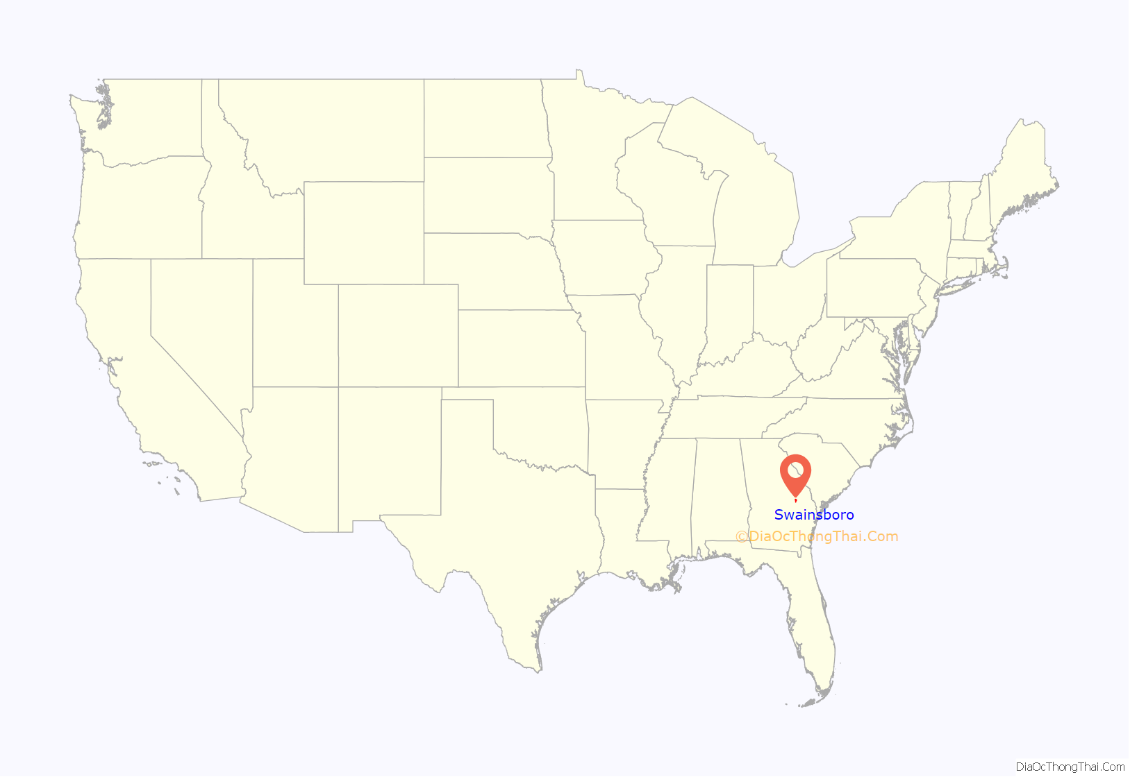
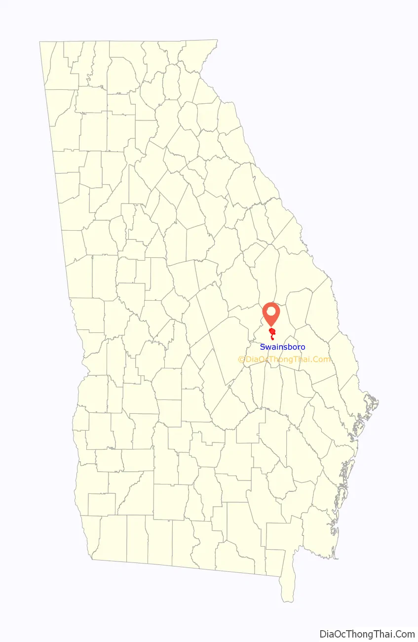
Swainsboro location map. Where is Swainsboro city?
History
In 1822, the Georgia state legislature established “Swainsborough” as the seat of Emanuel County. The town was named in recognition of Stephen Swain, the state senator who introduced the bill for the county’s creation in 1812. The town’s name was changed to “Paris” at its incorporation on February 18, 1854, but three years later reverted to its current name, Swainsboro.
Transportation
Early in its corporate life, much like other rural Georgia towns, Swainsboro depended on railroads for transportation. However, in the 1930s, many of the town’s streets and sidewalks were paved, and Swainsboro found itself at the intersection of two major national highways, U.S. 1 and U.S. 80, thus earning its city motto: “Crossroads of the Great South”. U.S. 1 was the principal highway from Maine to Key West, and U.S. 80, at that time, ran from Tybee Island, Georgia, to San Diego.
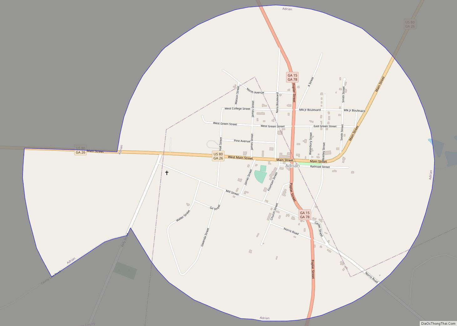
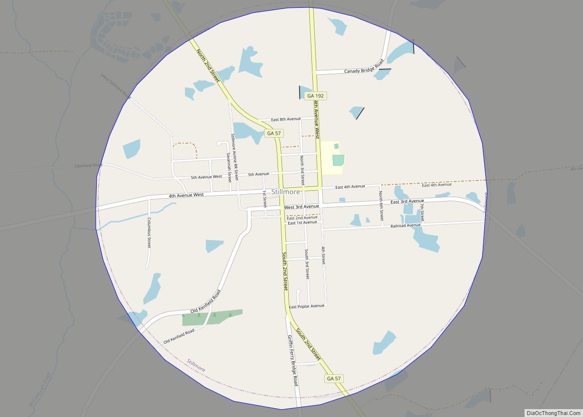
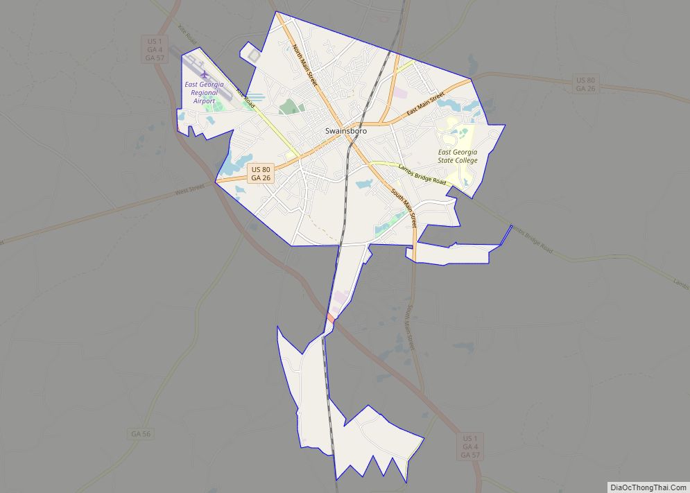
Swainsboro Road Map

Swainsboro city Satellite Map

Geography
Swainsboro is located near the center of Emanuel County at 32°35’37” North, 82°19’56” West (32.593743, -82.332146). U.S. Route 80 passes through the center of the city, and U.S. Route 1 bypasses it to the west. US 80 leads east 36 miles (58 km) to Statesboro and west 36 miles (58 km) to Dublin, while US 1 leads north 62 miles (100 km) to Augusta and south 106 miles (171 km) to Waycross. Interstate 16 is 14 miles (23 km) south of Swainsboro via US 1.
According to the United States Census Bureau, the city has a total area of 12.9 square miles (33.5 km), of which 12.6 square miles (32.6 km) is land and 0.35 square miles (0.9 km), or 2.81%, is water.
See also
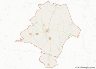
Map of Georgia State and its subdivision:- Appling
- Atkinson
- Bacon
- Baker
- Baldwin
- Banks
- Barrow
- Bartow
- Ben Hill
- Berrien
- Bibb
- Bleckley
- Brantley
- Brooks
- Bryan
- Bulloch
- Burke
- Butts
- Calhoun
- Camden
- Candler
- Carroll
- Catoosa
- Charlton
- Chatham
- Chattahoochee
- Chattooga
- Cherokee
- Clarke
- Clay
- Clayton
- Clinch
- Cobb
- Coffee
- Colquitt
- Columbia
- Cook
- Coweta
- Crawford
- Crisp
- Dade
- Dawson
- Decatur
- DeKalb
- Dodge
- Dooly
- Dougherty
- Douglas
- Early
- Echols
- Effingham
- Elbert
- Emanuel
- Evans
- Fannin
- Fayette
- Floyd
- Forsyth
- Franklin
- Fulton
- Gilmer
- Glascock
- Glynn
- Gordon
- Grady
- Greene
- Gwinnett
- Habersham
- Hall
- Hancock
- Haralson
- Harris
- Hart
- Heard
- Henry
- Houston
- Irwin
- Jackson
- Jasper
- Jeff Davis
- Jefferson
- Jenkins
- Johnson
- Jones
- Lamar
- Lanier
- Laurens
- Lee
- Liberty
- Lincoln
- Long
- Lowndes
- Lumpkin
- Macon
- Madison
- Marion
- McDuffie
- McIntosh
- Meriwether
- Miller
- Mitchell
- Monroe
- Montgomery
- Morgan
- Murray
- Muscogee
- Newton
- Oconee
- Oglethorpe
- Paulding
- Peach
- Pickens
- Pierce
- Pike
- Polk
- Pulaski
- Putnam
- Quitman
- Rabun
- Randolph
- Richmond
- Rockdale
- Schley
- Screven
- Seminole
- Spalding
- Stephens
- Stewart
- Sumter
- Talbot
- Taliaferro
- Tattnall
- Taylor
- Telfair
- Terrell
- Thomas
- Tift
- Toombs
- Towns
- Treutlen
- Troup
- Turner
- Twiggs
- Union
- Upson
- Walker
- Walton
- Ware
- Warren
- Washington
- Wayne
- Webster
- Wheeler
- White
- Whitfield
- Wilcox
- Wilkes
- Wilkinson
- Worth
- Alabama
- Alaska
- Arizona
- Arkansas
- California
- Colorado
- Connecticut
- Delaware
- District of Columbia
- Florida
- Georgia
- Hawaii
- Idaho
- Illinois
- Indiana
- Iowa
- Kansas
- Kentucky
- Louisiana
- Maine
- Maryland
- Massachusetts
- Michigan
- Minnesota
- Mississippi
- Missouri
- Montana
- Nebraska
- Nevada
- New Hampshire
- New Jersey
- New Mexico
- New York
- North Carolina
- North Dakota
- Ohio
- Oklahoma
- Oregon
- Pennsylvania
- Rhode Island
- South Carolina
- South Dakota
- Tennessee
- Texas
- Utah
- Vermont
- Virginia
- Washington
- West Virginia
- Wisconsin
- Wyoming