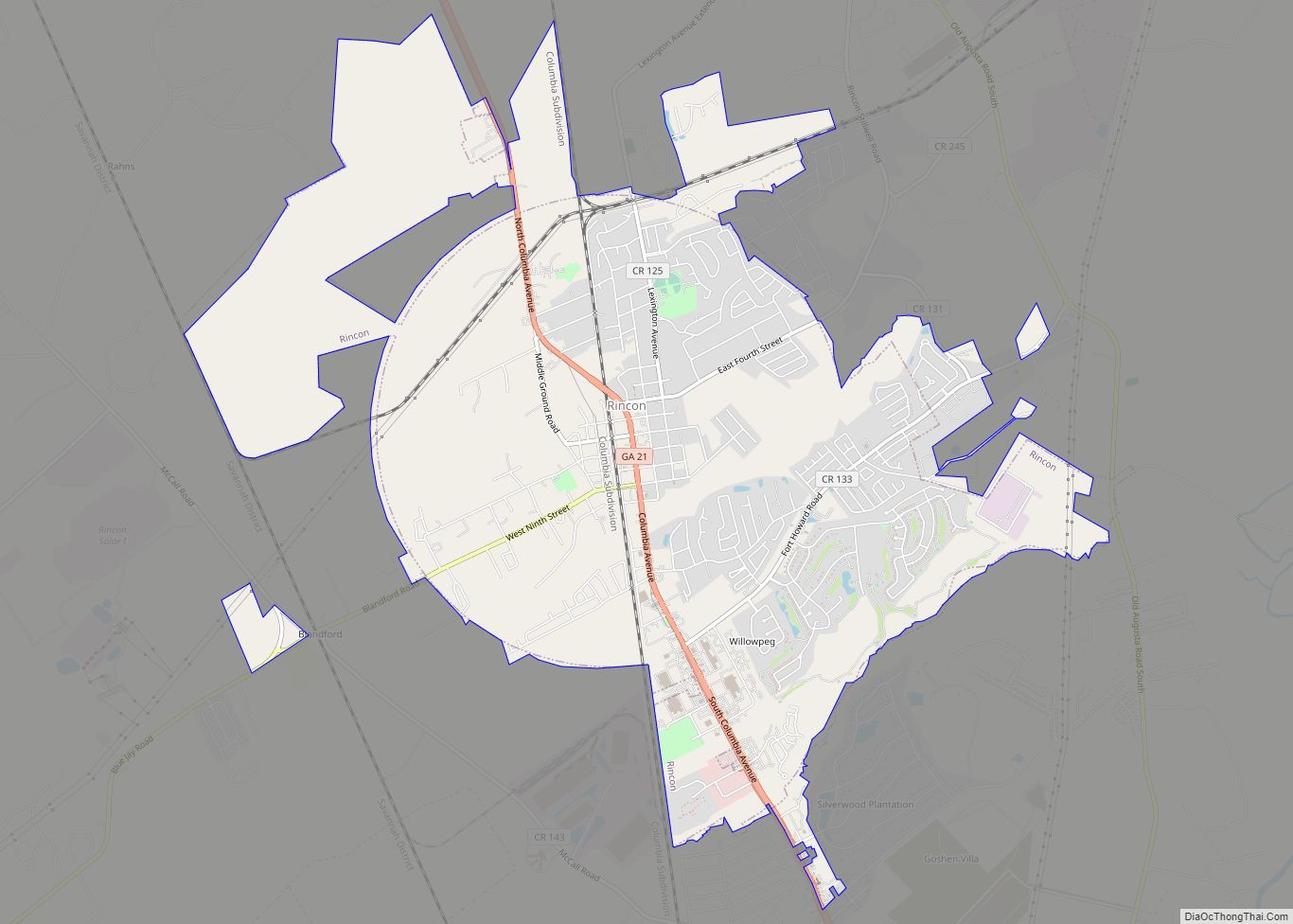
Rincon is a city in Effingham County, Georgia, United States. The 2020 population was 10,934, up from 8,836 at the 2010 census. Rincon is part of the Savannah Metropolitan Statistical Area.
| Name: | Rincon city |
|---|---|
| LSAD Code: | 25 |
| LSAD Description: | city (suffix) |
| State: | Georgia |
| County: | Effingham County |
| Elevation: | 72 ft (22 m) |
| Total Area: | 9.75 sq mi (25.24 km²) |
| Land Area: | 9.75 sq mi (25.24 km²) |
| Water Area: | 0.00 sq mi (0.00 km²) |
| Total Population: | 10,934 |
| Population Density: | 1,121.90/sq mi (433.17/km²) |
| ZIP code: | 31326 |
| Area code: | 912 |
| FIPS code: | 1365296 |
| GNISfeature ID: | 0332857 |
| Website: | www.cityofrincon.com |
Online Interactive Map
Click on ![]() to view map in "full screen" mode.
to view map in "full screen" mode.
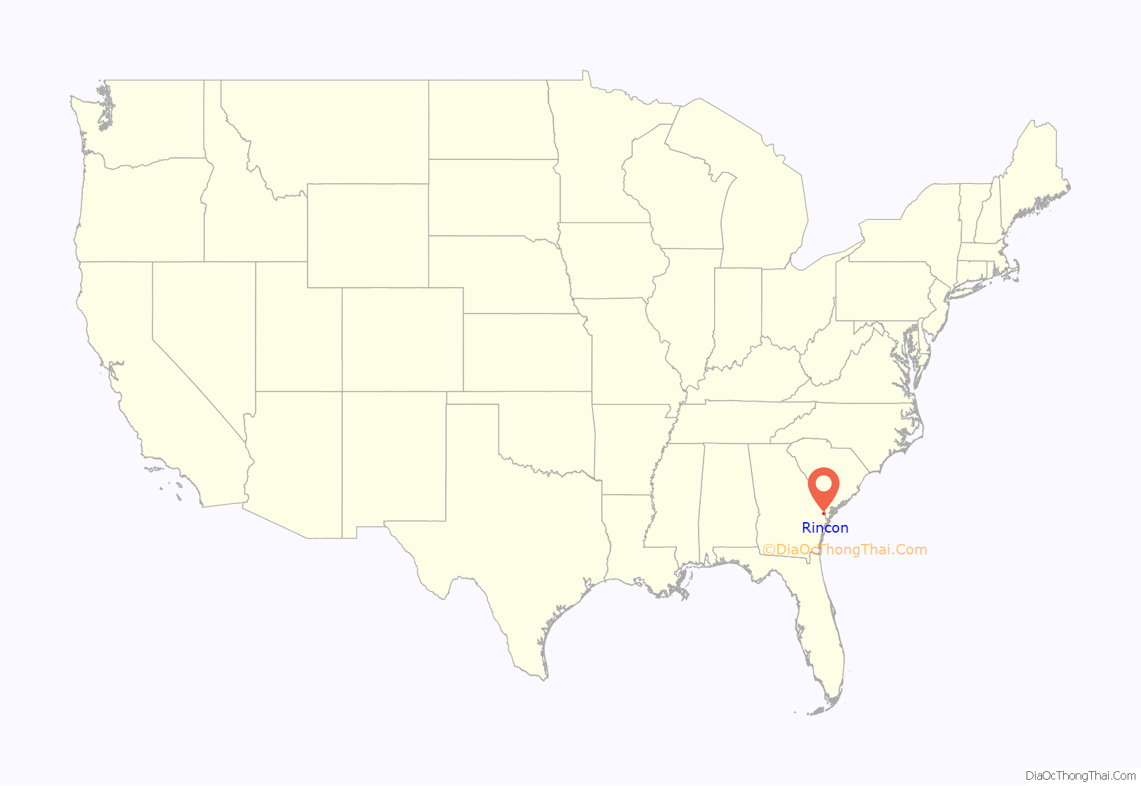
Rincon location map. Where is Rincon city?

History
Rincon, in the southeast area of Effingham County, Georgia, was incorporated as a city in 1927. While the earliest settlers came to the area in 1751, the area had little development until the late 19th century.
During the American Civil War, when forces of the Union Army penetrated the South, thousands of slaves escaped from plantations to go to their lines. Many fell in with the forces of Union General William Tecumseh Sherman and followed his March to the Sea. Hundreds of fugitive African-Americans drowned during the campaign while trying to cross Ebenezer Creek near the site of present-day Rincon, outside of Savannah. In 2010 the Georgia Historical Society erected a historical marker about this event, as part of a major project to memorialize little-known events from the Civil War era and recognize African-American sacrifices for freedom.
Rincon’s development was catalyzed by the coming of the railroad in the 1890s. A rail line was built from the Carolinas across the state line at the Savannah River and southward to Savannah. The name of the city is believed to have been adopted from the Spanish or Mexican name Rincón, after a small but prosperous town in Mexico. (Rincón means “corner”, more specifically an inside corner as one might refer to a nook, cove, or a more isolated location.)
Once the railroad and depot were built at Rincon, a telegraph operator or agent was on duty as early as about 1895. This opened up the area to long-distance communication. In addition to the railroad, a “dirt” road (now improved as State Highway 21) was built northwest from Savannah to Rincon and beyond, and other country roads were developed in the area. Rincon became a small hive of trading activity. The surrounding farmers, sawmill operators and the like, who had taken their products of cotton and lumber to Savannah, could “wagon” to Rincon to ship by rail. They also could receive shipments there and travel as rail passengers.
About the time of World War I, there was a spurt of local activity. Some men served in the military, and many locals in and around Rincon commuted daily to work in shipbuilding and other war-related plants in Port Wentworth and Savannah. Soon after the war, new homes were built or completed by new residents and old.
Residents established a grade school for white students about 1900 in an old two-story building opposite the Lutheran church. A few years later the school was relocated into a new two-story building between 4th and 5th streets. It had a steeple belltower and bell to signal recess and lunch periods, and the daily opening and closing of school. That building was used for at least 40 years for both grade school and high school. First known as the Effingham Institute. Its name was changed in the early 1920s to Rincon High School. Racial segregation continued to exclude African Americans from this school.
By 1929 the corporate government of the small town had become inactive, in part due to the small population. Sometime later, however, the population began to increase. By 1950 the population was 454. By 1955 it was 650 and by 1960 it was 1,057. Rincon was reincorporated and organized as the Town of Rincon around the end of 1954. The incorporated limits of Rincon originally formed a circle having a diameter of 2.5 miles (4.0 km), with the center at the site of the old (now gone) railroad depot, but annexations of land since the late 20th century have changed this shape.
In approximately 1934, Georgia State Route 21 was paved from the Chatham County line in the south, northward through Rincon and Springfield and beyond. In about 1939, electric lines were installed, and electric power was supplied from the Savannah Electric and Power Company, replacing private individual small plants. These improvements were made during the Great Depression to provide jobs to working men, with assistance from the federal government under the WPA program of President Franklin D. Roosevelt, whose administration invested heavily in infrastructure in the South.
In late 1955, Rincon installed its own city pump, tank, lines and water system, enabling “running water” throughout for the first time. In 1956, a volunteer fire department was organized. Also beginning in that year, many arterials and streets were paved.
As suburban development has expanded outward from Savannah, since 1990 the population of Rincon has grown rapidly, rising from 2,697 in 1990 to an estimated 9,638 in 2014.
Rincon Road Map

Rincon city Satellite Map

Geography
Rincon is located in southeastern Effingham County at 32°17′36″N 81°14′3″W / 32.29333°N 81.23417°W / 32.29333; -81.23417 (32.293258, -81.234171). Georgia State Route 21 passes through the town, leading northwest 7 miles (11 km) to Springfield, the county seat, and south 18 miles (29 km) to Savannah.
According to the United States Census Bureau, the city has a total area of 8.9 square miles (23.0 km), all land.
See also
Map of Georgia State and its subdivision:- Appling
- Atkinson
- Bacon
- Baker
- Baldwin
- Banks
- Barrow
- Bartow
- Ben Hill
- Berrien
- Bibb
- Bleckley
- Brantley
- Brooks
- Bryan
- Bulloch
- Burke
- Butts
- Calhoun
- Camden
- Candler
- Carroll
- Catoosa
- Charlton
- Chatham
- Chattahoochee
- Chattooga
- Cherokee
- Clarke
- Clay
- Clayton
- Clinch
- Cobb
- Coffee
- Colquitt
- Columbia
- Cook
- Coweta
- Crawford
- Crisp
- Dade
- Dawson
- Decatur
- DeKalb
- Dodge
- Dooly
- Dougherty
- Douglas
- Early
- Echols
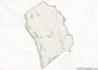
- Effingham
- Elbert
- Emanuel
- Evans
- Fannin
- Fayette
- Floyd
- Forsyth
- Franklin
- Fulton
- Gilmer
- Glascock
- Glynn
- Gordon
- Grady
- Greene
- Gwinnett
- Habersham
- Hall
- Hancock
- Haralson
- Harris
- Hart
- Heard
- Henry
- Houston
- Irwin
- Jackson
- Jasper
- Jeff Davis
- Jefferson
- Jenkins
- Johnson
- Jones
- Lamar
- Lanier
- Laurens
- Lee
- Liberty
- Lincoln
- Long
- Lowndes
- Lumpkin
- Macon
- Madison
- Marion
- McDuffie
- McIntosh
- Meriwether
- Miller
- Mitchell
- Monroe
- Montgomery
- Morgan
- Murray
- Muscogee
- Newton
- Oconee
- Oglethorpe
- Paulding
- Peach
- Pickens
- Pierce
- Pike
- Polk
- Pulaski
- Putnam
- Quitman
- Rabun
- Randolph
- Richmond
- Rockdale
- Schley
- Screven
- Seminole
- Spalding
- Stephens
- Stewart
- Sumter
- Talbot
- Taliaferro
- Tattnall
- Taylor
- Telfair
- Terrell
- Thomas
- Tift
- Toombs
- Towns
- Treutlen
- Troup
- Turner
- Twiggs
- Union
- Upson
- Walker
- Walton
- Ware
- Warren
- Washington
- Wayne
- Webster
- Wheeler
- White
- Whitfield
- Wilcox
- Wilkes
- Wilkinson
- Worth
- Alabama
- Alaska
- Arizona
- Arkansas
- California
- Colorado
- Connecticut
- Delaware
- District of Columbia
- Florida
- Georgia
- Hawaii
- Idaho
- Illinois
- Indiana
- Iowa
- Kansas
- Kentucky
- Louisiana
- Maine
- Maryland
- Massachusetts
- Michigan
- Minnesota
- Mississippi
- Missouri
- Montana
- Nebraska
- Nevada
- New Hampshire
- New Jersey
- New Mexico
- New York
- North Carolina
- North Dakota
- Ohio
- Oklahoma
- Oregon
- Pennsylvania
- Rhode Island
- South Carolina
- South Dakota
- Tennessee
- Texas
- Utah
- Vermont
- Virginia
- Washington
- West Virginia
- Wisconsin
- Wyoming