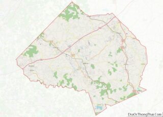
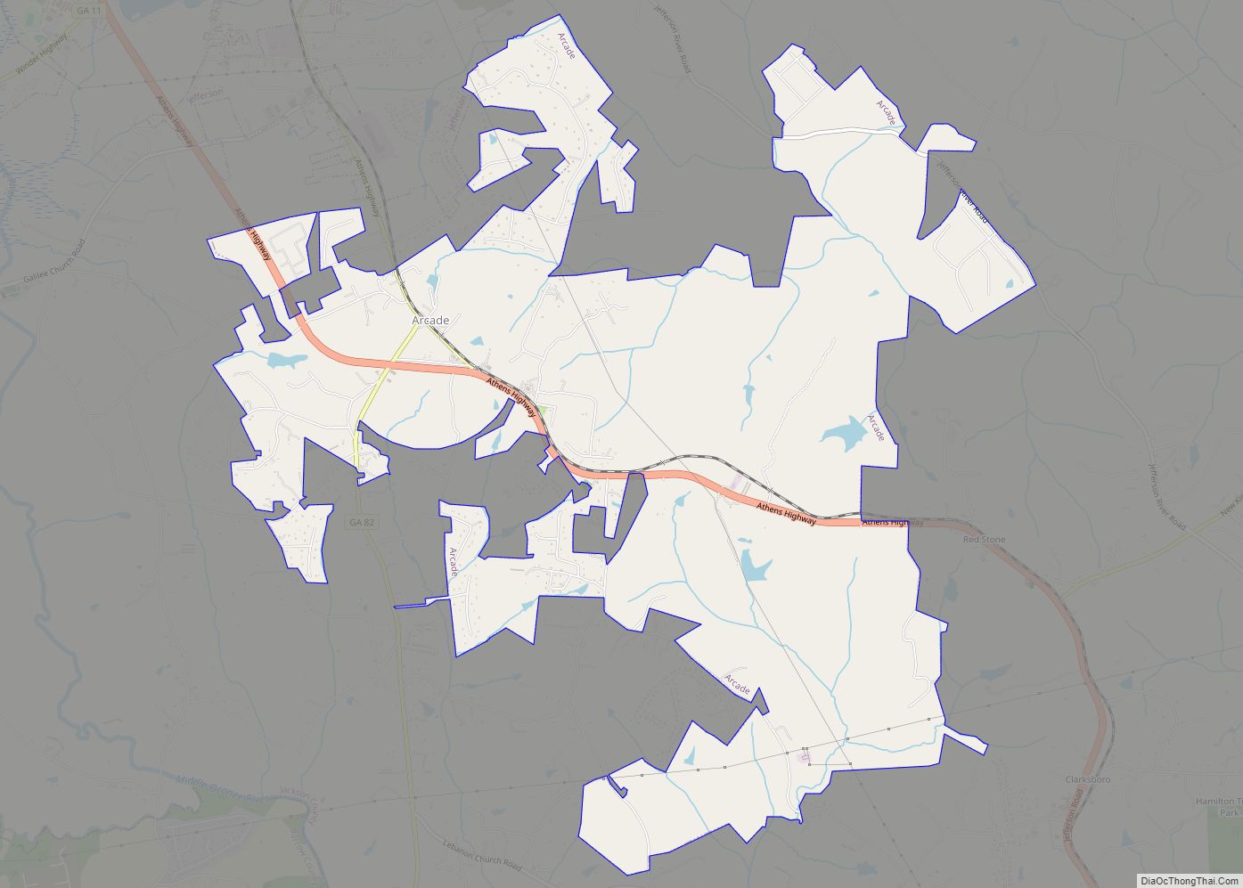
Arcade is a city in Jackson County, Georgia, United States. As of the 2020 census it had a population of 1,884.
| Name: | Arcade city |
|---|---|
| LSAD Code: | 25 |
| LSAD Description: | city (suffix) |
| State: | Georgia |
| County: | Jackson County |
| Elevation: | 876 ft (267 m) |
| Total Area: | 9.28 sq mi (24.02 km²) |
| Land Area: | 9.20 sq mi (23.82 km²) |
| Water Area: | 0.08 sq mi (0.21 km²) |
| Total Population: | 1,884 |
| Population Density: | 204.87/sq mi (79.11/km²) |
| FIPS code: | 1302648 |
| GNISfeature ID: | 0331049 |
| Website: | cityofarcade.org |
Online Interactive Map
Click on ![]() to view map in "full screen" mode.
to view map in "full screen" mode.
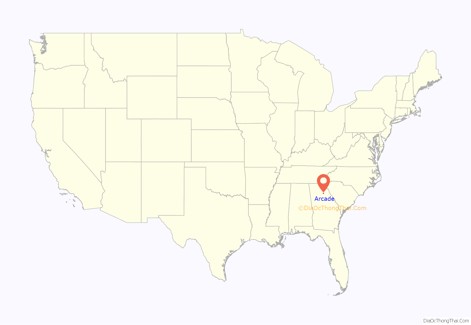
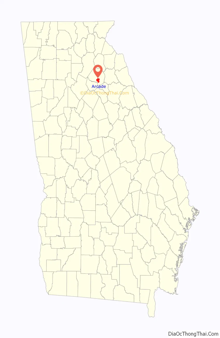
Arcade location map. Where is Arcade city?
History
Arcade was chartered in 1909. Early plans to erect an arcade-style schoolhouse accounts for the name.
Arcade Road Map
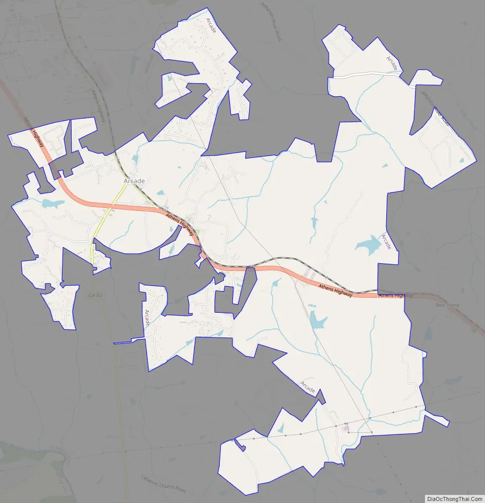
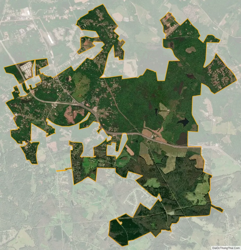
Arcade city Satellite Map
Geography
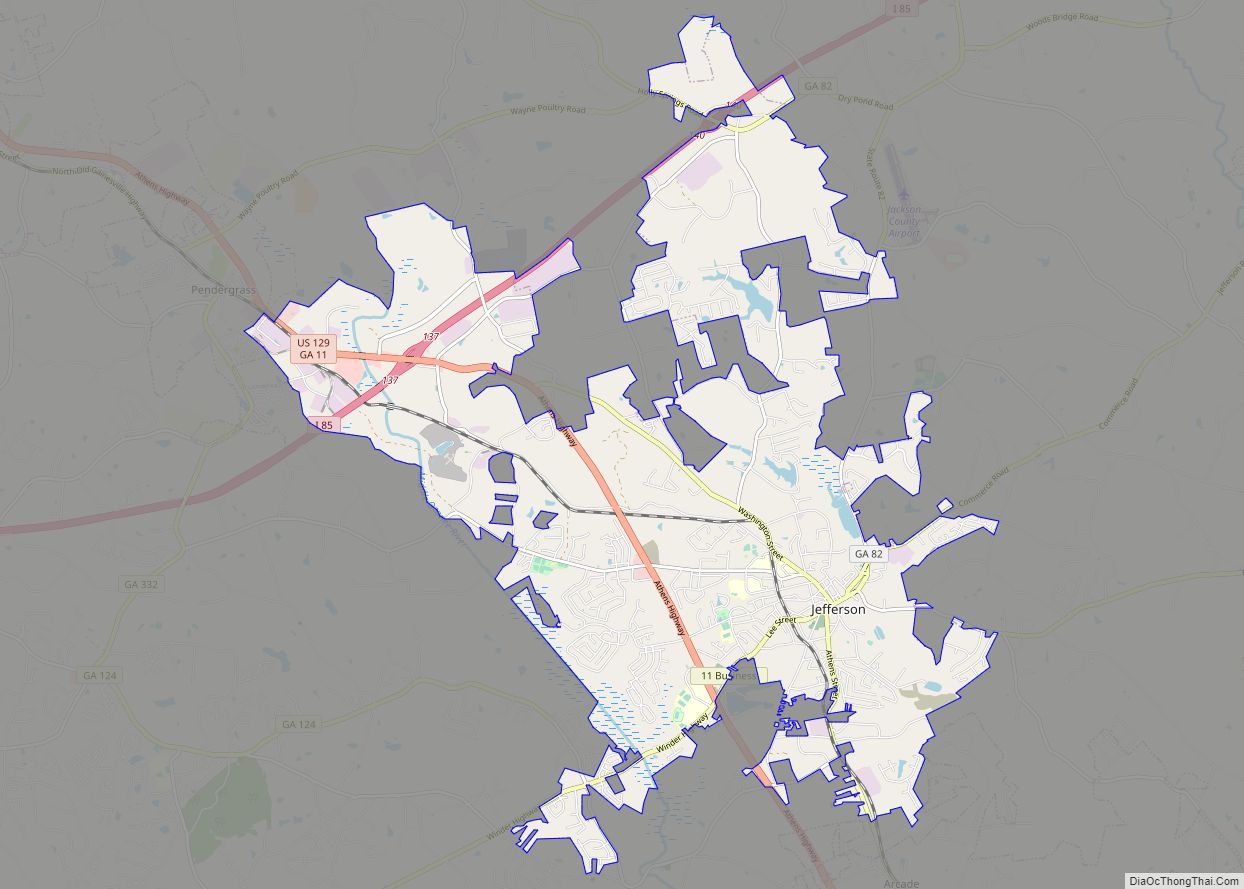
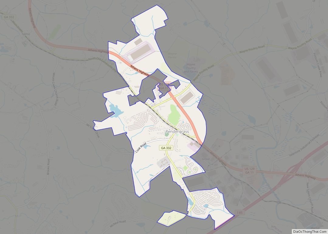
Arcade is located in southern Jackson County at 34°4′37″N 83°33′4″W / 34.07694°N 83.55111°W / 34.07694; -83.55111 (34.076951, -83.551147). It is bordered to the north by Jefferson, the county seat.
U.S. Route 129 passes through the southern side of the city, leading northwest 7 miles (11 km) to Interstate 85 in the northern outskirts of Jefferson, and southeast 15 miles (24 km) to Athens. Georgia State Route 82 leads south from Arcade 14 miles (23 km) to Winder.
According to the United States Census Bureau, Arcade has a total area of 8.5 square miles (22.0 km), of which 8.4 square miles (21.8 km) are land and 0.1 square miles (0.2 km), or 0.90%, are water.
Arcade does not have its own ZIP code, but instead uses neighboring Jefferson’s code of 30549.
See also
Map of Georgia State and its subdivision:- Appling
- Atkinson
- Bacon
- Baker
- Baldwin
- Banks
- Barrow
- Bartow
- Ben Hill
- Berrien
- Bibb
- Bleckley
- Brantley
- Brooks
- Bryan
- Bulloch
- Burke
- Butts
- Calhoun
- Camden
- Candler
- Carroll
- Catoosa
- Charlton
- Chatham
- Chattahoochee
- Chattooga
- Cherokee
- Clarke
- Clay
- Clayton
- Clinch
- Cobb
- Coffee
- Colquitt
- Columbia
- Cook
- Coweta
- Crawford
- Crisp
- Dade
- Dawson
- Decatur
- DeKalb
- Dodge
- Dooly
- Dougherty
- Douglas
- Early
- Echols
- Effingham
- Elbert
- Emanuel
- Evans
- Fannin
- Fayette
- Floyd
- Forsyth
- Franklin
- Fulton
- Gilmer
- Glascock
- Glynn
- Gordon
- Grady
- Greene
- Gwinnett
- Habersham
- Hall
- Hancock
- Haralson
- Harris
- Hart
- Heard
- Henry
- Houston
- Irwin
- Jackson
- Jasper
- Jeff Davis
- Jefferson
- Jenkins
- Johnson
- Jones
- Lamar
- Lanier
- Laurens
- Lee
- Liberty
- Lincoln
- Long
- Lowndes
- Lumpkin
- Macon
- Madison
- Marion
- McDuffie
- McIntosh
- Meriwether
- Miller
- Mitchell
- Monroe
- Montgomery
- Morgan
- Murray
- Muscogee
- Newton
- Oconee
- Oglethorpe
- Paulding
- Peach
- Pickens
- Pierce
- Pike
- Polk
- Pulaski
- Putnam
- Quitman
- Rabun
- Randolph
- Richmond
- Rockdale
- Schley
- Screven
- Seminole
- Spalding
- Stephens
- Stewart
- Sumter
- Talbot
- Taliaferro
- Tattnall
- Taylor
- Telfair
- Terrell
- Thomas
- Tift
- Toombs
- Towns
- Treutlen
- Troup
- Turner
- Twiggs
- Union
- Upson
- Walker
- Walton
- Ware
- Warren
- Washington
- Wayne
- Webster
- Wheeler
- White
- Whitfield
- Wilcox
- Wilkes
- Wilkinson
- Worth
- Alabama
- Alaska
- Arizona
- Arkansas
- California
- Colorado
- Connecticut
- Delaware
- District of Columbia
- Florida
- Georgia
- Hawaii
- Idaho
- Illinois
- Indiana
- Iowa
- Kansas
- Kentucky
- Louisiana
- Maine
- Maryland
- Massachusetts
- Michigan
- Minnesota
- Mississippi
- Missouri
- Montana
- Nebraska
- Nevada
- New Hampshire
- New Jersey
- New Mexico
- New York
- North Carolina
- North Dakota
- Ohio
- Oklahoma
- Oregon
- Pennsylvania
- Rhode Island
- South Carolina
- South Dakota
- Tennessee
- Texas
- Utah
- Vermont
- Virginia
- Washington
- West Virginia
- Wisconsin
- Wyoming