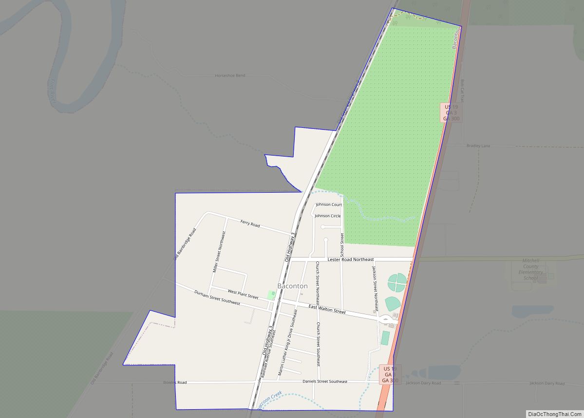
Baconton is a city in Mitchell County, Georgia, United States. As of the 2020 census, the city had a population of 856, down from 915 in 2010.
| Name: | Baconton city |
|---|---|
| LSAD Code: | 25 |
| LSAD Description: | city (suffix) |
| State: | Georgia |
| County: | Mitchell County |
| Elevation: | 174 ft (53 m) |
| Total Area: | 1.95 sq mi (5.05 km²) |
| Land Area: | 1.95 sq mi (5.05 km²) |
| Water Area: | 0.00 sq mi (0.00 km²) |
| Total Population: | 856 |
| Population Density: | 438.52/sq mi (169.34/km²) |
| ZIP code: | 31716 |
| Area code: | 229 |
| FIPS code: | 1304840 |
| GNISfeature ID: | 0331077 |
| Website: | www.cityofbacontonga.com |
Online Interactive Map
Click on ![]() to view map in "full screen" mode.
to view map in "full screen" mode.
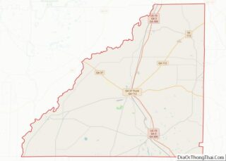
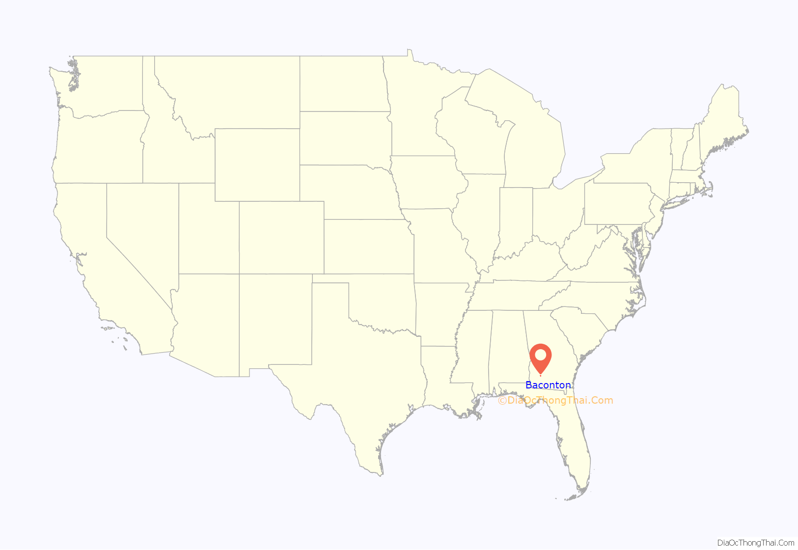
Baconton location map. Where is Baconton city?

History
Baconton was incorporated in 1903. The community was named after Major Robert James Bacon, an original owner of the town site.
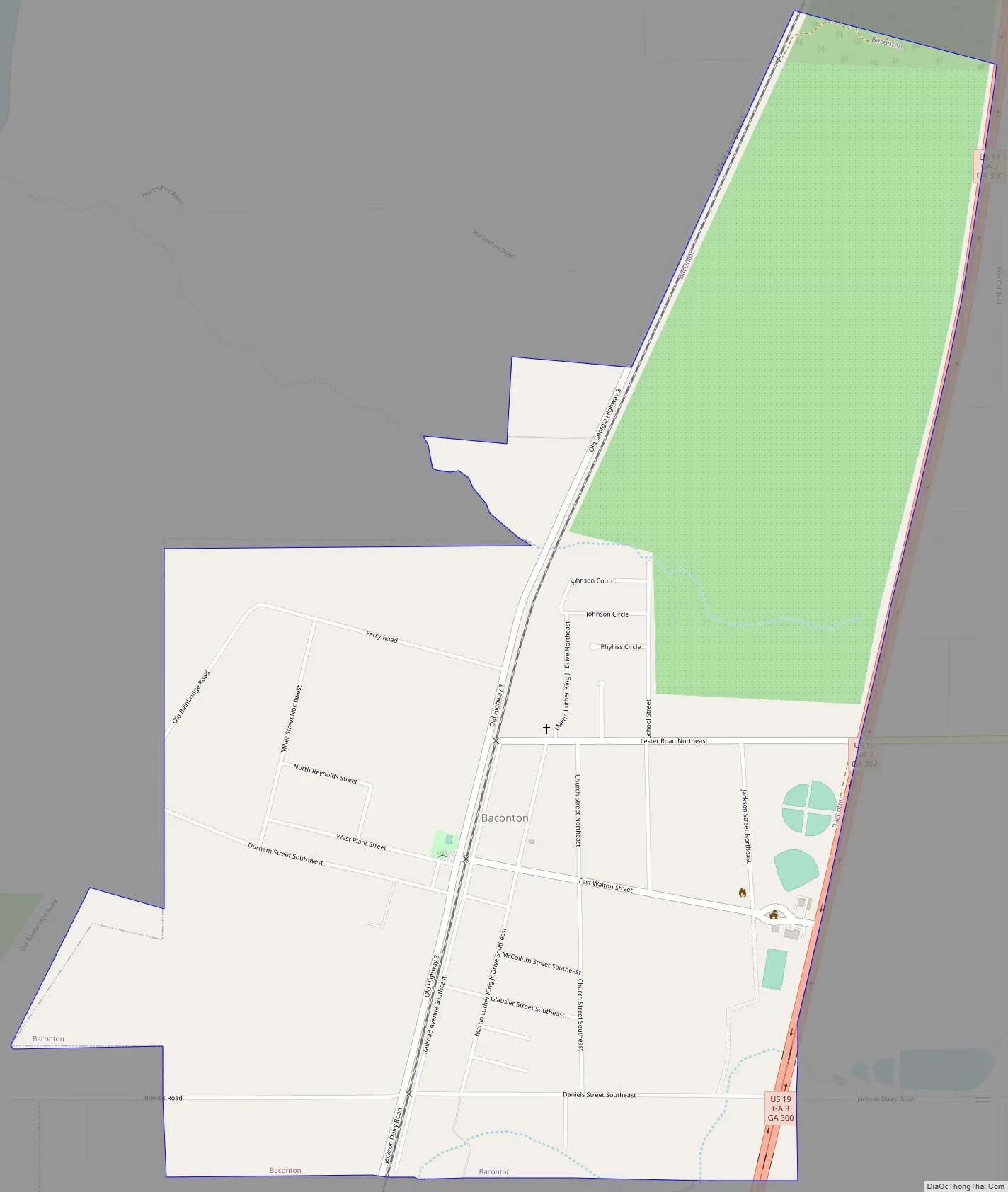
Baconton Road Map
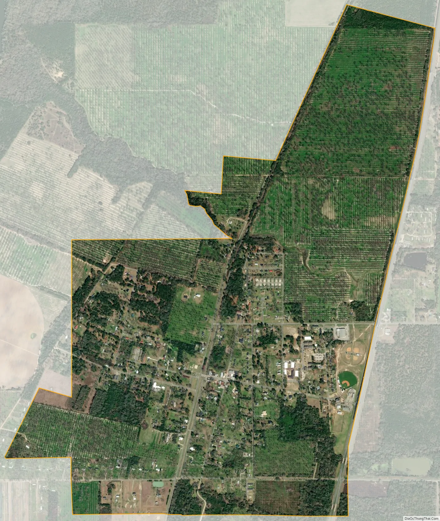
Baconton city Satellite Map
Geography
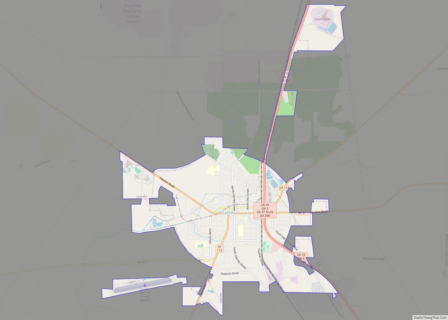
Baconton is located in northern Mitchell County at 31°22′34″N 84°9′41″W / 31.37611°N 84.16139°W / 31.37611; -84.16139 (31.376002, -84.161468). U.S. Route 19 runs along the eastern border of the city, leading south 10 miles (16 km) to Camilla, the county seat, and north 16 miles (26 km) to Albany.
According to the United States Census Bureau, Baconton has a total area of 2.0 square miles (5.2 km), all land. The Flint River passes 1 mile (1.6 km) to the west of the city.
Soils of Baconton are mostly well drained or somewhat excessively drained. They have grayish brown loamy sand topsoils overlying yellowish brown or red sandy clay loam subsoils. All belong to the Ultisol soil order. Where agricultural or urban development have not occurred, these soils support mixed forests dominated by pines and oaks.
See also
Map of Georgia State and its subdivision:- Appling
- Atkinson
- Bacon
- Baker
- Baldwin
- Banks
- Barrow
- Bartow
- Ben Hill
- Berrien
- Bibb
- Bleckley
- Brantley
- Brooks
- Bryan
- Bulloch
- Burke
- Butts
- Calhoun
- Camden
- Candler
- Carroll
- Catoosa
- Charlton
- Chatham
- Chattahoochee
- Chattooga
- Cherokee
- Clarke
- Clay
- Clayton
- Clinch
- Cobb
- Coffee
- Colquitt
- Columbia
- Cook
- Coweta
- Crawford
- Crisp
- Dade
- Dawson
- Decatur
- DeKalb
- Dodge
- Dooly
- Dougherty
- Douglas
- Early
- Echols
- Effingham
- Elbert
- Emanuel
- Evans
- Fannin
- Fayette
- Floyd
- Forsyth
- Franklin
- Fulton
- Gilmer
- Glascock
- Glynn
- Gordon
- Grady
- Greene
- Gwinnett
- Habersham
- Hall
- Hancock
- Haralson
- Harris
- Hart
- Heard
- Henry
- Houston
- Irwin
- Jackson
- Jasper
- Jeff Davis
- Jefferson
- Jenkins
- Johnson
- Jones
- Lamar
- Lanier
- Laurens
- Lee
- Liberty
- Lincoln
- Long
- Lowndes
- Lumpkin
- Macon
- Madison
- Marion
- McDuffie
- McIntosh
- Meriwether
- Miller
- Mitchell
- Monroe
- Montgomery
- Morgan
- Murray
- Muscogee
- Newton
- Oconee
- Oglethorpe
- Paulding
- Peach
- Pickens
- Pierce
- Pike
- Polk
- Pulaski
- Putnam
- Quitman
- Rabun
- Randolph
- Richmond
- Rockdale
- Schley
- Screven
- Seminole
- Spalding
- Stephens
- Stewart
- Sumter
- Talbot
- Taliaferro
- Tattnall
- Taylor
- Telfair
- Terrell
- Thomas
- Tift
- Toombs
- Towns
- Treutlen
- Troup
- Turner
- Twiggs
- Union
- Upson
- Walker
- Walton
- Ware
- Warren
- Washington
- Wayne
- Webster
- Wheeler
- White
- Whitfield
- Wilcox
- Wilkes
- Wilkinson
- Worth
- Alabama
- Alaska
- Arizona
- Arkansas
- California
- Colorado
- Connecticut
- Delaware
- District of Columbia
- Florida
- Georgia
- Hawaii
- Idaho
- Illinois
- Indiana
- Iowa
- Kansas
- Kentucky
- Louisiana
- Maine
- Maryland
- Massachusetts
- Michigan
- Minnesota
- Mississippi
- Missouri
- Montana
- Nebraska
- Nevada
- New Hampshire
- New Jersey
- New Mexico
- New York
- North Carolina
- North Dakota
- Ohio
- Oklahoma
- Oregon
- Pennsylvania
- Rhode Island
- South Carolina
- South Dakota
- Tennessee
- Texas
- Utah
- Vermont
- Virginia
- Washington
- West Virginia
- Wisconsin
- Wyoming