Pelham is a city in Mitchell County, Georgia, United States. The population was 3,507 at the 2020 census, down from 3,898 in 2010. Pelham is well-known for its agriculture, with vast farming of cotton and pecans in the area.
| Name: | Pelham city |
|---|---|
| LSAD Code: | 25 |
| LSAD Description: | city (suffix) |
| State: | Georgia |
| County: | Mitchell County |
| Elevation: | 361 ft (110 m) |
| Total Area: | 4.08 sq mi (10.56 km²) |
| Land Area: | 4.08 sq mi (10.56 km²) |
| Water Area: | 0.00 sq mi (0.00 km²) |
| Total Population: | 3,507 |
| Population Density: | 859.98/sq mi (332.08/km²) |
| ZIP code: | 31779 |
| Area code: | 229 |
| FIPS code: | 1359976 |
| GNISfeature ID: | 0320347 |
| Website: | cityofpelhamga.com |
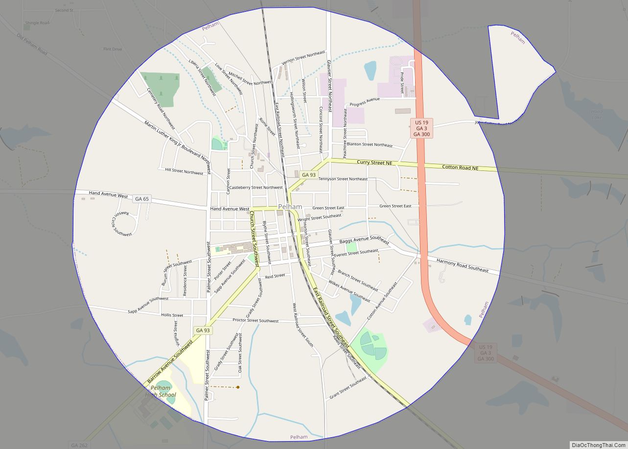
Online Interactive Map
Click on ![]() to view map in "full screen" mode.
to view map in "full screen" mode.
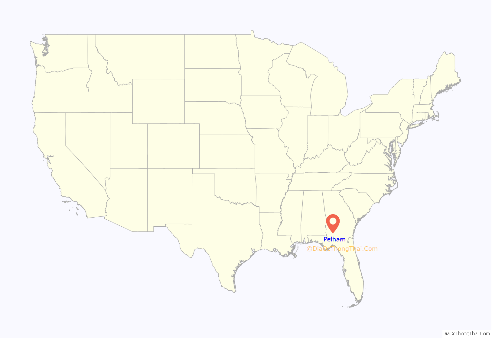
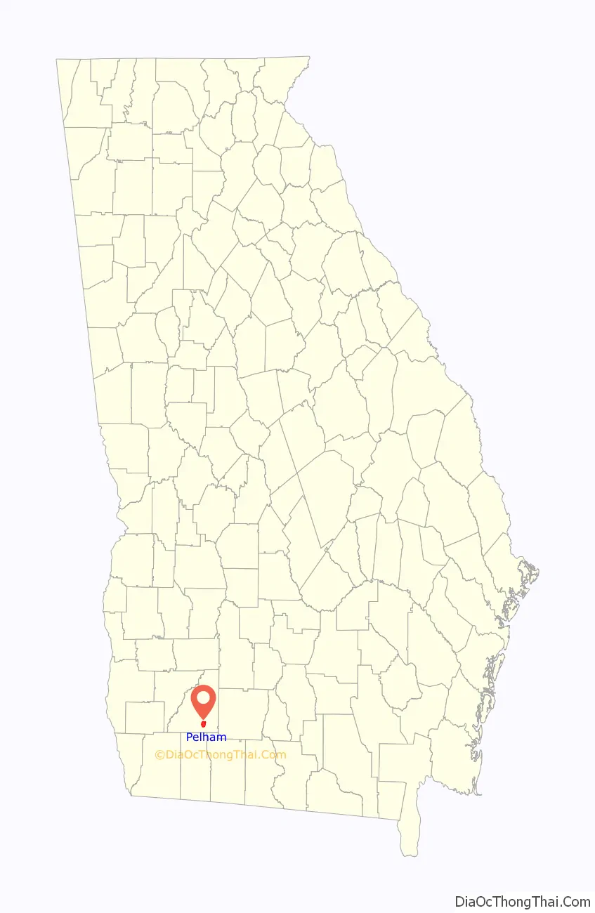
Pelham location map. Where is Pelham city?
History
Pelham was incorporated in 1881 and named in honor of Confederate officer John Pelham, who was born to a family of slave owners in northeastern Alabama in 1838.
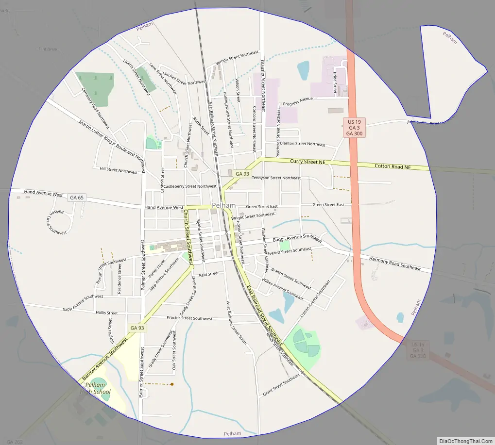
Pelham Road Map
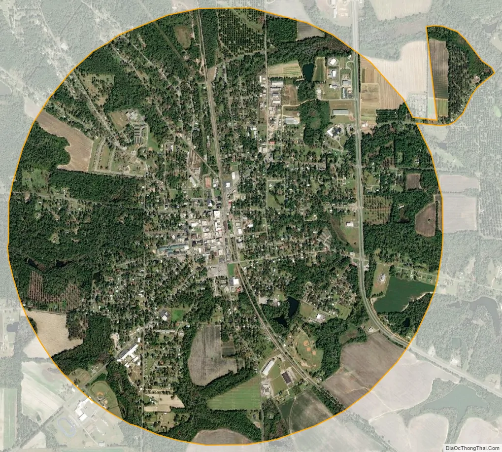
Pelham city Satellite Map
Geography
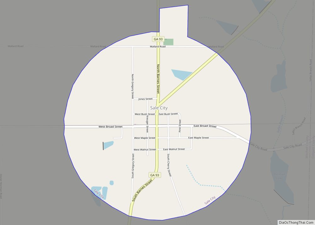
Pelham is in southeastern Mitchell County at 31°7′36″N 84°9′10″W / 31.12667°N 84.15278°W / 31.12667; -84.15278 (31.126629, -84.152703), sitting at the crossroads of US 19 and State Route 93. U.S. 19 passes through the east side of the city and leads northwest 8 miles (13 km) to Camilla, the county seat, and southeast 25 miles (40 km) to Thomasville. State Route 93 passes through the center of town, leading northeast 14 miles (23 km) to Sale City and south 19 miles (31 km) to Cairo, while State Route 65 leads west from Pelham 14 miles (23 km) to Hopeful.
According to the United States Census Bureau, Pelham has a total area of 4.1 square miles (11 km), all of it recorded as land.
Pelham has a humid subtropical climate, characterized by humid summers and mild winters. It receives an average of 52 inches (1,300 mm) of rain per year. The average number of days with any measurable precipitation is 90. Pelham has on average 233 sunny days per year. The July high is around 93 °F (34 °C), while the January low is 39 °F (4 °C).
See also
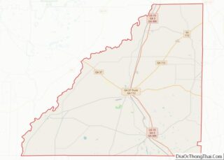
Map of Georgia State and its subdivision:- Appling
- Atkinson
- Bacon
- Baker
- Baldwin
- Banks
- Barrow
- Bartow
- Ben Hill
- Berrien
- Bibb
- Bleckley
- Brantley
- Brooks
- Bryan
- Bulloch
- Burke
- Butts
- Calhoun
- Camden
- Candler
- Carroll
- Catoosa
- Charlton
- Chatham
- Chattahoochee
- Chattooga
- Cherokee
- Clarke
- Clay
- Clayton
- Clinch
- Cobb
- Coffee
- Colquitt
- Columbia
- Cook
- Coweta
- Crawford
- Crisp
- Dade
- Dawson
- Decatur
- DeKalb
- Dodge
- Dooly
- Dougherty
- Douglas
- Early
- Echols
- Effingham
- Elbert
- Emanuel
- Evans
- Fannin
- Fayette
- Floyd
- Forsyth
- Franklin
- Fulton
- Gilmer
- Glascock
- Glynn
- Gordon
- Grady
- Greene
- Gwinnett
- Habersham
- Hall
- Hancock
- Haralson
- Harris
- Hart
- Heard
- Henry
- Houston
- Irwin
- Jackson
- Jasper
- Jeff Davis
- Jefferson
- Jenkins
- Johnson
- Jones
- Lamar
- Lanier
- Laurens
- Lee
- Liberty
- Lincoln
- Long
- Lowndes
- Lumpkin
- Macon
- Madison
- Marion
- McDuffie
- McIntosh
- Meriwether
- Miller
- Mitchell
- Monroe
- Montgomery
- Morgan
- Murray
- Muscogee
- Newton
- Oconee
- Oglethorpe
- Paulding
- Peach
- Pickens
- Pierce
- Pike
- Polk
- Pulaski
- Putnam
- Quitman
- Rabun
- Randolph
- Richmond
- Rockdale
- Schley
- Screven
- Seminole
- Spalding
- Stephens
- Stewart
- Sumter
- Talbot
- Taliaferro
- Tattnall
- Taylor
- Telfair
- Terrell
- Thomas
- Tift
- Toombs
- Towns
- Treutlen
- Troup
- Turner
- Twiggs
- Union
- Upson
- Walker
- Walton
- Ware
- Warren
- Washington
- Wayne
- Webster
- Wheeler
- White
- Whitfield
- Wilcox
- Wilkes
- Wilkinson
- Worth
- Alabama
- Alaska
- Arizona
- Arkansas
- California
- Colorado
- Connecticut
- Delaware
- District of Columbia
- Florida
- Georgia
- Hawaii
- Idaho
- Illinois
- Indiana
- Iowa
- Kansas
- Kentucky
- Louisiana
- Maine
- Maryland
- Massachusetts
- Michigan
- Minnesota
- Mississippi
- Missouri
- Montana
- Nebraska
- Nevada
- New Hampshire
- New Jersey
- New Mexico
- New York
- North Carolina
- North Dakota
- Ohio
- Oklahoma
- Oregon
- Pennsylvania
- Rhode Island
- South Carolina
- South Dakota
- Tennessee
- Texas
- Utah
- Vermont
- Virginia
- Washington
- West Virginia
- Wisconsin
- Wyoming