Bowdon is a city in Carroll County, Georgia, United States. As of the 2020 census, the city had a population of 2,161.
| Name: | Bowdon city |
|---|---|
| LSAD Code: | 25 |
| LSAD Description: | city (suffix) |
| State: | Georgia |
| County: | Carroll County |
| Elevation: | 1,079 ft (329 m) |
| Total Area: | 3.40 sq mi (8.80 km²) |
| Land Area: | 3.40 sq mi (8.80 km²) |
| Water Area: | 0.00 sq mi (0.00 km²) |
| Total Population: | 2,161 |
| Population Density: | 635.78/sq mi (245.44/km²) |
| ZIP code: | 30108 |
| Area code: | 770 |
| FIPS code: | 1309544 |
| GNISfeature ID: | 0354818 |
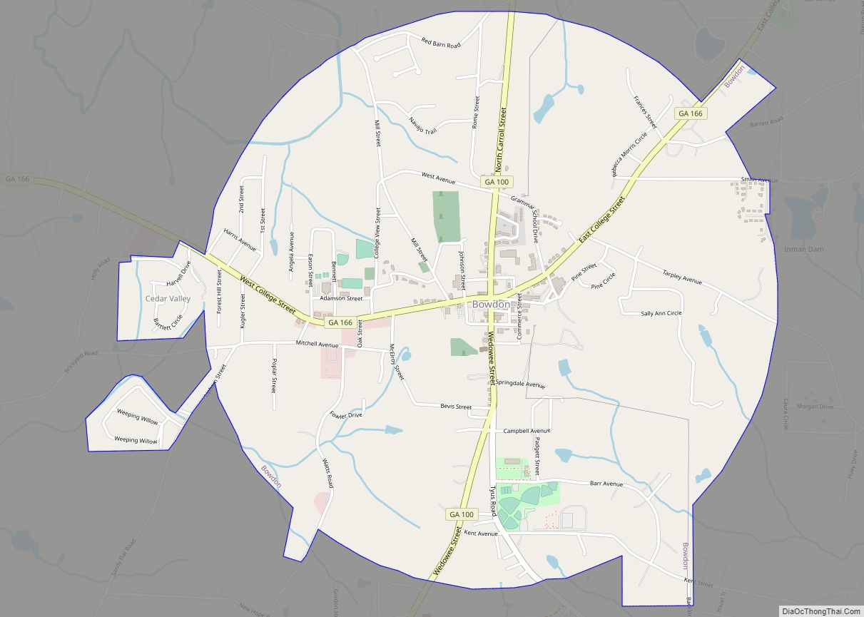
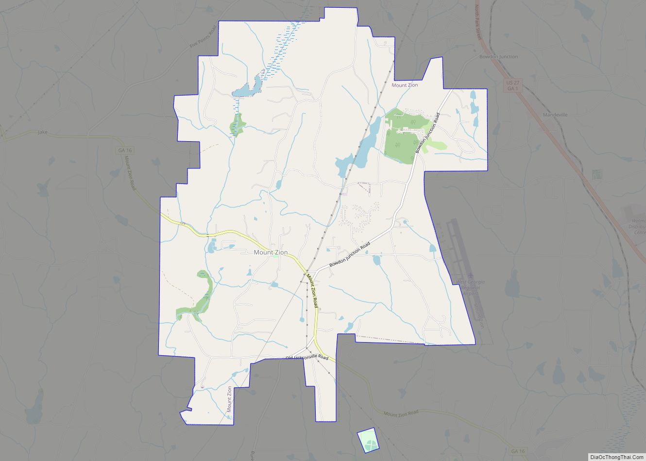
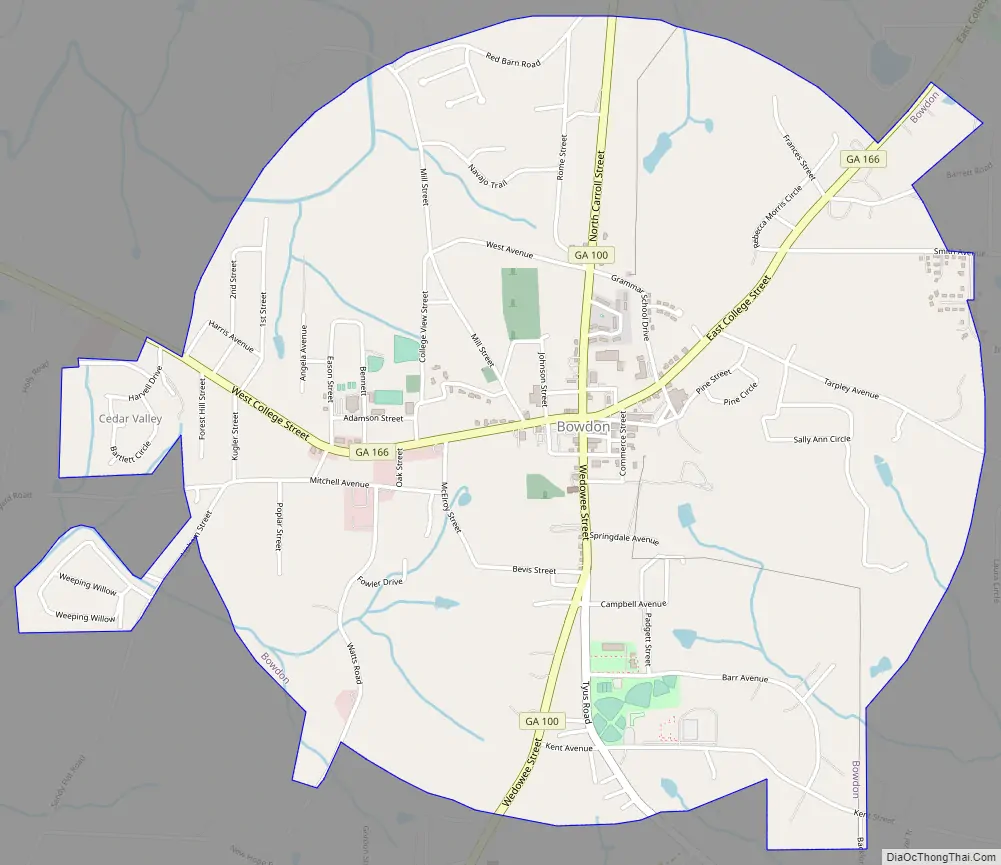
Online Interactive Map
Click on ![]() to view map in "full screen" mode.
to view map in "full screen" mode.
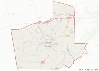
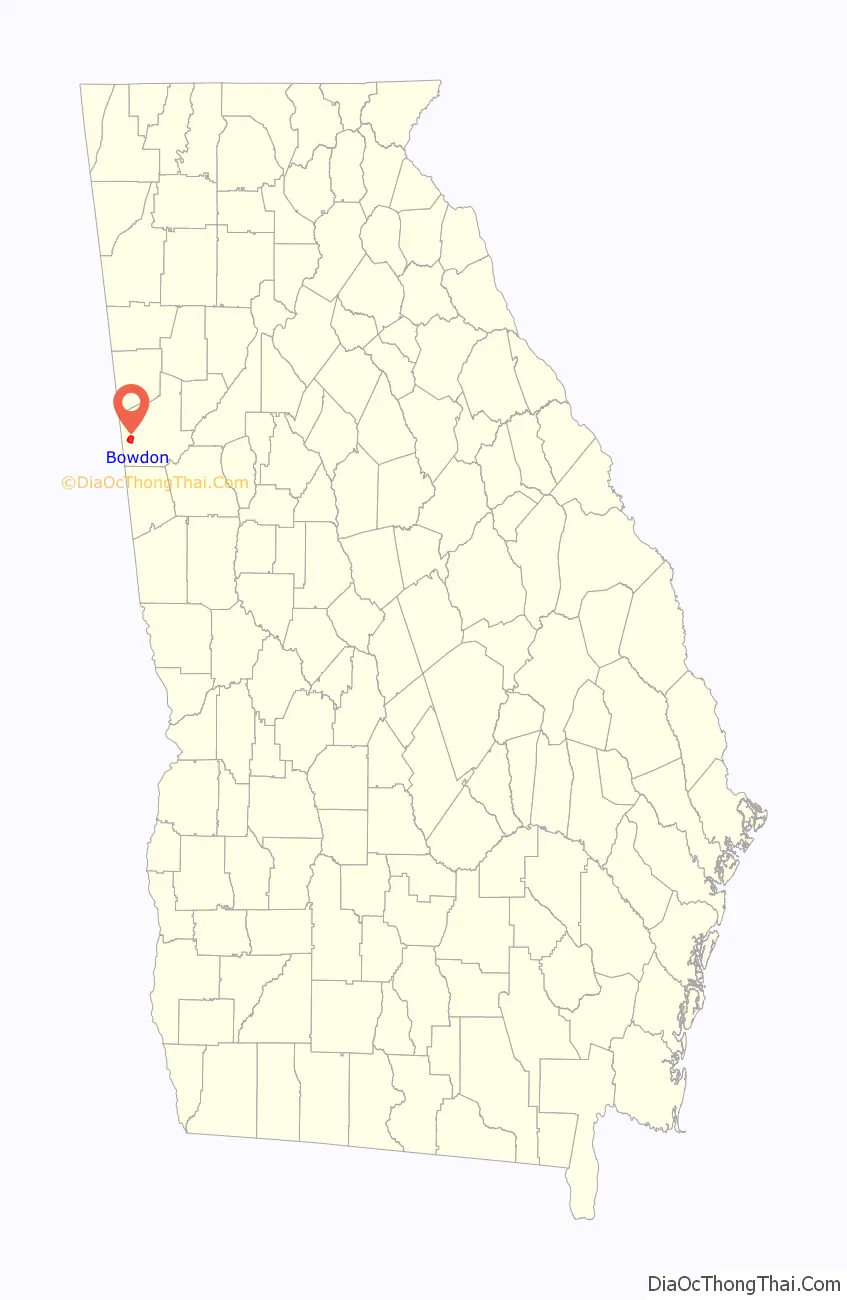
Bowdon location map. Where is Bowdon city?

History
The community was incorporated on January 1, 1859, and was named after Alabama congressman Franklin Welsh Bowdon.
A college was established in Bowdon in 1857.
Bowdon Road Map
Bowdon city Satellite Map

Geography
Bowdon is located near the Georgia-Alabama state line at 33° 32′ 22″ N, 85° 15′ 21″ W (33.539444 N, -85.255833 W). The main highways through the city are Georgia State Routes 100 and 166. GA-100 runs through the city from north to south, leading north 16 mi (26 km) to Tallapoosa and south 11 mi (18 km) to Ephesus. GA-166 runs through the city from west to east, leading east 12 mi (19 km) to Carrollton, the county seat, and west 4 mi (6.4 km) to its end at the Alabama-Georgia state line.
According to the United States Census Bureau, Bowdon has a total area of 3.4 square miles (8.8 km), all land.
Climate
Bowdon has generally mild winters, with highs averaging in the low to mid 50s and lows around 32. Usually there are one or two days each winter when lows drop below 15. Snow is infrequent, averaging about 2″ a winter. Some winters however, experience no snowfall. Ice is more common than snow. Rainfall is usually plentiful in the winter. Although severe weather is not very common, it does happen in the winter. The most recent severe weather event occurred on February 26, 2008, when an EF3 tornado hit an area about four miles north of Bowdon. The fall and spring months tend to bring the nicest weather, with numerous sunny days. Highs in the spring average in the 70s and lows average in the 40s and 50s. There is often severe weather in the spring, with occasionally a tornado. Fall tends to be the nicest season, with plentiful sunshine and highs in the 60s and 70s. Towards the end of fall, lows can drop below 30. Summer is often very humid and hot, although the heat is relieved by afternoon thunderstorms which occur almost daily. The summer of 2007 was one of the hottest on record with several days of highs above 100. Highs in the summer are generally around 90 with lows in the 60s. On May 11, 2008, Bowdon was hit by a series of tornadoes known as the “Mother’s Day Storm” with a few reported injuries, but no deaths.
See also
Map of Georgia State and its subdivision:- Appling
- Atkinson
- Bacon
- Baker
- Baldwin
- Banks
- Barrow
- Bartow
- Ben Hill
- Berrien
- Bibb
- Bleckley
- Brantley
- Brooks
- Bryan
- Bulloch
- Burke
- Butts
- Calhoun
- Camden
- Candler
- Carroll
- Catoosa
- Charlton
- Chatham
- Chattahoochee
- Chattooga
- Cherokee
- Clarke
- Clay
- Clayton
- Clinch
- Cobb
- Coffee
- Colquitt
- Columbia
- Cook
- Coweta
- Crawford
- Crisp
- Dade
- Dawson
- Decatur
- DeKalb
- Dodge
- Dooly
- Dougherty
- Douglas
- Early
- Echols
- Effingham
- Elbert
- Emanuel
- Evans
- Fannin
- Fayette
- Floyd
- Forsyth
- Franklin
- Fulton
- Gilmer
- Glascock
- Glynn
- Gordon
- Grady
- Greene
- Gwinnett
- Habersham
- Hall
- Hancock
- Haralson
- Harris
- Hart
- Heard
- Henry
- Houston
- Irwin
- Jackson
- Jasper
- Jeff Davis
- Jefferson
- Jenkins
- Johnson
- Jones
- Lamar
- Lanier
- Laurens
- Lee
- Liberty
- Lincoln
- Long
- Lowndes
- Lumpkin
- Macon
- Madison
- Marion
- McDuffie
- McIntosh
- Meriwether
- Miller
- Mitchell
- Monroe
- Montgomery
- Morgan
- Murray
- Muscogee
- Newton
- Oconee
- Oglethorpe
- Paulding
- Peach
- Pickens
- Pierce
- Pike
- Polk
- Pulaski
- Putnam
- Quitman
- Rabun
- Randolph
- Richmond
- Rockdale
- Schley
- Screven
- Seminole
- Spalding
- Stephens
- Stewart
- Sumter
- Talbot
- Taliaferro
- Tattnall
- Taylor
- Telfair
- Terrell
- Thomas
- Tift
- Toombs
- Towns
- Treutlen
- Troup
- Turner
- Twiggs
- Union
- Upson
- Walker
- Walton
- Ware
- Warren
- Washington
- Wayne
- Webster
- Wheeler
- White
- Whitfield
- Wilcox
- Wilkes
- Wilkinson
- Worth
- Alabama
- Alaska
- Arizona
- Arkansas
- California
- Colorado
- Connecticut
- Delaware
- District of Columbia
- Florida
- Georgia
- Hawaii
- Idaho
- Illinois
- Indiana
- Iowa
- Kansas
- Kentucky
- Louisiana
- Maine
- Maryland
- Massachusetts
- Michigan
- Minnesota
- Mississippi
- Missouri
- Montana
- Nebraska
- Nevada
- New Hampshire
- New Jersey
- New Mexico
- New York
- North Carolina
- North Dakota
- Ohio
- Oklahoma
- Oregon
- Pennsylvania
- Rhode Island
- South Carolina
- South Dakota
- Tennessee
- Texas
- Utah
- Vermont
- Virginia
- Washington
- West Virginia
- Wisconsin
- Wyoming