Temple is a city in Carroll and Haralson counties in the U.S. state of Georgia. The population was 4,228 at the 2010 census, up from 2,383 in 2000, a 77% increase.
| Name: | Temple city |
|---|---|
| LSAD Code: | 25 |
| LSAD Description: | city (suffix) |
| State: | Georgia |
| County: | Carroll County, Haralson County |
| Elevation: | 1,171 ft (357 m) |
| Total Area: | 6.90 sq mi (17.87 km²) |
| Land Area: | 6.81 sq mi (17.64 km²) |
| Water Area: | 0.09 sq mi (0.23 km²) |
| Total Population: | 5,089 |
| Population Density: | 747.39/sq mi (288.56/km²) |
| ZIP code: | 30179 |
| Area code: | 770 |
| FIPS code: | 1375832 |
| GNISfeature ID: | 0333205 |
| Website: | www.templega.us |
Online Interactive Map
Click on ![]() to view map in "full screen" mode.
to view map in "full screen" mode.
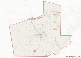
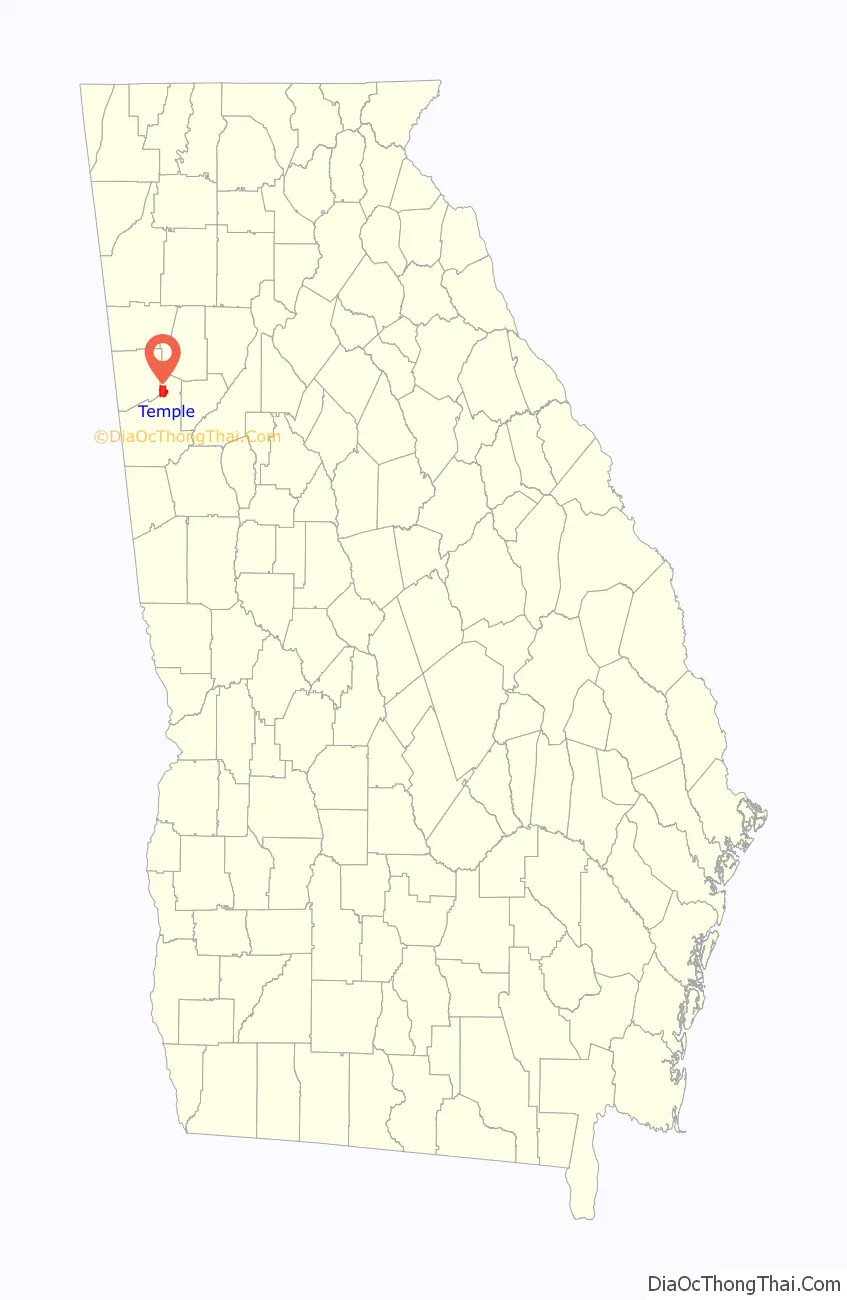
Temple location map. Where is Temple city?

History
The name “Temple” was adopted in 1883 when the railroad was extended to the settlement, after one Mr. Temple, a railroad official. The Georgia General Assembly incorporated Temple as a town in 1883.
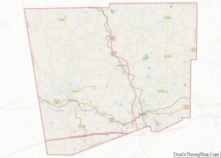
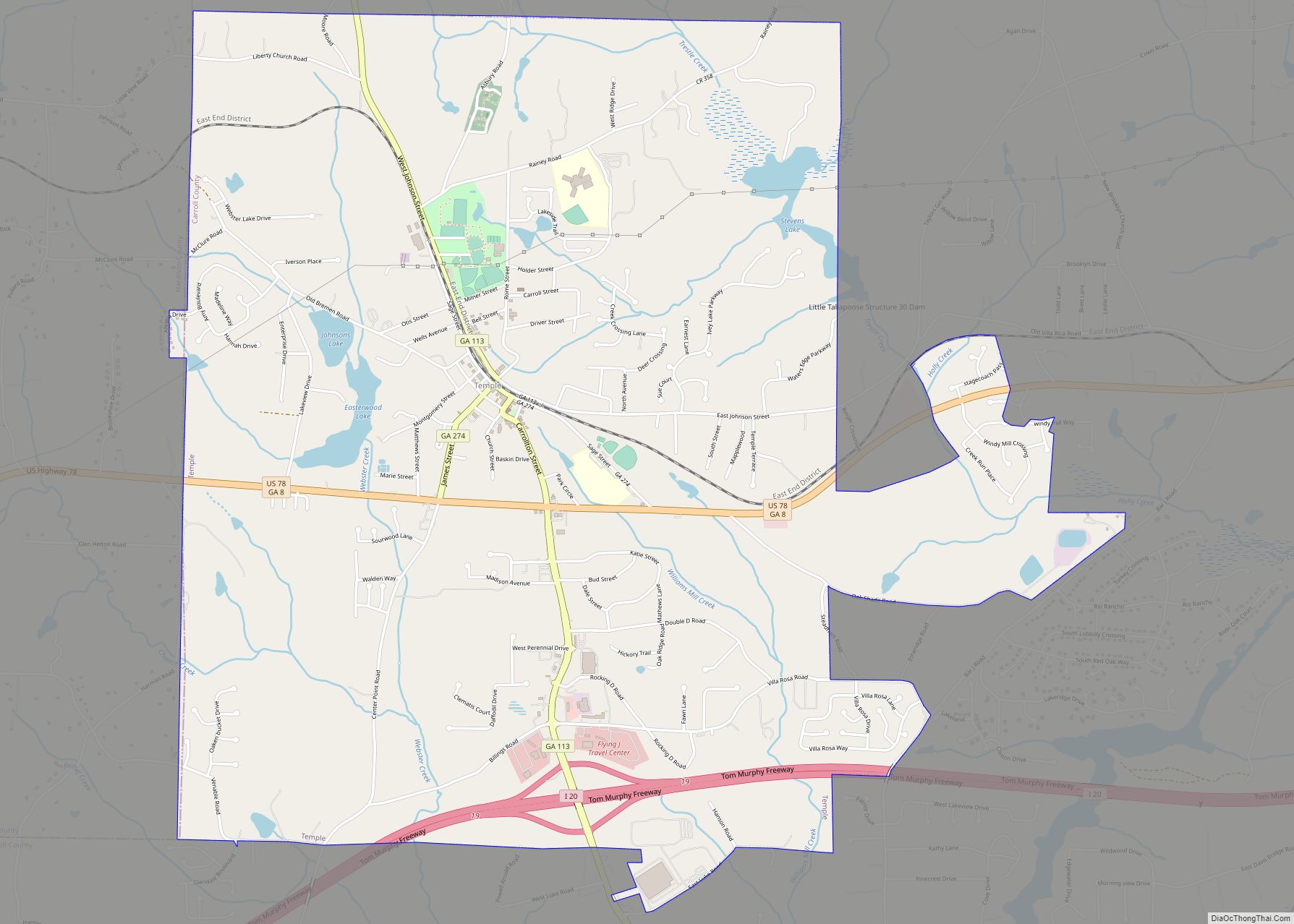
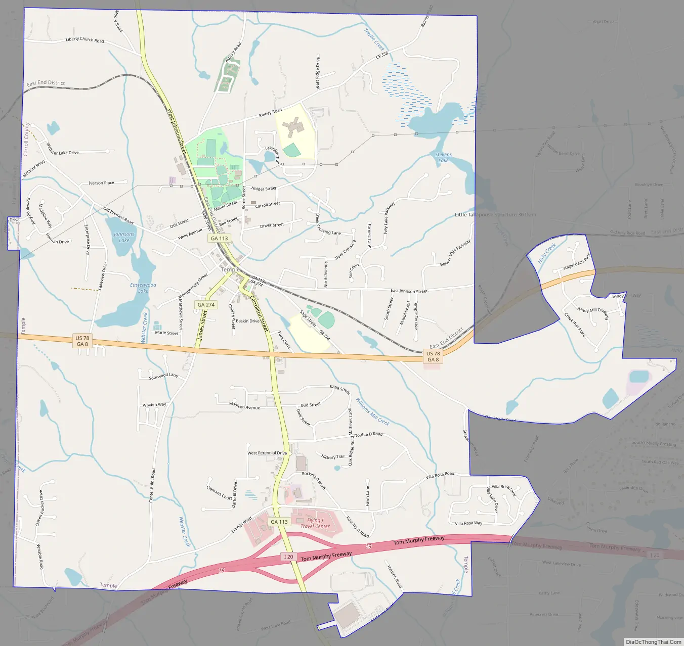
Temple Road Map
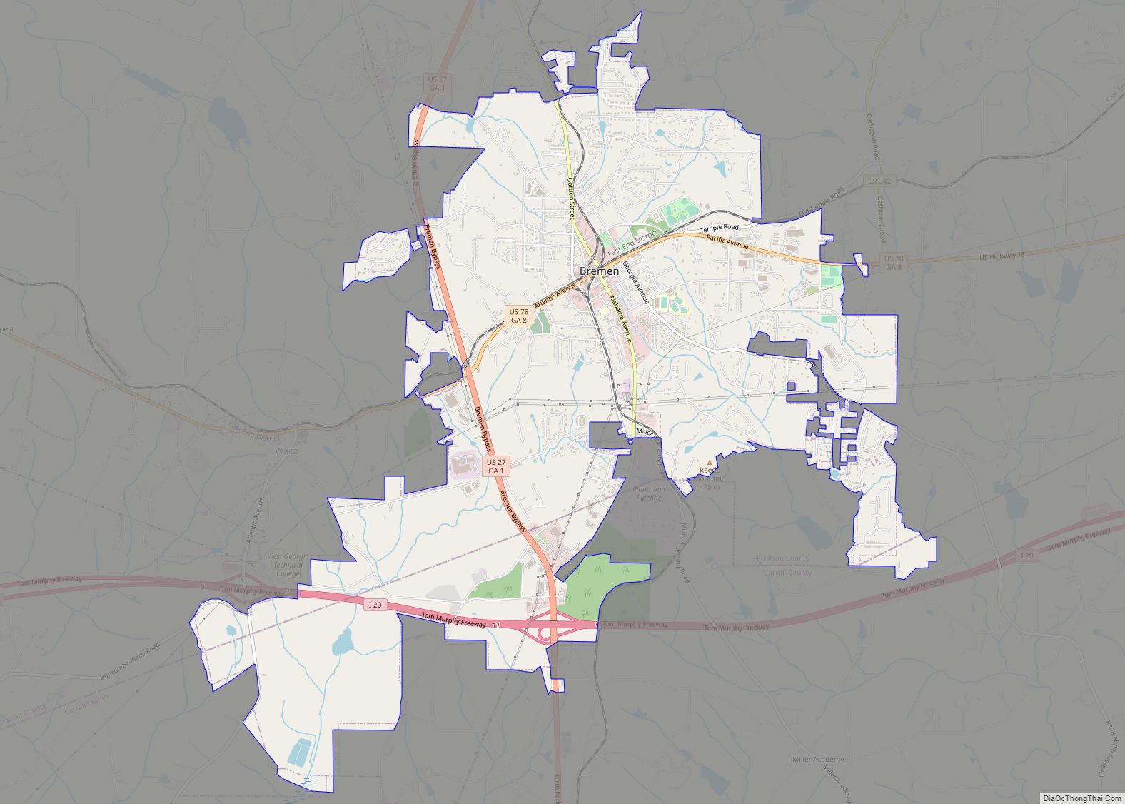
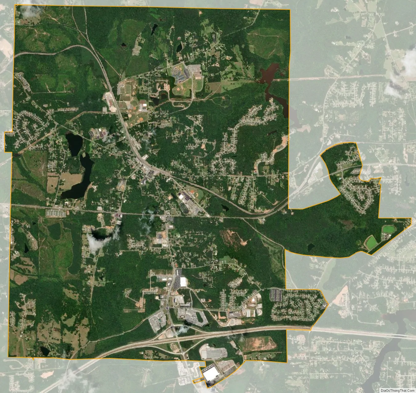
Temple city Satellite Map
Geography
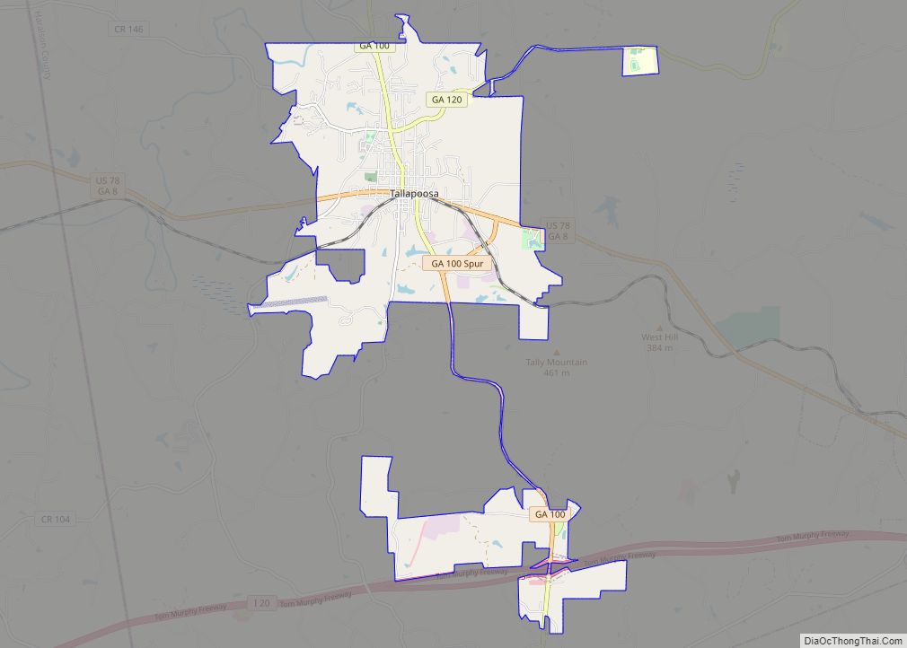
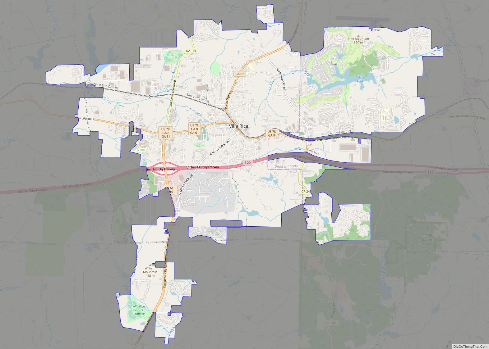
Temple is located in northeastern Carroll County at 33°44′9″N 85°1′38″W / 33.73583°N 85.02722°W / 33.73583; -85.02722 (33.735723, -85.027298). A very small portion of the city extends west into Haralson County. U.S. Route 78 passes just south of the center of town, leading east 6 miles (10 km) to Villa Rica and west 7 miles (11 km) to Bremen. Interstate 20 passes through the southernmost part of the town, with access from Exit 19, and leads east 38 miles (61 km) to Atlanta and west 48 miles (77 km) to Oxford, Alabama. Carrollton, the county seat, is 12 miles (19 km) south via Highway 113.
According to the United States Census Bureau, Temple has a total area of 6.9 square miles (17.9 km), of which 6.8 square miles (17.6 km) is land and 0.08 square miles (0.2 km), or 1.38%, is water.
See also
Map of Georgia State and its subdivision:- Appling
- Atkinson
- Bacon
- Baker
- Baldwin
- Banks
- Barrow
- Bartow
- Ben Hill
- Berrien
- Bibb
- Bleckley
- Brantley
- Brooks
- Bryan
- Bulloch
- Burke
- Butts
- Calhoun
- Camden
- Candler
- Carroll
- Catoosa
- Charlton
- Chatham
- Chattahoochee
- Chattooga
- Cherokee
- Clarke
- Clay
- Clayton
- Clinch
- Cobb
- Coffee
- Colquitt
- Columbia
- Cook
- Coweta
- Crawford
- Crisp
- Dade
- Dawson
- Decatur
- DeKalb
- Dodge
- Dooly
- Dougherty
- Douglas
- Early
- Echols
- Effingham
- Elbert
- Emanuel
- Evans
- Fannin
- Fayette
- Floyd
- Forsyth
- Franklin
- Fulton
- Gilmer
- Glascock
- Glynn
- Gordon
- Grady
- Greene
- Gwinnett
- Habersham
- Hall
- Hancock
- Haralson
- Harris
- Hart
- Heard
- Henry
- Houston
- Irwin
- Jackson
- Jasper
- Jeff Davis
- Jefferson
- Jenkins
- Johnson
- Jones
- Lamar
- Lanier
- Laurens
- Lee
- Liberty
- Lincoln
- Long
- Lowndes
- Lumpkin
- Macon
- Madison
- Marion
- McDuffie
- McIntosh
- Meriwether
- Miller
- Mitchell
- Monroe
- Montgomery
- Morgan
- Murray
- Muscogee
- Newton
- Oconee
- Oglethorpe
- Paulding
- Peach
- Pickens
- Pierce
- Pike
- Polk
- Pulaski
- Putnam
- Quitman
- Rabun
- Randolph
- Richmond
- Rockdale
- Schley
- Screven
- Seminole
- Spalding
- Stephens
- Stewart
- Sumter
- Talbot
- Taliaferro
- Tattnall
- Taylor
- Telfair
- Terrell
- Thomas
- Tift
- Toombs
- Towns
- Treutlen
- Troup
- Turner
- Twiggs
- Union
- Upson
- Walker
- Walton
- Ware
- Warren
- Washington
- Wayne
- Webster
- Wheeler
- White
- Whitfield
- Wilcox
- Wilkes
- Wilkinson
- Worth
- Alabama
- Alaska
- Arizona
- Arkansas
- California
- Colorado
- Connecticut
- Delaware
- District of Columbia
- Florida
- Georgia
- Hawaii
- Idaho
- Illinois
- Indiana
- Iowa
- Kansas
- Kentucky
- Louisiana
- Maine
- Maryland
- Massachusetts
- Michigan
- Minnesota
- Mississippi
- Missouri
- Montana
- Nebraska
- Nevada
- New Hampshire
- New Jersey
- New Mexico
- New York
- North Carolina
- North Dakota
- Ohio
- Oklahoma
- Oregon
- Pennsylvania
- Rhode Island
- South Carolina
- South Dakota
- Tennessee
- Texas
- Utah
- Vermont
- Virginia
- Washington
- West Virginia
- Wisconsin
- Wyoming