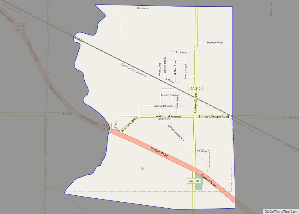
Brinson is a town in Decatur County, Georgia, United States. As of the 2020 census, the city had a population of 217.
| Name: | Brinson town |
|---|---|
| LSAD Code: | 43 |
| LSAD Description: | town (suffix) |
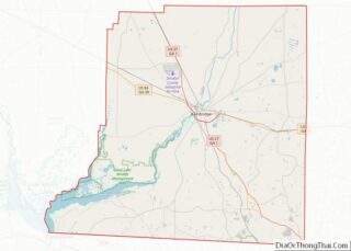
| State: | Georgia |
| County: | Decatur County |
| Elevation: | 121 ft (37 m) |
| Total Area: | 2.04 sq mi (5.29 km²) |
| Land Area: | 2.04 sq mi (5.29 km²) |
| Water Area: | 0.00 sq mi (0.00 km²) |
| Total Population: | 217 |
| Population Density: | 106.32/sq mi (41.05/km²) |
| ZIP code: | 31725, 39825 |
| Area code: | 229 |
| FIPS code: | 1310608 |
| GNISfeature ID: | 0354857 |
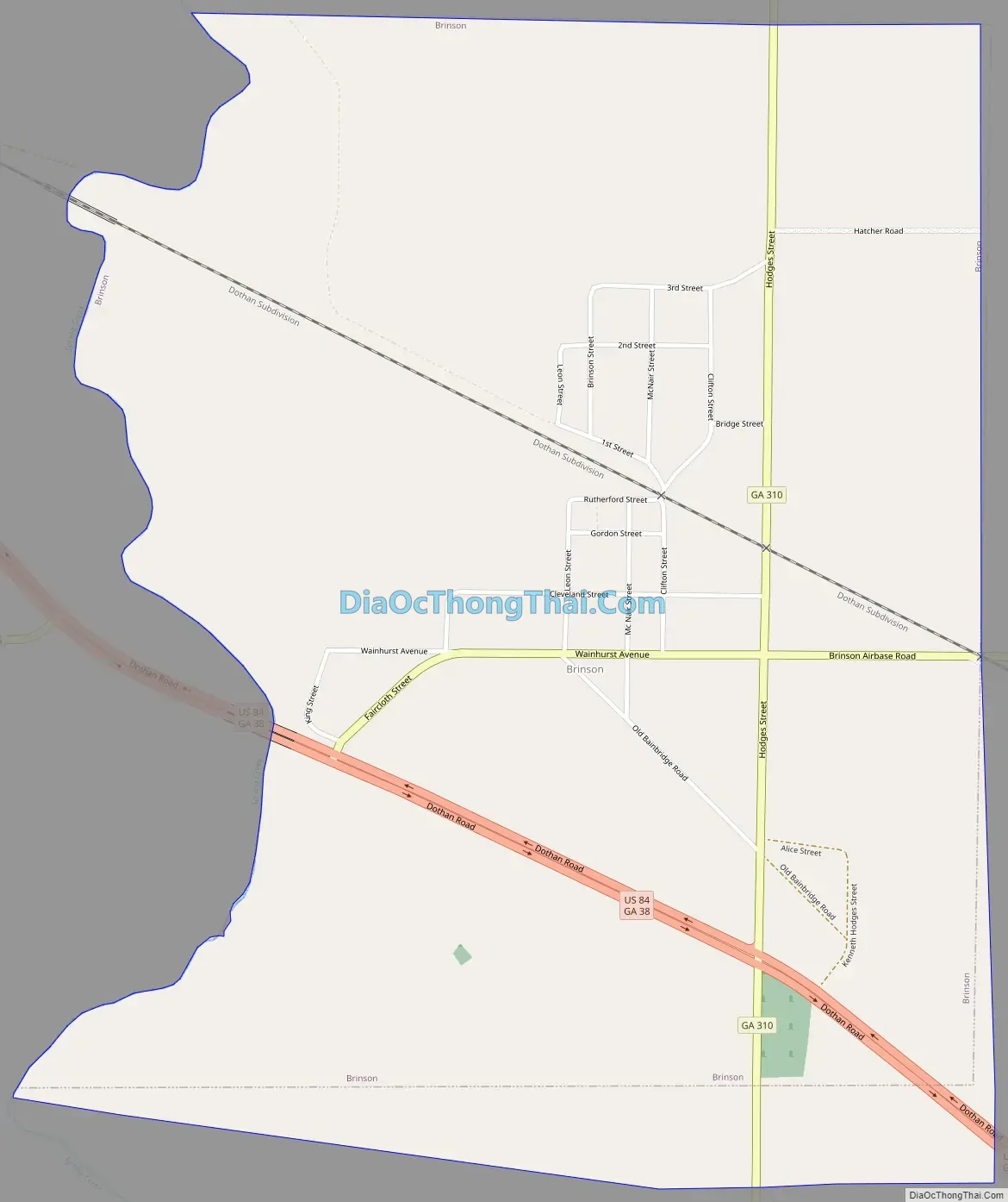
Online Interactive Map
Click on ![]() to view map in "full screen" mode.
to view map in "full screen" mode.
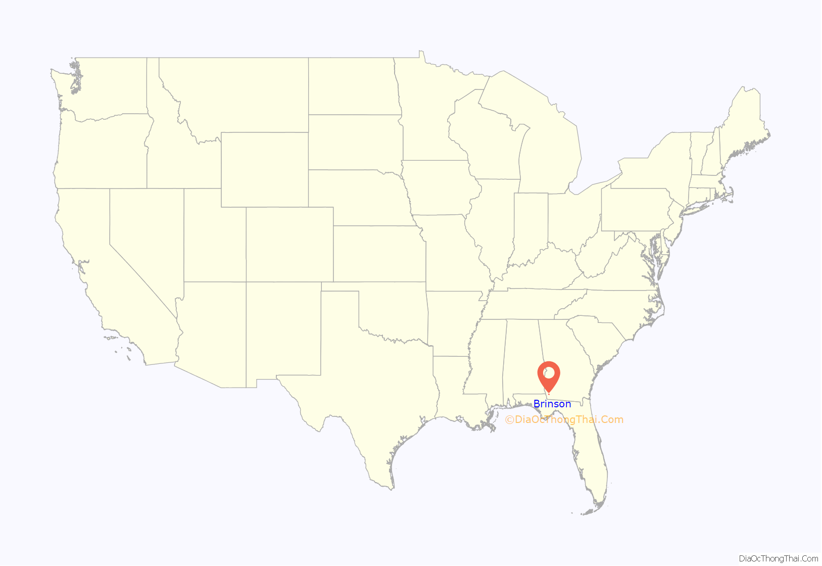
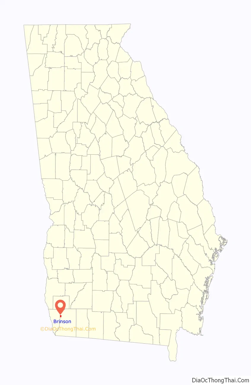
Brinson location map. Where is Brinson town?
History
Variant names were “Mount Zion and “Spring Creek. Simeon Brinson, an early postmaster and first mayor, gave the town its present name. The Georgia General Assembly incorporated the place as the “Town of Brinson” in 1907.
Agriculture predominates in the area. According to one compilation, three of the top ten recipients of U.S. farm subsidies are in Brinson.
Brinson Road Map
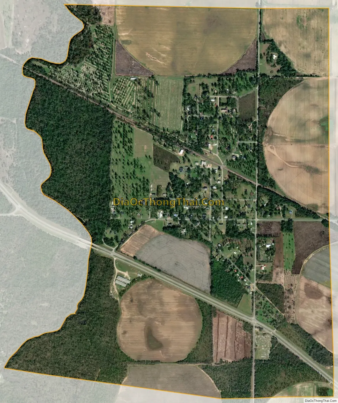
Brinson city Satellite Map
Geography
Brinson is located in northwestern Decatur County at 30°58′45″N 84°44′10″W / 30.97917°N 84.73611°W / 30.97917; -84.73611 (30.979029, -84.736059). U.S. Route 84 passes through the southwest side of the town, leading southeast 10 miles (16 km) to Bainbridge, the Decatur County seat, and northwest 44 miles to Dothan, Alabama.
According to the United States Census Bureau, Brinson has a total area of 2.0 square miles (5.3 km), all land.
See also
Map of Georgia State and its subdivision:- Appling
- Atkinson
- Bacon
- Baker
- Baldwin
- Banks
- Barrow
- Bartow
- Ben Hill
- Berrien
- Bibb
- Bleckley
- Brantley
- Brooks
- Bryan
- Bulloch
- Burke
- Butts
- Calhoun
- Camden
- Candler
- Carroll
- Catoosa
- Charlton
- Chatham
- Chattahoochee
- Chattooga
- Cherokee
- Clarke
- Clay
- Clayton
- Clinch
- Cobb
- Coffee
- Colquitt
- Columbia
- Cook
- Coweta
- Crawford
- Crisp
- Dade
- Dawson
- Decatur
- DeKalb
- Dodge
- Dooly
- Dougherty
- Douglas
- Early
- Echols
- Effingham
- Elbert
- Emanuel
- Evans
- Fannin
- Fayette
- Floyd
- Forsyth
- Franklin
- Fulton
- Gilmer
- Glascock
- Glynn
- Gordon
- Grady
- Greene
- Gwinnett
- Habersham
- Hall
- Hancock
- Haralson
- Harris
- Hart
- Heard
- Henry
- Houston
- Irwin
- Jackson
- Jasper
- Jeff Davis
- Jefferson
- Jenkins
- Johnson
- Jones
- Lamar
- Lanier
- Laurens
- Lee
- Liberty
- Lincoln
- Long
- Lowndes
- Lumpkin
- Macon
- Madison
- Marion
- McDuffie
- McIntosh
- Meriwether
- Miller
- Mitchell
- Monroe
- Montgomery
- Morgan
- Murray
- Muscogee
- Newton
- Oconee
- Oglethorpe
- Paulding
- Peach
- Pickens
- Pierce
- Pike
- Polk
- Pulaski
- Putnam
- Quitman
- Rabun
- Randolph
- Richmond
- Rockdale
- Schley
- Screven
- Seminole
- Spalding
- Stephens
- Stewart
- Sumter
- Talbot
- Taliaferro
- Tattnall
- Taylor
- Telfair
- Terrell
- Thomas
- Tift
- Toombs
- Towns
- Treutlen
- Troup
- Turner
- Twiggs
- Union
- Upson
- Walker
- Walton
- Ware
- Warren
- Washington
- Wayne
- Webster
- Wheeler
- White
- Whitfield
- Wilcox
- Wilkes
- Wilkinson
- Worth
- Alabama
- Alaska
- Arizona
- Arkansas
- California
- Colorado
- Connecticut
- Delaware
- District of Columbia
- Florida
- Georgia
- Hawaii
- Idaho
- Illinois
- Indiana
- Iowa
- Kansas
- Kentucky
- Louisiana
- Maine
- Maryland
- Massachusetts
- Michigan
- Minnesota
- Mississippi
- Missouri
- Montana
- Nebraska
- Nevada
- New Hampshire
- New Jersey
- New Mexico
- New York
- North Carolina
- North Dakota
- Ohio
- Oklahoma
- Oregon
- Pennsylvania
- Rhode Island
- South Carolina
- South Dakota
- Tennessee
- Texas
- Utah
- Vermont
- Virginia
- Washington
- West Virginia
- Wisconsin
- Wyoming